|
|
Post by BrianWilliams on Jun 24, 2006 1:26:35 GMT -8
Another general reply to all: An earlier post mentioned BC coast chauvinism. You bet, we have a lot to be proud of, but we can't take credit for our landscape. We are wise, or just lucky to live here. 6 air miles from downtown Vancouver, Howe Sound on an October morning is heart-stoppingly beautiful:  Lovely, too, is our mighty Fraser River at Marble Canyon near Pavilon, a sight too many Vancouver folks haven't discovered.  ... and the Fraser River, 800 miles upstream. You can toss a rock over the green mountain river at Rearguard Falls, and a few miles above in the pretty canyon near Overlander Falls.  Respect for our our country, I suggest, might begin with appreciation for the Fraser River. This undammed river flows over 800 miles from Rocky Mtn glaciers, through dense forests, claybank cattle country, stony canyons and broad plains to its end. Ignorant people have cursed the Fraser River, since I was a kid in Vancouver. Acch, traffic jam on the Patullo bridge, another on the Port Mann. Bridge, bridge, tunnel, bridge. Most folks don't notice the mighty river flowing under and over 'em. Jeannie and I are fortunate. We live a short steep block above the big river in New Westminster. Our Fraser River is a living creature. Yes, I still crawl with suburban traffic over the Queensborough and Annacis bridges every morning. But, our river is a jewel. A park at the bottom of Cumberland Street brings us and our dogs to the big river. The Fraser is not dirty. Sometimes it's brown, very brown ... early summer is the peak. The opaque khaki river is washing down another season of clay from the Cariboo. Mid-summer Fraser is lovely. The river turns jade-green, and so clear you can see twenty feet deep. That's when the Fraser lives on its glacial origins. Fall rains bring another torrent of clay, broken trees and debris from the upland. Our river turns serpentine green-brown for a while. Then winter begins 'way upstream. Roses still bloom in New Westminster, but the Fraser changes to steel-blue. The winter river is silver and steel until March. Pardon the long essay. Our marvellous river is a connection, if we care to look, at what's happening in half of BC. Coast people are not isolated from the interior. Our river tells us, if we pay attention. |
|
|
|
Post by BrianWilliams on Jun 24, 2006 2:38:42 GMT -8
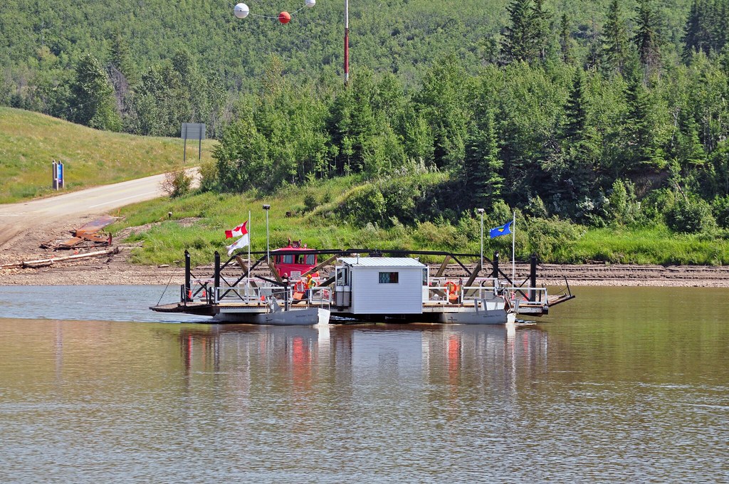
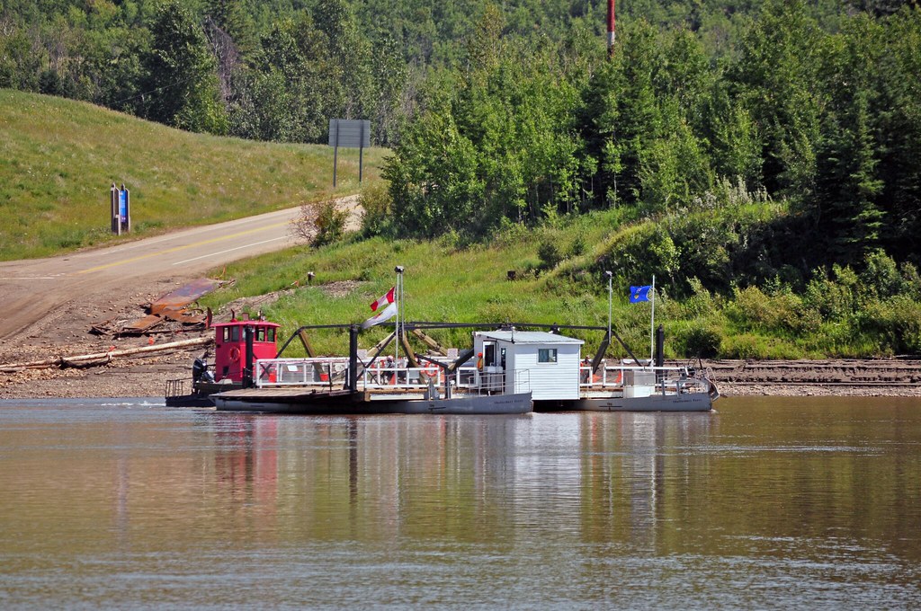
A late reply: Yes, the Bleriot ferry is free, and runs on demand in daylight hours. The skipper and his dog hang out on board, or in a shack on the south bank when it's too hot, cold or rainy. If no one's around, flash your lights and honk. The boat will take you. There are two bridges over the Red Deer River in Drumheller town, and several more on provincial highways not far away. The Bleriot Ferry is an historical oddity, one that Alberta is pleased to keep for old times' sake. Good for Alberta. (on the plateau above the crossing, pumpjacks quietly pour black gold into the province's Heritage Fund, so it's not a losing operation). In the spirit of loving another part of Canada, suggested earlier, I'll add a bunch of photos here. Drumheller was once a hellish place, demonstrated by photos we saw in the excellent East Coulee museum. Coal mines, railway lines, slag heaps, smoke and dirt everywhere. 140 mines, operated by dozens of companies. Some were fair employers, but many were gyppo operators who imported migrant workers, and blacklisted 'em at the first hint of Union sympathy. It is odd now. Today's Drumheller is the major town in the solidly conservative district of Crowfoot; but in the 1920's, Drumheller was a strong home to Communists of all factions, Anarchists, Socialists and the relatively moderate CCF. Oh well, the photos. I hope y'all agree they show a beauty unexpected in the Alberta badlands. We were surprised and pleased. Plains Prickly Pear:  Unknown, hardy flowers blooming in barren sand:  .. and tiny, very tiny flowers - less than 1/4", growing in the harshest place.  Way off the original topic, (though in Horsethief Canyon, only 5 km from the Bleriot Ferry), some gopher fun. This cheeky guy popped up, whistled at our dog Bo, and ducked.  Dumb, coastal BC dog Bo took the challenge and started to to dig. Bo dug halfway to China, covering himself with Alberta's sandy soil. A souvenier we still still have, embedded in our car's seats. Thanks, Bo, and thanks, Alberta.  |
|
|
|
Post by BrianWilliams on Jun 24, 2006 2:51:25 GMT -8
Real thanks to Drumheller, and the towns of Rosedale, Wayne and East Coulee. Our visit was blessed by their welcome. No nicer folks anywhere.  |
|
|
|
Post by Low Light Mike on Jun 24, 2006 7:56:02 GMT -8
Bravo, Brian. Well written.
This summer, I will have the joy of seeing the Fraser River as a mountain-green-river in the Rocky Mountains.
I'll also have the experience of seeing another famous river in the Rocky Mountains, that being the "Columbia".
Funny how the 2 rivers have such different destinies.
The Columbia has a few other names in BC, such as Kinbasket reservoir, and Arrow Lakes.......too bad it wasn't allowed to just be a "river".
Of course, I write this while my computer is powered by hydro-electricity......but it's still sad to see the Columbia all partitioned into sections of river & "lake".
|
|
|
|
Post by Scott on Jun 24, 2006 15:20:05 GMT -8
re: the Fraser I love the river too. Recently I discovered a park about a 7 minute drive from our place... not 100% sure of the name, but it might be the Fraser Foreshore Park... at the foot of Byrne Rd. in Burnaby. Beautiful place to let the kid play, watch the water and boats go by, and see the sunset. Has anyone here read the book by Bruce Hutchison, "The Fraser"? I read that twice in high school during a year's worth of "silent reading" period;) I rarely take the Coqihalla when I go to the Interior. Usually I'll go at least one way along the Fraser and Thompson Rivers. I just love the scenery and watching the landscape change as you go up the river. And the trains, as mentioned previously! To see how the roads and railways cling to the side of the canyon in some places is amazing. And it's just as amazing to watch the Fraser River. It's even more spectacular north of Lytton... I can remember on one occasion when the road had either been partly wiped out or there was contruction and there was just one gravel lane with hardly room to pass another vehicle... to our left was sheer mountainside, to our right was the Fraser River several hundred meters below us! I hope it's never dammed. On the off-topic of power generation.. why don't we just build a dozen nuclear plants on Baffin Island?  For anyone who takes me seriously, I'm being slightly facecious:) |
|
|
|
Post by WettCoast on Jun 24, 2006 15:53:17 GMT -8
Yes, South Coast dwellers sometimes do not really appreciate the beauty that lies beyond Hope.  Thompson River near Skihist with passing CP east bound double stack box train. [Sept 2003] |
|
|
|
Post by BrianWilliams on Jun 24, 2006 22:51:45 GMT -8
Thanks for the nice comments, all of you. The last photo, from westcoastkidjst is stunning. I was thinking of the Thompson River corridor while we climbed and descended the endless grades of the Coquihalla highway. Not so obvious at Skihist, but in other places nearby, you can see Hwy #1 roller-coastering, up and down above the river. Below, the CP and CN tracks run strictly level. RR builders were better engineers than the folks who carelessly drape highways over the hills. OK, more costly at first, but we keep regrading and straightening our roads; meanwhile burning too much fuel and killing people on blind hills and curves. The railways got it right very early. Not new to many folks here, but visit this place barely beyond Hope if you haven't:  Tunnels Provincial Park is off #5 at Othello Road. The park preserves the famous Quintette Tunnels, built in 1912 for the CPR's Kettle Valley RR. The impossible, impassible Coquihalla Canyon was traversed by McCullough's brilliant solution. He drew a straight line, bored five short tunnels and connected them with four bridges. Today, you can start at one end and walk straight through the bores, while the river twists madly below. Too bad, the RR lasted only 50 years and never earned a dime over costs. |
|
|
|
Post by BrianWilliams on Jun 25, 2006 0:26:22 GMT -8
HMCS Nanaimo: Right, the Columbia River is a staircase of dams and "lakes" all the way from Bonneville (near Portland) to Mica Dam above Revelstoke. In fairness to WAC Bennett, who started the BC dams in 1962, the USA had already destroyed the lower river in the 1930's. The Bonneville/Grand Coulee projects wiped out the greatest salmon river in western America, ruined the NW USA's fishery forever, and especially wrecked the traditional self-sustaining society of native Americans in Washington and Oregon. There is a brilliant Indian museum near Yakima that documents the Columbia tragedy. Worth a visit, if you're in the area. www.yakamamuseum.com (not much content on the website, unfortunately). One short side trip we didn't make this time: near Valemount, BC, the Canoe River runs into Kinbasket Lake. Shoulda found an hour to go see. John: Fraser Foreshore Park is one of our favourites, too. A very worthwhile GVRD project is underway: a riverfront trail is being built, linking river parks from Burnaby west to Vancouver. Much is already open. Shady walks under the cottonwoods will take you to the foot of Kerr Street, and it's planned to go all the way to the foot of Dunbar, then on to Pacific Spirit Park at UBC. *whew* PS: You may be kidding about nuclear power, but I do hope that many nukes will be built and operated safely before long. It's not impossible. France derives the majority of its electricity from nuclear plants. They haven't had a Three Mile Island or Chernobyl crisis in 50 years of production. It can be done, and should, I think. Canada was a very early pioneer in nuclear energy. Our Chalk River plant (near Ottawa) was built as a successful trial in the early 1950's. Pardon my dark suspicions, but in those days, Canada had no oil industry to speak of, and our coal mines were happily employed fuelling railway engines. North American power generation these days is one disaster piled on another. We've flooded entire landscapes (Tennessee Valley, James Bay, Columbia River, Peace River, California's Trinity River); filled the air with poison (coal burners all over the Midwest and mid-Atlantic states) and raped the land for fuel - see the aptly-named Colstrip, Montana and the Powder River coal bonanza in Wyoming. Sorry, it's getting a bit long for an off-topic digression! We saw, years ago, a curious pattern of white plumes below, while flying to Washington DC. A fellow passenger clued us in. From eastern Ohio, across PA and WV, there are hundreds of coal burning power plants, hidden in the valleys of the Appalachians. Not so visible from 30,000 feet is the wreckage and devastation of strip mining, feeding the plants. Hot wastewater has ruined the mountain streams, leaving only algae and crayfish to survive. A few years later, I saw one monster from the ground, near Kenosha, Wisconsin. One snappin' cold winter day, I escaped from a box-industry seminar in Chicago, and drove north along steely Lake Michigan. Big blue sky, ice on the lake and flat frozen prairie to the horizon. It was wonderful for a coastal BC boy. Just over the Wisconsin line, the secondary highway was interrupted by a RR crossing, heavily gated. The lights flashed, I stopped. A 120-car BNSF train roared by, all coal, in a hurry. A mile later, another x-ing, more lights. Another coal train. And another x-ing a half-mile on. More lights, another train. Now, I could see the towering plumes from a big plant on the lake a short way off. I stopped at a little tavern in Pleasant Prairie, WI for a burger (very good) and a coke. I asked around: the plant is a paper mill? a car factory? No, it's a coal burning power station, one of several in the area. The trains that surprised me are an endless conveyor of western coal. The local folks told me that the trains run 24/7, at 70 mph, 20 minutes apart. The waste, destruction and pollution are ridiculous. Let's go nuclear.
|
|
Neil
Voyager 
Posts: 7,171
|
Post by Neil on Jun 28, 2006 22:35:49 GMT -8
Nuclear power. Whoa. Think I'll pass on that one.
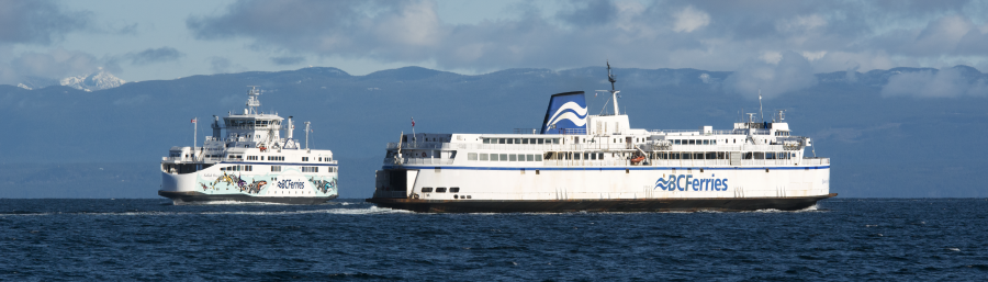
Coming back to Tsawwassen yesterday on the Queen of Alberni (which was less than half full, the only time that ferry is tolerable), I witnessed that small phenomenon that never fails to impress me: the point you cross over where the milky Fraser River water pushes out into the deeper green of Georgia Strait, where the change is so precise that you could literally have one arm in the Fraser water and the other in the Strait. You really get a sense of the size and volume of the Fraser- that it spreads itself out over such a swath of ocean past it's mouth. And that's just the visible part. Makes you realize how important the health of the river is, not just to the land, people and animals along it's banks, but to the well being of the entire Georgia basin.
Another one of my favorite views of the river is at the very end of River Road in Delta. From where you park your car, you can't see the river over the dike, but when you climb up on to the path, it's suddenly spread out in front of you in all it's silty splendor, wide and seemingly relatively untouched as it spills past farm fields on both sides, past the sand bars into the Strait. Quite the view, and nicely unsullied by the industry further back upstream.
Burnaby has done a nice job with Foreshore Park, and Vancouver is providing more access. The area around Mitchell Island is ghastly, but we can't 'gentrify' the whole river, I suppose. Industry has to go somewhere. When I think back to the beehive burners and other atrocities forced upon the Fraser when I was a kid, it's apparent we're moving in the right direction. The Fraser is no longer seen as a handy cesspool and repository for industrial waste, and hopefully, as access is improved, more people will come to realize what an important ecological and recreational asset the river is.
As a P.S., for Father's Day my older daughter gave me a beautiful book called 'Islands in the Salish Sea: A Community Atlas. Lushly illustrated with artistic maps of seventeen of the Georgia Strait islands, and detailed ecological and social profiles. An excellent primer on the nature of the lands in the Strait.
|
|
|
|
Post by BrianWilliams on Jun 30, 2006 22:42:42 GMT -8
HornbyGuy: I guess we are in full digession here - if the mods don't shut us up, the Fraser River romance may continue. Thanks for your eloquent description of the big river's effect in Georgia Strait. I'd like to add this: Vancouver beach lovers! The broad sands of Spanish Banks, and the sunny beaches from Jericho to Kits are -- Cariboo silt, brought down by our river, swept around Point Grey by the currents and dumped here for our sunbathing pleasure. Never has a city been more blessed by nature than Vancouver. We can have a full-on nuclear power debate on another forum, I suppose. I do believe that one dam on the Fraser River would be a tragedy. Even gung-ho "dam it and pave it" WAC Bennett left our grand river alone, though I remember many proposals in the 1960's. Marble Canyon/Moran was the highest on BC Hydro's list well into the 1980's. A reminder: the exit from Marble Canyon, a mile downstream from the coveted Moran dam site: Not shown, unfortunately - some photos I took in 1994 while following the High Bar Road across Indian land. From High Bar Ferry down to Kelly Lake, the one-lane clay track bumps along the Fraser River for many miles, then turns and climbs 3,000 feet in a spectacular ascent where Marble Canyon closes the gorge at Moran. On that day, my pal and and I gripped the wheel (me) and the dashboard (Mike) with white knuckles as the Volvo pointed to the sky. A unique BC experience. We left tumbleweeds and sage, entered pine forest and topped out in cool Douglas Firs. Wow. All in 20 minutes, in low gear. |
|
|
|
Post by Low Light Mike on Jun 30, 2006 23:09:11 GMT -8
Please continue on digressing.......this is very good stuff indeed. |
|
|
|
Post by BrianWilliams on Jun 30, 2006 23:12:06 GMT -8
A late note, Hornby:
Bravo to your lovely daughter for the Salish Sea gift.
I'm impressed, encouraged and pleased by the awareness some folks have learned about our Georgia Basin's unique character.
Smart kids like your daughter are paying attention. Very encouraging!
PS: find this favourite of mine in a bookstore or library: Harvey Manning's "Walking The Beach To Bellingham"
Manning was a 1950's-60's mountain climber, one of the great high Cascades men in his day. "Walking The Beach" is an older man's appreciation of our coast, an expression of pure joy at re-discovering the richness of shoreline, rivers and the Salish Sea.
Manning did hike from Seattle to Bellingham, nourished by apples, canned kippers and Rainer beer. Great story; you'll like it.
|
|
|
|
Post by BrianWilliams on Jul 7, 2006 22:43:47 GMT -8
A late note, and apology, to Shipdaughterwife:
Sorry, I didn't respond directly to your comments right away.
Yes! We did see the Little Church west of Drumheller. We stopped at the campground just past there to buy ice and look around. Very, very nice; clean, pleasant and welcoming.
|
|
|
|
Post by Low Light Mike on Oct 8, 2006 18:07:52 GMT -8
(If the pics don't appear, it's because TinyPic.com is being slow today. Try refreshing, or give up) I visited my parents for thanksgiving holiday, and I took a look through some old family photo albums, and I came across pictures from a family vacation to Alberta (Drumheller, specifically), in say 1971 or so. (photos taken by my father, with Pentax black & white, photos developed in his downstairs darkroom, using good old well-water and some chemicals from Hilton's Photo Supplies in Chemainus.) Here's a picture of a river ferry crossing, possibly the same crossing that BrianWilliams has pictures of, earlier in this thread. My parents didn't remember the name of the crossing, but it was part of the Drumheller trip, as the pictures surrounding it in our album attest. We're in the vehicle in the foreground. Our Ford station wagon, towing a tent trailer.  ------------------------------------ Here's a picture from same area, showing the rugged country, and that fabulous Ford stationwagon.  ---------------------------------- Here's a pic of 3 monsters, at Drumheller (there's a global-moderator on the dinosaur's left foot).  -------------------------------- Here I am, trying to figure out how to use a new toy camera. This is somewhere near Drumheller, Alberta; I have no idea where exactly. I appear to have on a nice pair of boots. Here's what my dad said about this location: " we took a circle tour around Drumheller in a counterclockwise direction. On the north-side we travelled west, till we got to the ferry. After taking it over the river, we travelled east to a little coal mining town (I forgot the name), and then back again to Drumheller. Now exactly where that bridge was, we don't remember."  |
|
|
|
Post by BrianWilliams on Oct 14, 2006 3:17:29 GMT -8
Wow! Thanks for the photos.
The ferry is certainly Bleriot.
The "little coal mining town" in your father's memory is hard to pin down, but the direction of your tour suggests Nacmine, now a part of Drumheller City.
Today's Nacmine is west of the city centre. Sorry, it's a bit forbidding as we saw it in June 2006 -- a few streets of old company houses, too many trailer homes and a lot of beater black pickup trucks with Harley Davidson stickers. The Whalley of Drumheller.
1965 Ford station wagon! Great car.
|
|
|
|
Post by Low Light Mike on Mar 28, 2007 20:01:02 GMT -8
Here's a postcard photo of Bleriot ferry. Photographer is Ron Garnett.  |
|
|
|
Post by Curtis on Mar 29, 2007 16:48:46 GMT -8
That's a very beautiful Postcard you found, Flugel.
|
|
|
|
Post by Jennifer king on Jul 7, 2008 16:17:20 GMT -8
;D I have a guestion in Drumheller is there a place to ride horses?? please write back  we are going there and we wanna know.... Jennifer |
|
|
|
Post by farout on Jul 8, 2008 0:31:06 GMT -8
|
|
|
|
Post by fargowolf on Jan 15, 2009 9:55:43 GMT -8
|
|
|
|
Post by Mike C on Aug 30, 2017 19:14:20 GMT -8
|
|


 For anyone who takes me seriously, I'm being slightly facecious:)