|
|
Post by Nickfro on Apr 25, 2011 11:05:39 GMT -8
Having not been on the Pat Bay Hwy since late May 2010, I never paid attention to what they were actually doing with this project. I had a feeling it might be to make it a freeway-style interchange, which is exactly the case. I just looked at the govt's slides showing traffic flow and how to navigate the interchange based on where you're coming from and going to. Personally I think this will work quite well, once the island drivers get used to how roundabouts work.It's significant because there are people (moi inclu) who were getting a little bit ticked with how long the McTavish interchange project was taking, and would have liked to know when it was completed. Now it's completed, so these certain people can drive Route 17 delay-and-barricade-free. Speaking as somebody who has dealt with that interchange construction EVERY DAY for the last 15 months, I can tell you that we knew back in January 2010 that it was scheduled to be completed by the end of March 2011, so it's not really a surprise that it's open. It opened April 9th, a whopping 10 days late... which given the scope of the project is not particularly bad. Not only that... but the construction never actually interfered with traffic on the main highway. The speed limit dropped from 80 to 60, but there were VERY few lane closures and the only highway closures were at night. I fail to see how this constitutes major delays. First of all, I don't understand how this ticks off a mainlander. If that ticks you off, I don't want to see your complete list of ticks! Secondly, 15 months doesn't sound so bad to me for such an interchange conversion project. I recall the Lonsdale and Westview interchange projects in North Vancouver. Each of those took up to 3 years to complete, so 15 months sounds good to me. |
|
Koastal Karl
Voyager  Been on every BC Ferry now!!!!!
Posts: 7,747
|
Post by Koastal Karl on Apr 25, 2011 15:03:29 GMT -8
How about those roundabouts eh??? lol! I am sure some people get confused with those things, lol!
|
|
|
|
Post by Nickfro on Aug 15, 2011 15:39:57 GMT -8
Recently completed a circle trip thru the Rockies via the Okanagan (heading there) and Whistler (coming home).
BC Highways travelled on:
Hwy 1 - North Vancouver to Hope
Hwy 5 - Hope to Merritt
Hwy 97C - Merritt to Westbank
Hwy 97 - Westbank to Vernon
Hwy 97A - Vernon to Sicamous
Hwy 1 - Sicamous to Alberta Border
Alberta Highways:
Hwy 1 - BC Border to Banff, return westbound to Lake Louise
Hwy 93 - Lake Louise to Jasper
Hwy 16 - Jasper to BC Border
Return to BC Highways:
Hwy 16 - Alberta Border to Tete Jeune Cache Junction
Hwy 5 - Tete Jeune Cache Junction to Kamloops
Hwy 1 - Kamloops to Cache Creek
Hwy 97 - Cache Creek to Hwy 99 Junction
Hwy 99 - Hwy 97 Junction to Vancouver
This was my first time travelling over the new bridge east of Golden. That is some crazy construction! They are currently building a new bridge over the Columbia River near Donald, about 25km west of Golden.
The Duffey Lake Road was also in relatively good shape, except for the 30km closest to Lillooet. The rest of it was recently paved with rumble strips along the yellow centre line. Some of the one lane bridges have been replaced in recent years too, which was new for me since I last did that drive about 5 years ago.
All in all, great weather, fantastic scenery, and look forward to travelling more BC Highways next time!
|
|
Nick
Voyager
Chief Engineer - Queen of Richmond
Posts: 2,078 
|
Post by Nick on Aug 15, 2011 16:26:41 GMT -8
BC has some incredible highways. I drove south on Highway 99 last month, and have driven that highway once a year for the past few 3 years. It seems that they are paving it in pieces, gradually moving closer to Lillooet. If the work continues, they should be done the whole thing next year.
I haven't been over the new Kicking Horse Canyon project yet, so I can't comment on that yet, although the pictures on the project website sure look nice.
I'm very lucky, in that I have driven almost every major highway in the province. Contrary to popular belief, BC's roads are not in bad shape at all, especially compared to some of our neighbours. Up north especially, it often seems like you cross the border into BC from the Yukon or Alaska, and the road levels out, there's no more heaves or potholes, and the road becomes this smooth, curvy ribbon of asphalt.
|
|
Koastal Karl
Voyager
Been on every BC Ferry now!!!!!
Posts: 7,747
|
Post by Koastal Karl on Aug 15, 2011 21:58:43 GMT -8
I like that drive from Cache Creek to Kamloops we recently did that a few weeks ago coming back from 100 Mile House. Dident really want to drive the Fraser Canyon both ways so we came back the Coquihalla from Kamloops to Hope. That is a nice drive. Also the drive from Merritt to Kelowna is a nice drive. I also really like highway 16 from Prince Rupert to Prince George. I want to drive more of the northern routes as I love it up north. Hope to drive the Alaska Highway one day!
|
|
|
|
Post by WettCoast on Sept 12, 2011 21:14:14 GMT -8
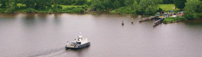
BC Min. of Transportation & Infrastructure photos of highway damage & repairs to Highways 37 North & 37A in BC's remote north west. 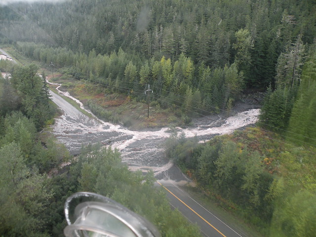 photo courtesy of BC Min of Transportation & Infrastructure Flickr Site photo courtesy of BC Min of Transportation & Infrastructure Flickr SiteWhile southern BC has been enjoying superb late summer sunshine with no rain, the same can not be said for the inner & outer North Coast. Although the sun has put in an appearance here (on the North Coast) over the last four or five days, prior to that it was quite another story. Stewart, BC & Hyder, AK, have been completely cut off for about a week now. Stores have run out of essentials; visitors have been stranded. It will be several more days, likely longer, before Stewart is reconnected. This again puts the spotlight on the inability of BC Ferries to be of any use in providing emergency access to communities up & down BC's coast. Perhaps it is time to change the thinking on this matter. For more photos click on this link to go to the BC Ministry of Transportation & Infrastructure Flickr photo site. |
|
D'Elete BC in NJ
Voyager
Dispensing gallons of useless information daily...
Posts: 1,671
|
Post by D'Elete BC in NJ on Sept 13, 2011 4:44:16 GMT -8
BC Min. of Transportation & Infrastructure photos of highway damage & repairs to Highways 37 North & 37A in BC's remote north west. photo courtesy of BC Min of Transportation & Infrastructure Flickr SiteWhile southern BC has been enjoying superb late summer sunshine with no rain, the same can not be said for the inner & outer North Coast. Although the sun has put in an appearance here (on the North Coast) over the last four or five days, prior to that it was quite another story. Stewart, BC & Hyder, AK, have been completely cut off for about a week now. Stores have run out of essentials; visitors have been stranded. It will be several more days, likely longer, before Stewart is reconnected. This again puts the spotlight on the inability of BC Ferries to be of any use in providing emergency access to communities up & down BC's coast. Perhaps it is time to change the thinking on this matter. For more photos click on this link to go to the BC Ministry of Transportation & Infrastructure Flickr photo site. It looks like northern BC is taking a similar weather related beating as we are on the central & north east coast. www.syracuse.com/news/index.ssf/2011/09/susquehanna_river_recedes_in_p.htmlwww.nj.com/news/index.ssf/2011/08/hurricane_irene_nj_death_toll.htmlBefore Lee came through, my understanding is our section of the east coast has received as much precipitaion in 1 month as we would normally receive in 6 months. Lee pushed many areas even higher. I would be interested to see the stats for northern BC to compare. |
|
|
|
Post by Low Light Mike on Oct 30, 2011 7:07:07 GMT -8
I recently bought a used book called "The Coast Connection", which details the history of BC's roads connecting the lower mainland and interior.
Author is Bob Harvey who had a career in engineering and in BC Highways depts, culminating in him being the Deputy Minister of Highways for 1976-83. The book is from 1994.
I've started reading it, and the first couple chapters are for colonial times and the late 19th century and are mostly about the Cariboo Wagon Road and various trails.
I think that the book's culmination will be the Coquihalla Highway, seeing as that was the most recent and ambitious project in recent memory at the time of the book's writing.
I'm looking forward to learning more about the roads and routes that I've travelled on during my life.
|
|
Nick
Voyager
Chief Engineer - Queen of Richmond
Posts: 2,078
|
Post by Nick on Oct 30, 2011 10:43:21 GMT -8
I recently bought a used book called "The Coast Connection", which details the history of BC's roads connecting the lower mainland and interior. Author is Bob Harvey who had a career in engineering and in BC Highways depts, culminating in him being the Deputy Minister of Highways for 1976-83. The book is from 1994. I've started reading it, and the first couple chapters are for colonial times and the late 19th century and are mostly about the Cariboo Wagon Road and various trails. I think that the book's culmination will be the Coquihalla Highway, seeing as that was the most recent and ambitious project in recent memory at the time of the book's writing. I'm looking forward to learning more about the roads and routes that I've travelled on during my life. That sounds like a very interesting read. I'm assuming this was a used bookstore find? |
|
|
|
Post by Low Light Mike on Oct 30, 2011 11:46:57 GMT -8
That sounds like a very interesting read. I'm assuming this was a used bookstore find? Used bookstore: on sale at Bygone Books in Nanaimo for $2.50 as part of their slow-closing sale. |
|
|
|
Post by Low Light Mike on Oct 6, 2013 8:16:33 GMT -8
Today is the celebration of the 50th anniversary of the opening of the Salmo-Creston "Skyway" mountain pass highway. - part of BC Hwy-3, the southern Crowsnest Pass route. Quote from the Creston Museum website More here: link----------- I've only driven it once, in summer of 1991. It is a highway pass that many of us ferry fans miss on purpose, because we'd rather take the longer way around, using the Kootenay Lake ferry. |
|
|
|
Post by WettCoast on Oct 6, 2013 9:32:43 GMT -8
Today is the celebration of the 50th anniversary of the opening of the Salmo-Creston "Skyway" mountain pass highway. Quote from the Creston Museum website That highway is also known as the 'Kootenay Skyway' and it is hard to believe that it has now been 50 years since it opened. Prior to the new highway opening, the Kootenay Lake ferries were part of the principal east-west route across southern BC. This claim is no longer true, and I don't believe that it was true even at that time. The Icefields Parkway in Alberta has two passes (Bow & Sunwapta) that are both higher than the top of the 'Skyway'. The Skyway highway may well have been opened before the gravel Banff-Jasper Hwy (the B-J, completed in 1940) was rebuilt & transformed to become today's Icefields Parkway. I know that the reconstruction took place in the first half of the 1960's, but I am not sure of the completion date. The Parkway is opened year-round. The Kootenay Skyway is, however, BC's highest public highway. PS: The highest public paved road in Canada is on Hwy #40 through Highwood Pass in Alberta's Kananaskis Country (2206 metres or 7239 feet). This road is apparently not opened rear-round, however. There are numerous roads in the USA that go to much higher elevations.
Last year (2012) was the 50th anniversary of the 'openings' of the Trans-Canada Highway #1 through Rogers Pass. Prime Minister John Diefenbaker presided at a ceremony held at the Rogers Pass summit 'Golden Arches', while down the road, toward Revelstoke, BC Premier WAC Bennett had his own ceremony. I do not recall anything special happening last year to recall that anniversary. |
|
|
|
Post by Low Light Mike on Oct 6, 2013 13:19:12 GMT -8
[PS: The highest public paved road in Canada is on Hwy #40 through Highwood Pass in Alberta's Kananaskis Country (2206 metres or 7239 feet). This road is apparently not opened rear-round, however. There are numerous roads in the USA that go to much higher elevations.
Last year (2012) was the 50th anniversary of the 'openings' of the Trans-Canada Highway #1 through Rogers Pass. Prime Minister John Diefenbaker presided at a ceremony held at the Rogers Pass summit 'Golden Arches', while down the road, toward Revelstoke, BC Premier WAC Bennett had his own ceremony. I do not recall anything special happening last year to recall that anniversary. Thanks for this information. In summer-2012, I was able to travel both the Rogers Pass summit and Highwood Pass, in my little Toyota Echo. - Regarding my transit of Rogers Pass, I was unaware of the 50th anniversary, and I don't recall seeing anything on the roadway or at the Rogers Pass visitors centre to mention the anniversary. |
|
|
|
Post by WettCoast on Oct 6, 2013 14:18:31 GMT -8
|
|
|
|
Post by Cable Cassidy on Dec 9, 2013 10:03:27 GMT -8
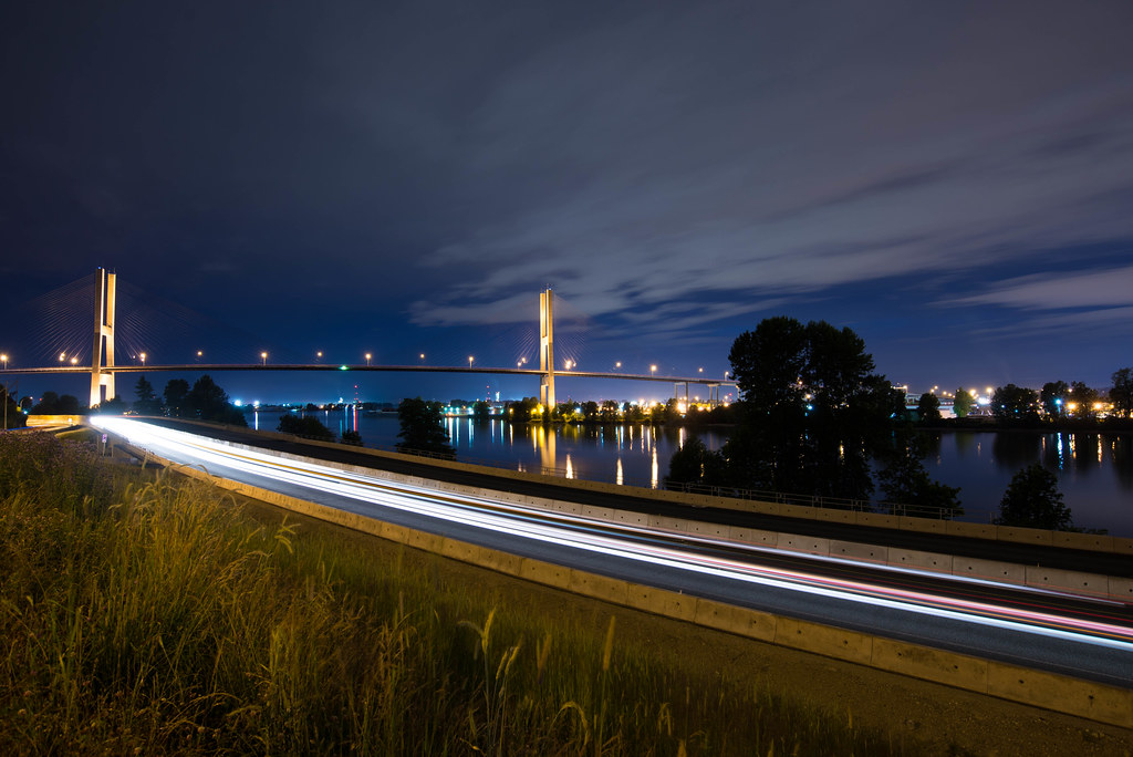
Last night I went for a cruise on the semi-open Highway 17 (SFPR) stretch between 103A Avenue in Surrey to the Highway 91 connector. They only have 1 lane open in each direction, and a speed limit of 50km/h, but boy is it an improvement over River Road.
The entire project is due for opening before Christmas, but there's still several sections that look a little "rough" (104th interchange).
|
|
|
|
Post by DENelson83 on Dec 21, 2013 16:07:41 GMT -8
Last night I went for a cruise on the semi-open Highway 17 (SFPR) stretch between 103A Avenue in Surrey to the Highway 91 connector. They only have 1 lane open in each direction, and a speed limit of 50km/h, but boy is it an improvement over River Road. The entire project is due for opening before Christmas, but there's still several sections that look a little "rough" (104th interchange). The whole SFPR is now open. Travel times between the Tsawwassen Ferry Terminal and Highway 1 should be cut in half, and big trucks will no longer have to go right through the centre of Ladner. |
|
Koastal Karl
Voyager
Been on every BC Ferry now!!!!!
Posts: 7,747
|
Post by Koastal Karl on Jun 28, 2014 9:09:57 GMT -8
Can you access Highway 10 from the new South Perimeter Road coming from Tsawwassen???
|
|
|
|
Post by Mike C on Jun 28, 2014 14:49:38 GMT -8
Can you access Highway 10 from the new South Perimeter Road coming from Tsawwassen??? You can access 99 South, but not Ladner Trunk Road. |
|
|
|
Post by Kahloke on Jun 28, 2014 14:58:03 GMT -8
Can you access Highway 10 from the new South Perimeter Road coming from Tsawwassen??? You can access 99 South, but not Ladner Trunk Road. Still, if Google Maps is correct, it doesn't look like it will be that difficult to get onto Hwy 10. 1. Don't get on the SFPR - get off at 17A like you're heading to Ladner, and take a right on Ladner Trunk Road like we always used to do. OR 2. Stay on SFPR, get on 99 South, and take exit 20 to Ladner Trunk Road. |
|
|
|
Post by Mike C on Jun 28, 2014 22:08:49 GMT -8
You can access 99 South, but not Ladner Trunk Road. Still, if Google Maps is correct, it doesn't look like it will be that difficult to get onto Hwy 10. 1. Don't get on the SFPR - get off at 17A like you're heading to Ladner, and take a right on Ladner Trunk Road like we always used to do. OR 2. Stay on SFPR, get on 99 South, and take exit 20 to Ladner Trunk Road. Google Maps hasn't been updated for the new 80th Street ramp, which is also an option. |
|
|
|
Post by Cable Cassidy on Jul 7, 2014 20:29:54 GMT -8
|
|
Koastal Karl
Voyager
Been on every BC Ferry now!!!!!
Posts: 7,747
|
Post by Koastal Karl on Jul 7, 2014 21:14:06 GMT -8
lol just out of curiosity why do they call it a road?? It's a highway isent it? lol! It should be called South Perimeter Highway!
|
|
|
|
Post by WettCoast on Jul 7, 2014 21:38:53 GMT -8
lol just out of curiosity why do they call it a road?? It's a highway isent it? lol! It should be called South Perimeter Highway! It is weird, isn't it? In Alberta they call freeways 'trails'. What's with that? |
|
|
|
Post by Starsteward on Jul 8, 2014 6:17:12 GMT -8
lol just out of curiosity why do they call it a road?? It's a highway isent it? lol! It should be called South Perimeter Highway! It is weird, isn't it? In Alberta they call freeways 'trails'. What's with that? Many years ago, someone in the sign painting department committed the 'biggie' error. The sign was erected and lasted for about 20 hours before the sign was replaced with the corrected edition. Yes, kids, 'Trail' is NOT spelled 'Trial'.  Imagine our American friends looking for directions trying to get out of Calgary and coming across a 'Deerfoot Trial' Oh dear |
|
|
|
Post by Cable Cassidy on Jul 8, 2014 7:19:47 GMT -8
Yesterday I heard a commercial on the radio for Sunbury Cedar, and they were talking about how easy it is to access via the new "South Fraser Perimeter Highway". That was, until last night when Karl mentioned it, the first I ever heard it called that.
|
|