|
|
Post by Low Light Mike on Mar 22, 2010 18:22:53 GMT -8
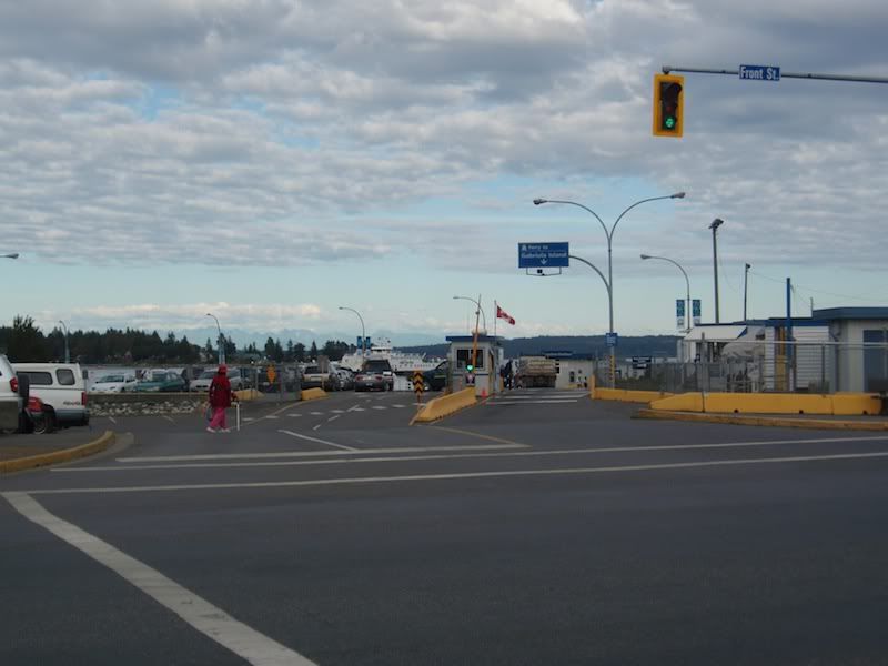
Photos of the Nanaimo harbour terminal, which is the gateway to Gabriola Island. Photos taken on March 21, 2010 from the harbourfront walkway, right next to the terminal, in the shadow of the condo tower. Quirky first view of the partially hidden berth. 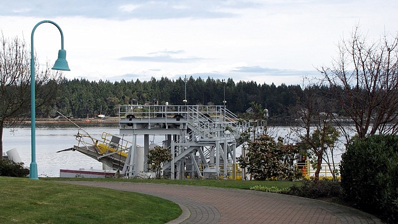 From another angle 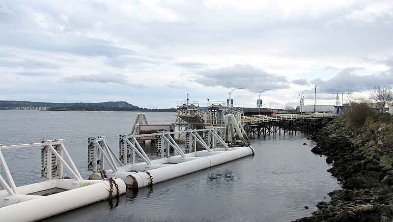 Bowen Queen in berth, and unloading 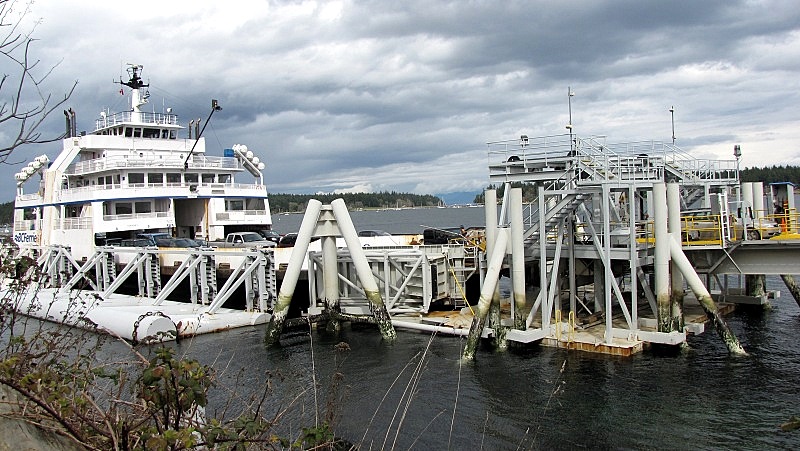 ... a few steps back, to add the Madrona/Arbutus tree to the shot. 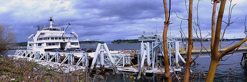 |
|
|
|
Post by Low Light Mike on Mar 27, 2010 21:51:09 GMT -8
|
|
|
|
Post by Low Light Mike on Jun 20, 2010 20:30:02 GMT -8
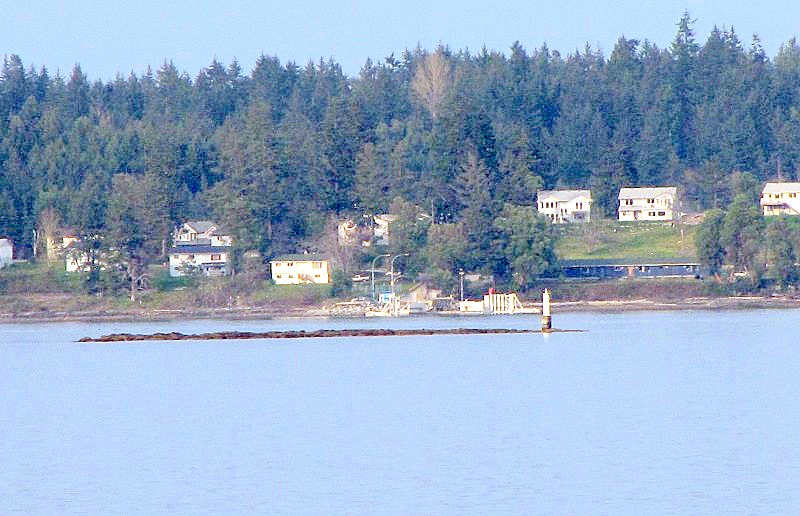
Descanso Bay @ Gabriola Island, seen from Nanaimo waterfront: 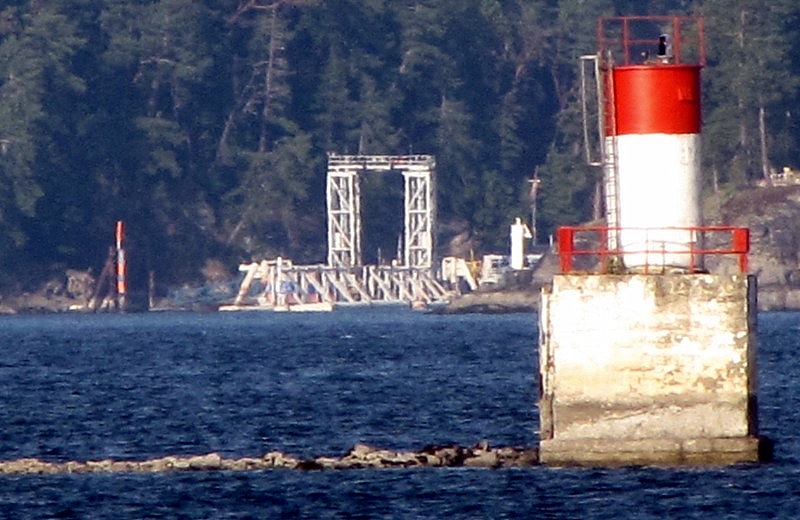 - the light marker is at Gallows Point, on the end of Protection Island. |
|
|
|
Post by Low Light Mike on Aug 21, 2010 19:05:59 GMT -8
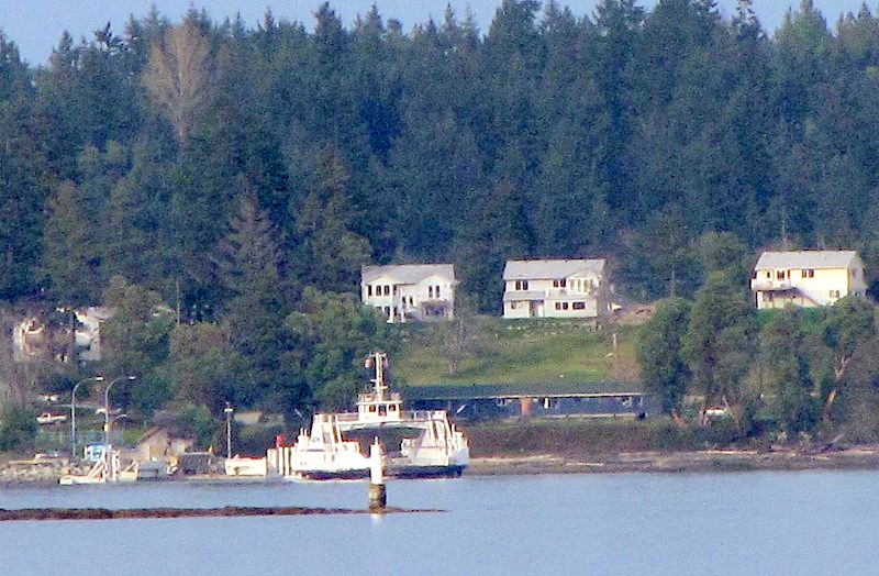
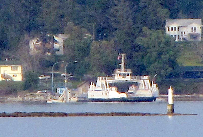
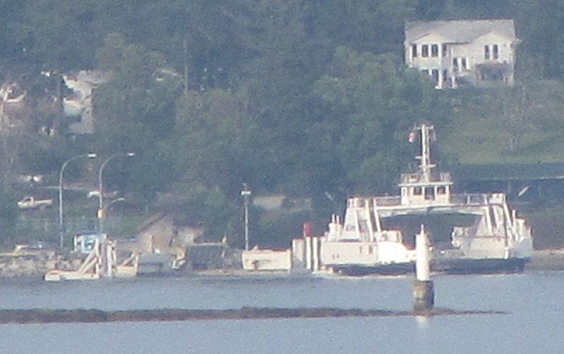
I was in Chemainus BC today, to see "Guys & Dolls" at the Chemainus Theatre. After the show, we went to see the Kuper arrive at the Chemainus terminal. Earlier in the day, while turning off the highway, we noticed that the sign for the ferry-terminal said "Thetis Island and Penelakut". Also at the terminal, we heard the terminal attendant refer to the Kuper Island destination as "Penelakut". Penelakut is the name of the 1st Nation that lives on Kuper Island. I wonder if this is a repatriation of the name for the island? Here is a view of the terminal from the end of the road, beside the traffic holding compound. The toll-booth and holding compound are further back (behind where I'm taking the photo from), because there needs to be public access to the marina which is right beside the ferry slip. - ferry slip is the road on the left, marina is the road on the right. 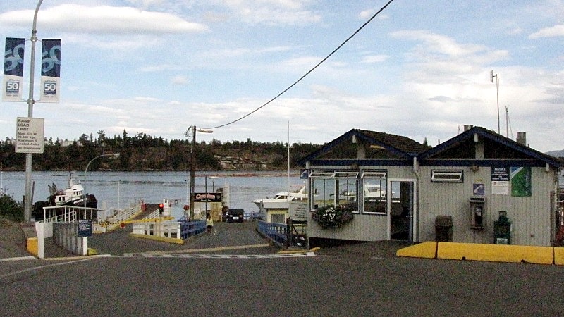 View from the marina. Notice the red paint on the apron, instead of the old yellow. 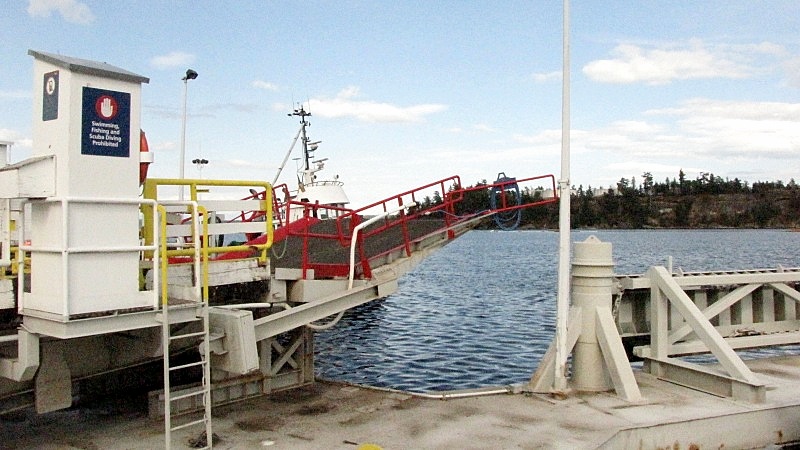 View up to the waiting room (located at top-left of photo), from the marina. 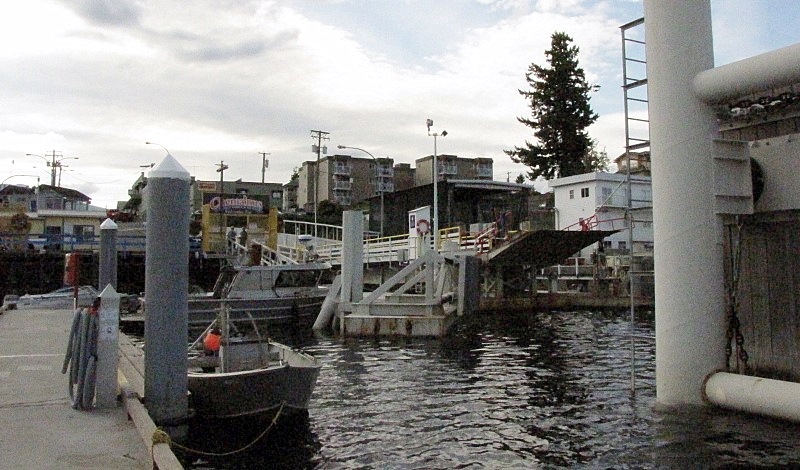 Kuper arriving, churning some water with her forward-port Z-pod. 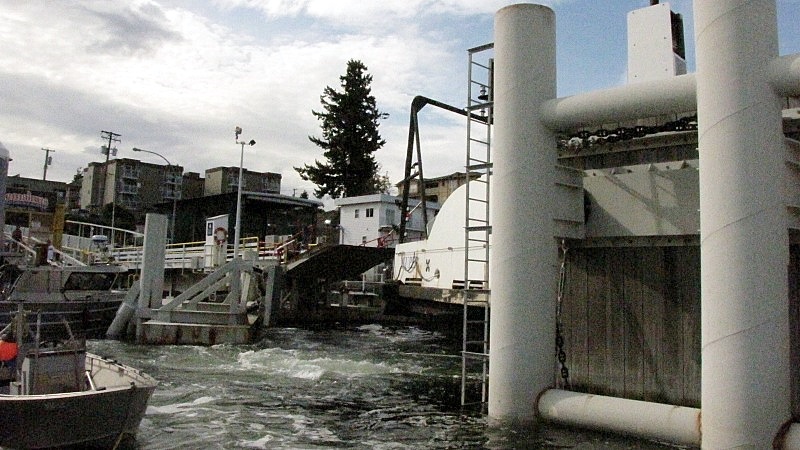 |
|
Neil
Voyager 
Posts: 7,172
|
Post by Neil on Aug 21, 2010 21:50:04 GMT -8
Earlier in the day, while turning off the highway, we noticed that the sign for the ferry-terminal said "Thetis Island and Penelakut". Also at the terminal, we heard the terminal attendant refer to the Kuper Island destination as "Penelakut". Penelakut is the name of the 1st Nation that lives on Kuper Island. I wonder if this is a repatriation of the name for the island? If the history of Kuper Island on Wikipedia is accurate, it's amazing that the first nations people there tolerated their island being named for a British Navy captain as long as they did. |
|
Mill Bay
Voyager
Long Suffering Bosun
Posts: 2,886 
|
Post by Mill Bay on Aug 22, 2010 13:15:16 GMT -8
Earlier in the day, while turning off the highway, we noticed that the sign for the ferry-terminal said "Thetis Island and Penelakut". Also at the terminal, we heard the terminal attendant refer to the Kuper Island destination as "Penelakut". Penelakut is the name of the 1st Nation that lives on Kuper Island. I wonder if this is a repatriation of the name for the island? If the history of Kuper Island on Wikipedia is accurate, it's amazing that the first nations people there tolerated their island being named for a British Navy captain as long as they did. Does this mean we can expect a renaming of the MV Kuper, as well? Perhaps something along the lines of the second (non-official) name that the MV Nicola carries would be a noteworthy reference to the identity of the island it sails to. |
|
|
|
Post by lmtengs on Sept 16, 2010 21:25:31 GMT -8
This might be old news, but how come suddenly Kuper Island's been renamed Penelakut Island?? Does this mean that the little ferry Kuper's going to be renamed Penelakut, too? www.bcferries.com/schedules/southern/chti-current.htmlI never heard anything of this change until I was quizzing myself on which ships serve which routes today  According to BC Ferries' site, the page was revised on August 24th, so the change is about a month old now. |
|
|
|
Post by Low Light Mike on Sept 16, 2010 21:54:12 GMT -8
This might be old news, but how come suddenly Kuper Island's been renamed Penelakut Island?? Does this mean that the little ferry Kuper's going to be renamed Penelakut, too? www.bcferries.com/schedules/southern/chti-current.htmlI never heard anything of this change until I was quizzing myself on which ships serve which routes today According to BC Ferries' site, the page was revised on August 24th, so the change is about a month old now. Take a glance at this here thread from say "mid-August", and you'll find a post by me about this very matter. Really it's there, just for someone like you to read.  |
|
|
|
Post by Low Light Mike on Sept 22, 2010 9:04:16 GMT -8
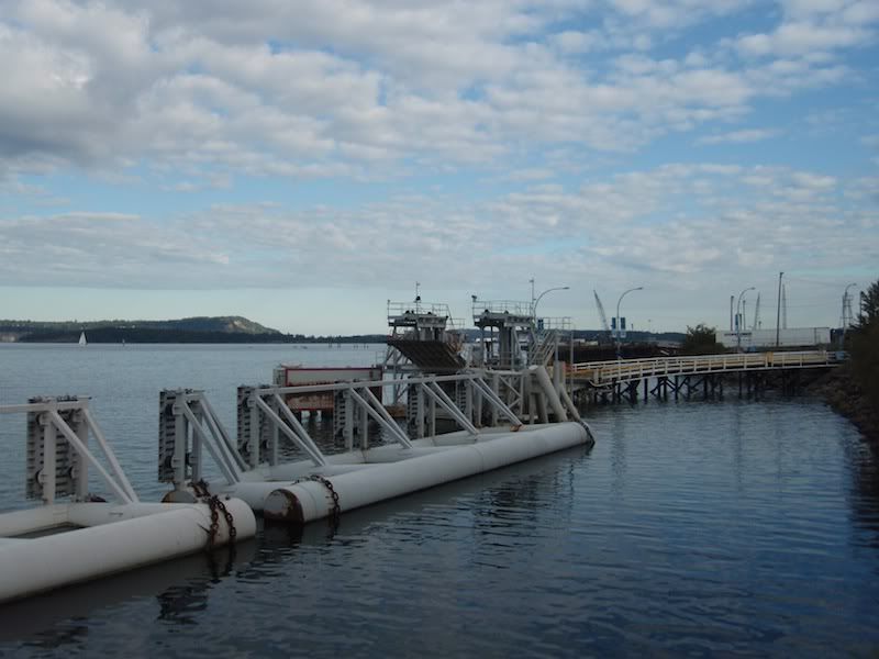
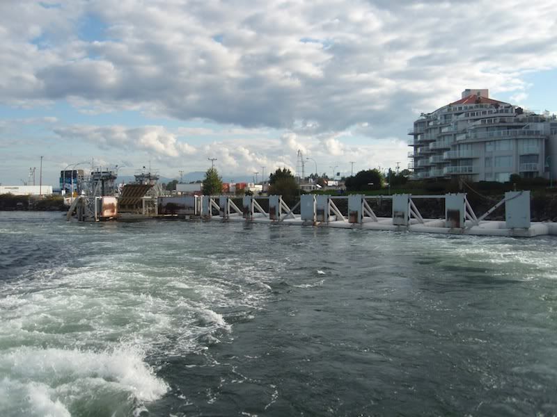
A photo-tour of the Chemainus ferry terminal. - photos taken by me on Sept.20, 2010. If you're doing a foot-passenger trip, you may need to figure out where to park your vehicle. Inside the terminal property is some 48-hour parking available, next to the crew spots. But there are only a few of these spots available.  Street parking on nearby Croft St. (right around the corner from the terminal entrance) is good for a short trip, as it's 4-hour free parking. The street extends all along the side of the mill, up the hill towards the theatre, so if you don't find a spot near the terminal, just keep looking further up the street, and you'll likely find something with only a 5-minute walk back to the terminal.  And here's the entrance to the terminal. - I asked about the new name for "the island formerly known as "Kuper". Apparently "Penelakut Island" is the new official geographic name, and new marine charts/maps are supposed to reflect this. 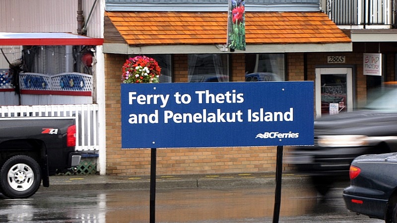 The road ways of the terminal are simple: - a lane-way towards the 1 ticket booth (drivers on the right, foot-passengers on the left-side of the booth). 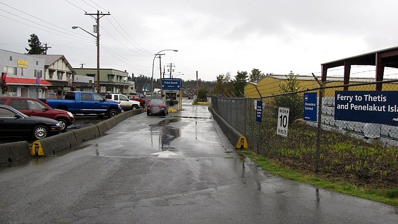 - and then a 3-lane holding compound. (the 48-hour parking area is shown on the right, where that silver truck is) 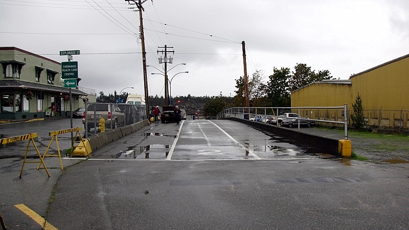 There is a passenger waiting room (with washrooms), similar to what's at the Westview terminal. 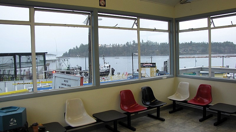 There's a covered- walkway on the left-side of the jetty. 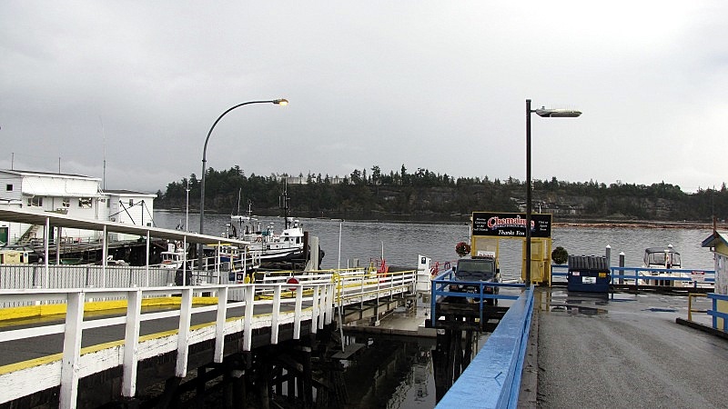 There are some special requirements for being allowed in the foot-passenger area. 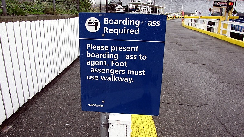 Once at the gate, the sign reminds you that it's ok to smoke on any other ship; but not the Kuper.  (by the way, the vessel name, like the old name of the island, is pronounced like "Cue-per".) From the terminal jetty, there is no great view of the approaching ferry, because the harbour ships block the view. So it's a last-second "coming into view" experience when the MV Cue-Per rounds the last ship and suddenly comes into view at the berth.  Here's the view from the ship, of the lowered ramp: - the ferry-berth has the town marina on one side, and a shipyard on the other side. 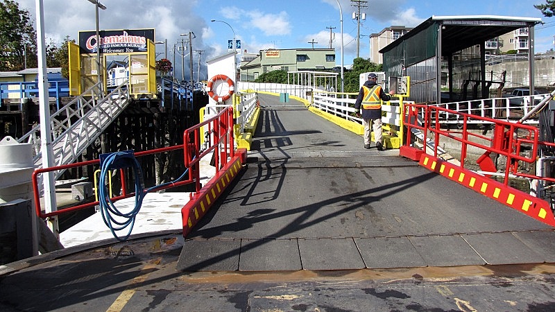 - here's a close-up of the ways. 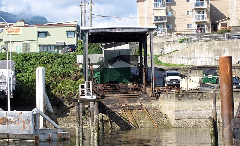 ----------------- As I mentioned earlier, the berth is well hidden by the harbour neighbours. Here's the view of the berth, from the ship: - approaching the berth, you can't see it. I realize that the camera-zoom distorts things, but the berth is at the gap that is just forward of the tug-boat's bow, and before the black dolphin. 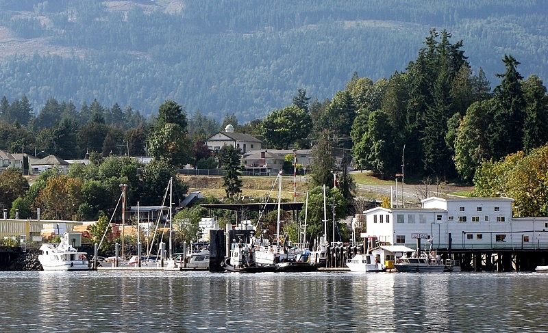 - as the ship approaches, the gap widens.  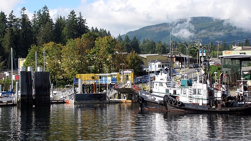 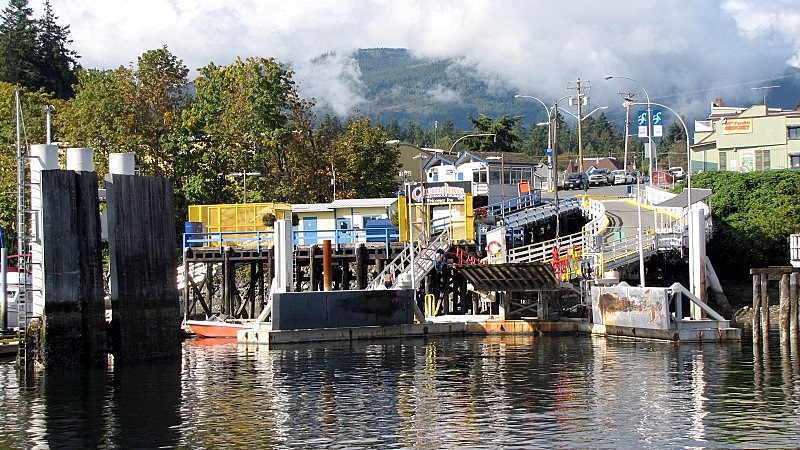 ------------ And to end this post: - a nice view from the water  |
|
|
|
Post by Low Light Mike on Sept 22, 2010 12:30:11 GMT -8
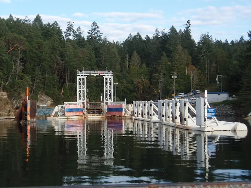
Penelakut Island is 100% 1st Nations reserve, and you need band-permission in order to disembark from the ferry at that island. I took a round-trip on the MV Kuper on Sept.20th, here are my photos of the Penelakut ferry landing and surrounding area (from the water, of course): ----------- Firstly, here's the geography lesson on this 3-port route: - there are 2 smaller islands that the ferry-routes goes past or behind: Dayman and Hudson. - For a direct route between Chemainus & Penelakut, the ferry goes south of Hudson Island. - For a direct route between Chemainus & Thetis, the ferry goes between Dayman and Hudson Islands. - And for the route between Penelakut and Thetis, the ferry goes behind Hudson Island, through a narrow channel between Hudson Island and Foster Point (which is on Thetis Island). Here's a map to illustrate this: 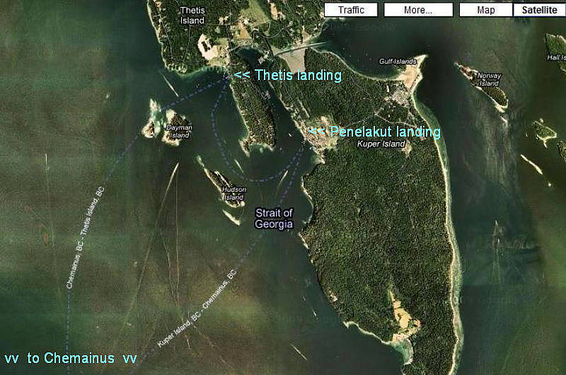 ------------------ Ferry in mid-journey, going to Penelakut. - Hudson Island is in foreground. You can see the green fields of Capernwray Harbour (which is beside the Thetis landing) on Thetis Island on the left-side of the photo, and some houses of Penelakut are visible on the right side of the photo. 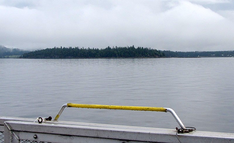 Passing Hudson Island on our left, as we head into Penelakut. - the gap-in-the-trees on Hudson Island is a private air-strip. - you can see the green-fields of Capernway on Thetis, and Foster Point on Thetis is in the photo's centre. 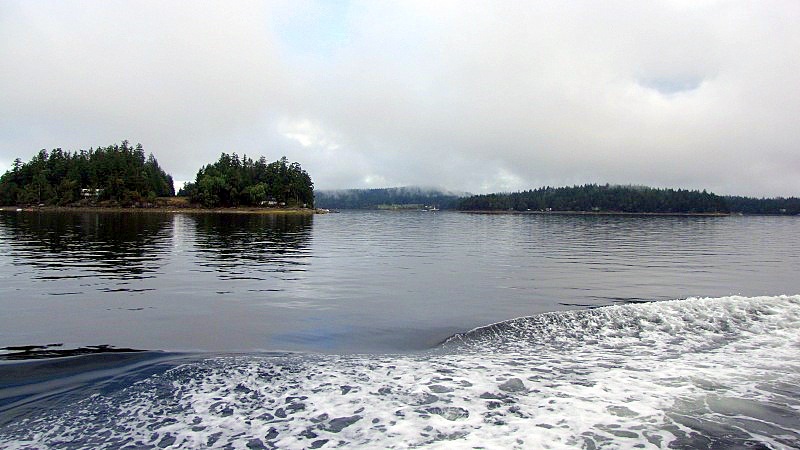 Approaching the berth at Penelakut Island.  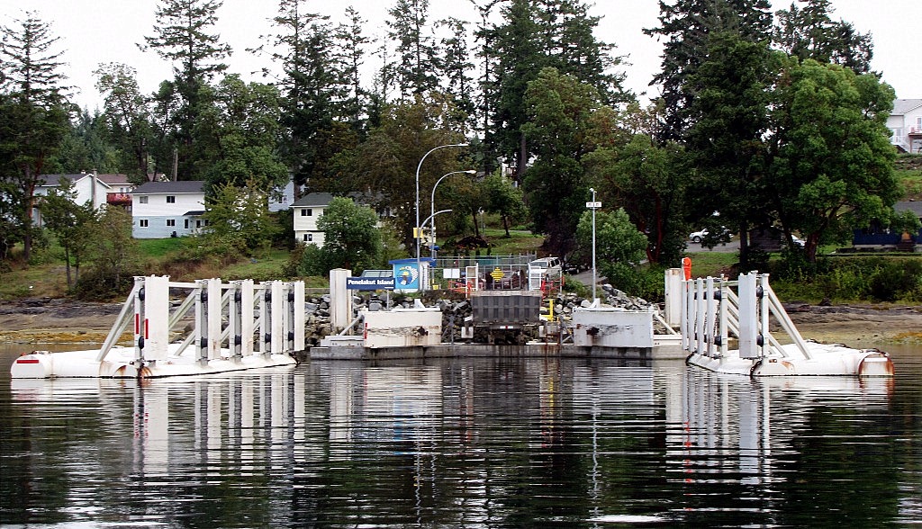 Some berth-area close-ups: 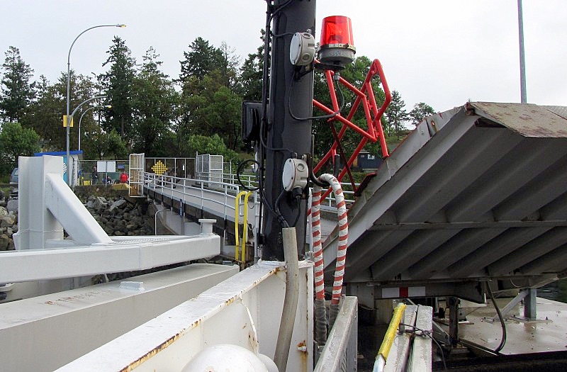 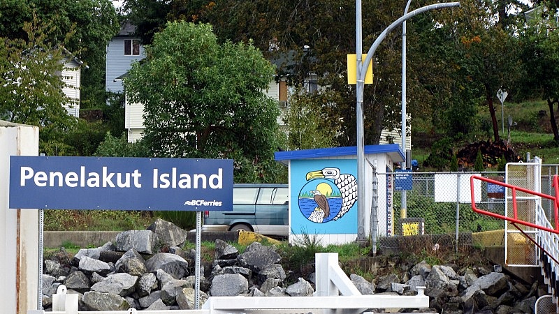 ------------------ After leaving the Penelakut berth, we go through the channel between Hudson Island and Foster Point:  Here's a video of the channel: www.facebook.com/v/437680413646Next stop, Thetis Island ! ============= |
|
|
|
Post by Low Light Mike on Sept 22, 2010 17:26:06 GMT -8
Thetis Island dock, at Capernwray Harbour: I took a round-trip on the MV Kuper on Sept.20th, here are my photos of the Thetis Island ferry landing and surrounding area (from the water, of course): ----------- The approach to the dock: 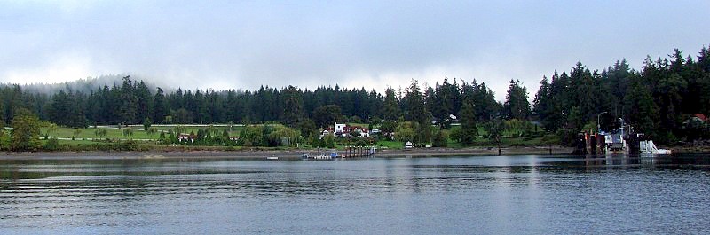 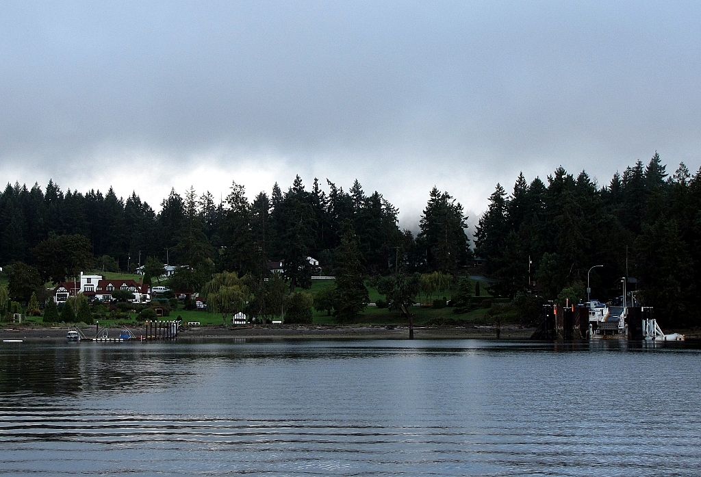 The farm-like / resort-like fields and buildings on the left of the ferry-dock are the Capernwray Harbour Bible School & Conference Centre. - a group of ladies from my church attends a ladies-retreat that is held there, each year. www.capernwray.caThe dock: - the holding compound is the typical "side of a steep, winding road". 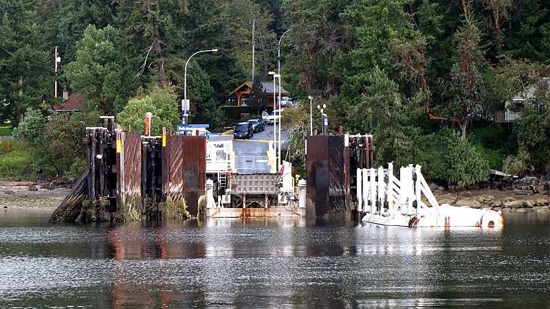 - There's a short jetty  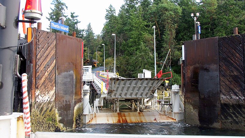 Leaving Thetis, and Capernwray Harbour: 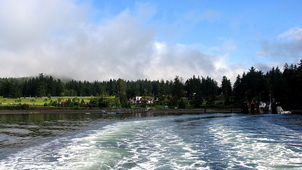 Looking forward at Vancouver Island in the distance: - Dayman Island on the right, Hudson Island on the left. 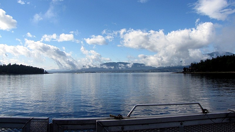 |
|
|
|
Post by lmtengs on Sept 22, 2010 20:45:48 GMT -8
Seeing that Thetus and Penelakut are so close together, why don't they just have a bridge built between the two islands instead of all the extra cost of running a ferry service to both?
|
|
Koastal Karl
Voyager
Been on every BC Ferry now!!!!!
Posts: 7,747
|
Post by Koastal Karl on Sept 22, 2010 21:24:16 GMT -8
There is a little canal that seperates the two islands! At low tide you could almost walk right across. Little boats go through there when the tide is high! I have been to Thetis once and saw it but I havent been there recently!
|
|
|
|
Post by Curtis on Oct 3, 2010 21:09:49 GMT -8
|
|
|
|
Post by novabus9228 on Nov 26, 2010 12:09:35 GMT -8
Mural at the Descanso Bay terminal, Gabriola Island notice the QuinSAM inbound to her dock. Nov 24, 2010 Attachments:
|
|
|
|
Post by Low Light Mike on Jan 4, 2011 20:45:16 GMT -8
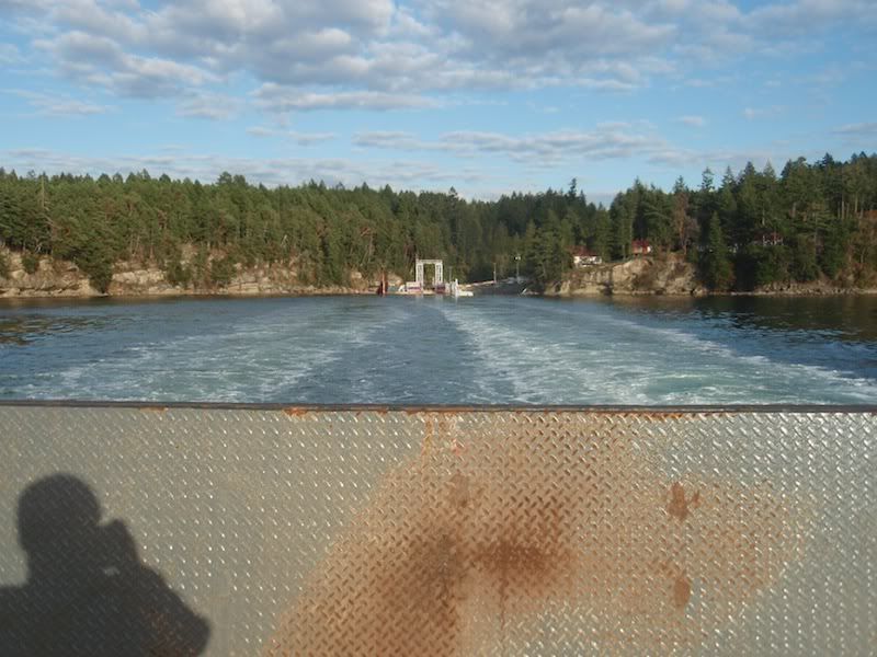
Gabriola route terminals. Photos from 12/31/2010 and 1/1/2011: - Nanaimo Harbour terminal, at winter sunrise: 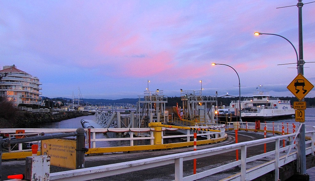 - Kingfisher using the Nanaimo harbour terminal as a resting-spot.  Berth at Descanso Bay: 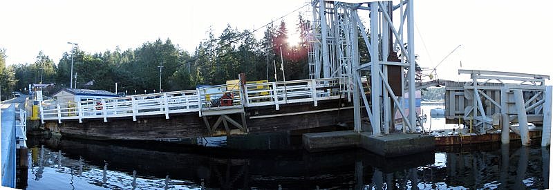 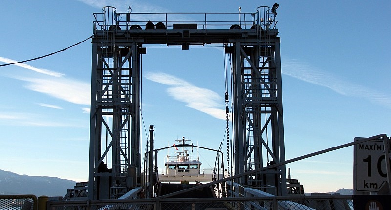 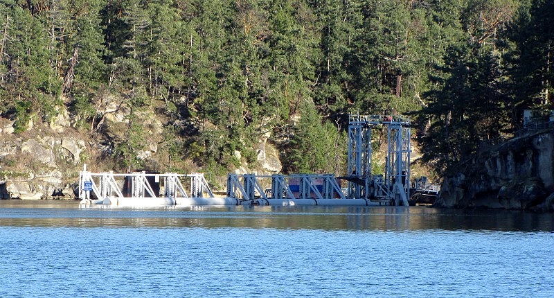 |
|
|
|
Post by Low Light Mike on Jan 6, 2011 18:49:51 GMT -8
Another early morning view of the Gabriola route's Nanaimo harbour terminal. - from the departing Quinsam on 12/31/2010:  |
|
|
|
Post by Low Light Mike on Jan 17, 2011 12:43:09 GMT -8
|
|
|
|
Post by Low Light Mike on Jun 4, 2011 20:05:38 GMT -8
Nanaimo harbour terminal's new building, under construction. - this will be used for the passengers waiting to travel to Gabriola Island.  - photo from June 4, 2011. |
|
|
|
Post by Low Light Mike on Jun 5, 2011 12:40:55 GMT -8
Photo of the construction of the ferry-landing at Descanso Bay. - from the Gabriola Museum  |
|
|
|
Post by Low Light Mike on Jun 9, 2011 14:56:04 GMT -8
A new thread to break-out Gabriola and Thetis/Penelakut route terminals.
- to reduce congestion on the main Southern Gulf Islands terminal thread.
|
|
|
|
Post by Low Light Mike on Jun 9, 2011 15:00:57 GMT -8
Karl has given me permission to post some photos from his Facebook albums. - I've adjusted the contrast & colours a bit, and here are some of his photos relating to this thread: ------------------------------- Penelakut Island 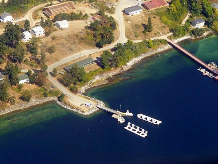 |
|
|
|
Post by lmtengs on Jun 20, 2011 18:32:24 GMT -8
|
|
|
|
Post by Low Light Mike on Aug 20, 2011 12:32:31 GMT -8
August 20, 2011 photos of the under-repair trestle at Nanaimo Harbour terminal. - 1 week after a paving contractor damaged the structure. -----------------    |
|
|
|
Post by Low Light Mike on Sept 10, 2011 10:52:13 GMT -8
The new passenger building at Nanaimo Harbour terminal, for the Gabriola Island route. 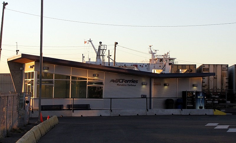 That's Seaspan's Carrier Princess in the background. |
|