|
|
Post by WettCoast on Nov 25, 2017 11:09:47 GMT -8
A scene viewed from a ferry ( Q of Cumberland) with a really big lens ... Gulf Islands view with Portlock Point Lighthouse in the left foreground, Galiano Island in distance & the Coast Mountains across Georgia Strait in the far distance. 8 November 2017 The mountains in this view are in & around Mount Garibaldi, I believe. Portlock Point Lighthouse is now a part of Gulf Islands National Park Reserve. Take a read on this ...  © WCK-JST by Jim Thorne, on Flickr © WCK-JST by Jim Thorne, on Flickr |
|
|
|
Post by Low Light Mike on Nov 25, 2017 13:13:46 GMT -8
That was a good read, full of sad and interesting history. Thanks for that link.  |
|
|
|
Post by Kahn_C on Dec 7, 2017 21:33:07 GMT -8
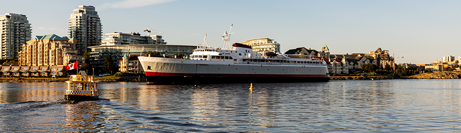
Looking towards Gibsons from deck 3 of the Queen of Surrey on a foggy December day. If you squint, you can just make out a Raven perched at Langdale. (I tried to get a decent shot, but given the lack of a real camera, the low light and the fog it didn't work out...)  Langdale from the Queen of Surrey Langdale from the Queen of Surrey by KC, on Flickr |
|
|
|
Post by Low Light Mike on Feb 4, 2018 18:08:17 GMT -8
I'm on board the Baynes Sound Connector and looking at a thin line of Denman Island in the fog. - morning of February 4, 2018  DSC00197 DSC00197 by Mike Bonkowski, on Flickr |
|
|
|
Post by Low Light Mike on Feb 10, 2018 17:07:40 GMT -8
Here is a dashboard camera view of a car & ferry trip from Fanny Bay area to Hornby Island, and back. I went to Hornby for a work trip (the video will show you where), and so I had camera fun on my trip.
I post this as a tribute to those who've done this journey before me:
- To the farmers with their wagons on the Water Lily
- To the Studebakers on the Hornby Island V
- To the Dung Bomb on the Quinitsa
|
|
Neil
Voyager 
Posts: 7,170
|
Post by Neil on Feb 10, 2018 17:29:34 GMT -8
Here is a dashboard camera view of a car & ferry trip from Fanny Bay area to Hornby Island, and back. I went to Hornby for a work trip (the video will show you where), and so I had camera fun on my trip. I post this as a tribute to those who've done this journey before me: - To the farmers with their wagons on the Water Lily - To the Studebakers on the Hornby Island V - To the Dung Bomb on the Quinitsa I see you have a movie agent on Hornby who has already posted your film to the island's facebook page. When you left the Co-op gas station, you briefly turned on to Sollans, as if you were heading to my place (I wasn't on the island) but then you turned around. How come? You could have continued down and seen the controversial Warhol soup can water tank. |
|
|
|
Post by Low Light Mike on Feb 10, 2018 18:28:40 GMT -8
I see you have a movie agent on Hornby who has already posted your film to the island's facebook page. When you left the Co-op gas station, you briefly turned on to Sollans, as if you were heading to my place (I wasn't on the island) but then you turned around. How come? You could have continued down and seen the controversial Warhol soup can water tank. My friend Katherine had a no-fee special on film distribution to the Word-of-Mouth group, so I took advantage of it. - I try to be a member of the prime local Facebook group on each island that I visit, so that I can share vacation photos or work-trip photos like this. Sometimes the group lets me join (Sointula, Pender, SaltSpring, Gabriola), and other times I get the non-local thumbs-down. I was wondering how much commercial or community-service things were near the Sollans & Central intersection, so I did the brief turn-off to see the library area, just out of curiosity. I figured it was the 2nd busiest corner on the island. I forgot that I could have continued down that road to Grassy Point and gotten back to Central Road further on. My other excuse is that I was aiming to catch a ferry, to get home in time to watch the Super Bowl. |
|
Neil
Voyager
Posts: 7,170
|
Post by Neil on Feb 10, 2018 22:40:01 GMT -8
I see you have a movie agent on Hornby who has already posted your film to the island's facebook page. When you left the Co-op gas station, you briefly turned on to Sollans, as if you were heading to my place (I wasn't on the island) but then you turned around. How come? You could have continued down and seen the controversial Warhol soup can water tank. My friend Katherine had a no-fee special on film distribution to the Word-of-Mouth group, so I took advantage of it. - I try to be a member of the prime local Facebook group on each island that I visit, so that I can share vacation photos or work-trip photos like this. Sometimes the group lets me join (Sointula, Pender, SaltSpring, Gabriola), and other times I get the non-local thumbs-down. I was wondering how much commercial or community-service things were near the Sollans & Central intersection, so I did the brief turn-off to see the library area, just out of curiosity. I figured it was the 2nd busiest corner on the island. I forgot that I could have continued down that road to Grassy Point and gotten back to Central Road further on. My other excuse is that I was aiming to catch a ferry, to get home in time to watch the Super Bowl. Is that our now very infrequent contributor, Kather Anne? The corner of Central and Sollans is definitely the center of Hornby's community services. Within a very few hundred metres, you have the school, pre-school, hall, seniors center, new archive building, library, medical clinic, social services building, dental clinic, and credit union. Nearby is the ballpark, recycling center, cemetery, and new firehall. I've sometimes thought it would be nice if the island could have developed all these facilities in concert with a commercial hub; then you would have what could properly be called a village center. But it didn't happen that way. |
|
|
|
Post by Low Light Mike on Feb 10, 2018 22:45:27 GMT -8
Is that our now very infrequent contributor, Kather Anne? That is her. You can find her at a Facebook photo group called "Vancouver Island Images." One of the most interesting people that I've ever met on the internet. |
|
|
|
Post by Low Light Mike on Mar 27, 2018 18:19:36 GMT -8
Here's a video I made of a trip from Earls Cove to Courtenay.
|
|
|
|
Post by WettCoast on Mar 28, 2018 9:05:49 GMT -8
View from the Queen of Cowichan ... Point Atkinson Light & the Lions Gate Bridge at the entrance to Vancouver Harbour 17 March 2018 In this pic you can just make out that another ferry is visible on the right of the photo. 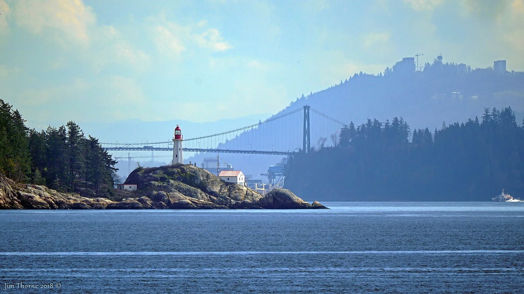 © WCK-JST by Jim Thorne, on Flickr © WCK-JST by Jim Thorne, on Flickr |
|
lohium
Oiler (New Member)

Posts: 18 
|
Post by lohium on Mar 28, 2018 20:12:54 GMT -8
View from the Queen of Cowichan ... Point Atkinson Light & the Lions Gate Bridge at the entrance to Vancouver Harbour 17 March 2018 In this pic you can just make out that another ferry is visible on the right of the photo. © WCK-JST by Jim Thorne, on FlickrIs that the V2V ferry? |
|
|
|
Post by WettCoast on Mar 28, 2018 20:34:00 GMT -8
|
|
|
|
Post by paulvanb on Mar 28, 2018 20:34:06 GMT -8
View from the Queen of Cowichan ... Point Atkinson Light & the Lions Gate Bridge at the entrance to Vancouver Harbour 17 March 2018 In this pic you can just make out that another ferry is visible on the right of the photo. © WCK-JST by Jim Thorne, on FlickrWow, the power of super zoom! The complete opposite of wide angle. |
|
lohium
Oiler (New Member)
Posts: 18
|
Post by lohium on Apr 15, 2018 19:34:34 GMT -8
|
|
|
|
Post by WettCoast on Apr 15, 2018 20:56:43 GMT -8
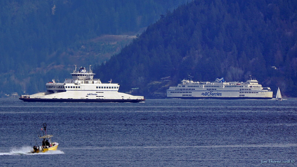
Not my video, but are any of you able to identify the ferry in this video from just the short clip at :40 in the video? It must be one the Coastals, probably the Inspiration because that has to be Route 30, right? This is just as likely to be route 1 as route 30, so the ferry in question could be any of the three Coastals ... It is not uncommon to see this 'line in the water' when the Fraser is in 'freshet' in May - June. In June a few years back I saw Fraser water meeting ocean blue in Active Pass, half way on the route between Tsawwassen & Swartz Bay. www.flickr.com/photos/41465870@N04/8218719365/in/datetaken/ |
|
|
|
Post by Curtis on Apr 19, 2018 0:00:48 GMT -8
Scenes of Jervis Inlet as seen from the Bowen Queen. All Photos are © CS16 Photography and may only be used with Permission from the Owner.Looking toward the East the Inlet,  Car Deck, #2 End, Bowen Queen. Car Deck, #2 End, Bowen Queen. by Curtis Simonetta, on Flickr And looking toward the mast, er, west.  Car Deck #1 End, Bowen Queen. Car Deck #1 End, Bowen Queen. by Curtis Simonetta, on Flickr Never get tired of this view.  Mount Calder and Freil Lake Falls, Jervis Inlet. Mount Calder and Freil Lake Falls, Jervis Inlet. by Curtis Simonetta, on Flickr As we go between Islands.  Deck 5, Sun Deck, Bowen Queen. Deck 5, Sun Deck, Bowen Queen. by Curtis Simonetta, on Flickr 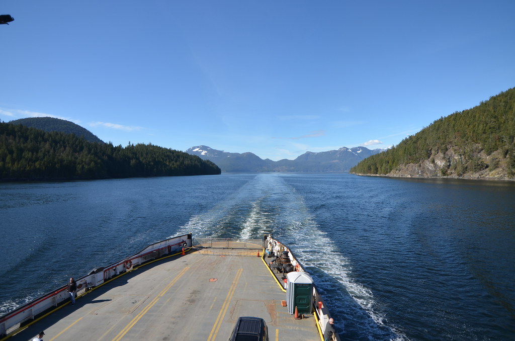 Car Deck #1 End, Bowen Queen. Car Deck #1 End, Bowen Queen. by Curtis Simonetta, on Flickr Back the other way. 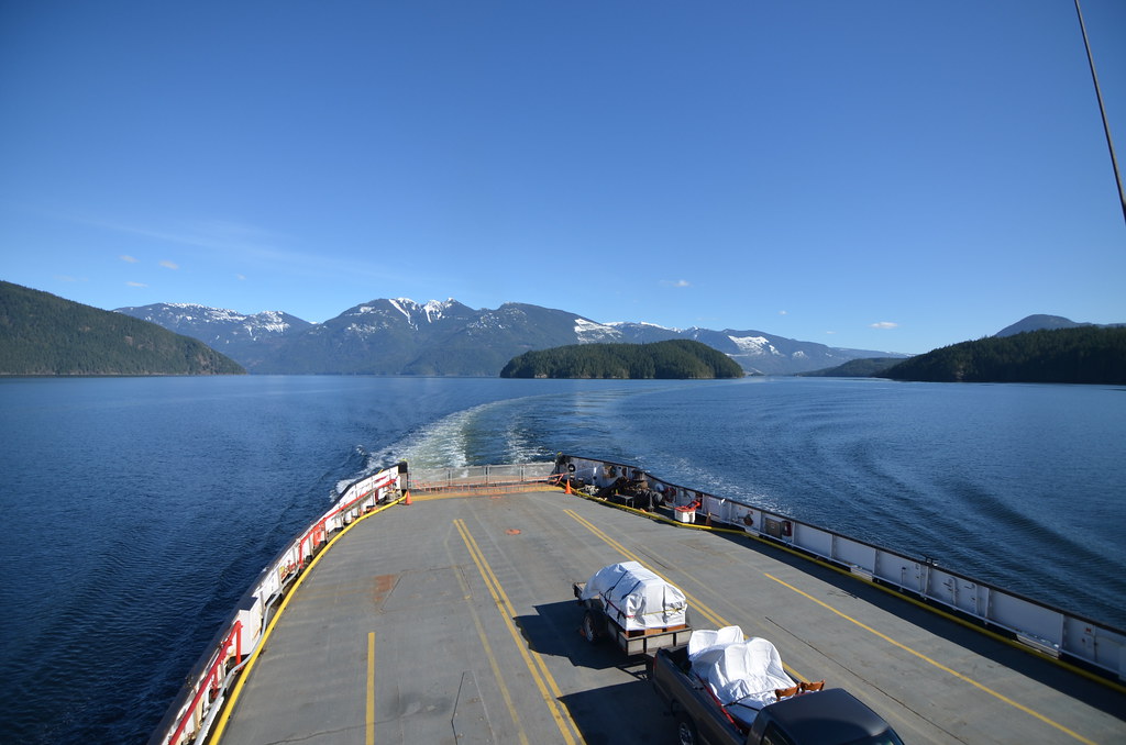 Car Deck #2 End, Bowen Queen. Car Deck #2 End, Bowen Queen. by Curtis Simonetta, on Flickr In the shadow of Mount Troubridge. 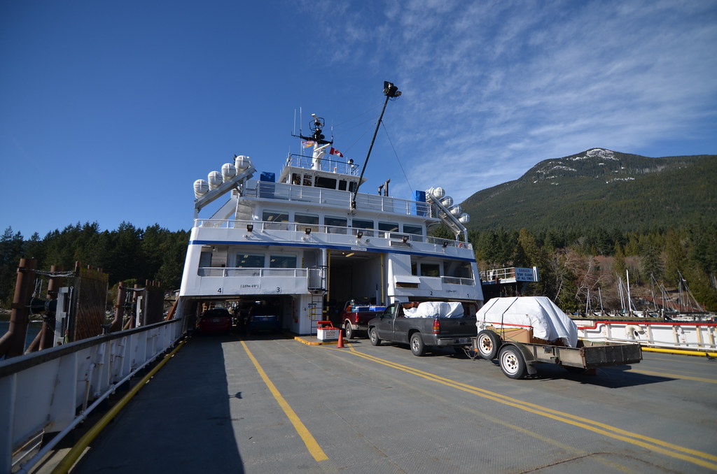 Deck 2, Car Deck, Bowen Queen. Deck 2, Car Deck, Bowen Queen. by Curtis Simonetta, on Flickr That's all for now. |
|
|
|
Post by WettCoast on Apr 20, 2018 10:47:04 GMT -8
|
|
|
|
Post by WettCoast on May 1, 2018 9:05:52 GMT -8
The Tusk, Howe Sound & BC Ferries 'The Tusk' would be the peak named 'The Black Tusk', in Garibaldi Park, which is visible on the skyline in this photo. The ferry is the Queen of Coquitlam heading for Langdale on the Sunshine Coast. 17 March 2018 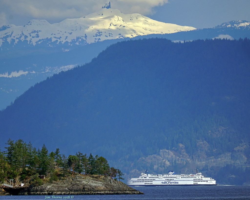 © WCK-JST by Jim Thorne, on Flickr © WCK-JST by Jim Thorne, on Flickr |
|
|
|
Post by Low Light Mike on Jul 16, 2018 10:49:01 GMT -8
The ferry view of Active Pass. I never get tired of it...
|
|
|
|
Post by Low Light Mike on Jul 27, 2018 16:14:54 GMT -8
The Swartz Bay to Fulford Harbour route, see from Skeena Queen.
July 19, 2018
|
|
|
|
Post by ragingpotatoyt on Aug 1, 2018 14:34:12 GMT -8
 Powell River In the distance |
|
|
|
Post by timmyc on Sept 1, 2018 14:16:30 GMT -8
|
|
|
|
Post by paulvanb on Feb 12, 2019 9:06:48 GMT -8
|
|
|
|
Post by paulvanb on Mar 25, 2019 17:38:29 GMT -8
|
|