|
|
Post by Low Light Mike on Jul 22, 2012 21:11:03 GMT -8
If you do the spirals I really recommend the hike up to the old "big hill" grade where you can find the remains of an old narrow gauge steam engine. Here's how it looked a few weeks ago: 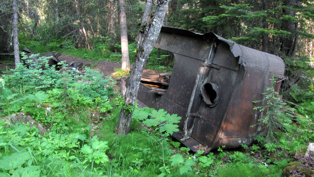 And here's the sign for the #3 safety-spur, which is "item #7" on the "Walk in the past" interpretive trail.  |
|
|
|
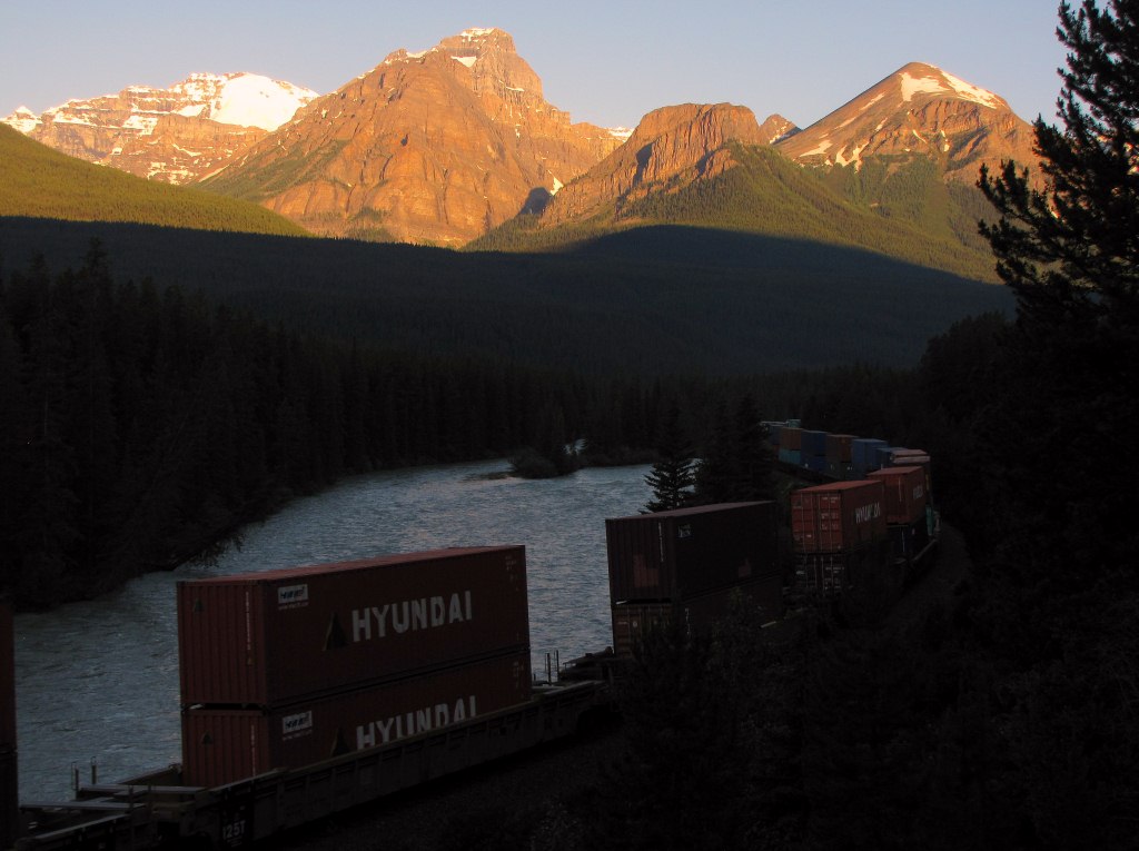
Post by Low Light Mike on Jul 23, 2012 19:24:56 GMT -8
Westbound double-stack container train at Morant's Curve.
- just after sunrise, on July 11, 2012.
VIDEO:
|
|
|
|
Post by Low Light Mike on Jul 28, 2012 16:11:26 GMT -8
View from Hwy-1, on east side of Rogers Pass. The 2 CPR grades are visible, with the low-slope westbound track having a coal train visible. The higher-slope eastbound grade is barely visible, there is a bridge over a ravine on the far-left of the photo. 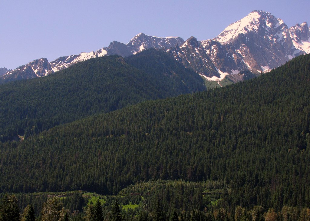 |
|
|
|
Post by Low Light Mike on Jul 28, 2012 16:47:39 GMT -8
Mt. Stephen became a familiar and always-breathtaking sight during our 3 night stay at Cathedral Mountain Lodge in Yoho Park. - there is a short rail tunnel at the bottom of the mountain. 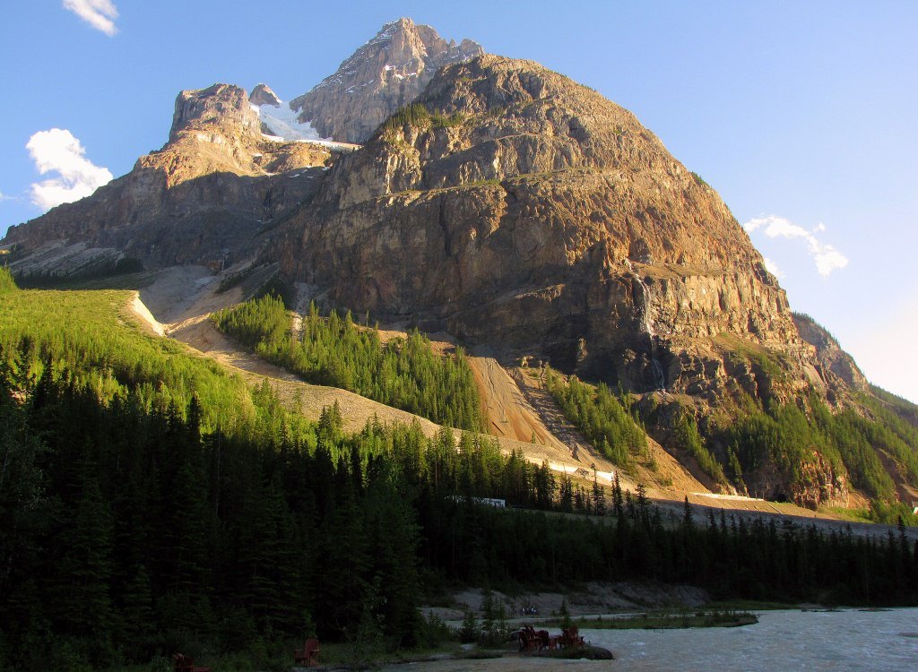 Westbound train entering the 1884 nose tunnel. 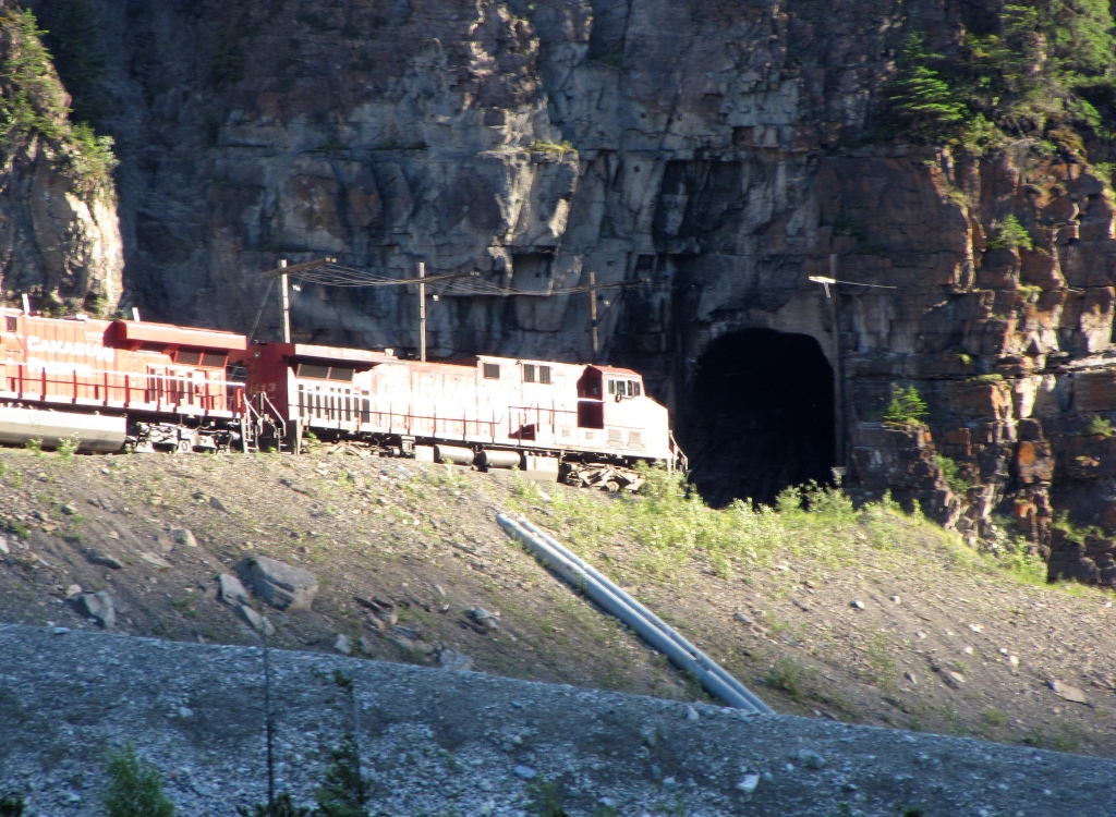 Through the nose. 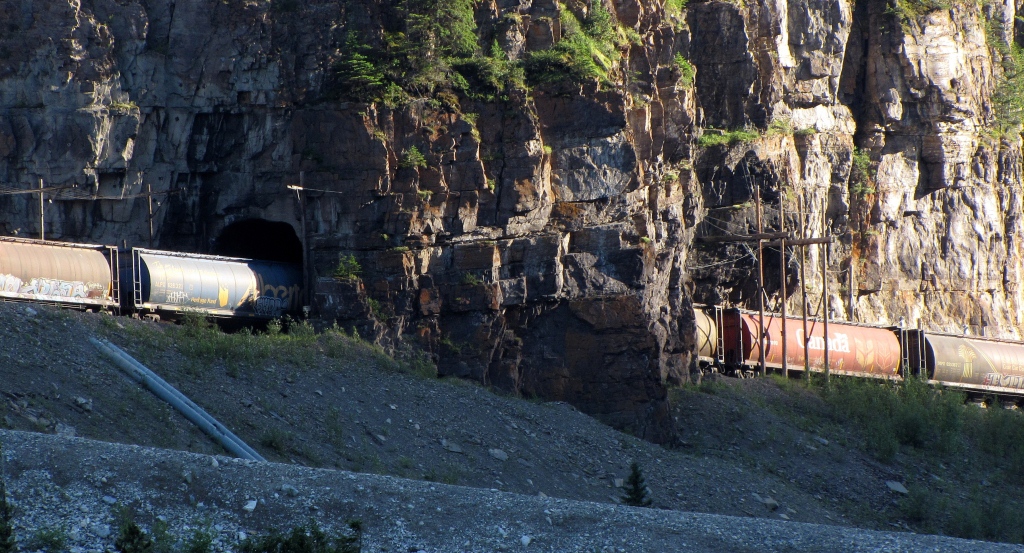  |
|
|
|
Post by Low Light Mike on Jul 28, 2012 18:46:46 GMT -8
A few pano-stitches from my recent trip: Antique cars at the Lake Louise train station 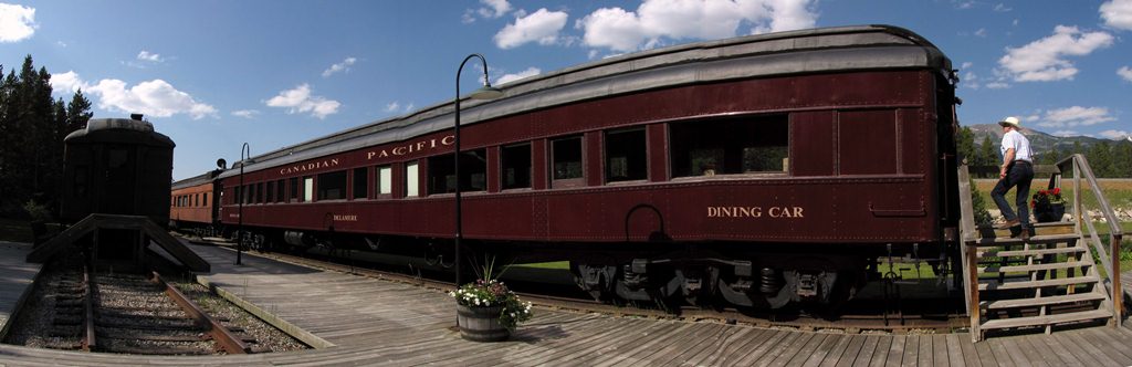 The mecca that is Morant's Curve: At Sunrise:  In mid-morning, a few days later: 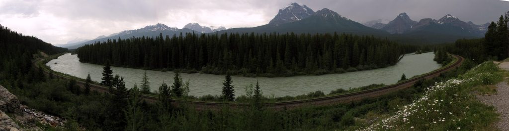 |
|
|
|
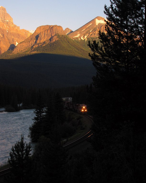
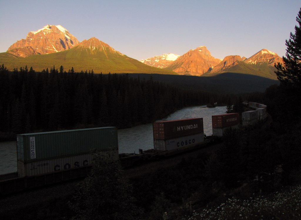
Post by Low Light Mike on Jul 29, 2012 16:43:29 GMT -8
Westbound container train at Morant's Curve. - 6:10am on July 11, 2012. -------------------- First glimpse: 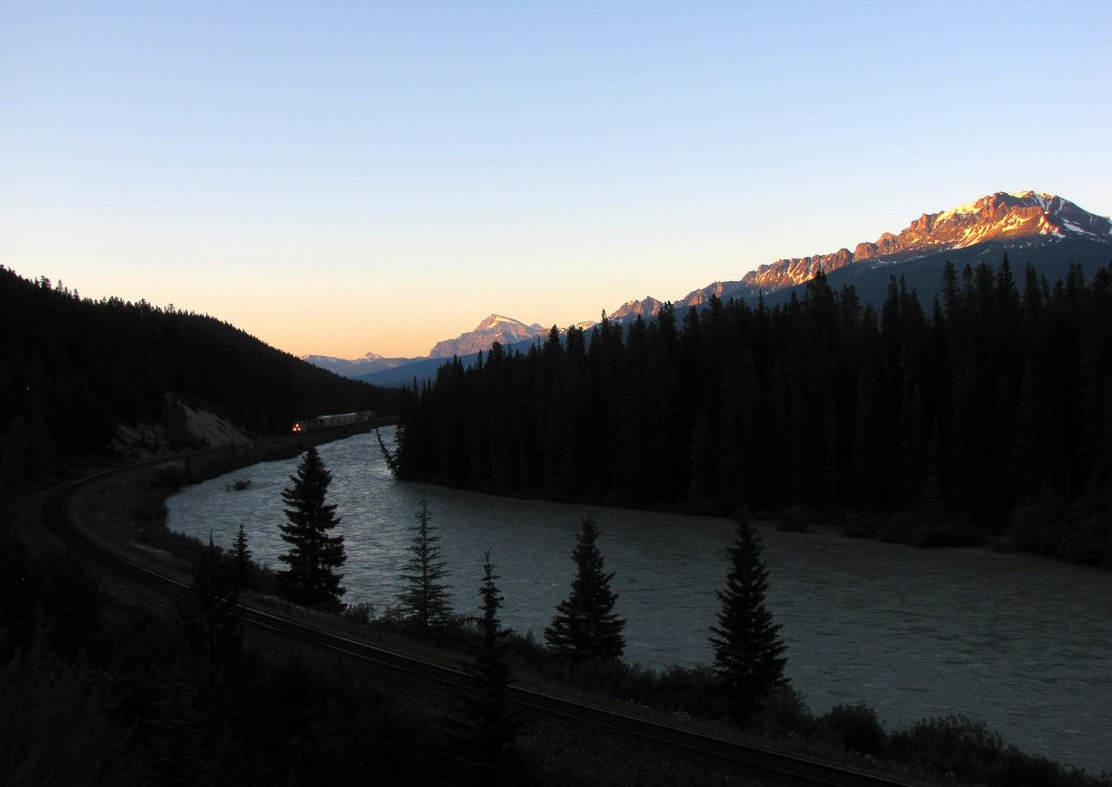 I like the headlight shine on the rails: 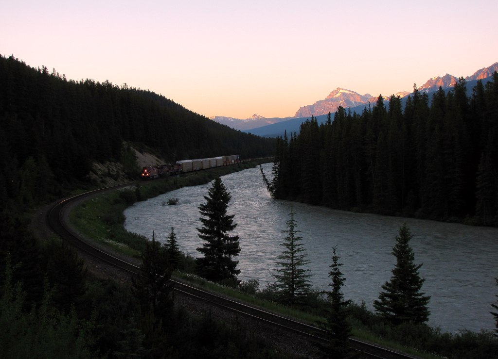 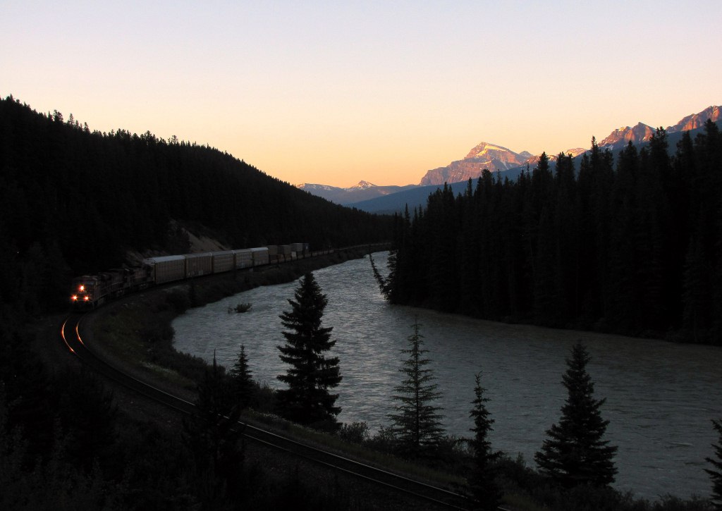 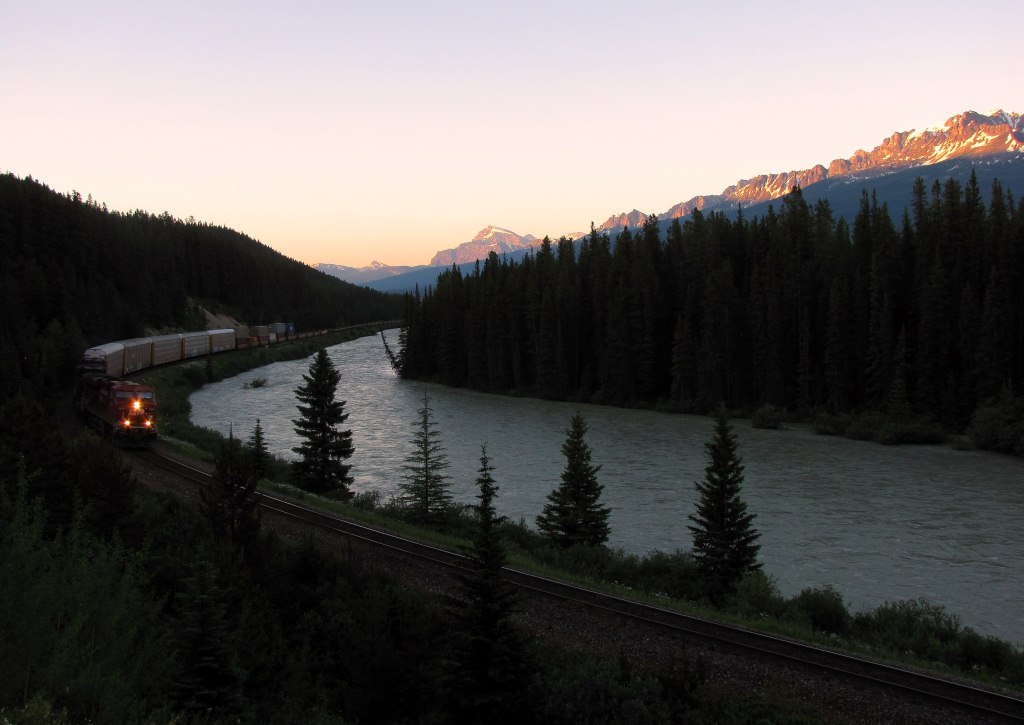 Head locomotives passing in front of me.  The classic westward view:  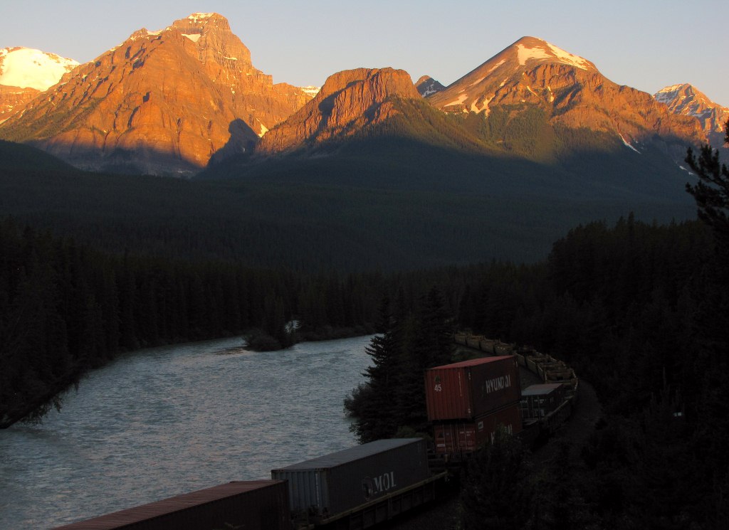 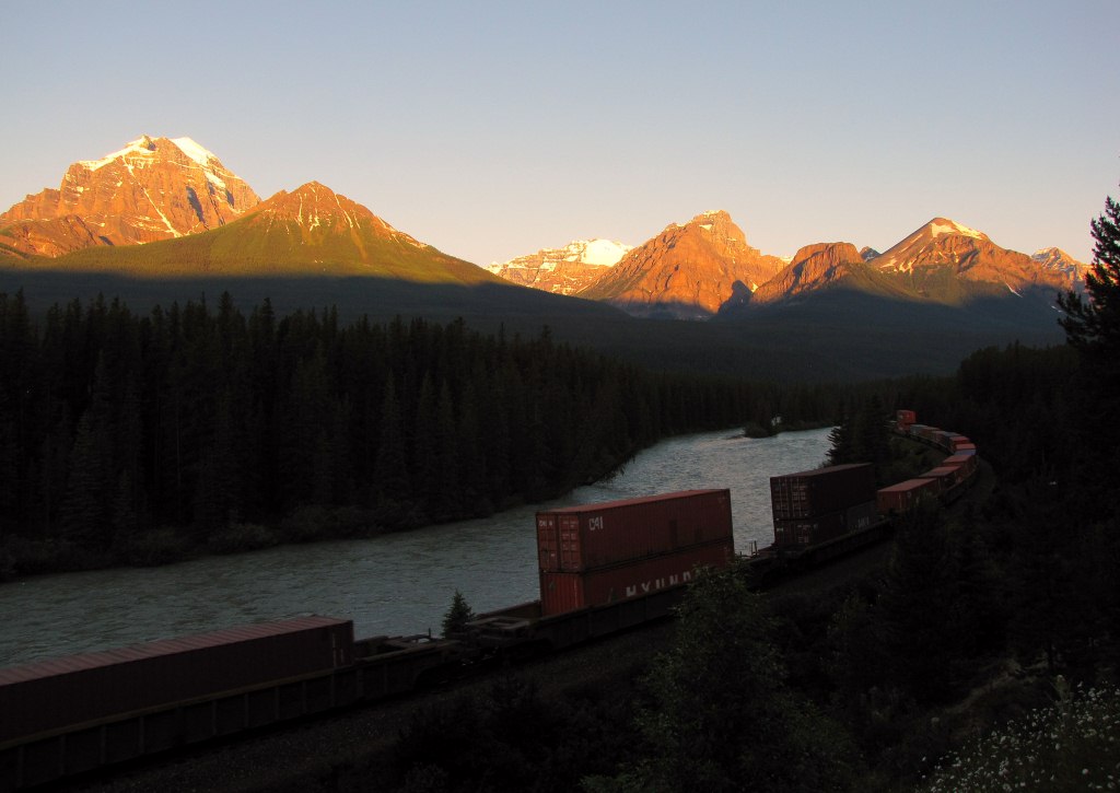 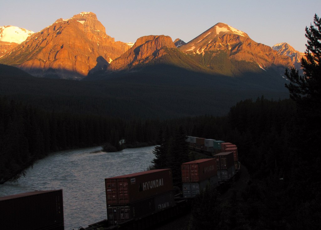 Mid-train locomotive. 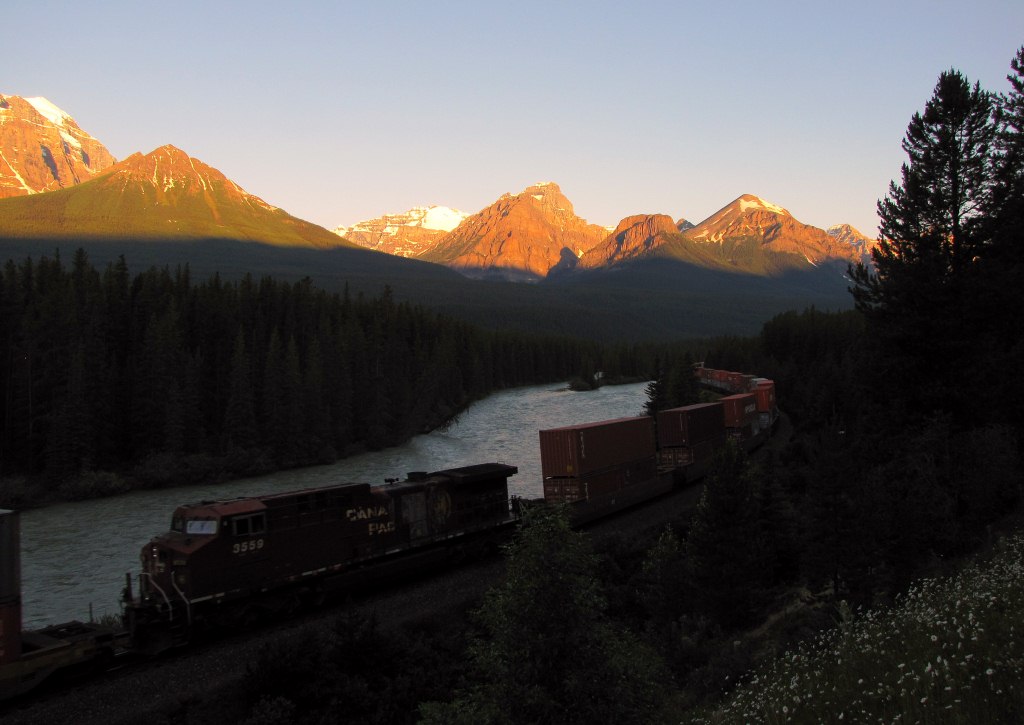 |
|
|
|
Post by Low Light Mike on Jul 30, 2012 17:06:55 GMT -8
|
|
|
|
Post by Low Light Mike on Jul 30, 2012 17:56:09 GMT -8
An hour or so after I saw 2 trains at sunrise in Morant's Curve, I saw an eastbound train climbing through the upper spiral tunnel. - July 11, 2012, seen from the viewpoint on Yoho Valley Rd. Head locomotive is on the upper track. Both portals are visible (the top right portal is like a shed) 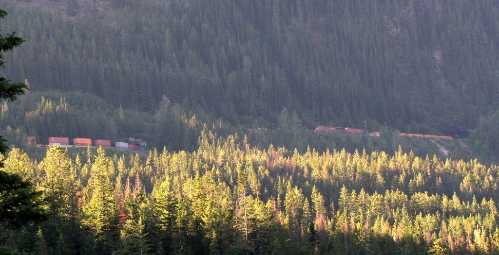 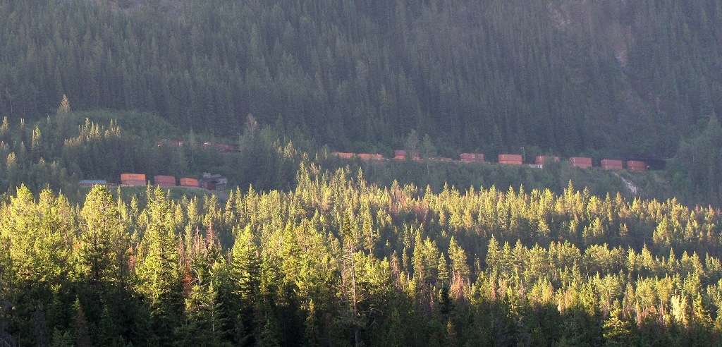 ------------- I'll do a more complete photo essay of both spiral tunnels, soon. |
|
|
|
Post by Low Light Mike on Jul 31, 2012 20:02:25 GMT -8
Upper spiral tunnel on CPR line, seen from viewpoint across the valley on Yoho Valley Rd. - morning on July 11, 2012. The setting: 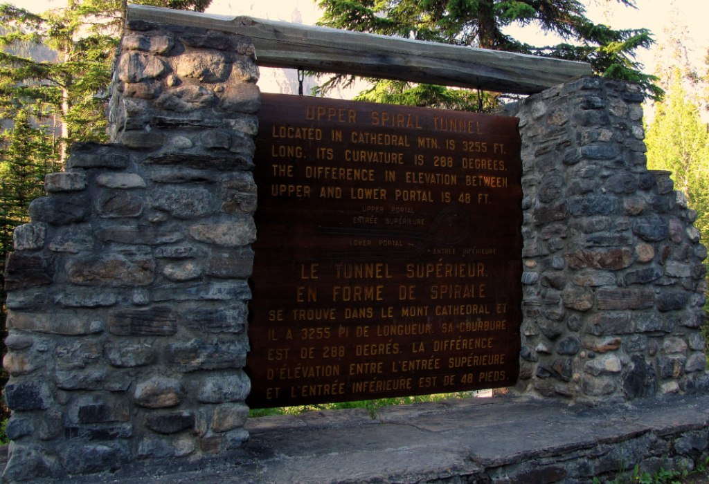 ------------------- The same eastbound (uphill) train is visible in the following 6 photos. As I told the other tourists at the viewpoint on the next day, "look to the landslide, and then look to the left". - series of zooms (that's Mt. Stephen on the right) 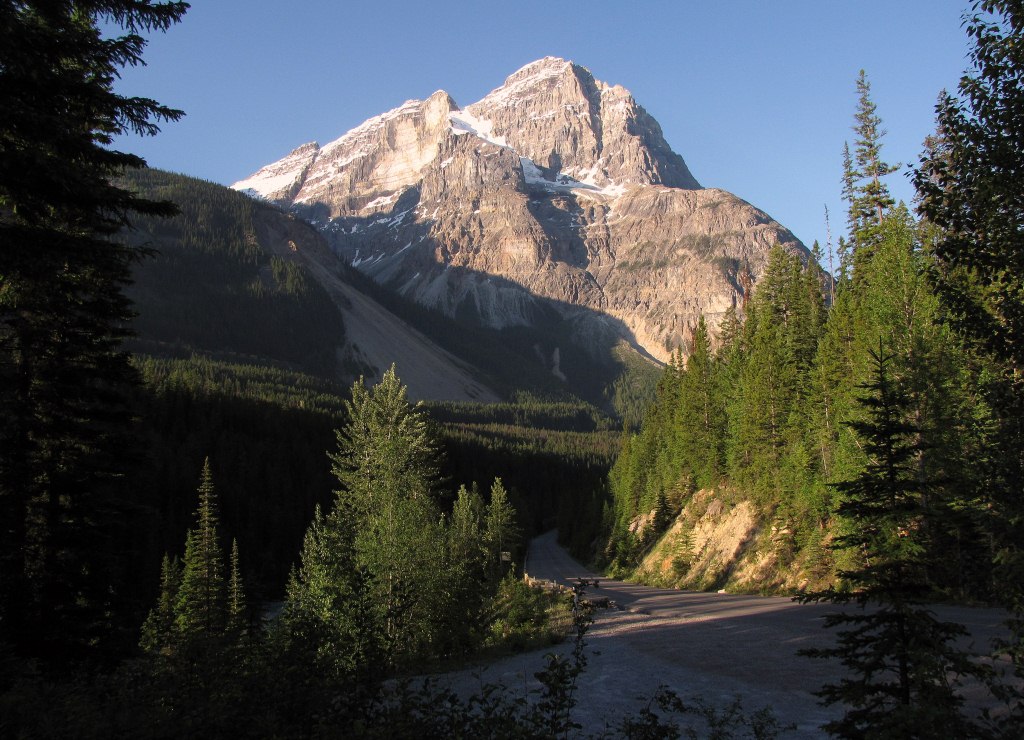 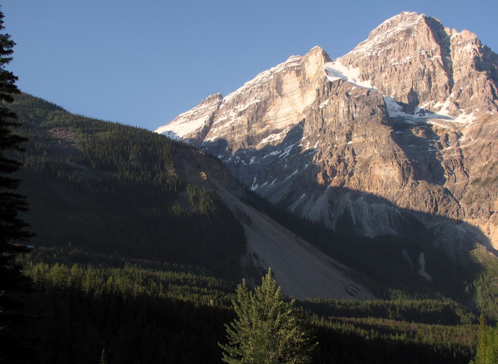 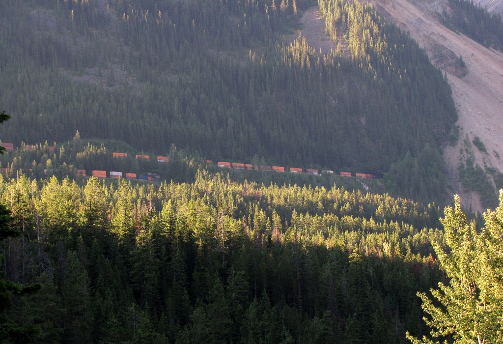  Bottom portal 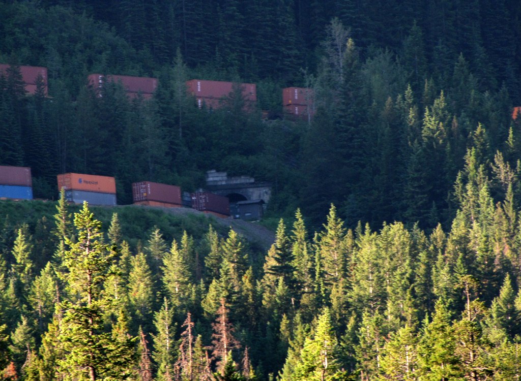 Top portal 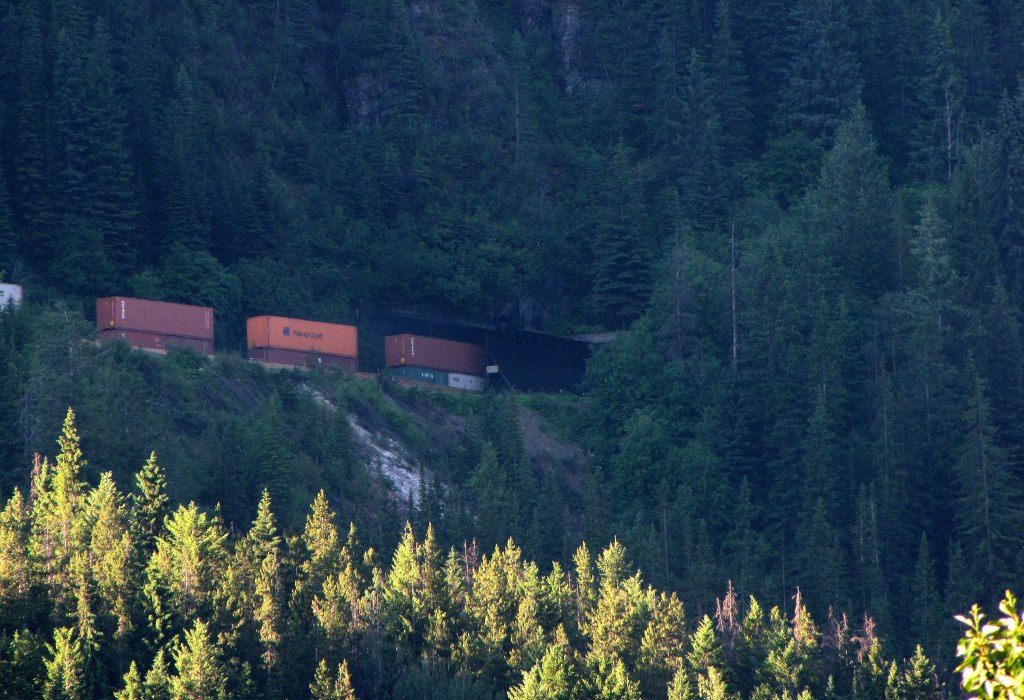 ------------------ I saw another train here, the next afternoon. I'll review and post those photos later. - I also got photos and video of a train transiting the lower spiral tunnel, where you can see the same train in 3 places at once. (that's when I played "tour guide" at the viewpoint, explaining how it all worked.....) |
|
|
|
Post by Low Light Mike on Aug 1, 2012 18:33:57 GMT -8
Some more train related items seen July 11, 2012 by me: View of Field BC, looking east. This shows the tall mountains (Mt. Stephen) and the narrow valley for the rail line.  Classic sign at Field BC 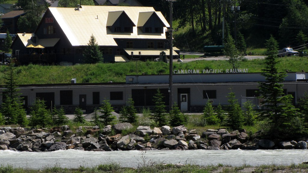 ---------------------------- Lake Louise train station: - the building is now a restaurant.  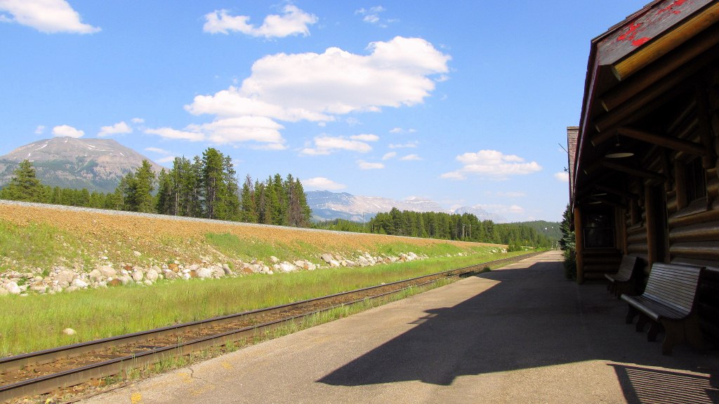 The old cars: 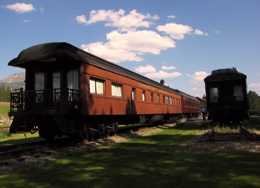 View of the 2 rail lines, with different heights. Note the make-up of the fill under the upper track.  This rock looks like Ronald McDonald  |
|
|
|
Post by lmtengs on Aug 1, 2012 19:46:54 GMT -8
Some more train related items seen July 11, 2012 by me: View of Field BC, looking east. This shows the tall mountains (Mt. Stephen) and the narrow valley for the rail line. My own rapid-drive-by photo of Field from a similar spot:  Taken not too long after yours. |
|
|
|
Post by Low Light Mike on Aug 1, 2012 20:21:36 GMT -8
Morant's curve, looking eastward in the evening light - the end of a busy July 11, 2012 for me. 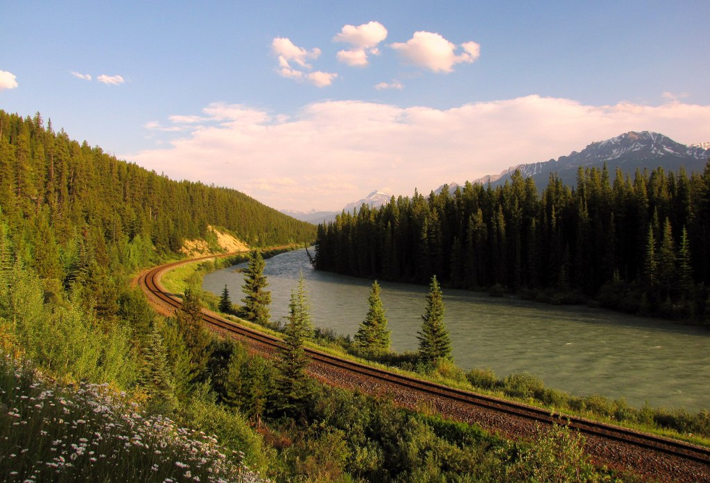 |
|
|
|
Post by Low Light Mike on Aug 2, 2012 21:05:24 GMT -8
July 12, 2012, 9:13am, and I am playing the role of tour-guide to friendly strangers at the Lower spiral-tunnel viewpoint. Happily explaining the directions of the train and how it will appear in 3 places at once. This is an Eastbound double-stack freight train, heading uphill of course. Here's the VIDEO: -------------------- And some stills: The empty track of the upper portal 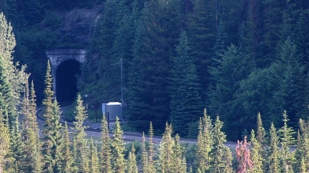 The lead locomotive appears and is about to enter the lower portal. - you can see the concrete outline of the portal, ahead of the locomotive and just behind a hilly bit of trees.  The lead locomotive emerging from the upper portal. 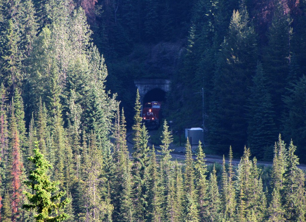  ...and a close up of same photo:  The cross-over effect, seeing the same train in 2 places. - but not quite as impressive as 3 places.... - this train enters through the bottom portal, and exits on top. 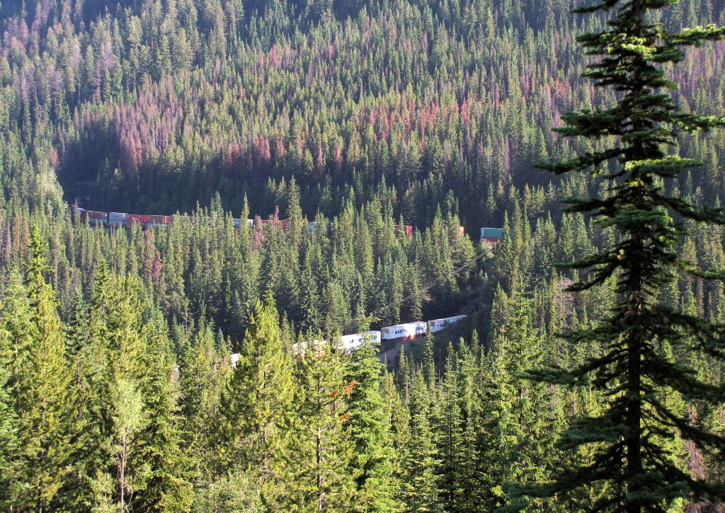 ....then the train continues on the track, across the Kicking Horse River, and appears below our viewpoint, on it's way towards the Upper spiral tunnel (which is on the other side of the highway) - Same train, 3 places seen at once 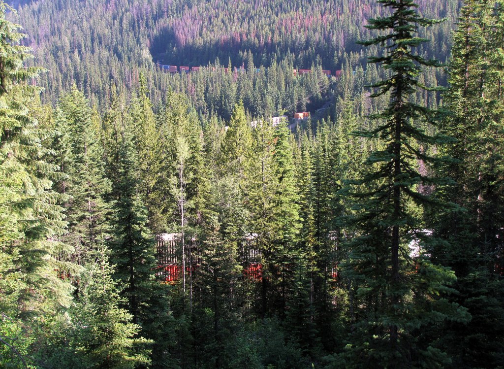 Focus back on the top portal of the tunnel, with the concrete lower portal visible in the bottom-right of the photo. 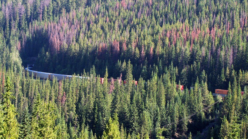 End of train, as it leaves the top portal of the lower spiral tunnel. Soon it will make its way to the track that is just below our viewpoint. 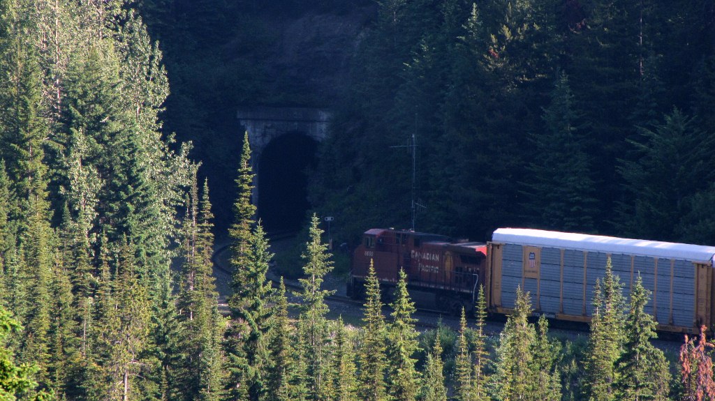 |
|
|
|
Post by Low Light Mike on Aug 5, 2012 17:27:21 GMT -8
The landslide shed over the CPR line, just east of the Mt. Stephen nose tunnel. - just above Hwy-1 in Yoho Park, across from where I stayed for 3 nights in July. The scene of the landslide path, where there have been numerous slides over the years, caused by a water build-up in a water-pool (tarn?) near the top of Mt. Stephen (or something like that). - there was a bad slide in 1988, and after that there was a water-diversion (like an overflow run-off valve) installed. Still, this photo shows the problem. The highway is at the bottom of the photo, below the rail line.  A close-up of the west end of the slide shed. - the highway guard rail is visible in the bottom left corner. 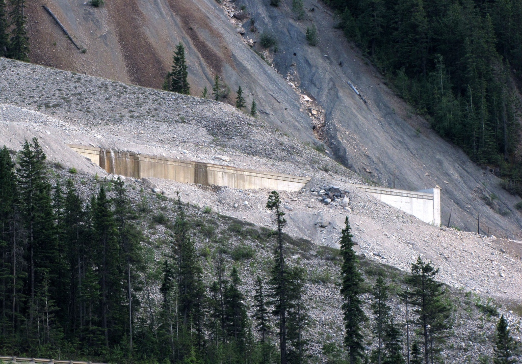 |
|
|
|
Post by Low Light Mike on Aug 5, 2012 17:40:52 GMT -8
Another set of photos of a train passing through the 1884 nose tunnel in Mt. Stephen. - Westbound train on the CPR line. - July 12, 2012, 10:55am. 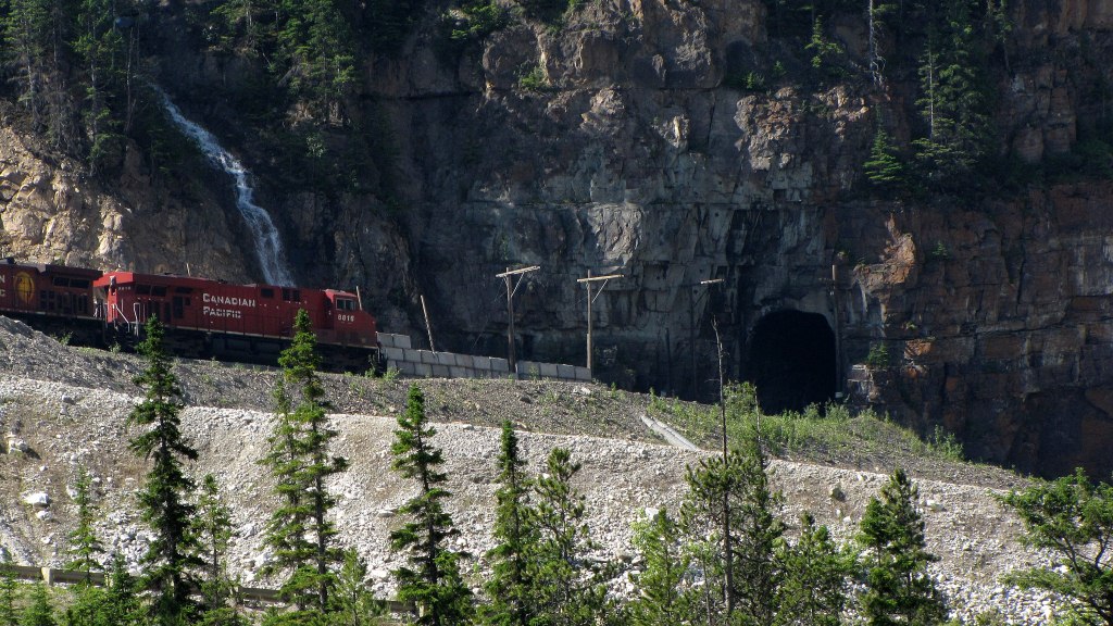  Cool cargo:  The view from my Adirondack chair, along the Kicking Horse River. 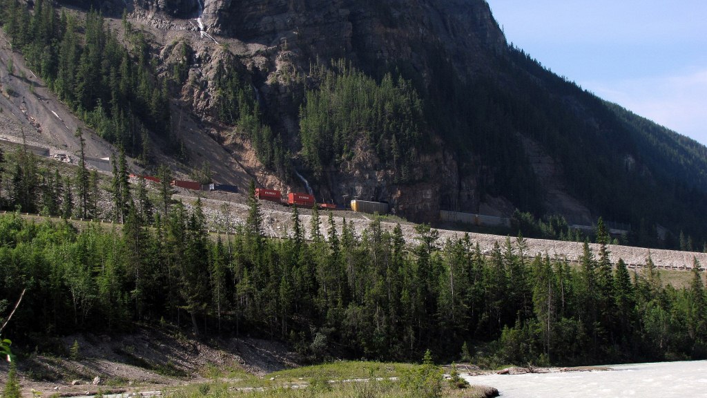  |
|
|
|
Post by Low Light Mike on Aug 6, 2012 12:53:33 GMT -8
CPR upper spiral tunnel. - in Yoho National Park, as seen from the viewpoint across the valley on Yoho Valley Rd. (no trains in these photos......) Setting the scene: 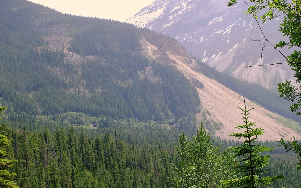 bottom portal on the lower left, top portal on upper right.  close up of the bottom portal 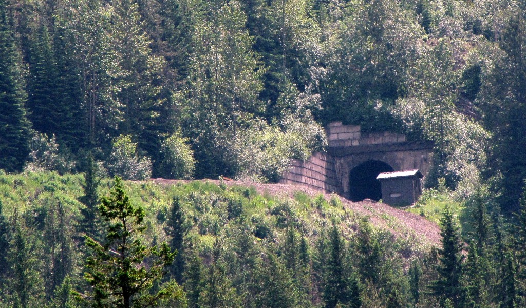 close up of the top portal. 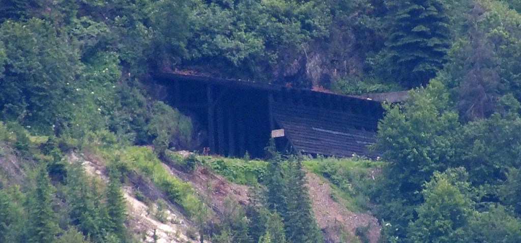 |
|
|
|
Post by Low Light Mike on Aug 6, 2012 16:18:07 GMT -8
Eastbound (uphill) train at the upper spiral tunnel. - seen from lookout on Yoho Valley Rd. July 12, 2012, 2:30pm. Lead locomotive headed for the bottom portal, which had a sharp left-turn in the entrance, and then starts the circle turn to the right. 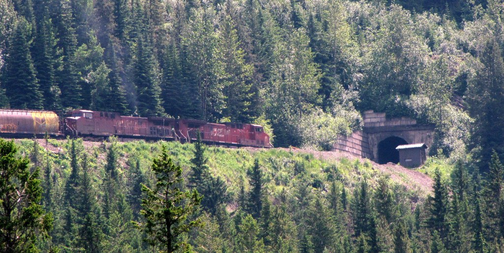  3 minutes after my first photo was taken, the train emerges from the top portal. 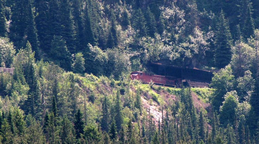 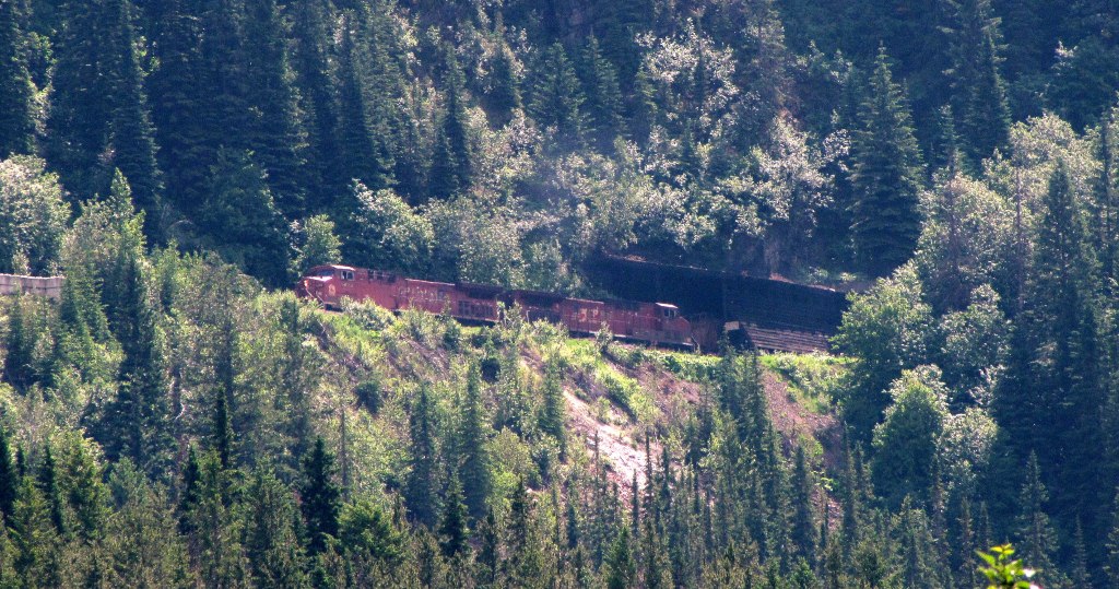 Cross-over begins: 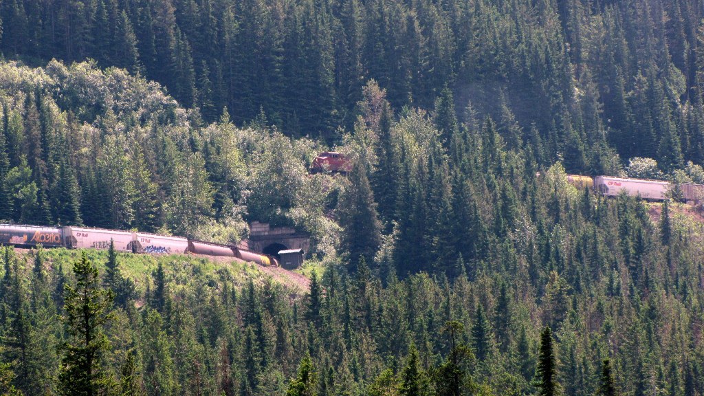 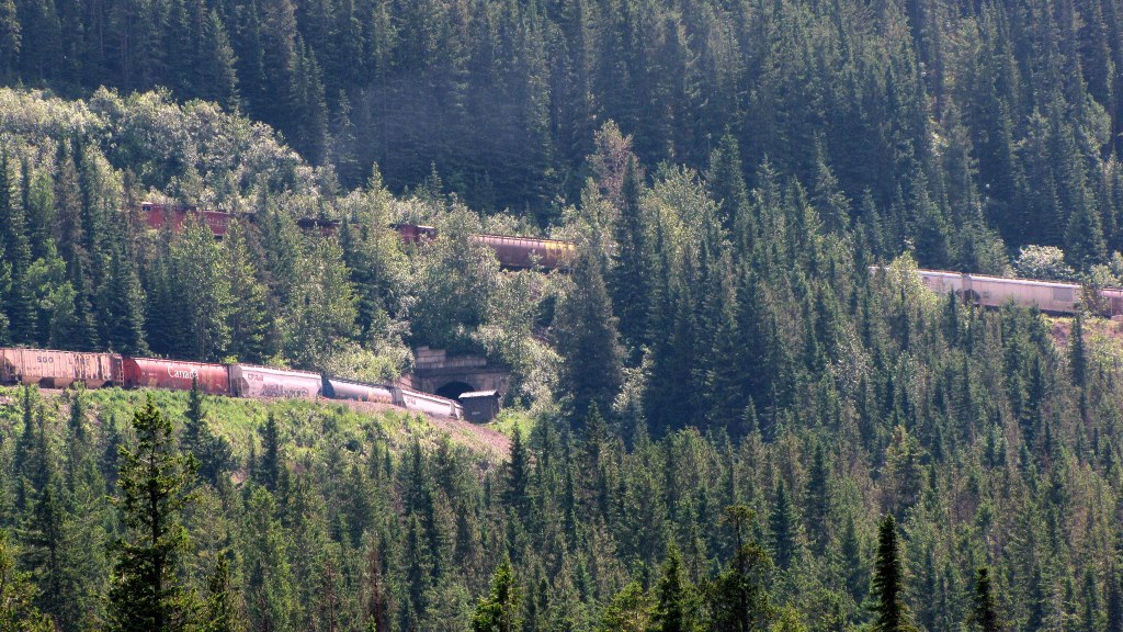 The scene: 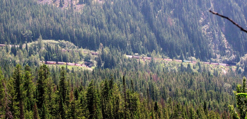 |
|
|
|
Post by Low Light Mike on Aug 12, 2012 16:34:37 GMT -8
CPR station in Banff, AB. - used only for Rocky Moutaineer and I think a bus company uses part of the building.   -------------------- A photo of the Big-Hill bridge, seen at the Whyte Museum in Banff. 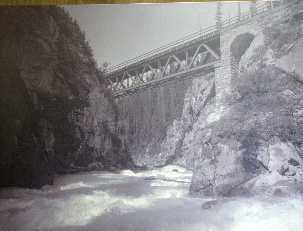 |
|
|
|
Post by Low Light Mike on Jun 22, 2013 17:31:10 GMT -8
re the 2013 Alberta floods: - I'm curious about the impact that the flooding Bow River may have had on Morant's Curve. I expect that some of the trees near the river's edge have now been swept away. Here are my views from 11 months ago: 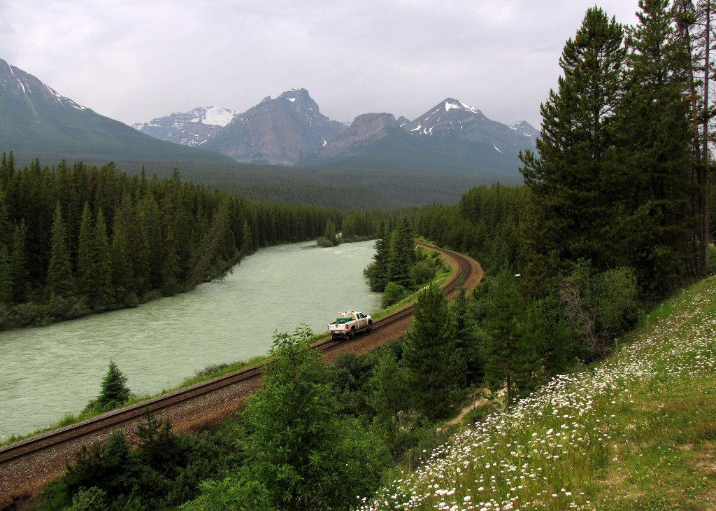 |
|
|
|
Post by stvfishy on Jun 22, 2013 20:20:46 GMT -8
|
|
|
|
Post by WettCoast on Jun 24, 2013 9:03:08 GMT -8
I gather that it is pretty much standard practice for the railways to 'park' loaded & heavy rail cars on bridges during flood events. I have seen CN do this with bridges along the rail line between Terrace & Prince Rupert during a very high spring snow melt freshet a few years ago. The weight of the cars on the bridge does reduce the likelihood of the bridge being swept away if the river water actually comes in direct contact with the bridge truss structure. Presumably the cars are loaded with non-hazardous materials such as rock or gravel.
|
|
|
|
Post by WettCoast on Jun 24, 2013 9:39:19 GMT -8
re the 2013 Alberta floods: - I'm curious about the impact that the flooding Bow River may have had on Morant's Curve. I expect that some of the trees near the river's edge have now been swept away. Here are my views from 11 months ago: I understand that both of CP routes through the Canadian Rockies (Kicking Horse Pass mainline & Crows Nest Pass) have been severely damaged and will be out of service for some time. I would expect that they are working 'their butts off' to get the mainline reopened asap. As for damage around Morant's curve, I think that it might be okay. I have a planned hike into the Skoki area north of Lake Louise for around about the 20th of July. I went on the Banff National Park website to check their 'Trail Report' page and its sounds as though the damage to trails & infrastructure around Lake Louise was not as severe as further east/south in Banff & Canmore. I gather CP is only able to move a limited amount of freight west to the coast by diverting some trains over CN's route via Yellowhead Pass, and over some US railways. Yes, the railways are competitive, but they do co-operate to help each other out when all hell breaks loose, such as is the case now.
Update (17:00 PDT): Apparently CP crews have been successful in reopening their main line between Calgary & Vancouver. Other routes, such as the Crows Nest Pass, will take a little longer. www.cpr.ca/en/news-and-media/news/Pages/cp-recovery-from-floods-ahead-of-schedule.aspx |
|
|
|
Post by Low Light Mike on Jun 24, 2013 20:33:44 GMT -8
|
|
|
|
Post by Low Light Mike on Jun 27, 2013 7:11:36 GMT -8
|
|
|
|
Post by WettCoast on Jun 27, 2013 8:49:54 GMT -8
Bad train news for CP in Calgary, and also possibly bad news for the environment.... (and bad news for me as a shareholder of CP  ) I am uncertain if this bridge is part of the main east-west CP line across Alberta. If it is, this is indeed bad news for CP, its shareholders, & those who need to ship stuff back & forth across the country. I hope they have a workable detour for their trans-continental traffic. I suspect the flooding river has scoured out the river bed around one or more of the pylons that support the bridge. When they inspected the bridge following the worst of the flood, I don't know if they could really determine whether or not all the pylons are well anchored to the land below the river bed. A river in flood not only gets wider, but it also gets higher, much faster (and hugely increases its scouring power). The river also gets deeper and in an extreme event such as happened in southern Alberta last week can & will undermine bridge pylons & abutments. |
|


 )
)