|
|
Post by Mike C on Apr 21, 2014 22:17:46 GMT -8
I was wrong. This tin photo is a genuine image looking westward at the Storm Mountain lookout along Hwy-1A, Bow Valley Parkway. Not Morant's Curve, but almost as nice. There's an image taken in the exact same spot in my Natural Resource Development textbook that I used this year. There was no (useful) caption, so I appreciate the identification of location. |
|
|
|
Post by WettCoast on Apr 22, 2014 15:05:38 GMT -8
I was wrong. This tin photo is a genuine image looking westward at the Storm Mountain lookout along Hwy-1A, Bow Valley Parkway. Not Morant's Curve, but almost as nice. Nice bit of sleuth work. I was unaware of this viewpoint, but I am now. Last summer I spent a night at the Baker Creek Chalet, just a little to the west of this place. Had I known, I would have gone & checked this spot out. www.cpr.ca/en/news-and-media/photo-gallery/merchandise/PhotoGallery/Attachments/7/merch_007.jpg |
|
|
|
Post by Low Light Mike on Apr 22, 2014 16:29:07 GMT -8
I was wrong. This tin photo is a genuine image looking westward at the Storm Mountain lookout along Hwy-1A, Bow Valley Parkway. Not Morant's Curve, but almost as nice. Nice bit of sleuth work. I was unaware of this viewpoint, but I am now. Last summer I spent a night at the Baker Creek Chalet, just a little to the west of this place. Had I known, I would have gone & checked this spot out. www.cpr.ca/en/news-and-media/photo-gallery/merchandise/PhotoGallery/Attachments/7/merch_007.jpgPhoto-location sleuthing is fun. Google Earth (with it's various user photos) and Google-Maps street-view are good tools. Street-view recently was added for the Bow Valley Parkway, including the Storm Mountain lookout parking lot. --------------- One more bit of sleuthing, and this involves Morant's Curve. I've found a few photos online that are taken from above the highway, which allows for a better line of sight to the west (but removes the eastward track view). Here are 2 examples to show what I mean: Morant's at nightMorant's in daylightAnd a quote from a photo website about the hill: From my Google Maps street-view research, these 2 photos must be taken from atop a short cliff/hill side, located on the east end of the tiny parking lot across the road from the viewpoint. I will find this spot and hopefully use it, next time I am there. A little bit of extra elevation helps the camera angle (this reminds me of a picnic table at Swartz Bay.....) ps: Who here, besides myself and WCK, has been to and/or taken photos from Morant's Curve? Michael H? |
|
|
|
Post by Mike on Apr 22, 2014 16:43:08 GMT -8
ps: Who here, besides myself and WCK, has been to and/or taken photos from Morant's Curve? Michael H? The last time I was in that area was 2008. I wanted to stop there, but didn't research how to get there. My dad was more interested in seeing Lake Louise, which we didn't end up seeing either because all the parking was full. |
|
|
|
Post by WettCoast on Apr 22, 2014 17:03:39 GMT -8
Being in the Banff/Jasper area in peak tourist season can be a real pain. The area is simply loved to death by so many people. I recommend September, if you can do it.
|
|
|
|
Post by WettCoast on Apr 22, 2014 20:38:36 GMT -8
Here are some of my 'CP east of Kamloops' to the Alberta border & a little beyond photos. These shots were taken over the last couple of years, and have not been seen here on the WCFF, though they have been on my Flickr site for some time. These photos are roughly in geographical order moving west to east along CP's main line.
All photos © WCK/JST - by Wett Coast, on Flickr
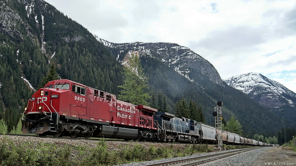
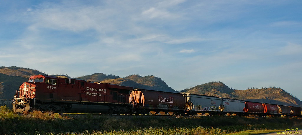 CP # 8709 leads west bound grain on Shuswap Sub, between Kamloops & Chase, BC - 19 September 2013 CP # 8709 leads west bound grain on Shuswap Sub, between Kamloops & Chase, BC - 19 September 2013 CP # 8912 leads east bound intermodal over swing bridge crossing channel separating Shuswap & Mara lakes - Shuswap Sub @ Sicamous, BC - 20 September 2013. For more photos at this site see Mr. Horn's work from last summer earlier in this thread. CP # 8912 leads east bound intermodal over swing bridge crossing channel separating Shuswap & Mara lakes - Shuswap Sub @ Sicamous, BC - 20 September 2013. For more photos at this site see Mr. Horn's work from last summer earlier in this thread.  Lead units of CP west bound mixed intermodal emerge from short tunnel as train descends 'the hill' below Cathedral Mountain on the Laggan Subdivision just east of Field, BC - 23 July 2013 Lead units of CP west bound mixed intermodal emerge from short tunnel as train descends 'the hill' below Cathedral Mountain on the Laggan Subdivision just east of Field, BC - 23 July 2013 Lead units of CP east bound box train emerge from upper portal of lower (Mt. Ogden) spiral tunnel on the 'Big Hill' - Laggan Sub just east of Field, BC, CP main line - 23 July 2013 Lead units of CP east bound box train emerge from upper portal of lower (Mt. Ogden) spiral tunnel on the 'Big Hill' - Laggan Sub just east of Field, BC, CP main line - 23 July 2013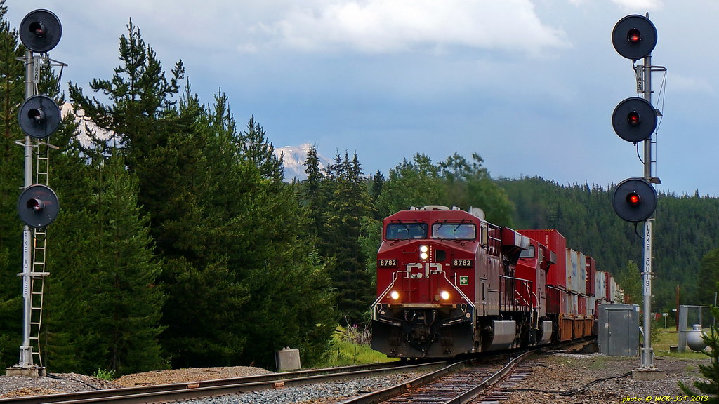 Canadian Pacific double-stacked box train on Laggan Subdivision @ Lake Louise headed onto the west bound 1% ascending main track leading to Kicking Horse Pass - 22 July 2013. Canadian Pacific double-stacked box train on Laggan Subdivision @ Lake Louise headed onto the west bound 1% ascending main track leading to Kicking Horse Pass - 22 July 2013.  Tail end of CP intermodal train on 2nd (west bound) 1% ascending main track (Laggan Sub) @ Lake Louise, Alberta, leading to Kicking Horse Pass - 22 July 2013. Tail end of CP intermodal train on 2nd (west bound) 1% ascending main track (Laggan Sub) @ Lake Louise, Alberta, leading to Kicking Horse Pass - 22 July 2013. The track at centre left is normally used by east bound trains descending the grade from the Pass. It runs by Lake Louise station visible on the left. It is the original line, constructed in the 1880's. The train shown here is using the 'new' track constructed a hundred years later in the 1980's as the Lake Louise '2nd Mainline'. Lake Louise station, btw, was originally called 'Laggan'. CP's Laggan Subdivision is named for this place. 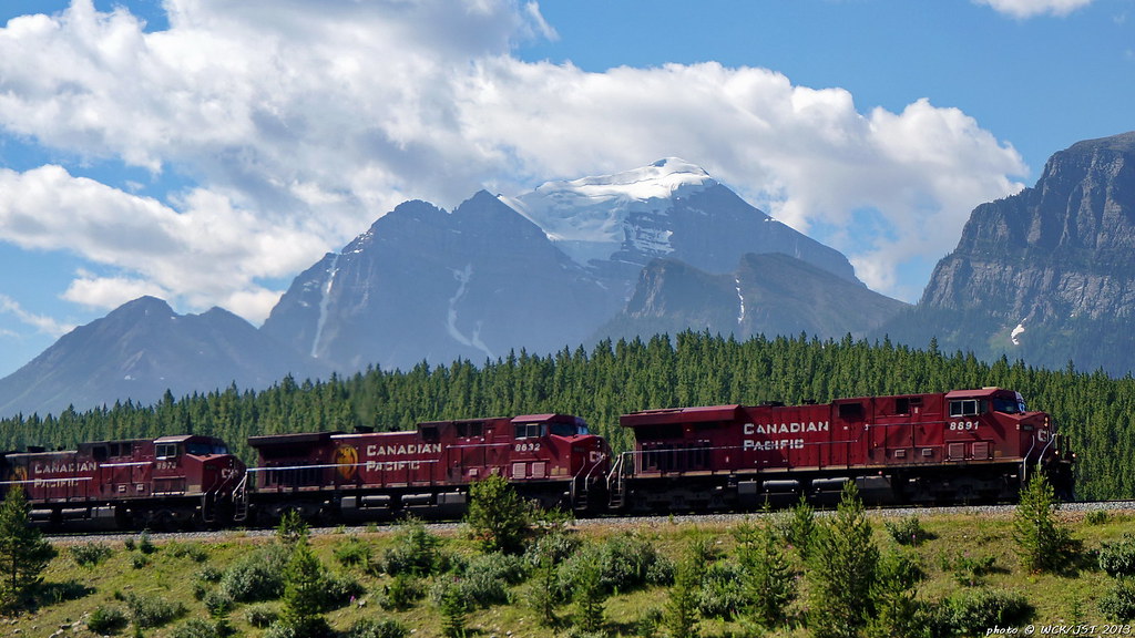 CP west bound mixed intermodal on the 'new' 2nd main line, Laggan Subdivision, @ Lake Louise, Alberta - 23 July 2013. This train is about to cross over the Trans Canada Hwy #1. That glacier clad peak in the background is Temple Mountain, at 3544 metres the highest peak in the Lake Louise area. CP west bound mixed intermodal on the 'new' 2nd main line, Laggan Subdivision, @ Lake Louise, Alberta - 23 July 2013. This train is about to cross over the Trans Canada Hwy #1. That glacier clad peak in the background is Temple Mountain, at 3544 metres the highest peak in the Lake Louise area. 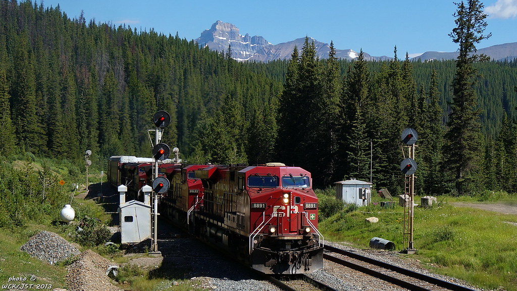 CP 8891 leads west bound mixed intermodal through signals @ west (upper) end of Lake Louise 2nd mainline, Laggan Sub, on the BC-Alberta border at Kicking Horse Pass - 23 July 2013. The track on the left is the original mainline with the steeper grade leading down to Lake Louise station. It is normally used by east bound trains going down hill. CP 8891 leads west bound mixed intermodal through signals @ west (upper) end of Lake Louise 2nd mainline, Laggan Sub, on the BC-Alberta border at Kicking Horse Pass - 23 July 2013. The track on the left is the original mainline with the steeper grade leading down to Lake Louise station. It is normally used by east bound trains going down hill. 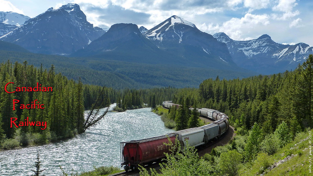 Tail end of CP west bound mixed train @ Morant's Curve - Laggan Subdivision, CP Mainline near Lake Louise, AB - 28 June 2012. Tail end of CP west bound mixed train @ Morant's Curve - Laggan Subdivision, CP Mainline near Lake Louise, AB - 28 June 2012. That is the Bow River on the left. 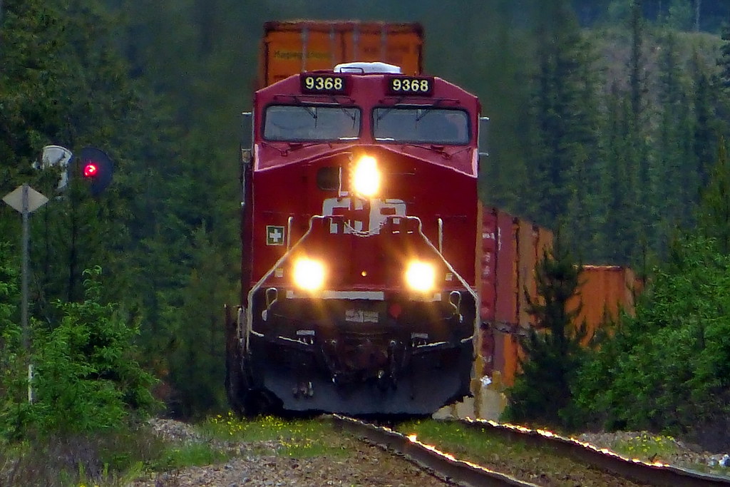 CP west bound box train on CP's Laggan Subdivision near Castle Junction, Banff National Park, Alberta - 30 June 2012. This is very near to Castle Junction where the Trans Canada Highway, Hwy 93 to Radium Hot Springs, & the Bow Valley Parkway all come together. All photos © WCK/JST - by Wett Coast, on Flickr CP west bound box train on CP's Laggan Subdivision near Castle Junction, Banff National Park, Alberta - 30 June 2012. This is very near to Castle Junction where the Trans Canada Highway, Hwy 93 to Radium Hot Springs, & the Bow Valley Parkway all come together. All photos © WCK/JST - by Wett Coast, on Flickr
|
|
|
|
Post by Low Light Mike on Apr 23, 2014 5:53:56 GMT -8
Here are some of my 'CP east of Kamloops' to the Alberta border & a little beyond photos. These shots were taken over the last couple of years, and have not been seen here on the WCFF, though they have been on my Flickr site for some time. These photos are roughly in geographical order moving west to east along CP's main line. Thanks for that great photo essay. I appreciate the Lake Louise 2nd-line visual explanations. |
|
|
|
Post by WettCoast on Jun 7, 2014 6:39:28 GMT -8
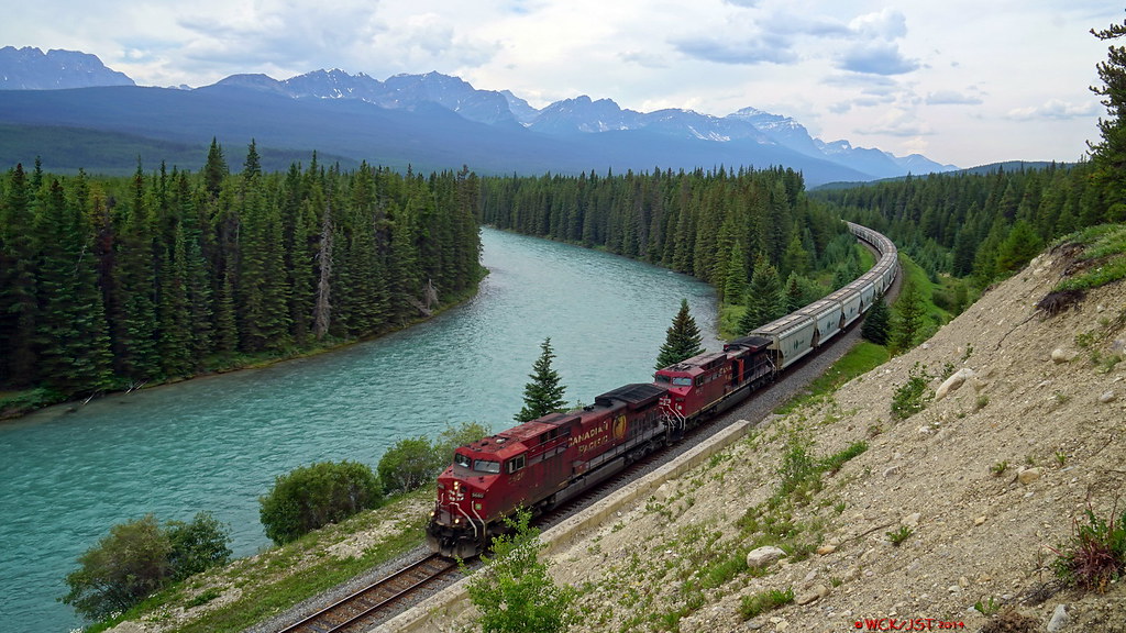
Canadian Pacific intermodal train led by #8901 heads east through Morant's Curve on CP's Laggan Subdivision just east of Lake Louise, AB - 5 June 2014. Banff National Park, Canadian Rockies 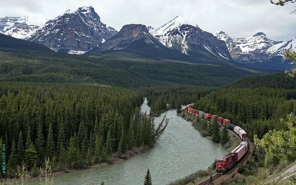 © WCK-JST by Wett Coast, on Flickr © WCK-JST by Wett Coast, on Flickr |
|
|
|
Post by Low Light Mike on Jun 7, 2014 7:53:13 GMT -8
Canadian Pacific intermodal train led by #8901 heads east through Morant's Curve on CP's Laggan Subdivision just east of Lake Louise, AB - 5 June 2014. Banff National Park, Canadian Rockies Thanks for sharing this moment with us; it is much enjoyed. How much time did you spend at the curve, and was this the one and only train that you saw? |
|
|
|
Post by WettCoast on Jun 7, 2014 13:16:41 GMT -8
Canadian Pacific intermodal train led by #8901 heads east through Morant's Curve on CP's Laggan Subdivision just east of Lake Louise, AB - 5 June 2014. Banff National Park, Canadian Rockies Thanks for sharing this moment with us; it is much enjoyed. How much time did you spend at the curve, and was this the one and only train that you saw? I got lucky. I saw two trains in about 30 minutes. The first one was a long west bound potash train which was coming as soon as I got to the parking area there. The second one (in the photo above) was east bound & must have been waiting for the potash train to clear. That photo was taken from the high vantage point that you (Mr. Horn) mentioned some time back. The 'trail' up there is more like a mountain goat scramble, but worth it for the view. I have many more photos to share. WCK Abbottsford |
|
|
|
Post by Low Light Mike on Jun 7, 2014 13:31:27 GMT -8
That photo was taken from the high vantage point that you (Mr. Horn) mentioned some time back. The 'trail' up there is more like a mountain goat scramble, but worth it for the view. I have many more photos to share. Where is the best place to find the start of that goat-trail? Does it start from the back of that little parking lot, or is it roadside? Thanks for all your sharing of photos and experiences.  |
|
|
|
Post by WettCoast on Jun 7, 2014 22:35:30 GMT -8
Where is the best place to find the start of that goat-trail? Does it start from the back of that little parking lot, or is it roadside? It does start at the back end of the parking area. This looks to be a little trail where some would go back into the woods to 'pee', as there are no facilities at this place *. Just immediately east (toward Banff) of the parking area on the roadside is a bit of a cliff that would be very difficult to climb. At the top of that cliff is your photo vantage point, which you reach via the circuitous 'goat' trail. Be warned that it is just a bit risky up there. You do want to ensure that you have secure footing. *I did not encounter any nasty surprises, however. |
|
|
|
Post by WettCoast on Jun 9, 2014 19:49:46 GMT -8
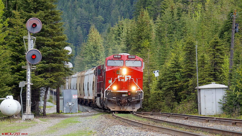
Canadian Pacific west bound potash train led by #9939 heads downhill between the upper & lower spiral tunnels on the Laggan Subdivision, CPR mainline, just east of Field, BC - 5 June 2014. These locomotives, and two more DPU units further back in the train, are in full dynamic breaking mode as this train creeps down the 2.2% grade here. The brake shoes are squealing, also... In the background is Yoho Park's Cathedral Mountain. 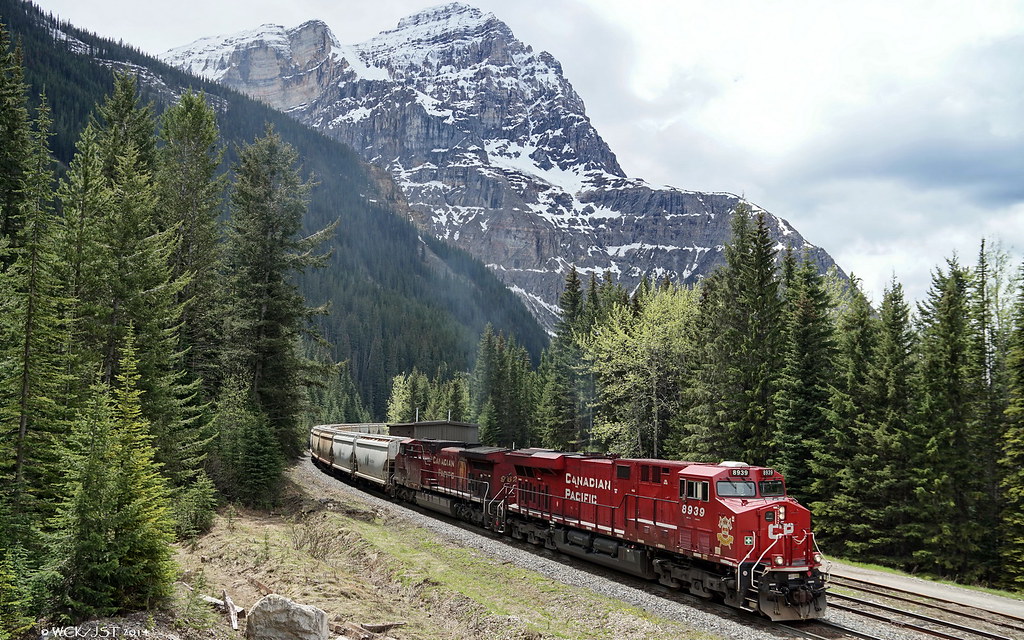 © WCK-JST by Wett Coast, on Flickr © WCK-JST by Wett Coast, on Flickr |
|
|
|
Post by WettCoast on Jun 17, 2014 21:52:57 GMT -8
|
|
|
|
Post by WettCoast on Jul 14, 2014 18:17:38 GMT -8
|
|
|
|
Post by Low Light Mike on Jul 14, 2014 21:27:41 GMT -8
This one is for Mr. Horn... East bound potash empties on CP's Laggan Sub, as seen from Storm Mountain Lookout Lovely. Thanks. I'm assuming that this location is an approximate 30-second walk from the parking lot. I'll see it in September... |
|
|
|
Post by WettCoast on Jul 16, 2014 11:53:55 GMT -8
Yes, a short walk & an approx. 5 minute drive from Castle Junction. The view is not as good as at Morant's Curve for west bound trains...
|
|
|
|
Post by WettCoast on Sept 9, 2014 12:43:08 GMT -8
|
|
|
|
Post by Low Light Mike on Sept 9, 2014 13:00:12 GMT -8
Here are two photos of a west bound loaded potash train at Morant's Curve on CP's main line Laggan Subdivision just west of Lake Louise, Alberta. Lovely photos. Minor geography typo: should say "just east of Lake Louise" ----- ps: thanks for the Banff / Bow Valley Parkway interchange train advice. |
|
|
|
Post by Low Light Mike on Sept 11, 2014 16:44:04 GMT -8
I was at this beautiful spot for an hour today. Only one thing was missing: a train ! I enjoyed the view, and took note of the trail location (for use on early Sunday morning, for a Morant sunrise session) 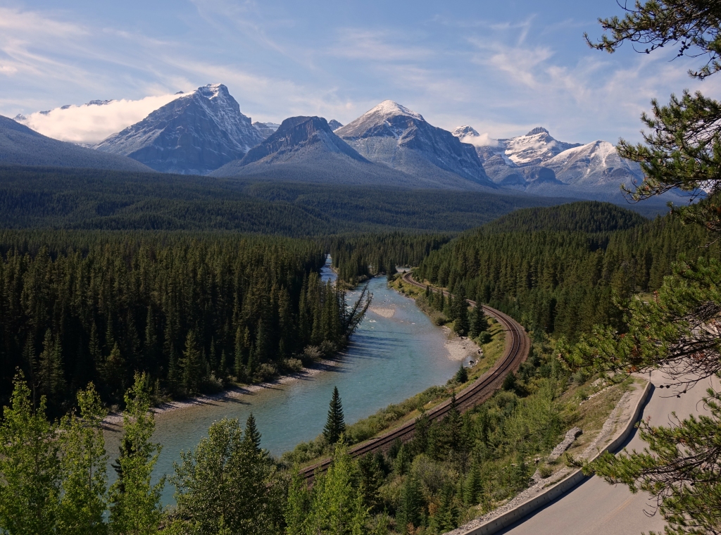 |
|
|
|
Post by WettCoast on Sept 11, 2014 20:17:53 GMT -8
Flugel Horn went up the (steep) hill to fetch a pail of pictures...
Next line coming on Sunday...
PS; That's a great view & the sun is shining. Get some sleep!
|
|
|
|
Post by Low Light Mike on Sept 12, 2014 17:39:26 GMT -8
A couple of CPR rail views from September 12, 2014. Eastbound double-stack train, in the upper spiral tunnel. Flanked by Cathedral Mountain (on left) and Mt. Stephen (named for George) - the train is exiting the upper portal of the upper tunnel, in an upper fashion, moving from right to left. 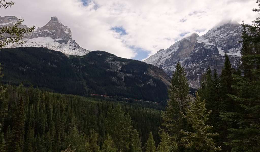 Storm Mountain lookout, looking West. No train, just the track and the Bow River 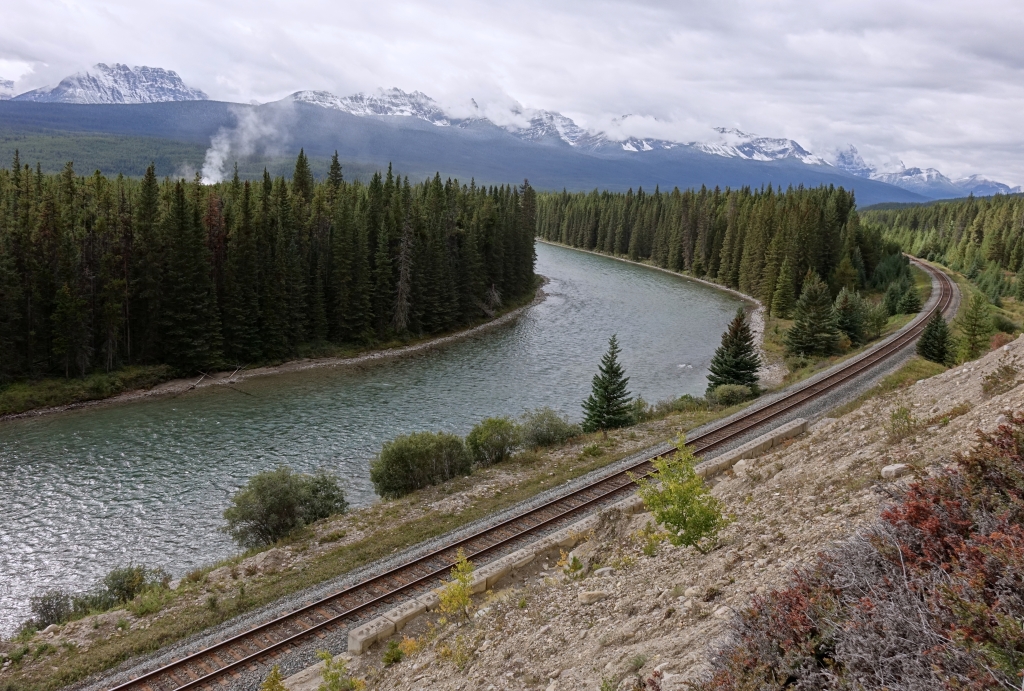 |
|
|
|
Post by Low Light Mike on Sept 13, 2014 8:37:22 GMT -8
Storm Mountain lookout, along the Bow River. - early morning on September 13, 2014 I spent 2 hours here, from 6:30am to 8:30am, and I saw 3 trains, all eastbound. Here is the first train (this poorest lit set of the 3): Nice track-shine 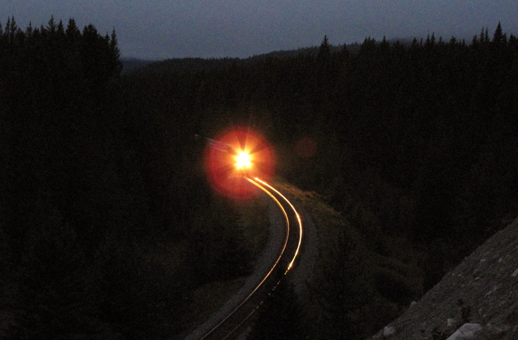 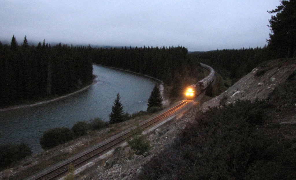 Looking east, at the blur in the low light 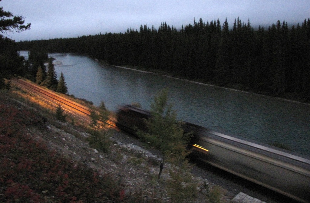 |
|
|
|
Post by Low Light Mike on Sept 13, 2014 15:56:00 GMT -8
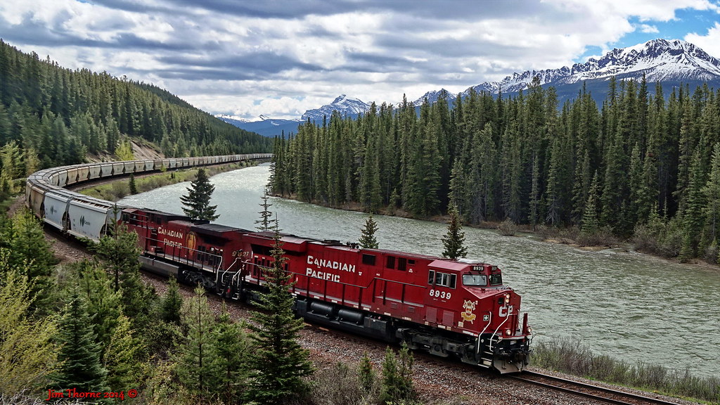
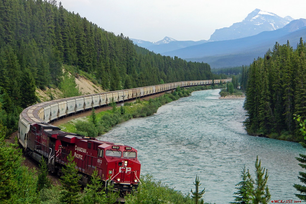
My Saturday afternoon at Morant's Curve; September 13, 2014. I set myself up on the cliff above the curve. I was there for 2 hours, and saw 2 trains; one eastbound and one westbound. ---------------- Eastbound train 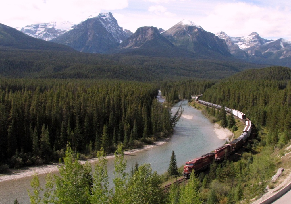 Westbound train - the island in the Bow looks a bit like a wye.  Fully zoomed out: "The Full Morant" 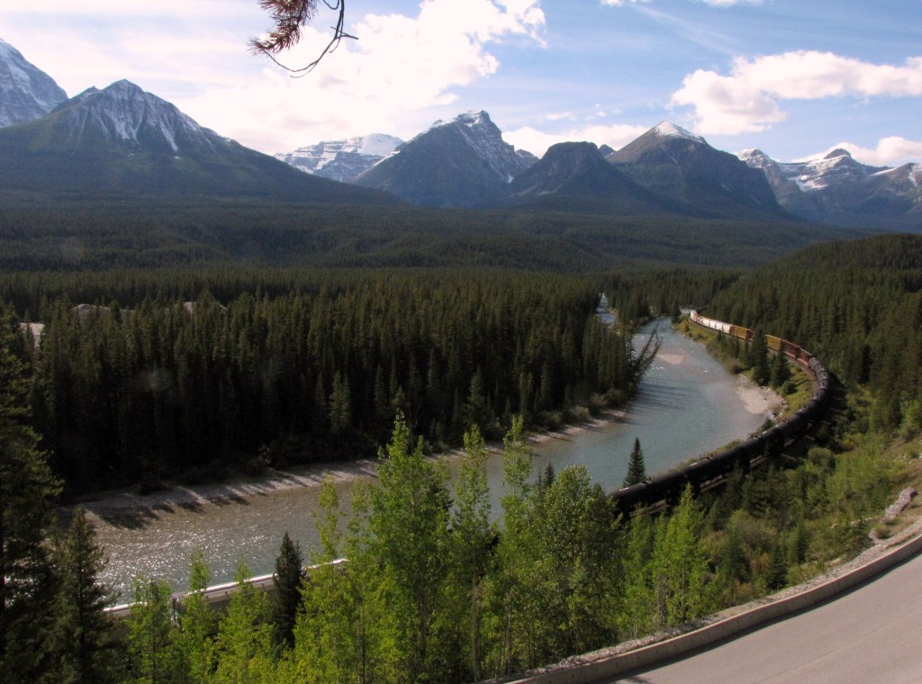 =========== I shot these with my old Canon. I filmed video with my Sony, and I will process and post all my Sony train videos in the coming weeks. |
|
|
|
Post by Low Light Mike on Sept 13, 2014 16:09:35 GMT -8
My second train sighting at Storm Mountain Lookout, on Saturday morning. 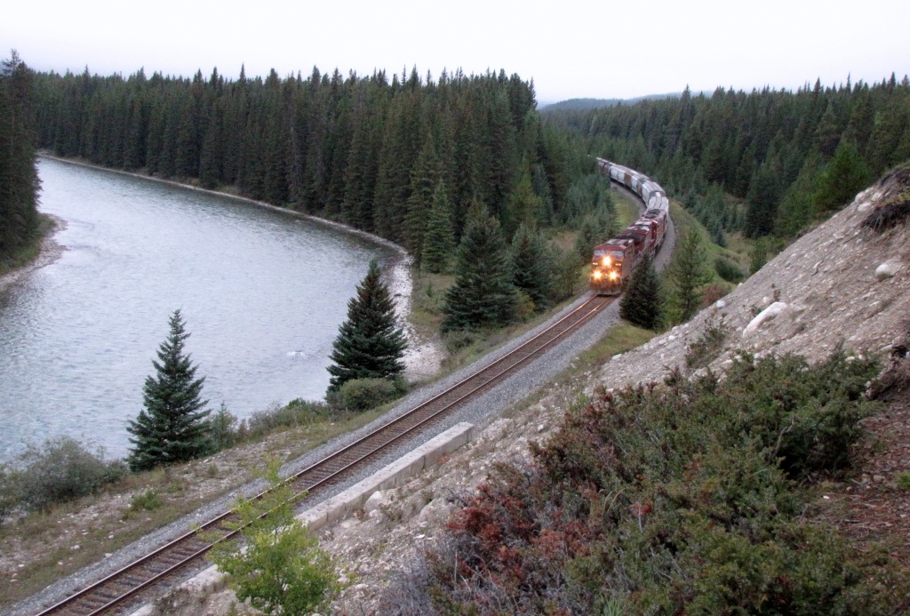 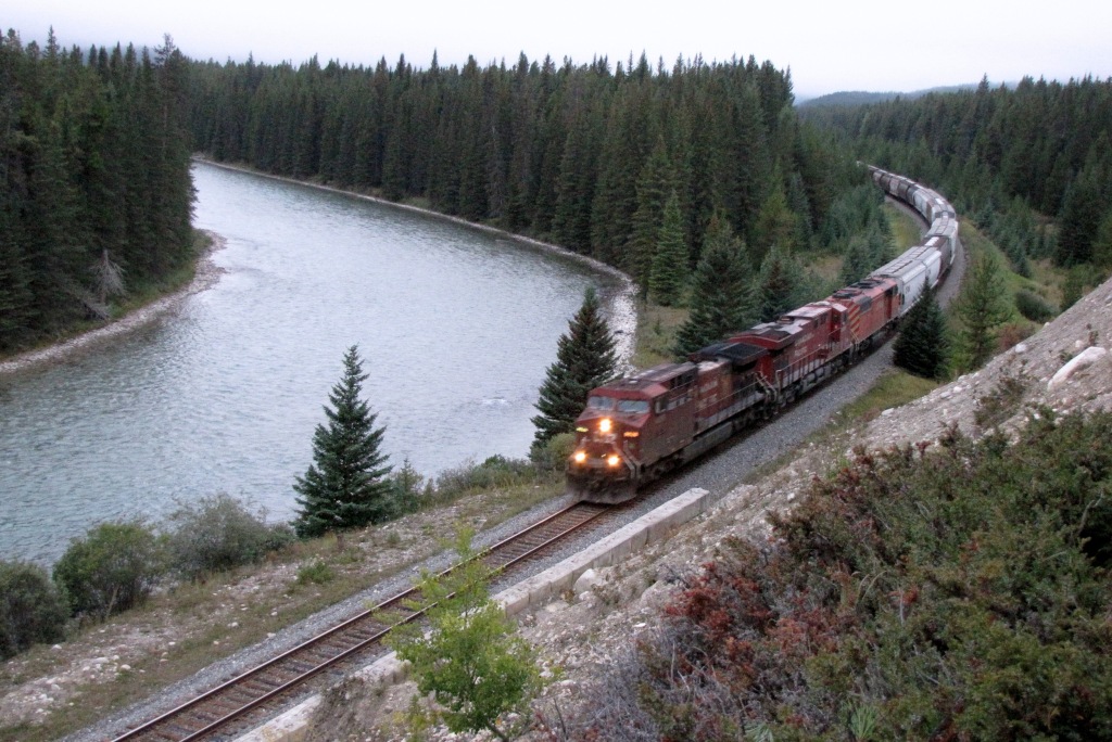 |
|