|
|
Post by glasseye on Aug 2, 2011 23:44:32 GMT -8
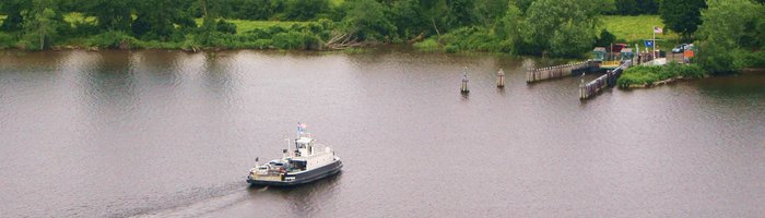
Ex-Torontonian here to fill in a few gaps: The Toronto Island chain is almost completely interconnected by causeways and bridges. There is a road from one end to the other. The airport area, however, is fenced off from the rest of the Island and operates under different rules from the rest of the island. Special permission is required to take a vehicle over to the island chain. The few residents on the chain don't have vehicles on the island. The Ongiara carries no vehicles more often than not. I don't recall seeing it ever carry more than two vehicles at once. At the Toronto terminal, the empty space between the concrete walls is where the old tollbooths used to sit. There are enough slips at the Toronto side to dock all five ferries at once. Indeed, they all overnight at the Toronto terminal. All three island terminals are essentially unmanned. Personnel are sent to the Island side for crowd control during major events (e.g. fireworks night or festivals) but there are no permanent ferry staff at any island terminal. Hanlan's Point does, however, have a concession stand very close to the ferry slips. Hanlans Point and Centre Island have two operable slips each. The wider slip is for the Ongiara while the narrower slip is for the passenger-only ferries. Wards Island has only one slip. Despite the fact that Wards sees year-round service, using the Ongiara in the winter, the berth was originally too narrow for the Ongiara to reach the ramp. Winter service was originally accomplished by wedging the Ongiara into the berth and extending a 15' metal gangplank over the 10' of open space (over water that would cause lethal hypothermia within minutes) between the Ongiara's bow and the dock ramp. I have no idea why Transport Canada allowed this. The berth has subsequently been widened to allow the Ongiara to dock safely. Remains of earlier docks are visible on Google Maps at Wards Island. Note the small orange ramp at an angle to the main ramp. This was used as an interim measure for safer Winter service before the berth was widened. The lowered area on the south of the dock pier was used in ye olden days for early ferry service. All of the system's docks had to be reworked in the late 1980s due to a permanent increase in the water level of Lake Ontario. The old ramps were much lower, wooden, and not readily adjustable to cope with water level changes. The new(er) ramps are about 2' higher, are hydraulically operated and can be adjusted by ferry crews as necessary. The old ramps looked something like the disused ramp at Centre Island except with a wooden deck mounted to the metal pins embedded in the concrete. The three passenger ferries have a maximum speed of 12 knots but I don't know how fast they go in service. The Ongiara has a maximum speed of 8.7 knots. In comparison to our Seabuses, the Sam McBride is 100 gross tons lighter and has 400 fewer horsepower despite having the same service speed and carrying 600 more passengers. Modern ferries are much better built than Toronto's floating antiques. |
|
|
|
Post by Northern Exploration on Aug 4, 2011 13:01:06 GMT -8
The pic of Hanlan's Point and comment that not much is happening there might be quite correct on a cool windy day. However on a sunny summer day the activity is out of sight of the ferry. This is because it is Toronto's version of Wreck Beach without hippies. And before a certain person in NJ comments, I have never been to the beach on a hot sunny day, just in spring in warm clothes.
BTW thanks for the pics and commentary.
|
|
D'Elete BC in NJ
Voyager  Dispensing gallons of useless information daily...
Posts: 1,671
|
Post by D'Elete BC in NJ on Aug 5, 2011 3:00:46 GMT -8
LMAO...obviously, there isn't a Keg there! ;D
|
|
|
|
Post by Dane on Jun 3, 2012 19:43:51 GMT -8
In retrospect I shouldn't have put the year into the thread's title! Regardless, here is a 2012 article from the Globe & Mail on the renaming of the Toronto side terminal to "Jack Layton Ferry Terminal." www.theglobeandmail.com/news/toronto/jack-and-the-islands-deserve-better/article4226090/ As an aside the almost totally-off-topic comments on the article are more hilarious, offensive, and bizarre than usual for G&M-types, at least. Marcus Gee
Jack, and the islands, deserve betterThe Globe and Mail Published Friday, Jun. 01 2012, 9:06 PM EDT Last updated Friday, Jun. 01 2012, 9:09 PM EDT It makes perfect sense to rename the Toronto Island ferry terminal after Jack Layton. The late NDP leader and former city councillor fought for the right of island residents to stay in their homes. He married Olivia Chow on the islands, bicycled on their car-free paths and took his kids on island excursions. The islands held such a special meaning for him that some of his ashes were scattered there last summer. Councillor Pam McConnell, who was part of the group that chose the terminal to be named after Mr. Layton, says the ferries were “a bridge between the busy urban living that Jack loved and the tranquillity and peacefulness of the islands. For us it was a perfect a-ha moment because it embraced those two diversities that Jack loved.” The trouble is that the ferry terminal is a rather awful place. I’ve been going through it for decades on trips to the islands to picnic, swim or sail and it has always struck me as dingy and depressing. The terminal is wedged behind the Westin Harbour Castle hotel and the residential Harbour Square towers. These ugly concrete slabs, constructed by developer Robert Campeau before the collapse of his real estate empire, are a blot on the Toronto waterfront. They block all view of the water. Standing at Bay and Queens Quay, the approach to the ferry docks, you could just as easily be at Portage and Main. Cars charge out of the underground parking lot and over the sidewalk on the south side, while, on the northeast corner, the squat bunker of the conference centre looms over the intersection. A less friendly environment for pedestrians approaching the docks is hard to imagine. The ferry terminal itself is an asphalt slab surrounded by concrete walls and barred gates that make it feel like a cattle pen. With no roof over most of it, you stand exposed to the sun on a hot summer day, crammed together with the rest of the hordes heading to Centre, Ward’s or Hanlan’s. Getting to the lovely islands through this grim portal is like travelling to Narnia through a public washroom. What a way to welcome tourists to one of the city’s main attractions. To its credit, the city made some improvements to the terminal last year, adding new ticket booths, a canopy for shade and some new fencing. It also did over the washrooms inside. More improvements are on the way this year and next, including new benches, better lighting and a canopy for the Centre Island dock. But, in the end, these are Band-Aids on what is a disappointing and inadequate facility, a perfect example of the sort of “good-enough” attitude that has often led to mediocrity in the city’s public spaces. The terminal looks especially bad considering all the great changes going on all around it. Two brilliantly designed new waterfront spaces, Sugar Beach and Sherbourne Common, lie just to the east. To the west, Waterfront Toronto is redoing York Quay near the foot of York Street by replacing a surface-level parking lot with an underground one, freeing up valuable public space. Waterfront Toronto is also about to embark on a massive redesign of Queens Quay from Spadina to Bay. Sadly, the agency says that while a better ferry terminal is on its “wish list,” it doesn’t have the money. But Councillor McConnell believes that naming the terminal after Mr. Layton will be a catalyst for change. “I think this is just the beginning of a great transformation of the ferry docks, and that’s exactly what Jack would want,” she says. Let’s hope so. The islands are one of the city’s glories. They deserve a better gateway. |
|
|
|
Post by Low Light Mike on Jun 3, 2012 19:49:05 GMT -8
In retrospect I shouldn't have put the year into the thread's title! Now fixed, using some moderator-magic |
|
|
|
Post by Scott on Jun 3, 2012 21:35:14 GMT -8
Thanks for sharing that article, Dane. I remember having the same feeling as the writer when I took the ferry to Toronto Islands in 2006. It was like being in prison, waiting for the ferry, standing behind the barred gates until they let you on the boat. The concrete walls and lack of any amenities, even much seating, added to the depressing atmosphere. However, once on the boat and the islands, it was awesome, and I'd recommend visiting the islands if you're ever in Toronto. On a hot day, it's refreshing and there are great views of the city. We went in May and there wasn't much going on there - I would think that they get very busy in the summer.
|
|
|
|
Post by lmtengs on Jun 3, 2012 21:59:53 GMT -8
I actually don't mind the design of the terminal. It's a good example of Post-modern/Brutalist architecture, an under-appreciated style if design that we're seeing less and less of these days.
If they renovated the interior to some level while retaining the exterior facade, it would save enough of the historic value of the building.
|
|
|
|
Post by timmyc on Mar 31, 2014 17:47:15 GMT -8
Just came back to Calgary from Toronto this past week. Took the opportunity to visit Wards Island (Centre Island is not ferry accessible until late spring/summer). The ferry that took us over was the M/V Ongiara. Enjoy the photos! As seen from Wards Island:  Walking onto the ferry from Downtown: 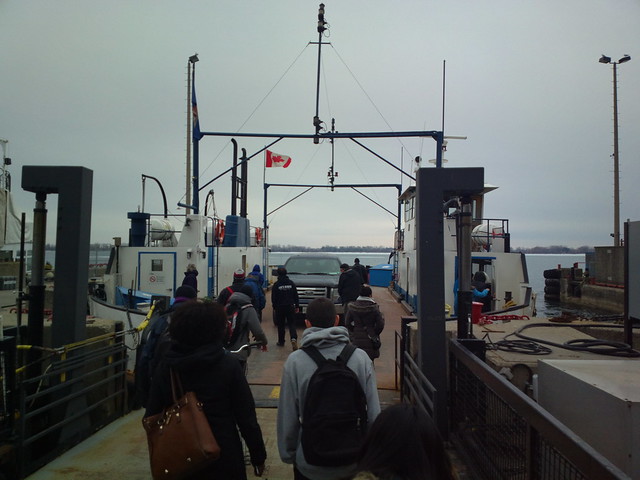 Pano on the deck: 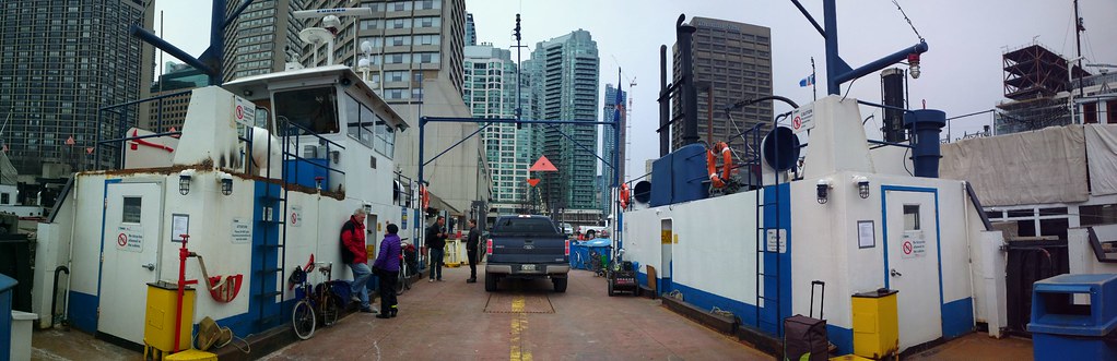 The three larger ferries (8MP original here if you want to get a closer look: farm4.staticflickr.com/3769/13550643213_814af2a692_o_d.jpg ):  They don't take it easy on her - some very sharp turns going on here: 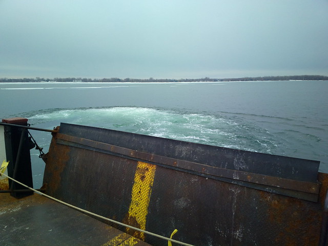 Soon after departing Downtown: 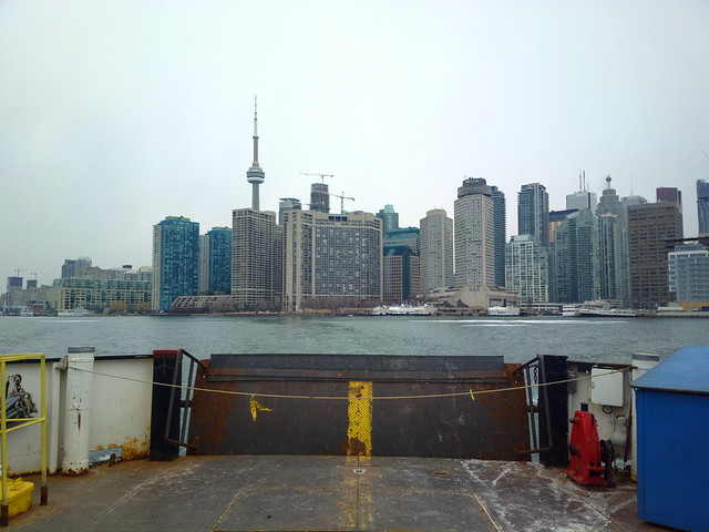 No qualms about running through the ice! We slammed into a fairly large chunk - the crunch was quite satisfying. 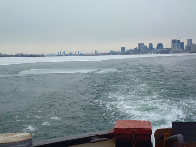 Approaching Wards Island to pick us up: 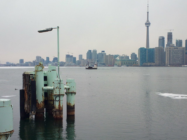 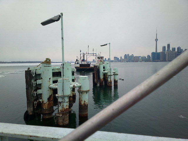 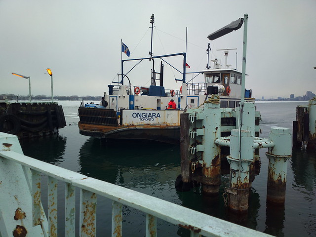  Obligatory "artsy" shot:  Also, here's a photo of the ship's drawings: farm4.staticflickr.com/3740/13550643753_da8c228208_o.jpgBonus: Captain John's ship, still here and rusting away:  The full size originals of these can be found in this album: www.flickr.com/photos/98854733@N06/sets/72157643238064815 |
|
|
|
Post by Starsteward on Apr 1, 2014 6:41:22 GMT -8
Very interesting post Tim. I've never seen nor heard of Captain John's boat before. It's an odd yet rather charming old ship. Does anyone out there know what the history of this oldie might be?
|
|
|
|
Post by timmyc on Apr 1, 2014 16:14:37 GMT -8
|
|
|
|
Post by Starsteward on Apr 1, 2014 16:38:23 GMT -8
Thanks for providing the info. pages on the Jadran. A sad epitaph for a former icon of Toronto's waterfront culinery destinations. The only people who are going to benefit from this ship's future would appear to be 'lawyers'  |
|
|
|
Post by Ferryman on May 29, 2014 14:40:59 GMT -8
I did a trip on an Ontario Highway's Ferry today for the first time. I figured this thread was appropriate, since the ferry route itself is 15 mins west of Kingston. The Ferry in the spotlight today is the Frontenac II. Currently the ship that I'm working on is unloading cargo near the small village of "Bath". It was about an hour for me to walk at a fairly fast pace to get down to the ferry. Along the way, I saw signs mentioning "Historical attraction: Frontenac launch site". I had a quick look around the "site", and it wasn't anything more than a couple of picnic benches, a semi covered area, and a very small dock. There was at least a plaque that would explain the history of the site, and the Frontenac (I) was the first steamship to ever sail on Lake Ontario in 1816. Further reading of the story, she was sold in 1825, burned and sank in the Niagara River (assuming Arson?). So it was pretty neat that their Ferry was named the Frontenac II. The price for footsies is free of charge. If you want to bring your car on, it's $9.00 for a return trip. You can also buy 25 round trips for $100, and a Deckhand collects the fares from each vehicle upon Departure from the Mainland. The last fare increase was apparently in May 2007. Service starts at 6:00am and runs until 1:30am. The ferry itself carries a maximum of 33 cars, and the crossing time is 20 minutes. As Dane mentioned in his reports, the culture is quite different, or at least the routine seems to be much more relaxed. I was a walk-on passenger, and the Deckhands were slightly confused that I hadn't opened up the gate and was ready to step aboard as soon as the ship's ramp was on the dock. On our arrival, there were a few walk-on passengers waiting to get on, and they had helped theirself to opening up the gates, and standing just barely far enough back that they wouldn't get hit by the ramp as it came down. So here are some photos to go along with this report: 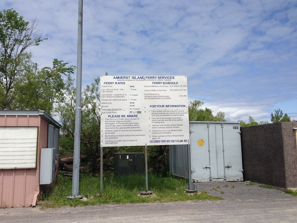 Ferry schedule, fares, and rules Ferry schedule, fares, and rules by Deck-dog SSI, on Flickr Here she is arriving at Millhaven (mainland). She reminds me of the Quinsam/Quinitsa/Kuper, but with side loading. 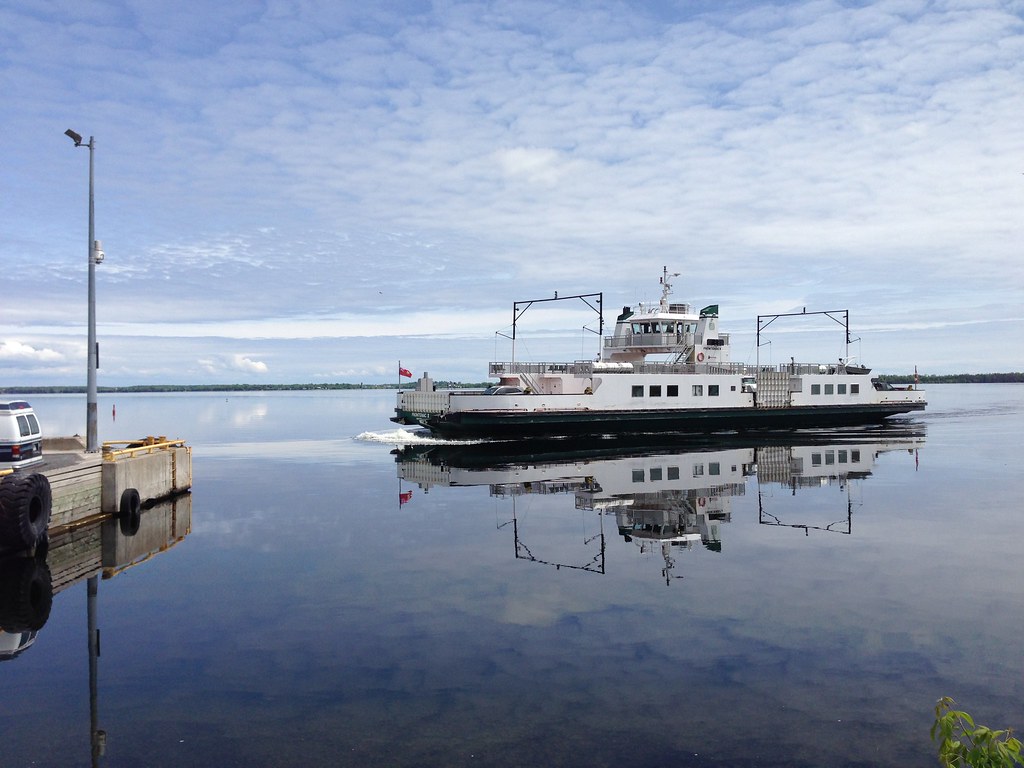 Frontenac II arriving at Millhaven Terminal Frontenac II arriving at Millhaven Terminal by Deck-dog SSI, on Flickr A look at the whole terminal itself at Millhaven. 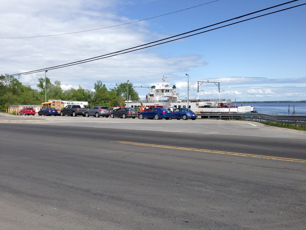 Millhaven Terminal Millhaven Terminal by Deck-dog SSI, on Flickr The sideloading arrangement they have, and the ramp is just landing on the dock. The ferry itself appears to have capabilities of conventional end to end loading, but I'm not sure if the docks themselves are quite setup for it, especially since there are no dolphins for her to push up against of course. 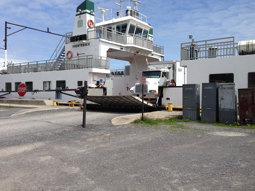 Frontenac II, side loading Frontenac II, side loading by Deck-dog SSI, on Flickr There's seating on the upper decks, similar to the recent modifications to the K-Class at BCF 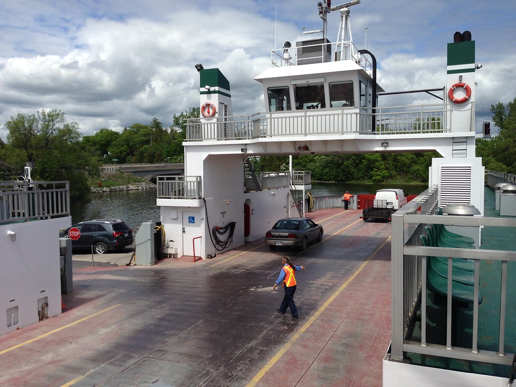 Frontenac II side loading Frontenac II side loading by Deck-dog SSI, on Flickr I'm not entirely sure if there were waiting rooms on shore on either side. The buildings that were on shore looked almost derelict, and no clear signage indicating their purpose. If there isn't any waiting rooms, I could only imagine what it would be like in the winter time in the sub zero temperatures. This one and only little lounge would be a very good sight to see after waiting for the ferry to arrive. As you can see, it also serves as a storage locker for not only life jackets, but mooring lines. 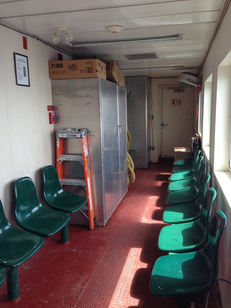 Passenger Lounge, Frontenac II Passenger Lounge, Frontenac II by Deck-dog SSI, on Flickr Here's a closer look at Amherst Island. It looks like there's a lot of farm land there. I didn't get much of a chance to wander around, since my feet were already blistering from the 5km walk to the ferry, and I was anticipating another 5km walk back to my ship. I did go ashore while the ferry was unloading, and there wasn't a single café or pub like I was hoping for, nearby by at least. There was however, a lot of signage displaying the islanders disinterest to the idea of allowing wind mill farms on the island, which seem to be quite common out here. 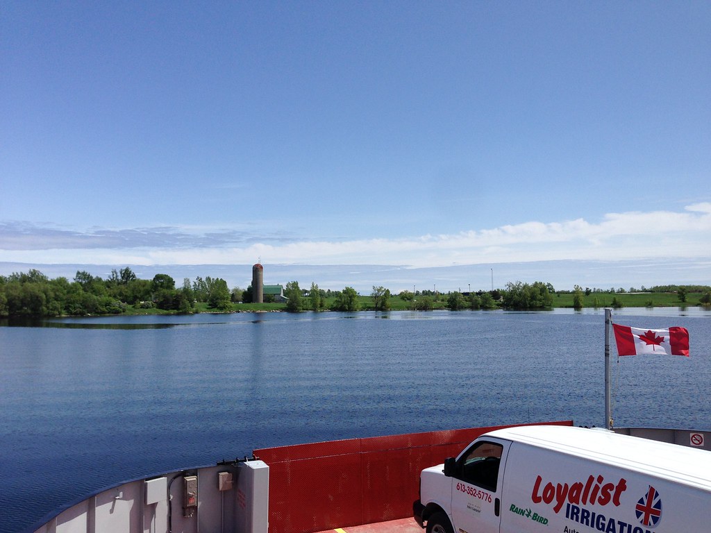 Farmland on Amherst Island Farmland on Amherst Island by Deck-dog SSI, on Flickr Here we are arriving at Stella on Amherst Island  The dock at Stella, Amherst Island The dock at Stella, Amherst Island by Deck-dog SSI, on Flickr And also a look back at the ferry from the boat launch. On this side, there's only the road to park on to wait for the ferry. No holding lanes set aside like there is on the mainland 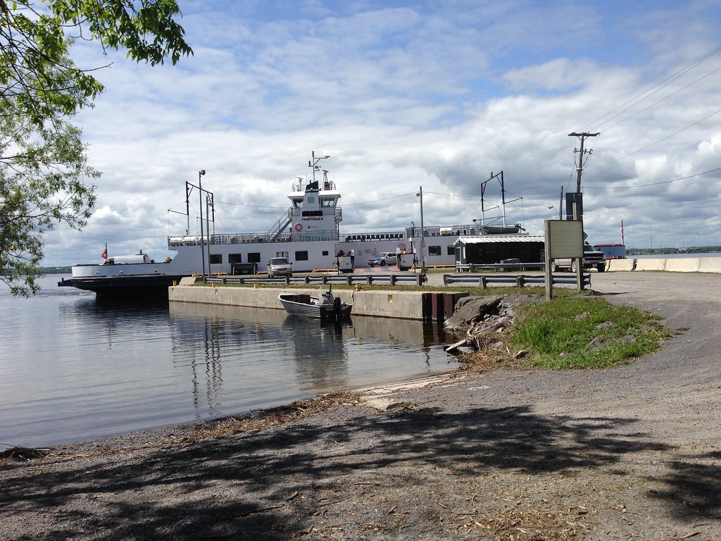 Frontenac II at Stella Terminal, on Amherst Island Frontenac II at Stella Terminal, on Amherst Island by Deck-dog SSI, on Flickr On the way back, there was a moving truck that came on. Originally it was first in line, but it was set aside to allow the cars to come on first, in order for the truck to park thwartship, making it easier to drive off. 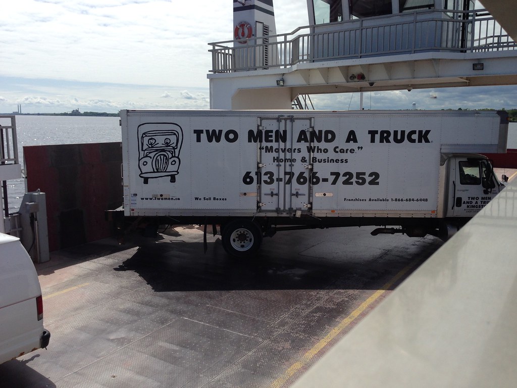 Commerical Vehicles parked nearly Thwartships Commerical Vehicles parked nearly Thwartships by Deck-dog SSI, on Flickr So there you have it. This concludes our look at the Frontenac II in Bath, Ontario. For more info, see their website: www.amherstisland.on.ca/ferry.htm |
|
Koastal Karl
Voyager
Been on every BC Ferry now!!!!!
Posts: 7,747
|
Post by Koastal Karl on May 29, 2014 17:12:04 GMT -8
So no front and stern loading?? What do they do turn the cars around on the boat???
|
|
|
|
Post by Ferryman on May 30, 2014 6:17:23 GMT -8
That's right, no bow and stern loading.
Each car is directed to back up towards the other end of the ferry, and then drive straight off the side ramp.
Pretty inefficient setup, but there never seems to be any real urgency or need to speed things up. There were only 15 or so cars on each of the two sailings I was on, so there was time to spare within the 10 minutes they have in dock.
|
|
|
|
Post by Low Light Mike on Feb 28, 2016 13:46:08 GMT -8
I was looking for a bit of a break while exploring Prince Edward County, so I decided to park the jeep and walk onto the Glenora Ferry for a ride between Glenora and Adolphustown. It’s a free ride, it was a nice day, and I felt like it. Gord Downie (musician, of Tragically Hip fame) used to work on this ferry. Here's a song inspired by it, from his "Country of Miracles" group: |
|
|
|
Post by Low Light Mike on Feb 29, 2016 8:16:30 GMT -8
A new thread for all various ferries in Ontario.
|
|
|
|
Post by articulated on Aug 16, 2017 18:53:07 GMT -8
At the end of last month I took a weekend trip down to southwestern Ontario, and spent the Sunday taking the ferry out to Pelee Island, so I thought I'd share some of my photos from the trip and a bit of my experience of this ferry route. Since I can't quite figure out how to get Flickr photos to show on this forum, I'll add three photos of the vessels as attachments and others will get links to Flickr. The Pelee Island ferry service is contracted out to the Owen Sound Transportation Company, the same company that operates the larger and more well-known MS Chi-Cheemaun from Tobermory on Lake Huron. Two vessels are operated on the Pelee Island service:  MV Pelee Islander is the older of the two, and the one I rode out to the island. She was built in 1960, with a stated capacity for 196 passengers and 10 autos. Her replacement vessel is currently being built by ASENAV in Chile, and is expected to arrive in time for next season. Most of the passenger space is outdoors on the upper deck, with a small indoor passenger lounge and snack bar in the front of the lower deck.  Notice a difference between this shot and the other one? On my morning trip she was flying the Ontario provincial flag, but after departing Pelee Island she now carries the American flag on the bow. This is because Pelee Islander's main route is between Pelee Island and Sandusky, OH, but during the summer she does one round trip in the morning to the mainland for extra capacity before doing 1-2 round trips to Sandusky in afternoon/evening.  In contrast to Pelee Islander, the other vessel on the route is MV Jiimaan, built in 1992, can accommodate 399 passengers and 34 autos, or 4 tractor trailers/16 autos. Being the larger vessel, Jiimaan only operates from the island to the Ontario mainland. Passenger space is primarily indoors, with a large full-service cafeteria available. The only outdoor space is at the back of the rear deck, and is unsheltered. There is some covered passenger space in the middle of the upper deck, but strangely there is no seating in this area. Being the Sunday afternoon sailing back to the Ontario mainland, it was a full sailing, with very little space indoors or outdoors. The two vessels are completely different designs, owing in large part to the 30-year difference: Pelee Islander ties up to the side of the pier, with vehicles having to be loaded into the rear deck by crew members using the side ramps. Jiimaan on the other hand is a more modern RORO vessel with a bow visor door. In Leamington, they actually have two parallel docks to accommodate the two vessels: Jiimaan docks on the left side of the photo, with the ramp for the bow visible and foot passengers using the two ramps on the left. Pelee Islander ties up on the pier on the right side of the photo. The terminal on Pelee Island is more compact with both vessels sharing the same position. This photo shows the different passenger facilities better, with a lower ramp for Pelee Islander and the elevated walkways for Jiimaan. And another oddity: the terminal on the Ontario mainland switches halfway through the season. All sailings for the first half of the season (April - July 31) are from Leamington, and on August 1st the vessels switch to Kingsville, about 13km west of Leamington, for the rest of the season until the lake freezes in December. I suspect this is primarily a political reason, to split tourism/work between the two towns, but it results in twice the capital cost/investment, and also leaves the terminal infrastructure sitting unused for half a season. |
|
|
|
Post by Low Light Mike on Aug 16, 2017 20:17:45 GMT -8
At the end of last month I took a weekend trip down to southwestern Ontario, and spent the Sunday taking the ferry out to Pelee Island, so I thought I'd share some of my photos from the trip and a bit of my experience of this ferry route. Since I can't quite figure out how to get Flickr photos to show on this forum, I'll add three photos of the vessels as attachments and others will get links to Flickr. In your Flickr, click on the photo. - on bottom right of screen, click the right-facing-arrow icon that says "share photo" when you hover on it. - choose BBC code - set size to 1024x290 if your pic is larger than that - copy & paste the code into your post. simple as that. |
|
|
|
Post by northwesterner on Aug 16, 2017 22:24:18 GMT -8
At the end of last month I took a weekend trip down to southwestern Ontario, and spent the Sunday taking the ferry out to Pelee Island, so I thought I'd share some of my photos from the trip and a bit of my experience of this ferry route. Since I can't quite figure out how to get Flickr photos to show on this forum, I'll add three photos of the vessels as attachments and others will get links to Flickr. In your Flickr, click on the photo. - on bottom right of screen, click the right-facing-arrow icon that says "share photo" when you hover on it. - choose BBC code - set size to 1024x290 if your pic is larger than that - copy & paste the code into your post. simple as that. Tagging Neil for Flickr instructions... |
|
Neil
Voyager
Posts: 7,175
|
Post by Neil on Aug 17, 2017 18:06:35 GMT -8
At the end of last month I took a weekend trip down to southwestern Ontario, and spent the Sunday taking the ferry out to Pelee Island, so I thought I'd share some of my photos from the trip and a bit of my experience of this ferry route. Since I can't quite figure out how to get Flickr photos to show on this forum, I'll add three photos of the vessels as attachments and others will get links to Flickr. In your Flickr, click on the photo. - on bottom right of screen, click the right-facing-arrow icon that says "share photo" when you hover on it. - choose BBC code - set size to 1024x290 if your pic is larger than that - copy & paste the code into your post. simple as that. 1024x290? |
|
|
|
Post by Low Light Mike on Aug 17, 2017 19:19:46 GMT -8
In your Flickr, click on the photo. - on bottom right of screen, click the right-facing-arrow icon that says "share photo" when you hover on it. - choose BBC code - set size to 1024x290 if your pic is larger than that - copy & paste the code into your post. simple as that. 1024x290? Forget the 290 part. My mistake. |
|
|
|
Post by WettCoast on Aug 17, 2017 19:37:27 GMT -8
Forget the 290 part. My mistake. The max horizontal size in pixels is 1024 (except of course for the flagship 'headers'). There is also a max vertical size (I think?) of 800 pixels. So if a photo is 1024 x 1000 for example then you would need to choose a smaller size for display on this forum (800 x781, for example). We need to redo the guidelines shown on page 1 of the thread Guide: How to upload photos for display on WCFFferriesbc.proboards.com/thread/8451/guide-upload-photos-display-wcff#ixzz4q4g29TnX |
|
|
|
Post by articulated on Aug 18, 2017 15:31:38 GMT -8
Thanks Low Light Mike for the photo tips. I had tried the "embed" code from Flickr first, that didn't work, then tried the URL to the photo with the "Insert Image" button, and that still didn't work... Also read the Rules and Information post, but using the ![]() tags around a photo link also did not work. The recommendation of using Photobucket and Imageshack instead of Flickr made me think that the forum software for whatever reason didn't support Flickr, so I gave up and just used the attachment feature. Lessons learned! Anyway, the second day of that same trip led me to photographing some of the cross-border ferries that operate along the St Clair river. MV Daldean, launched in 1952, is operated by the Bluewater Ferry between Sombra, ON and Marine City, MI. 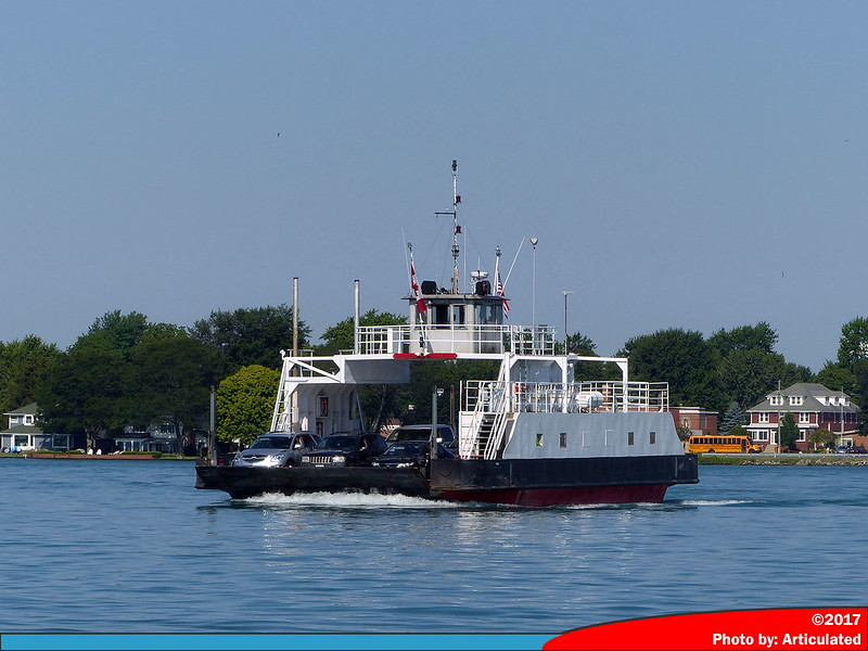 Daldean Daldean by Andrew Crawford, on Flickr MV Ontamich, launched in 1939. It's a secondary vessel to Daldean, occasionally operating alongside Daldean during busy periods. In the middle of a regular Monday morning, it was tied up at the dock. 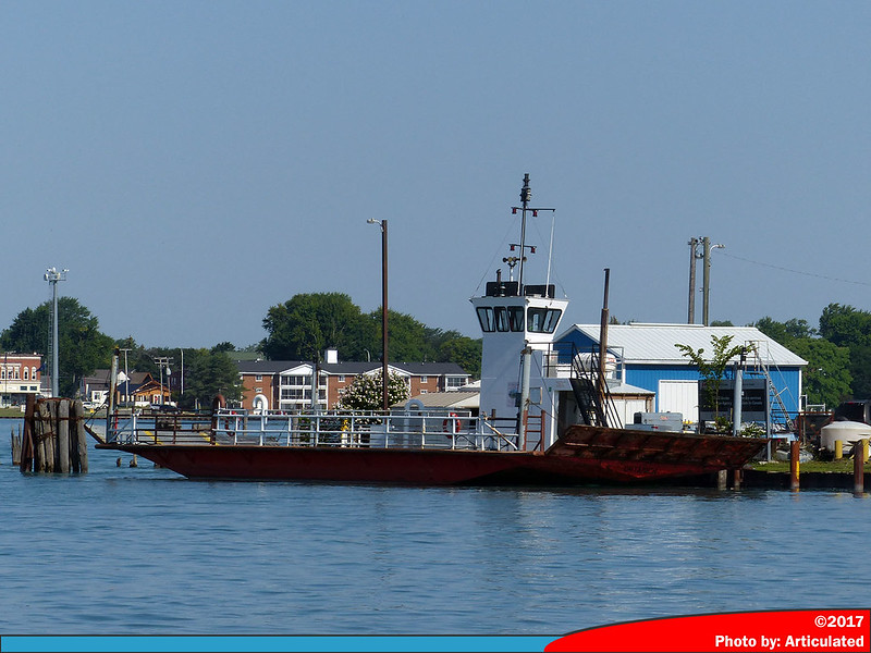 Ontamich Ontamich by Andrew Crawford, on Flickr MV City of Algonac operates between the Walpole Island reserve and Algonac, MI. There is also a second vessel for this route, the Walpole Islander, but it was not operating or visible that day. 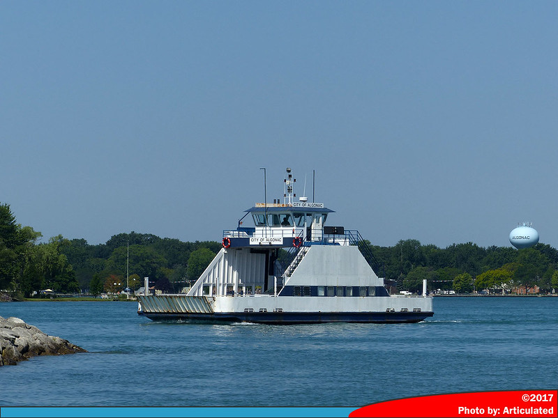 City of Algonac City of Algonac by Andrew Crawford, on Flickr |
|
|
|
Post by Low Light Mike on Nov 8, 2018 16:00:33 GMT -8
Sometime in the future, if you ride the ferry to Amherst Island or to Wolfe Island, you'll be on a ferry that is similar (note that I chose this word with care, did not say "the same" - haha, this is for the precision-police) in look to the new BC Ferries Island Class ships. Here's the article with 3 different photos of artist-renderings included: H E R E |
|
|
|
Post by WettCoast on Nov 8, 2018 18:00:18 GMT -8
Sometime in the future, if you ride the ferry to Amherst Island or to Wolfe Island, you'll be on a ferry that is similar (note that I chose this word with care, did not say "the same" - haha, this is for the precision-police) in look to the new BC Ferries Island Class ships. Here's the article with 3 different photos of artist-renderings included: You missed pointing out a very important difference. These Ontario ferries are to be battery electric powered vessels. They will produce 95% less CO 2 emissions than conventional diesel powered ferries. BC Ferries should be doing this with any new vessels operating on shorter routes. These vessels in Ontario appear to be so 'progressive' that its a wonder that the new boss man down there has not cancelled them yet. |
|