|
|
Post by compdude787 on Dec 28, 2013 10:55:31 GMT -8
I am relieved to see that the old Port Mann Bridge is still alive and well--for now.  I also like how part of the new bridge is obscured by fog. The old bridge looks so much nicer. I will always say that it's a shame that it wasn't twinned like the Tacoma Narrows Bridge was. Vancouver seems to have little regard for historic and nice looking bridges. You already had enough cable-stayed bridges before you built this one, and they all looked fairly similar. |
|
dave2
Chief Steward
 Deckhand!: Todo: Introduction post (I was born less than 100 feet from the ocean. The tide was...)
Posts: 155
|
Post by dave2 on Jan 8, 2014 3:54:04 GMT -8
Welcome Dave. I saw that article, and I'm a bit sad. All practicality aside, I like the charm of a 1-lane bridge. - I'm not sure if the Chemainus river bridge is a true 1-laner, or just a 1.5 squeeze. But everytime I need to go from Crofton up-island, I like to take that bridge and then go through Chemainus. The old bridge was built in 1952 (apparently), as was the Allenby Road Bridge just south of Duncan. That makes sense; the Silver Bridge over the Cowichan and the similar green bridge over the Chemainus were built c. 1948-1950. Perfect time to replace whatever bridges were there on the 'old island highway'. |
|
dave2
Chief Steward
Deckhand!: Todo: Introduction post (I was born less than 100 feet from the ocean. The tide was...)
Posts: 155
|
Post by dave2 on Jan 8, 2014 9:26:46 GMT -8
My mother spent her teenage years living in the Kennedy area south of the Fraser River. She remember when the Patullo bridge opened, named for a BC Premier of the 1930's, Duff Patullo, who was the MLA for Prince Rupert. My mother tells me that the tolls to use the bridge were very steep, relative to family incomes at that time. The bridge became known as the "PAY-Toll-a". In my experience tolls are taken off bridges, tunnels, highways, etc. shortly before provincial elections, the most recent example being the Coquihalla Highway & Gordon Campbell, September 2008... www.cbc.ca/news/canada/british-columbia/story/2008/09/26/bc-coquihalla-highway-tolls-dropped.htmlThere was probably a BC provincial election later in 1962 or early in 63, and WAC Bennett had socialist hordes breathing down his neck. Getting rid of tolls is a really good way to ensure that you are re-elected. April 1 1963. "Free Free Free"... There was a federal election a week later. Davie Fulton was back to breath down the other side of WAC's neck. news.google.com/newspapers?id=z5hlAAAAIBAJ&sjid=W4oNAAAAIBAJ&pg=6441%2C6280 1960 63 66 69 72.. Aug/Sept. 1960 vs 1963. Six modern ferries, two more on the way. Rogers Pass: Done. Fraser Canyon. almost, Sorry for the inconvenience. Dad took the family on a BC road trip iin July '63. I was 11 months  |
|
dave2
Chief Steward
Deckhand!: Todo: Introduction post (I was born less than 100 feet from the ocean. The tide was...)
Posts: 155
|
Post by dave2 on Jan 8, 2014 9:47:18 GMT -8
_  |
|
|
|
Post by Mike C on Jan 8, 2014 11:37:55 GMT -8
Thanks for posting this. The date stamped on the article is 1979, indicating that this is pre-Alex Fraser Bridge days. I imagine, at this point, that they would be in the consultation and research period of exploring the Annacis Highway project, now Hwy 91 and Alex Fraser Bridge. Interestingly enough, a mere 7 years after the article was dated, the concept that Transportation Minister Fraser dismisses (counterflow) was implemented (3 lanes in the peak direction, 1 lane in the non-peak direction, as indicated by a lane-control system). I expect that this was implemented as a result of the opening of Hwy 91. |
|
mrdot
Voyager  Mr. DOT
Posts: 1,252
|
Post by mrdot on Jan 8, 2014 11:45:33 GMT -8
:)on reading this just posted transportation clipping, I was working with the Delta Planning when this was a hot potato issue, and not much later in time I was at the inaugural of the Queen of Oak Bay, over at Swartz Bay and sat with Alex Fraser at that event! a bit distant memory by now! :)mrdot
|
|
|
|
Post by Blue Bus Fan on Jan 8, 2014 19:49:37 GMT -8
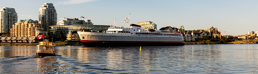
The lions gate bridge as seen from Stanley Park: 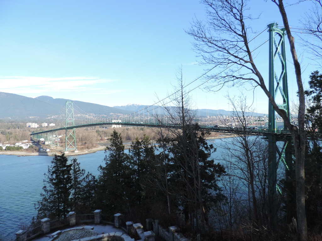 As seen from West Vancouver:   William R. Bennett Bridge which is the only floating bridge in BC right now :  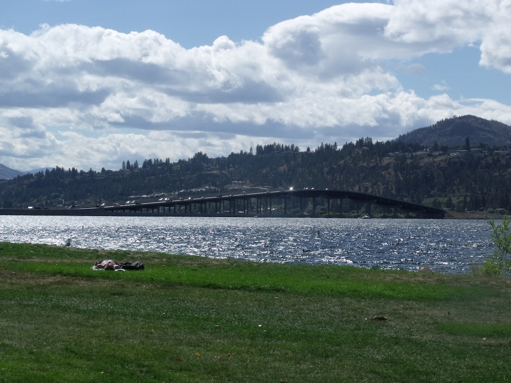 I find this kinda find this funny that Kelowna is asking the Province to build another bridge to cross Okanagan lake. Link: www.news1130.com/2013/09/21/kelowna-waits-to-get-its-second-bridge/ |
|
|
|
Post by Blue Bus Fan on Feb 14, 2014 18:36:19 GMT -8
Some photos of Skybridge and Pattullo Bridge as seen from Brownsville Bar Park. 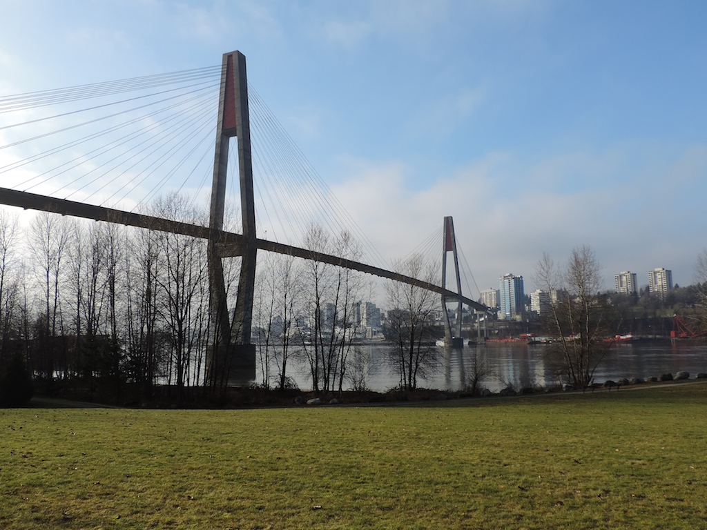 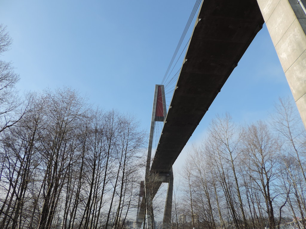 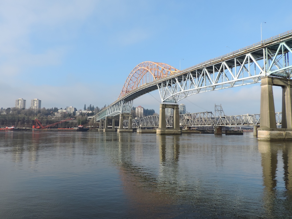 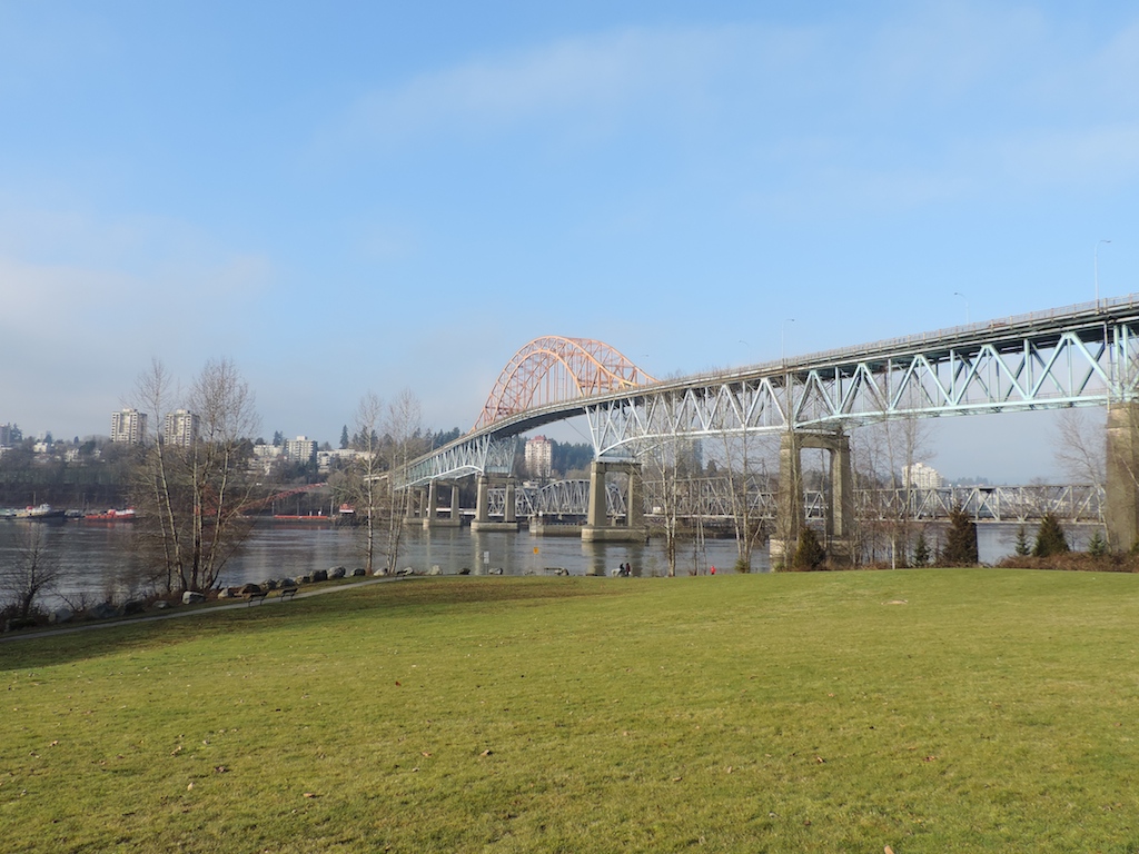 The Provincial Government has said they will pay one-third of price to replace the Pattullo Bridge |
|
|
|
Post by compdude787 on Feb 15, 2014 0:17:17 GMT -8
Some photos of Skybridge and Pattullo Bridge as seen from Brownsville Bar Park. [pics] The Provincial Government has said they will pay one-third of price to replace the Pattullo Bridge No way! I do not want to see that bridge replaced!! It is a piece of history, and like the original (and MUCH better looking) Port Mann Bridge, it does not have a finite service life. It is the only road bridge on the Lower Fraser River that can be considered a landmark. No I don't consider cable-stayed bridges to be landmarks since they're popping up all over the place worldwide, and there's nothing really interesting about them, unlike a cantilever bridge, or an arch bridge. Joseph Strauss, the chief engineer for the Golden Gate Bridge, said that that bridge would last forever, if it was cared for and adequately maintained. It seems like we live in a society that throws away things because they're "old." I still have a first-generation iPod Nano from 2005, and it still works (except that it can't hold a charge).  It ain't old, it's historic! The city of Vancouver, in particular, seems to show little regard to preserving its historic bridges, which is especially evidenced by the replacement of the beautiful Port Mann Bridge. It is this stupid replacement (it should've been twinned) that has made me more passionate about preserving historic bridges. I hope you guys appreciate the beauty and uniqueness of the Patullo Bridge and that you would be sad to see this bridge be replaced with yet another cable-stayed bridge. |
|
Deleted
Deleted Member
Posts: 0
|
Post by Deleted on Feb 15, 2014 12:16:42 GMT -8
Some photos of Skybridge and Pattullo Bridge as seen from Brownsville Bar Park. [pics] The Provincial Government has said they will pay one-third of price to replace the Pattullo Bridge No way! I do not want to see that bridge replaced!! It is a piece of history, and like the original (and MUCH better looking) Port Mann Bridge, it does not have a finite service life. It is the only road bridge on the Lower Fraser River that can be considered a landmark. No I don't consider cable-stayed bridges to be landmarks since they're popping up all over the place worldwide, and there's nothing really interesting about them, unlike a cantilever bridge, or an arch bridge. Joseph Strauss, the chief engineer for the Golden Gate Bridge, said that that bridge would last forever, if it was cared for and adequately maintained. It seems like we live in a society that throws away things because they're "old." I still have a first-generation iPod Nano from 2005, and it still works (except that it can't hold a charge). It ain't old, it's historic! The city of Vancouver, in particular, seems to show little regard to preserving its historic bridges, which is especially evidenced by the replacement of the beautiful Port Mann Bridge. It is this stupid replacement (it should've been twinned) that has made me more passionate about preserving historic bridges. I hope you guys appreciate the beauty and uniqueness of the Patullo Bridge and that you would be sad to see this bridge be replaced with yet another cable-stayed bridge. Beauty and uniqueness? Have you ever crossed the Patullo? I'll be happy when it gets torn down. The bridge is crumbling. |
|
Neil
Voyager
Posts: 7,175
|
Post by Neil on Feb 15, 2014 13:25:48 GMT -8
Some photos of Skybridge and Pattullo Bridge as seen from Brownsville Bar Park. [pics] The Provincial Government has said they will pay one-third of price to replace the Pattullo Bridge No way! I do not want to see that bridge replaced!! It is a piece of history, and like the original (and MUCH better looking) Port Mann Bridge, it does not have a finite service life. It is the only road bridge on the Lower Fraser River that can be considered a landmark. No I don't consider cable-stayed bridges to be landmarks since they're popping up all over the place worldwide, and there's nothing really interesting about them, unlike a cantilever bridge, or an arch bridge. Joseph Strauss, the chief engineer for the Golden Gate Bridge, said that that bridge would last forever, if it was cared for and adequately maintained. It seems like we live in a society that throws away things because they're "old." I still have a first-generation iPod Nano from 2005, and it still works (except that it can't hold a charge). It ain't old, it's historic! The city of Vancouver, in particular, seems to show little regard to preserving its historic bridges, which is especially evidenced by the replacement of the beautiful Port Mann Bridge. It is this stupid replacement (it should've been twinned) that has made me more passionate about preserving historic bridges. I hope you guys appreciate the beauty and uniqueness of the Patullo Bridge and that you would be sad to see this bridge be replaced with yet another cable-stayed bridge. I suspect that about 99.5% of the people who use the Pattullo are concerned with safety, capacity, and access, and 0.5% care whether it's cable or truss. The lanes are dreadfully narrow, and the sidewalk is as well. The thing is indeed crumbling, and the sooner it's replaced, the better. However, I can understand New Westminster's concerns about any additional traffic being funnelled through their community as a result of a larger bridge... their roads are badly clogged as it is, especially with the toll resisters spilling over from the new Port Mann. |
|
|
|
Post by compdude787 on Feb 15, 2014 14:43:31 GMT -8
Okay, we can agree to disagree on whether you think the bridge is worth preserving. I do agree that it has narrow lanes, which of course goes to show that cars were much narrower in the 1930s. Don't you think it would be possible to retrofit the bridge so that it's like new? They could build another bridge next to it with similar design (or it could be a concrete through-arch bridge like the 1997 Blue Water Bridge between Michigan and Ontario, which supplemented a bridge that was also built in 1938). Arch bridges, IMHO, look a lot better than cable stayed bridges. Not that cable-stayed bridges are horrible, but there's over 9000 of them already and we don't need to be so quick to build another one. If you build a 2nd bridge next to the Patullo Bridge, you could keep the old one, retrofit it to current seismic standards, and make it have just three wider lanes in one direction. The new bridge could be made wider so as to put in a bike path, since I don't think you'd be able to fit anything else on the Patullo Bridge as it is. I am not the only one who thinks this bridge is worth preserving. The person who maintains the website called HistoricBridges.org has written an entry about this bridge. Check out all these cool facts HERE. He expresses the same sentiment towards this bridge as I do, as well as Vancouver's inability to preserve many of its historic bridges. I think the city of Seattle has a much better track record when it comes to preserving historic bridges. In 2007, they did a seismic upgrade and rebuilt the approaches to the 1917-vintage Fremont Bridge. It's a drawbridge, the kind that many commuters hate because it just has to open whenever they're late for work or school. I think it's also lowest to the water than the other bridges across the Ship Canal. Most people would have said "good riddance" if they'd replaced it with a higher bridge, but yet, the city of Seattle still retrofitted it. I know some people who questioned why they didn't make it higher than it was before. That's not the oldest bridge in Seattle open to car traffic. There's also the 12th Avenue South Bridge built in 1911, and it's a steel-arch bridge near downtown Seattle located near the I-5/I-90 interchange. He also has info about the Port Mann Bridge, which I will miss, and is being torn down as we speak. Another thing about the Port Mann arch bridge: the government made the claim throughout the bridge replacement project that the old bridge only had a design life of 50 years. Nothing could be further from the truth: I found this article where the engineer of the original Port Mann Bridge said that he designed the bridge to have a life of 100 years, not fifty. |
|
|
|
Post by Kahloke on May 24, 2014 20:06:30 GMT -8
Here is a look at the San Diego-Coronado Bridge as seen from the Alaska Airlines 737-800 series aircraft I was on at the time as we were making our final approach into SAN: 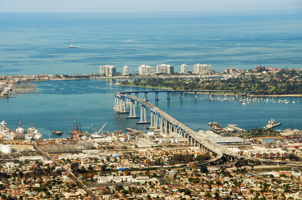 |
|
|
|
Post by Low Light Mike on Sept 17, 2014 14:23:36 GMT -8
Scene along the Columbia River, just above the 49th Parallel, in Trail BC - I chose this part of my vacation trip route, because I wanted to cross the Columbia at a place I'd never been before: this bridge, at Trail. September 17, 2014 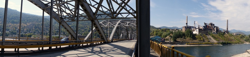 |
|
|
|
Post by Low Light Mike on Oct 30, 2014 18:58:09 GMT -8
There's a lot of transportation history in this photo that I took, so here's the explanation: 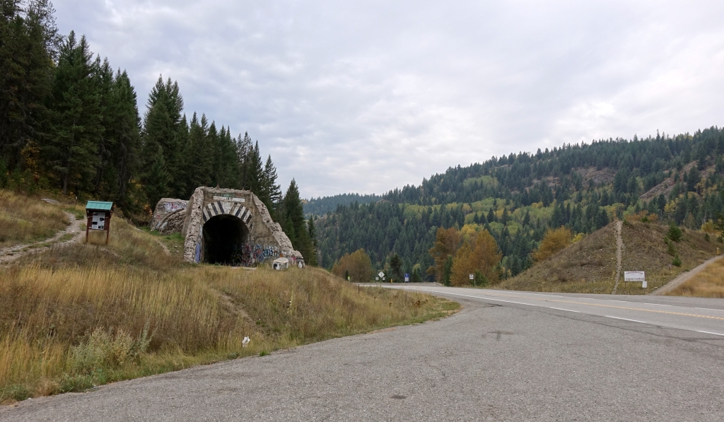 The highway is Hwy-3, just east of Greenwood, BC - the 1-lane road tunnel was for the original road to run under the KVR railway. - you can imagine the rail grade running from left-to-right on this photo, over the road tunnel, across the highway on a bridge, ending up on the earth embankment on the far side of the highway - Eventually the 1-lane road was replaced with this 2 lane highway. Imagine that the KVR railway crosses here on a bridge over the highway, and imagine that the older 1-lane road tunnel is completely covered with earth. - After the railway was torn up and the rail bridge removed, they decided to un-earth the historic old road-tunnel, just for the sake of viewing some history. - the rail grade is now part of the Trans Canada Trail. And here's a video. The road tunnel is at the end of this short video. |
|
|
|
Post by Low Light Mike on Jan 17, 2015 9:41:02 GMT -8
Here's a YouTube video that I found, which is a GoogleEarth flyover of the course of the Columbia River.
....plenty of bridges in this video, so I thought this was the best spot for this item. Regardless of the placement here, I think this is a view that many here would find interesting.
I'm in the "idea genesis" stage of thinking through a possible trip to drive the shore of Columbia River from source to mouth. Donald to Mica Dam (old Big Bend route) is the main no-see section of the river. There's another sizable gap from Needles to Castlegar.
Pretty much the rest of the entire river can be seen by various highways, with only small gaps where the river is missed.
....some day.
|
|
|
|
Post by Low Light Mike on Jan 30, 2015 8:47:09 GMT -8
Here's some bridge porn for you to enjoy. This low bridge is in Durham, North Carolina: bridge info here: HERE |
|
|
|
Post by Low Light Mike on Apr 4, 2015 17:03:57 GMT -8
A few bridges seen on one fun Sept.2014 day in the BC Kootenays: Hwy 3 bridge over CPR Railway, near Yahk 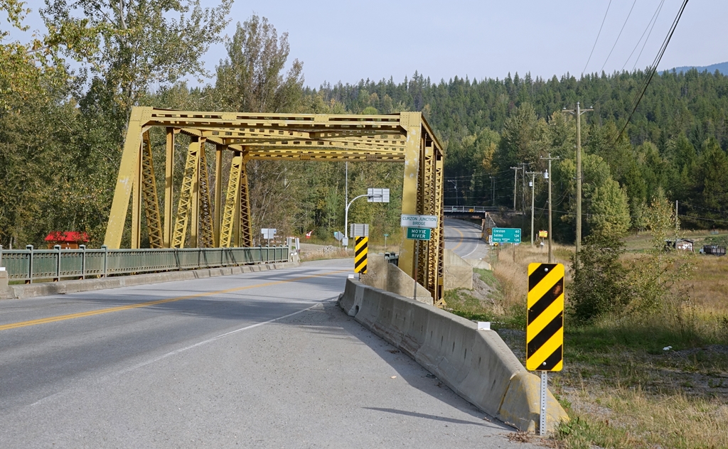 Highway bridge in Trail, over the Columbia River 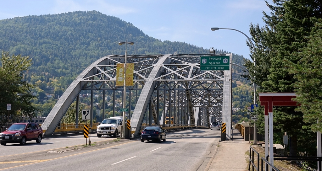 Minister Gaglardi has his name on similar plaques all over BC. That's a bad thing, in that it is now time in many many places to replace these bridges. 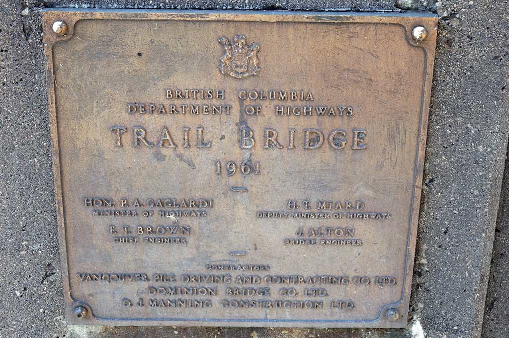 Rail bridge in Grand Forks, now part of the TransCanada Trail. In railway times, this was part of the CPR's Columbia & Western Railway. 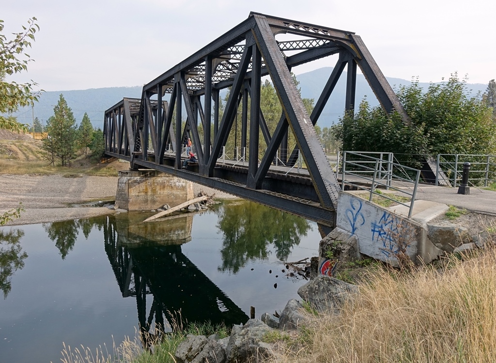 |
|
Deleted
Deleted Member
Posts: 0
|
Post by Deleted on Apr 4, 2015 22:42:46 GMT -8
The original Nelson Creek Bridge, carrying the Upper Levels Highway on its original alignment - now a public trail. 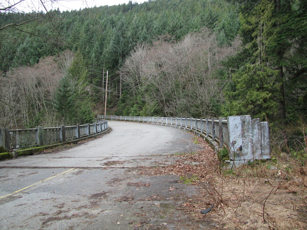 |
|
|
|
Post by paulvanb on Apr 5, 2015 16:39:46 GMT -8
The original Nelson Creek Bridge, carrying the Upper Levels Highway on its original alignment - now a public trail. Cool! How do you access this? |
|
Deleted
Deleted Member
Posts: 0
|
Post by Deleted on Apr 5, 2015 21:01:12 GMT -8
Thanks Paul. Because I am always going westbound on the Upper Levels, I like to take the Caulfield Exit. Once exited, hang a left onto Woodgreen Drive, which becomes Westport Road. You'll see the highway for most of your drive, as Westport Road follows much of the old highway alignment. Once you've driven under the current-Upper Levels, keep an eye on the right for a small entrance to the trailhead for Whyte Lake. You may have seen this parking lot just after crossing the Nelson Creek Bridge, after getting off the ferry in HSB. Park there, and it's a ten-minute walk down to the old bridge. Make sure you don't follow the signs to Whyte Lake, and just continue down the gravel road. Good luck! |
|
|
|
Post by Kahloke on Apr 30, 2015 19:19:05 GMT -8
A couple of bridges in Oregon: First up is the double-decked Fremont Bridge (I-405) in Portland, spanning the Willamette River 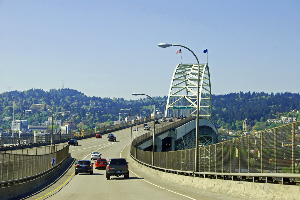 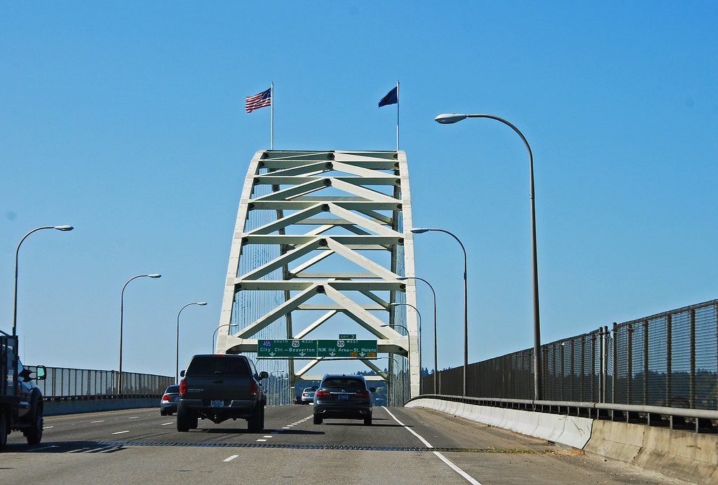 The second is The St. Johns Bridge in NW Portland, also spanning the Willamette, just a bit downstream from the Fremont Bridge 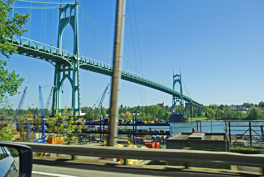 |
|
|
|
Post by WettCoast on May 2, 2015 10:55:09 GMT -8
The photo below shows the US Highway 101 bridge across the Columbia River estuary between Astoria, Oregon, on the south shore, and Megler, Washington, on the north shore. I took this photo on 18 March 2015, during the recent US west driving vacation enjoyed by my wife & I. This view is from the south side in Astoria and shows the elevated part of the bridge. The elevated section (clearance 196 feet or 60 metres above high water) was needed to allow ocean-going ships access upriver to the 'inland' ports of Portland, Oregon, & Vancouver, Washington. Not so obvious, in the distance, is the long, long, section of the bridge that is just above water level, and another elevated section before making land on the Washington side. The bridge is 4.1 miles (6.6 km) in length overall. It was completed in 1966. This bridge replaced a ferry service that operated for 45 years in the same location. For more info see these links: en.wikipedia.org/wiki/Astoria%E2%80%93Megler_Bridge & en.wikipedia.org/wiki/Astoria%E2%80%93Megler_Ferry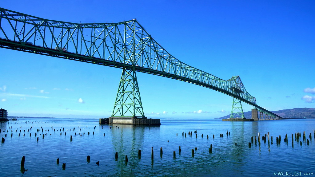 © WCK-JST by Wett Coast, on Flickr © WCK-JST by Wett Coast, on Flickr
|
|
|
|
Post by WettCoast on May 24, 2015 8:42:47 GMT -8
Re the old 1920's Alexandra suspension bridge in the Fraser Canyon between Yale & Boston Bar... First, two quotes: Quoting myself from 5 February 2012: Yea, the original bridge was finally taken apart in 1912 after sitting damaged for a few years. A replacement wasn't built for years after, and is the old one you see today. Apparently the foundations of the original bridge are still visible, but after two visits in the past year, I've yet to find them. Luke, I was just reading the Wikipedia article Jim posted, and apparently the 1926 bridge was built on the footings for the old bridge, only 10 feet higher. This would explain why you can't find the footings. During my big road trip earlier this year I again visited the old Alexandra Bridge, and got a few photos from below the bridge (made possible by the low river level at that time of the year - mid March). I also did see, and put my hands upon, a piece of the original 1860's Joseph Trutch bridge. First the photos: 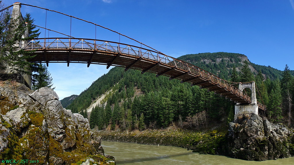 The 2nd (1920's built) Alexandra Bridge - Fraser Canyon - 13 March 2015 The 2nd (1920's built) Alexandra Bridge - Fraser Canyon - 13 March 2015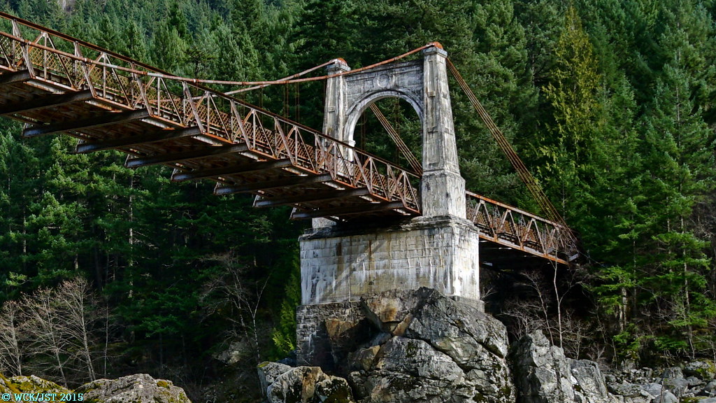 A close up of the east pier of the bridge. Click on this link to go to a hi-res version of this photo where you can get a better look at that bridge pier. Note that the lower part of the pier is built of stone blocks and is, in fact, the pier that supported the original 1860's bridge. The concrete upper portion dates from the 1920's and allowed for the deck of the 'new' bridge to be placed 10 feet higher than that of the 1860's bridge. That was deemed to be safe from any flood of the magnitude of the spring of 1894 flood (the worst on record in the history of the Fraser River). BTW, the pier on the west side is the same, with a concrete upper portion resting on the stone block 1860's pier. This is the one that you can get to on foot and actually lay your hands upon the stone craftsmanship of workers from 150 years ago. A close up of the east pier of the bridge. Click on this link to go to a hi-res version of this photo where you can get a better look at that bridge pier. Note that the lower part of the pier is built of stone blocks and is, in fact, the pier that supported the original 1860's bridge. The concrete upper portion dates from the 1920's and allowed for the deck of the 'new' bridge to be placed 10 feet higher than that of the 1860's bridge. That was deemed to be safe from any flood of the magnitude of the spring of 1894 flood (the worst on record in the history of the Fraser River). BTW, the pier on the west side is the same, with a concrete upper portion resting on the stone block 1860's pier. This is the one that you can get to on foot and actually lay your hands upon the stone craftsmanship of workers from 150 years ago.
www.michaelkluckner.com/bciw6alexbridge.html
Finally, a look at the current (newest) bridge that opened 51 years ago in 1964. This is located about two kilometres below the 1920's bridge, & carries the Trans Canada Highway over the river and the mainlines of both CP & CN railways. The view here is from the 1920's bridge. In 1964 this bridge replaced the suspension bridge which was then about 40 years old. The 'new' bridge is now over 50 years old. How long before we see a fourth bridge at Alexandra?
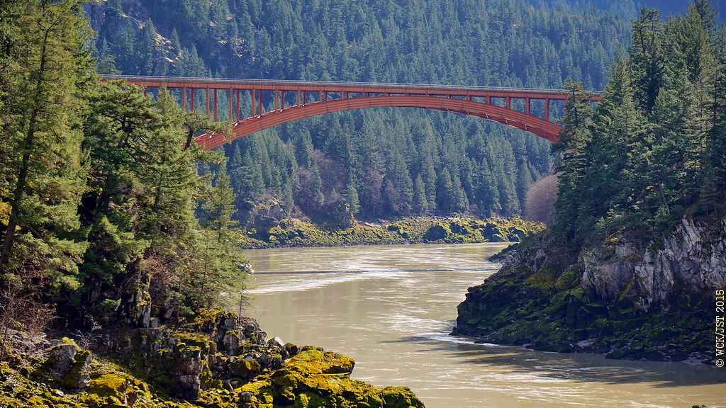 Current (1964) Alexandra Bridge that carries the Trans Canada Hwy # 1 over the Fraser River @ Spuzzum, BC - 13 March 2015. This too is a fine looking bridge, I think... Current (1964) Alexandra Bridge that carries the Trans Canada Hwy # 1 over the Fraser River @ Spuzzum, BC - 13 March 2015. This too is a fine looking bridge, I think...
All photos © WCK-JST by Jim, on Flickr
|
|
|
|
Post by Low Light Mike on Aug 14, 2015 18:16:41 GMT -8
Victoria's old Johnson Street bridge, seen by me on morning of August 13, 2015. A gravel barge went up the harbour, and then later the tug returned, so I saw 2 different openings/closings. Here are some photos: Gravel barge headed for bridge: 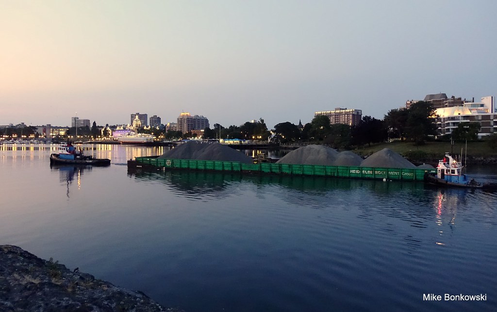 DSC00656 DSC00656 by Mike Bonkowski, on Flickr Stern of barge needs a push, for the tight corner 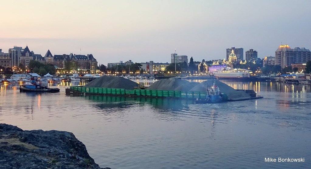 DSC00659 DSC00659 by Mike Bonkowski, on Flickr The open bridge awaits... 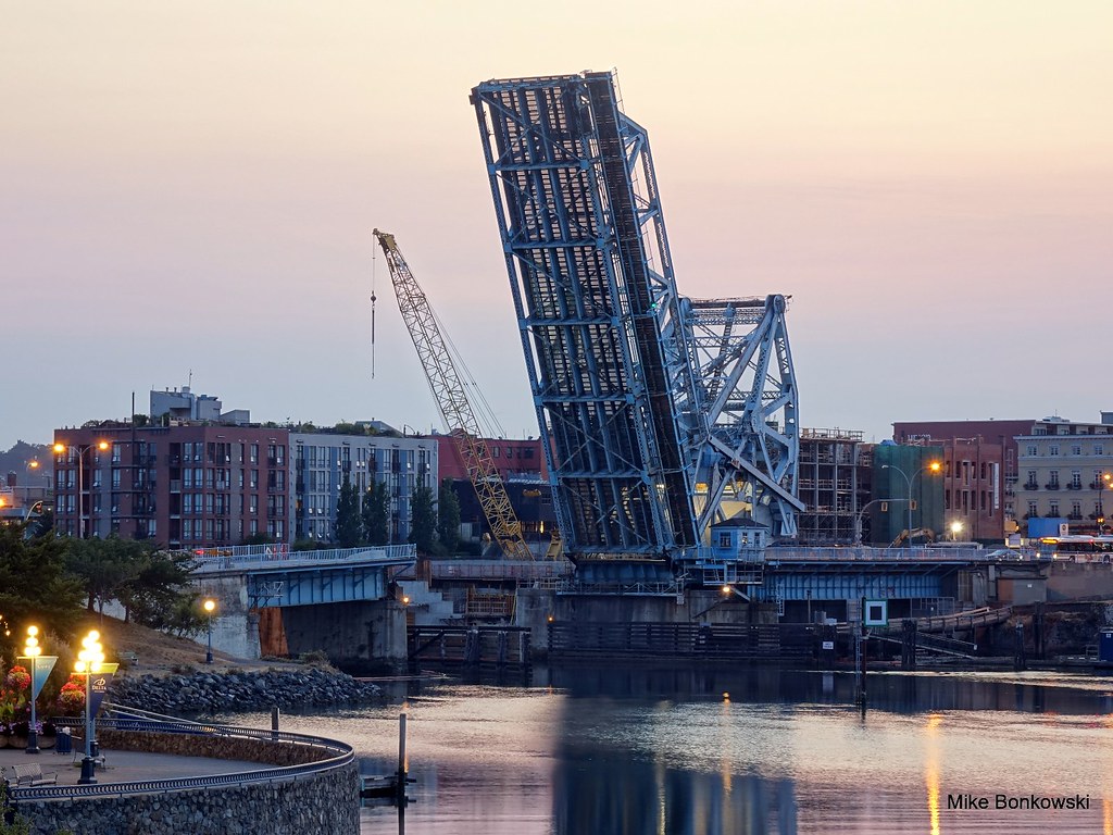 . . by Mike Bonkowski, on Flickr 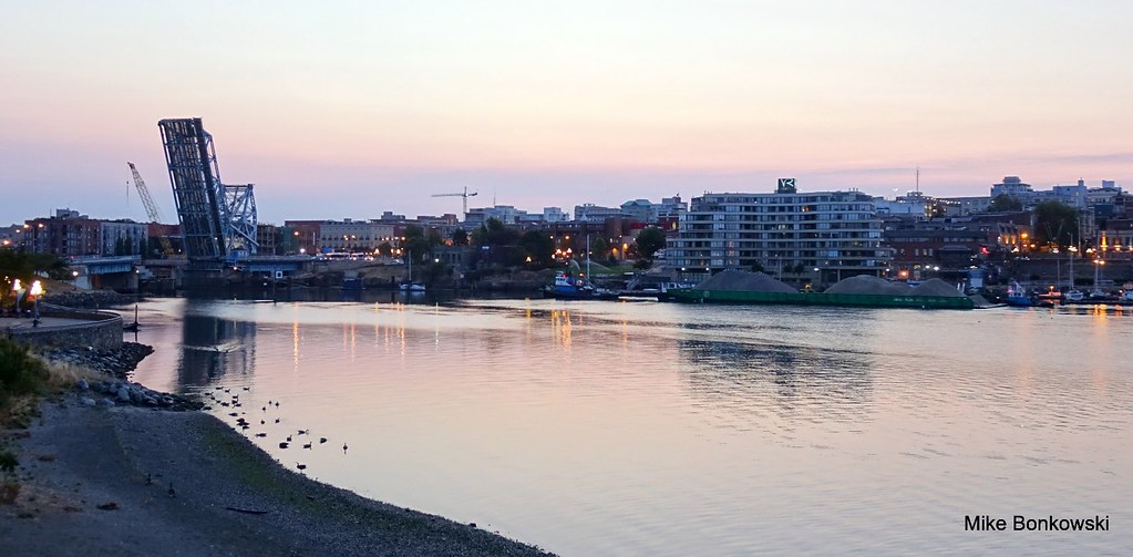 DSC00663 DSC00663 by Mike Bonkowski, on Flickr 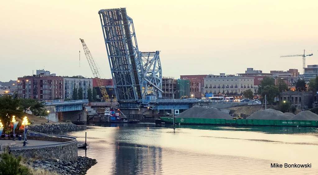 DSC00665 DSC00665 by Mike Bonkowski, on Flickr I think this was taken sometime around sunrise. 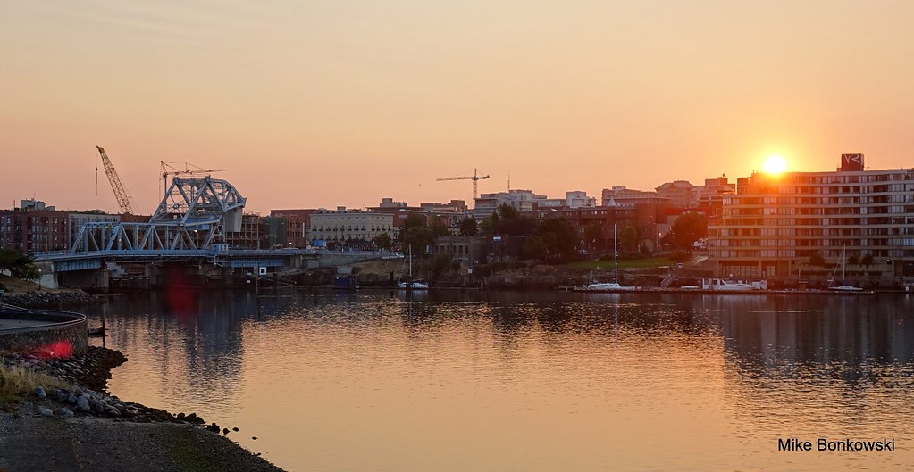 DSC00679 DSC00679 by Mike Bonkowski, on Flickr Video to come later |
|


 I also like how part of the new bridge is obscured by fog. The old bridge looks so much nicer. I will always say that it's a shame that it wasn't twinned like the Tacoma Narrows Bridge was. Vancouver seems to have little regard for historic and nice looking bridges. You already had enough cable-stayed bridges before you built this one, and they all looked fairly similar.


 It ain't old, it's historic! The city of Vancouver, in particular, seems to show little regard to preserving its historic bridges, which is especially evidenced by the replacement of the beautiful Port Mann Bridge. It is this stupid replacement (it should've been twinned) that has made me more passionate about preserving historic bridges.