|
|
Post by Low Light Mike on Aug 1, 2010 18:08:34 GMT -8
Continuing my report of the Haida Gwaii part of my trip: On Sunday, July 11, we took a side-trip to Moresby Island on the MV Kwuna. We spent a few hours driving and sitting in the car at Sandspit. The car-sitting was to watch the ocean (there was a minor storm, or at least some dark clouds and wind) and to relax and read. That storm: 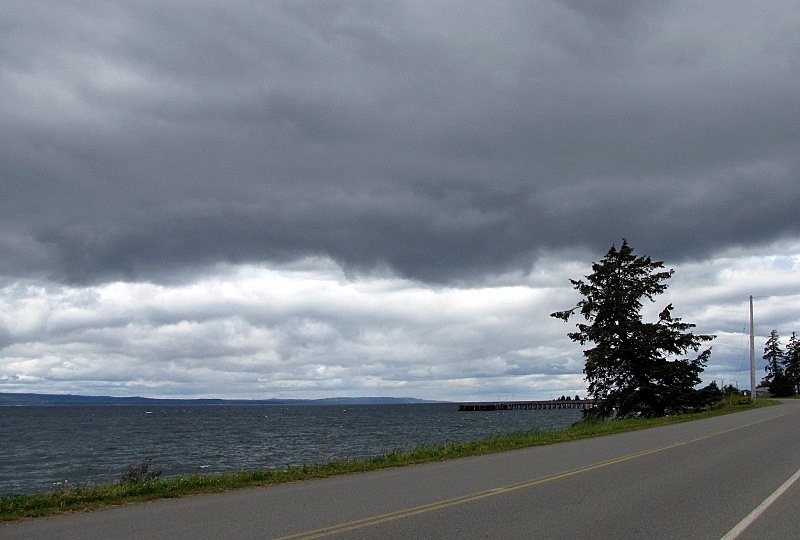 - later that evening, we both used toques and fleece jackets for our evening walk. For Sandspit, it was a small settlement. We found the main landmarks:  Surprisingly, I've never been to this restaurant.  Because we didn't take the time to drive 20+ km on gravel road, we didn't see Gray Bay, which is supposed to be one of the finest beaches on the island. But you've seen my cloud picture, so we didn't pick a great beach day. We saw that the Sandspit area of Moresby Island is a staging area for adventure tripping for fishing, kayaking and eco-tourism. The airport is at the northeast corner of Moresby Island, a great location for it. ---------------------- Later that evening at our Inn in Queen Charlotte, I saw an eagle fly with a salmon up to the top of a utility-pole across the street from our inn. 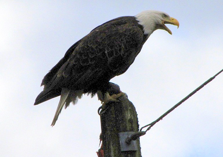 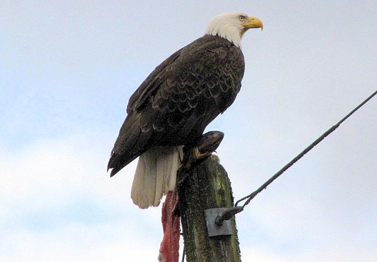 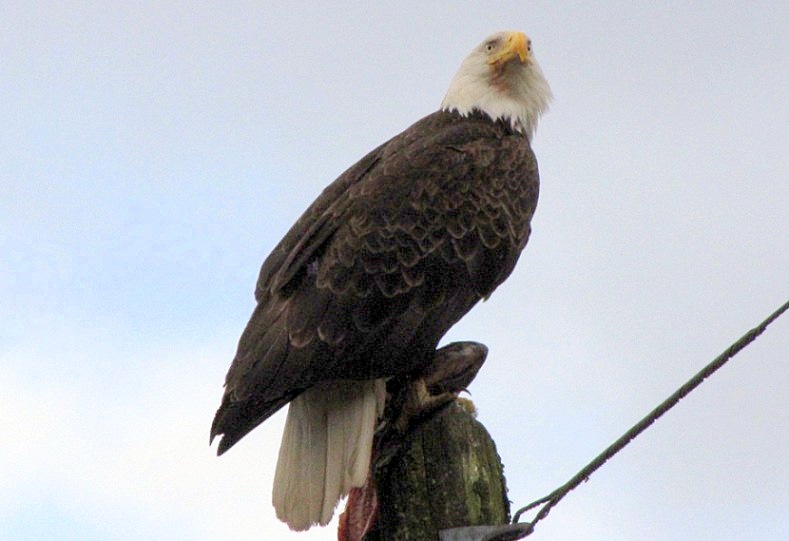 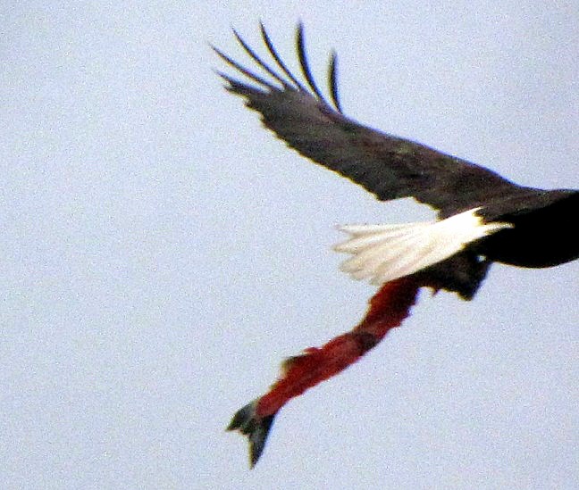 - I missed the departing eagle in the last shot, but it does show what it was working on. -------------------- Look at the ranges of tides: - photos from same vantage point: 1) Low tide at 9:30am.  2) High tide at 1:00pm. 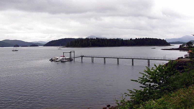 -------------------- The scenes which are making me want to return someday.... From our inn area at the village of Queen Charlotte, looking at the waters of Bearskin Bay, with the mountains of Maude Island and Moresby Island in the background. 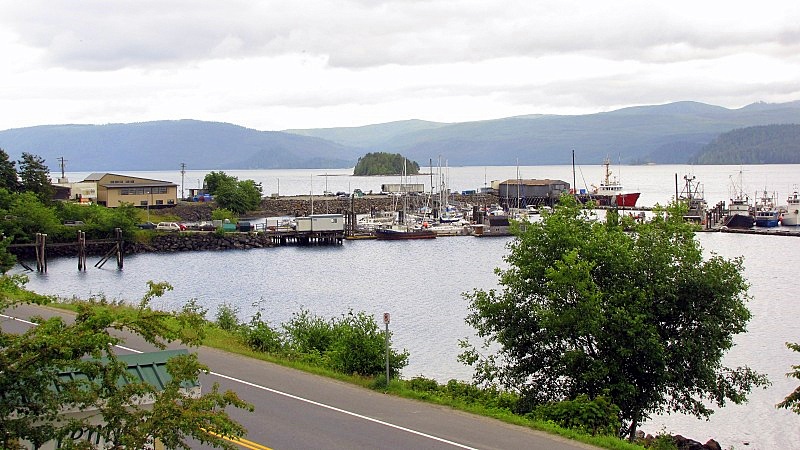 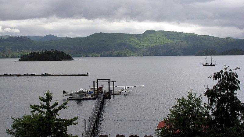 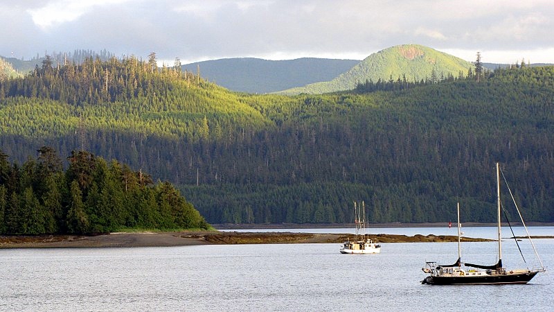 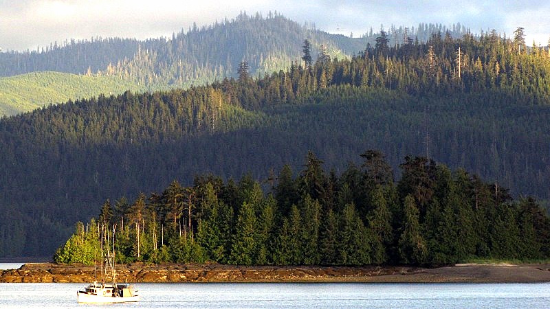 |
|
|
|
Post by Low Light Mike on Aug 2, 2010 9:58:22 GMT -8
On Wednesday July 14 2010, we visited the North Pacific Cannery at Port Edward, which is a few KM east of Prince Rupert. Located on the Skeena River, it's a Canadian National Historic Site. website: web.mac.com/andrewcthamilton/iWeb/NPC/welcome.htmlWe arrived at the start of their tourist-day, on a misty & buggy morning. We arrived just before a senior's tour bus, and so we had to wait a bit for those people to use the washrooms before we could all start our guided tour together. The scene from the parking lot: 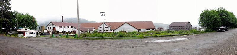 - the CN railway line is between the wheelhouse and the cannery building. This is a neat use of an old wheelhouse. - Can you imagine having the Queen of Tsawwassen's wheelhouse in your backyard. I know that it's been done with a WSF wood-electric. 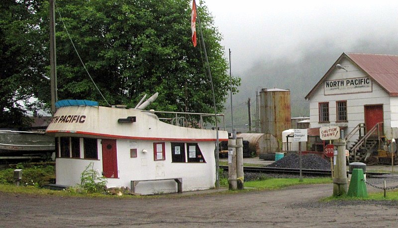 The tour was great, led by an amusing character nicknamed "Spider". 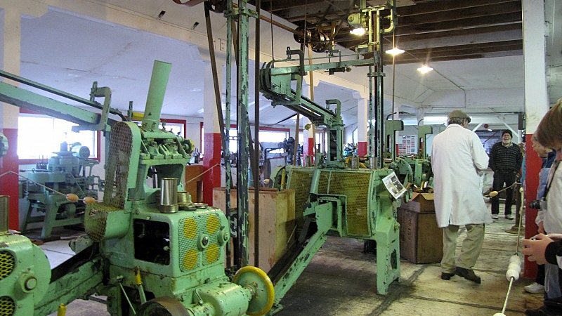 The site is built on pilings on the bank of the Skeena. 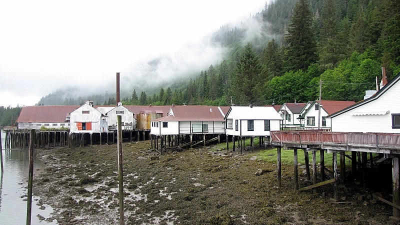 Part of it is falling down. 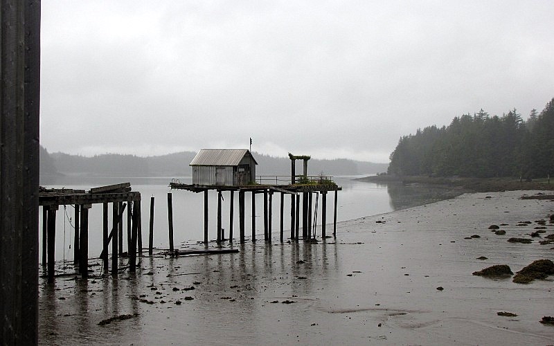 The row of manager's houses. 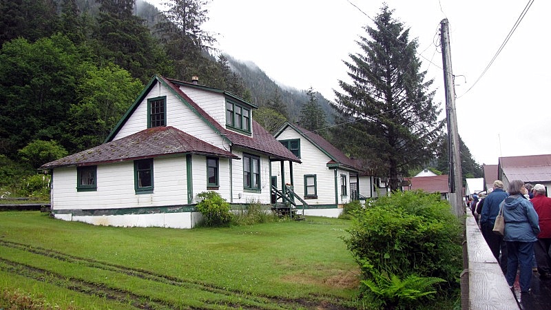 Some of the memorabilia inside the cannery building: 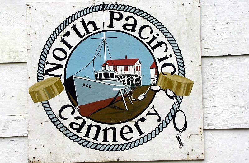 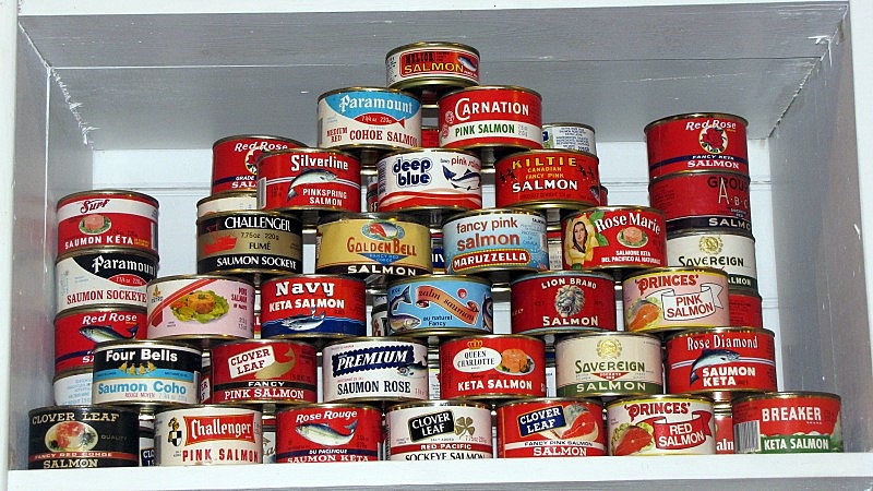 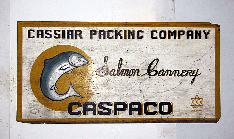 It's a pity that I wasn't able to get a better picture of this label. 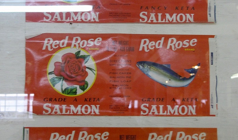 |
|
|
|
Post by Kahloke on Aug 2, 2010 11:19:32 GMT -8
Great travelogue, Flug! Keep 'em coming!
|
|
|
|
Post by Low Light Mike on Aug 2, 2010 12:00:33 GMT -8
Great travelogue, Flug! Keep 'em coming! Upcoming reports will cover the following: - Lava fields - remote northern highways - Stewart & Hyder - Francois Lake. - The joys of returning to towns that have Tim Hortons |
|
|
|
Post by Low Light Mike on Aug 2, 2010 13:33:29 GMT -8
We finally started to have some longer days of car travel, during our vacation's 2nd week. Other than Day-1's 400+km from Nanaimo to Port Hardy, we only had short car days between July 5 and 14, which is because we took long ferry trips and mainly stayed in one place. Well, that started to change on Wednesday July 14th, as we left Prince Rupert and finally set foot (or tires) on the mainland. - you've seen my sarcastic post & picture about the great bridge linking Prince Rupert's Kaien Island to the mainland. We we crossed that bridge and then the entire continent of North America was available for exploration. We of course headed for Terrace, the " Port Alberni of the North". Driving east on Hwy 16, the sudden sight of the Skeena River is breathtaking, similar to the first view of Mt. Robson a few days further east on the same highway....  The CN rail track runs parallel to the Hwy 16, for much of the distance between 'Rupert & Terrace. Here the bridges give a good comparison: 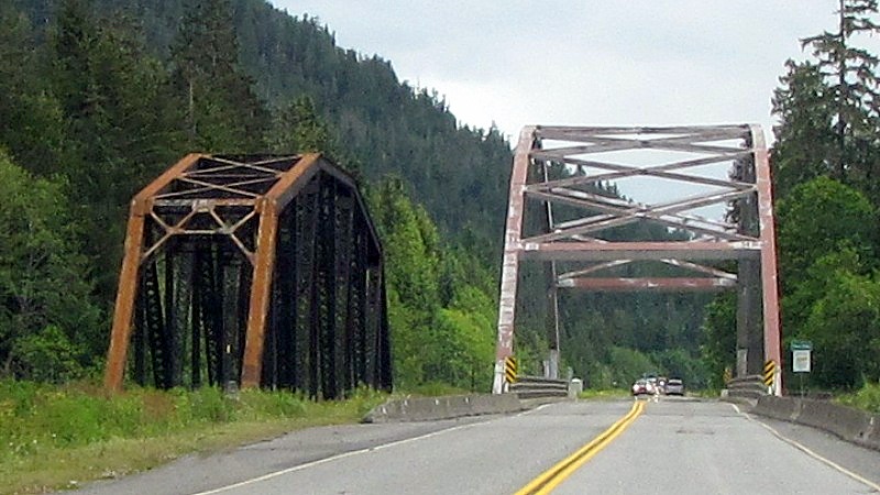 Later, after changing sides, we have one of those narrow sections of cliff / road / rail / river. 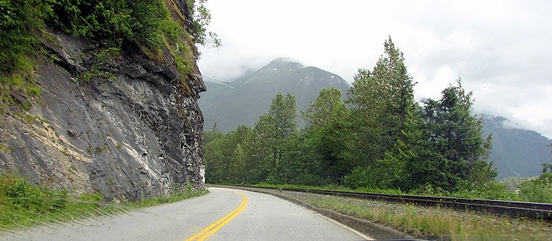 (I'll experience something similar near Porteau Cover, later in my trip). Once in Terrace, we visited the local tourist info centre, to get some material about the Nass Valley, our next day's destination. We decided to forgo the 32km return trip to the Usk ferry and back, and so we found our 1st Tim Hortons of our trip and then found our hotel. This was our largest and most modern hotel so far on our trip, a Best Western, which was adequate and comfortable. Terrace's marketing / cultural symbol seems to be the Kermode bear. Propaganda had told me that this bear sub-species was only found on Princess Royal Island, but I've now learned that there are some in the Terrace area. 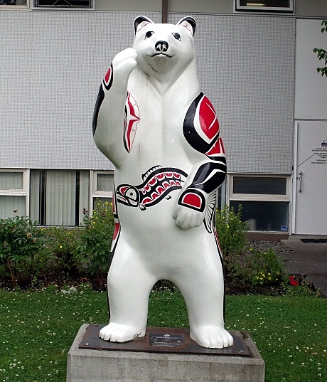 ============= The next day, July 15, we left Terrace and headed north on Highway 113, the "Nisga'a Highway". This was good pavement all the way from Terrace to New Aiyansh. - I will do separate posts later about the lava fields and about the sights around Canyon City and New Aiyansh. We felt welcomed to this 1st nation area, where the Province of BC had signed a huge treaty with the Nisga'a in the mid 1990's. 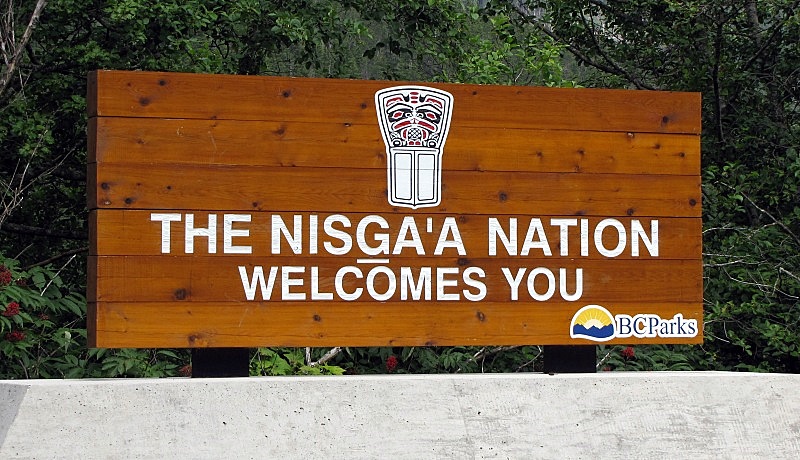 The Nass Valley of the Nisga'a had a full page advert in the Terrace tourism booklet, promoting its natural and cultural attractions. There was even a mention of "Nisga'a salmon" that you could purchase in decorative cans; and we thought this would be a good gift idea for us to do. Lava Lake was altered by the 1700's volcanic eruption in this area. The bed of the lake was raised. I'll take their word for it. 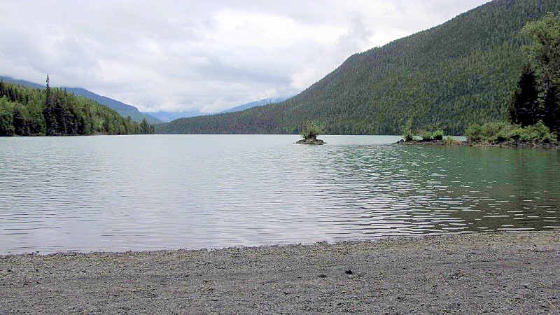 Further up Hwy 113, we found a nice small waterfall, just off the highway. I decided to practice with some of the settings on my camera. We also met a couple of older ladies here, parked and taking lots of flower pictures. They were sisters, traveling from the state of Mississippi. They were the "furthest away people" that we encountered on our trip. 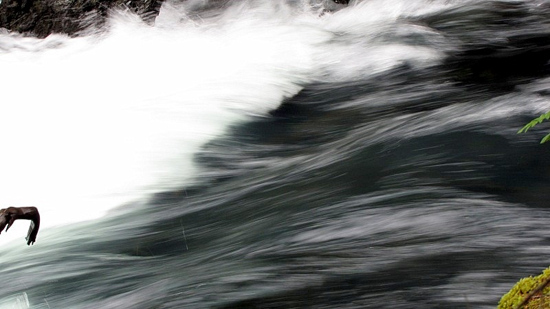    We finally arrived at what the tourist advert called the "Vetter Creek Visitor Centre". Perhaps we could buy some souvenirs or maybe some art? - Nice building, but a hand-written note taped to the door said "closed 'till 1:30", and it was still only 11:45am. Too bad for us and them.  After enjoying the lava fields, the suspension bridge at Canyon City, and the totems (and 2 black-bear sightings) at New Aiyansh, we headed down the secondary logging road "Cranberry Connector", which would link us to Highway 37 North. - this is a 50km road, which we found good for our little car. - amazingly, we had good radio reception for CBC-1. However I'd still have to wait a few more days to finally be in a location where I could listen to my favourite "CBC-2".   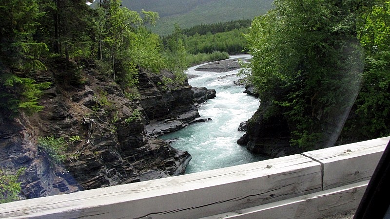 - I'm not sure how recent this blow-down was, but there was a passage cut-out just wide enough for 1 vehicle. 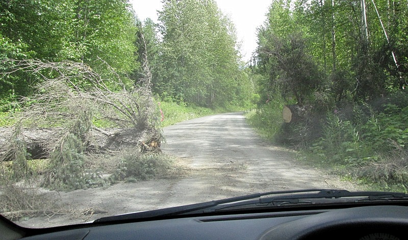 At the end of the Cranberry Connector road, there was a sign that showed us that we really were in Northern BC, with these place-names that I had only previously seen on maps. 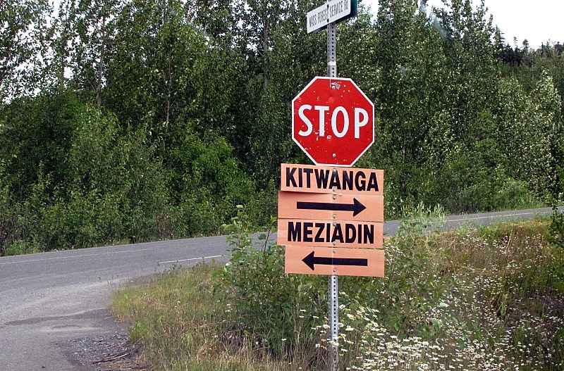 After an hour or so on Highway 37 north (including the Nass River 1 lane bridge - see the "favourite bridges" thread for that one), we arrived at the bustling metropolis of Meziadin Junction. After all, if a place is on a map and on highway distance signs, it must be a cool place, right? Here is the Mez: 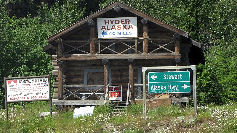 - In fairness, although it's no "Tuxedo Junction", Meziadin Junction has a few buildings, a bit south from the junction itself. We turned west here onto Highway 37A, and headed towards Stewart on what is called the "Glacier Highway". We'd find out why soon. 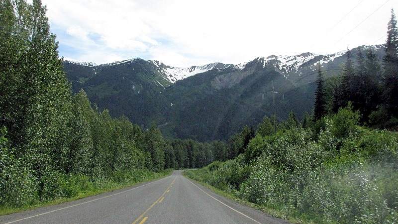 |
|
|
|
Post by Low Light Mike on Aug 2, 2010 19:21:11 GMT -8
As part of our drive from Terrace to Stewart BC on July 15th, we drove through the Nisga'a 1st-Nation and saw some of the lava beds park. - I'm calling it "Nisga'a Memorial Lava Bed Park". ;D 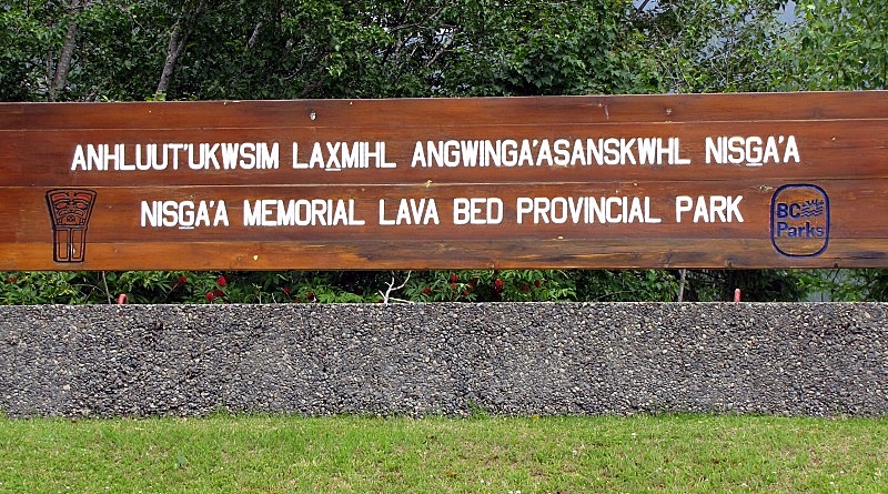 We had earlier picked up a printout for the self-guided driving tour of the park, and along the route the various attractions had these nice signs: 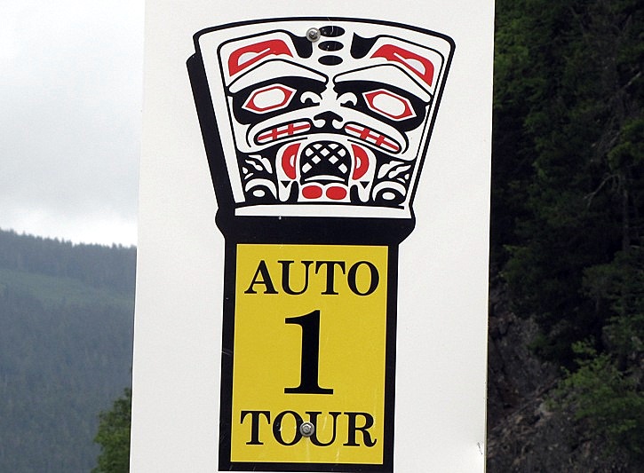 Here's some pictures from where we stopped in the south portion of the park, near the volcanic cone trail. - when I walked the trail, it was "crunch, crunch, crunch" on the rocks. - I was amazed at how much lichen there was on the lava. - and you can see that trees have only recently started to come back to this valley. 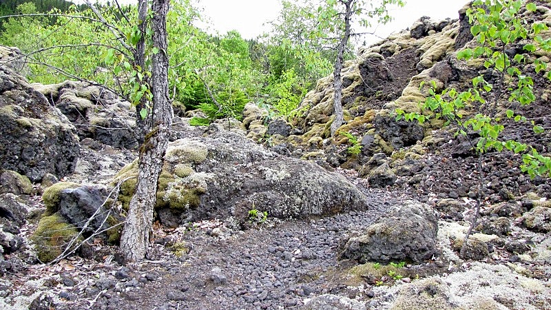 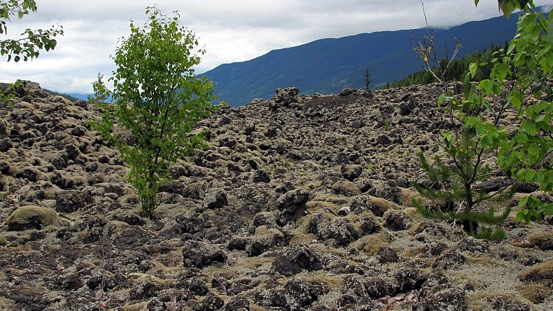 Close-ups of the Nisga'a moonscape. 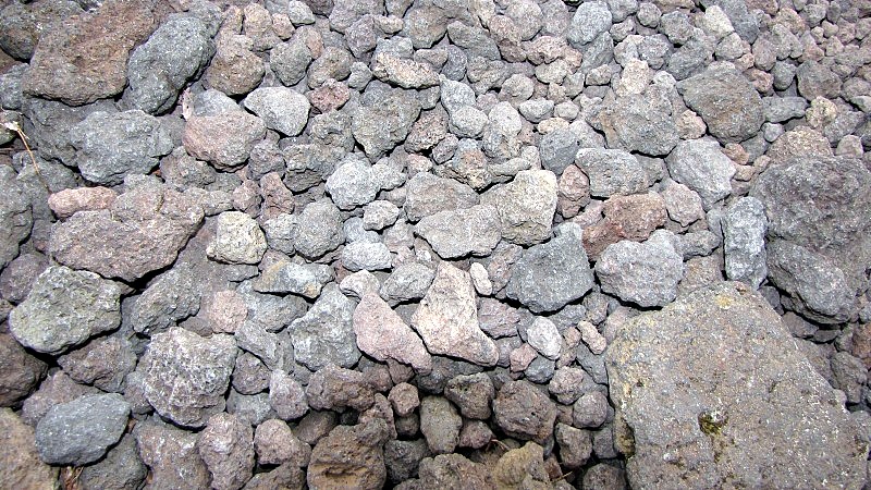 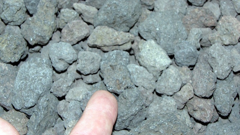  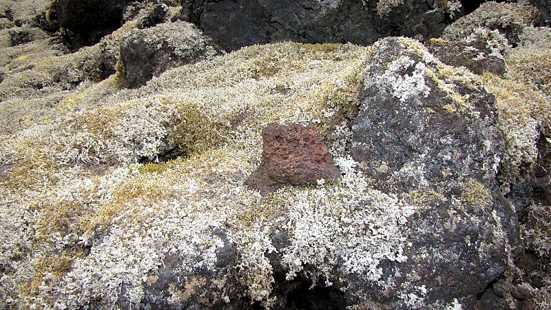 Near Beaupre Falls, we stopped again, and saw a similar area with a path through it.  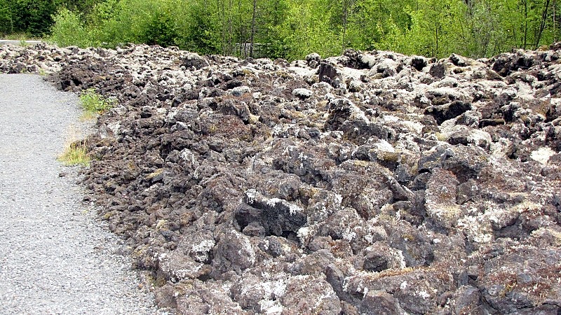 Then it was time to hit the road and drive through the Hawaiian, oops Nisga'a moonscape to find what us white guys call Canyon City, and its suspension bridge over the Nass River. 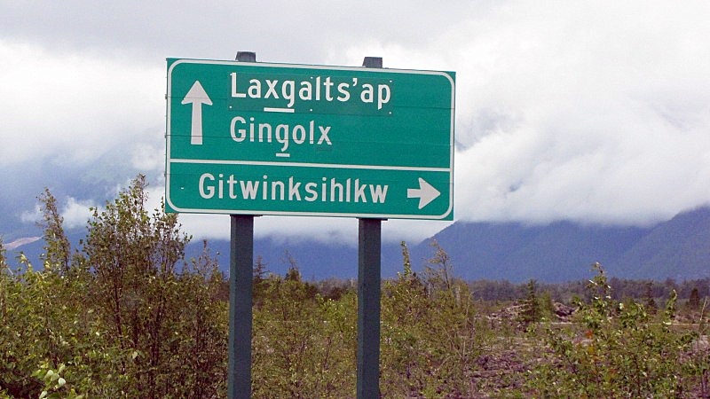 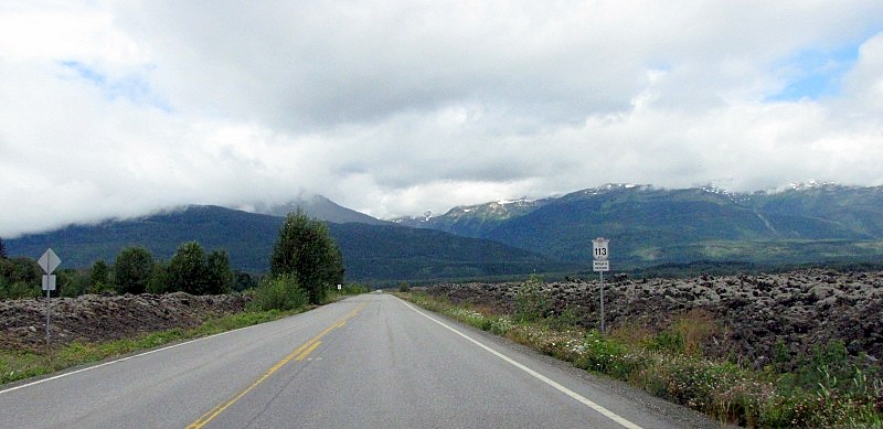 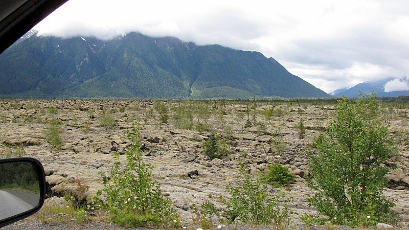 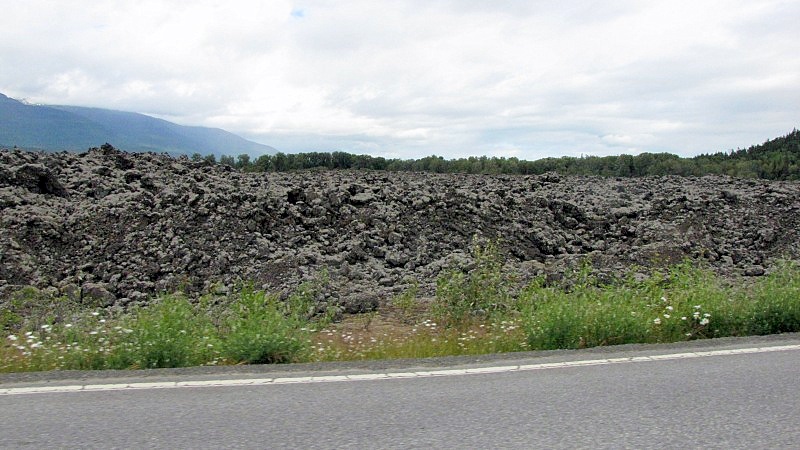 We'd see New Aiyansh later.... 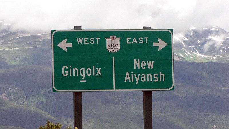 |
|
|
|
Post by lmtengs on Aug 2, 2010 19:50:46 GMT -8
Later, after changing sides, we have one of those narrow sections of cliff / road / rail / river. 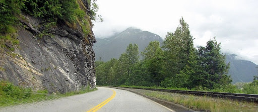 I've got an interesting book called Road, Rail, and River, written by a family friend, Phylis Bowman. There are some really great shots of those types of scenes from back in the mid 1900s when it was actually scary to drive down that highway. The book's out of print now, but it's a real gem. There are some great old steamboat, and maybe some BC Ferries pictures too, in it and it's sister-book " Whistling through the West". I forgot to mention that the entire BC North runs on 'Island time'  We've got a good family friend living in Kitwanga. I don't suppose you saw an old guy running his tractor down the highway there? It's already been said before, but I'll say it again: "Keep it coming!" |
|
|
|
Post by Low Light Mike on Aug 2, 2010 19:58:39 GMT -8
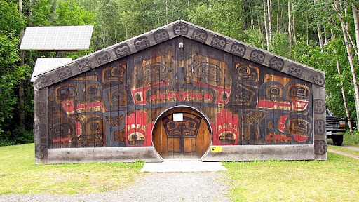
While in the Nisga'a 1st-Nation, we visited 2 communities. Canyon City (now known as "Gitwinksihlkw") is on the opposite bank of the Nass River from the Highway, and previously the only access for the village was by a foot-traffic suspension bridge. I'm not sure when the new bridge was constructed (probably sometimes after the treaty was signed in the 1990's). Here's the approach to the new bridge: 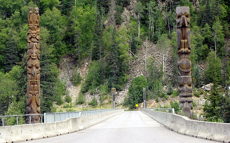 And the view of the old bridge is barely visible, downstream from the new. 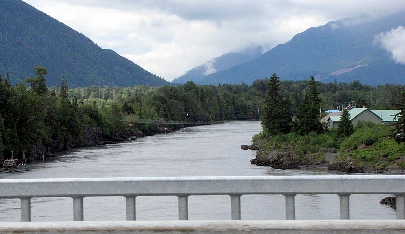 A better view of the suspension bridge. 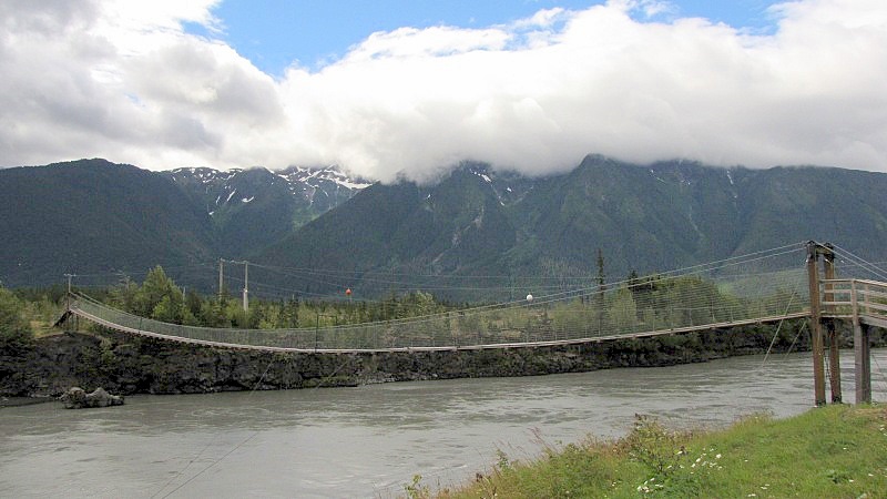 As I was walking across the bouncy bridge... 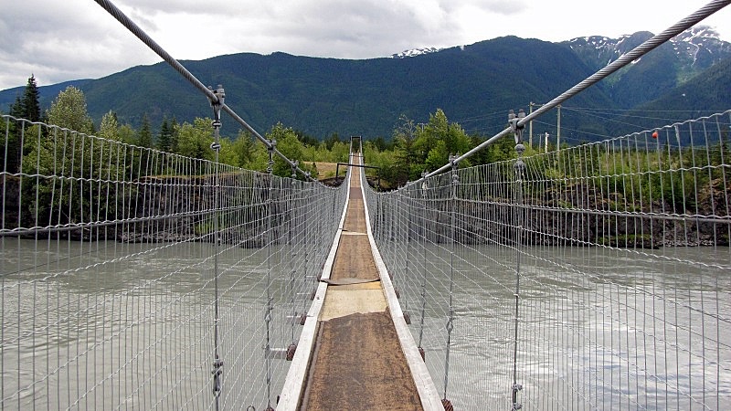 ================= Then it was off to spend a few moments in the capital city, New Aiyansh. 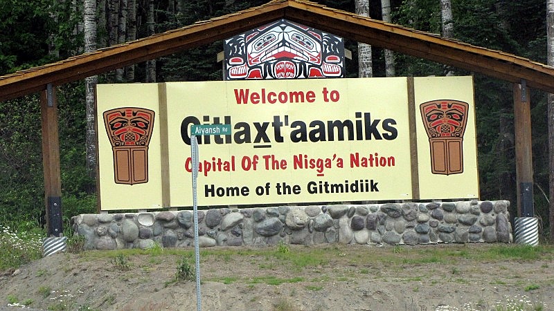 - just past this sign, we saw a black bear. The community hall. Notice the protruding beak on the artwork. 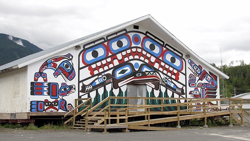 The totems in front of the Government building. - no truth to the rumour that Glen Clark himself carved the pole using his special pocket-knife, after signing the Nisga'a treaty. - all kidding aside, it is really interesting to see this area a decade after Premier Clark's significant agreement with this group. 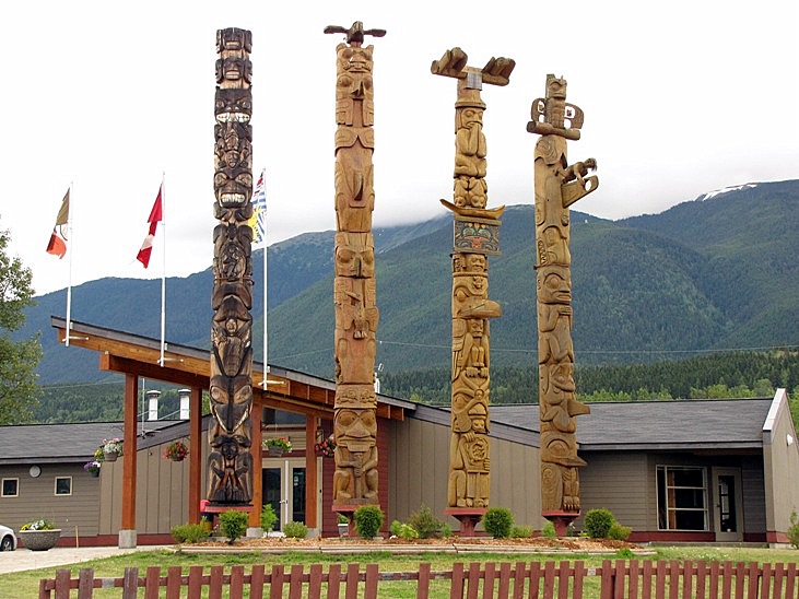 - check out the bases of these poles; the poles themselves aren't buried into the ground like other poles are. I love the detail on these contemporary poles. 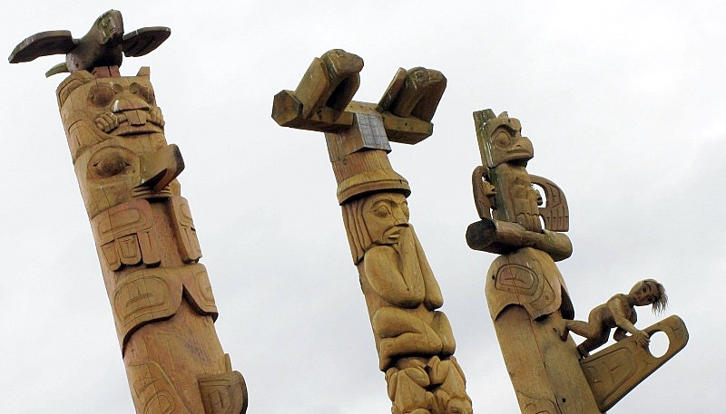 |
|
|
|
Post by Low Light Mike on Aug 2, 2010 20:01:39 GMT -8
At the end of the Cranberry Connector road, there was a sign that showed us that we really were in Northern BC, with these place-names that I had only previously seen on maps. 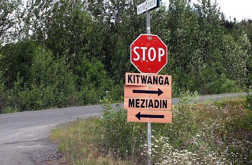 Thanks Luke. No tractor-guy sightings. But one thing that interested me is that "Kitwanga" is already a pretty native sounding name. But even it is being revised, and the "K" is now a "G". - Just north of K-Gitwanga is a National Historic Site commemorating a 1st Nations stronghold site from a few hundred years ago. More on that later. |
|
Nick
Voyager  Chief Engineer - Queen of Richmond
Posts: 2,078 
|
Post by Nick on Aug 2, 2010 20:06:04 GMT -8
This photo reminds me of the Craters of the Moon National Monument in southern Idaho, only not as hot and with more greenery. While I knew of the Nisg'aa lava beds, I never realized how barren and massive they were. Thanks for putting the effort into showing us these photos and your travelogue. This is a shot of the Craters of the Moon from last summer.  |
|
|
|
Post by Low Light Mike on Aug 6, 2010 17:27:50 GMT -8
The road into Stewart BC is Highway 37A. The scenery was somewhat like that of Highway 20 in the Bella Coola Valley, with tall mountains on either side of the highway that start green and end rocky. Also, the 37A is a spur off a main north-south route. Similar to how Bella Coola's Hwy20 is a spur off of Hwy 97. However, instead of being nicknamed the "Freedom Highway", this 37A is referred to as the "Glacier Highway". Here's some of that scenery, from the 2 days that we traveled this short spur (with 2 nights at Stewart in-between): 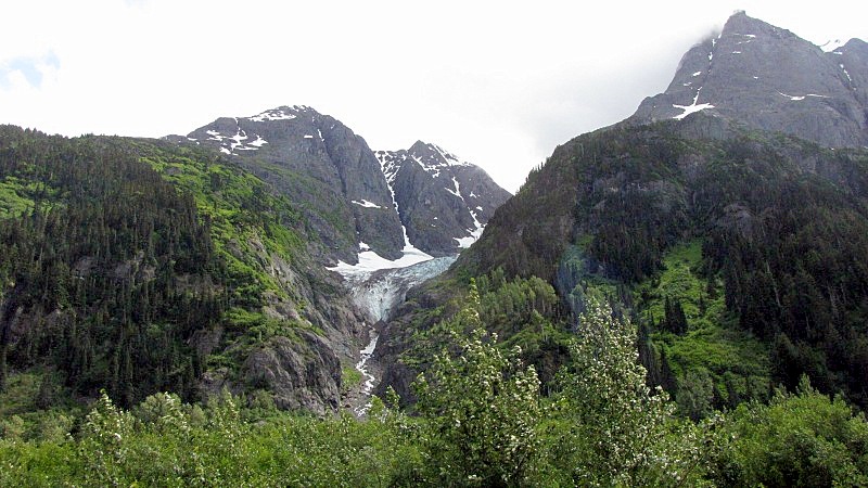 A smaller glacier, close to the highway: 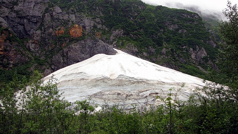 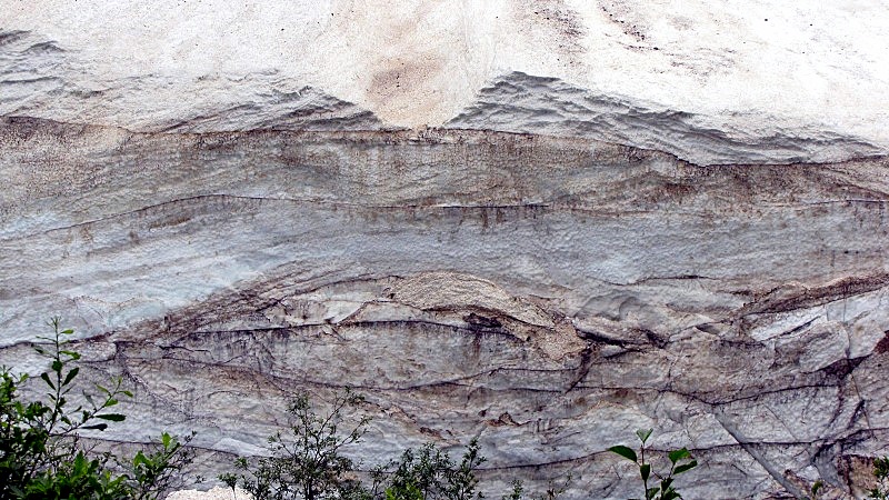 There was one stretch of Hwy-37A that had rock-piles around the base of each utility pole. - Is this for extra stability during avalanches? 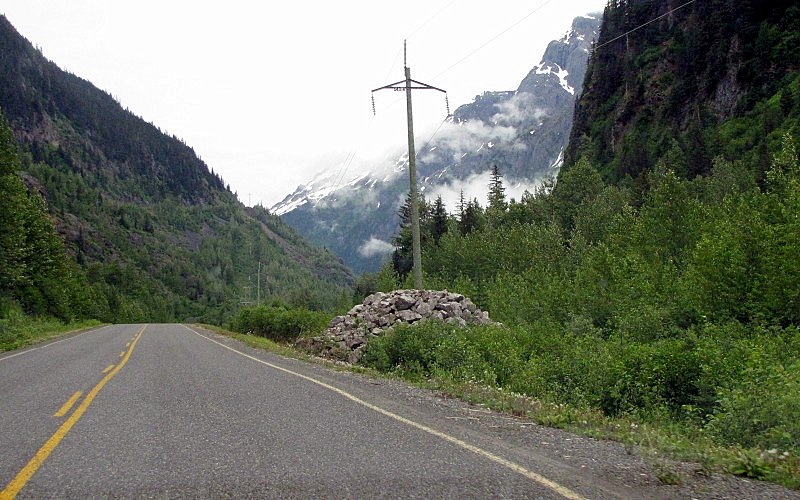 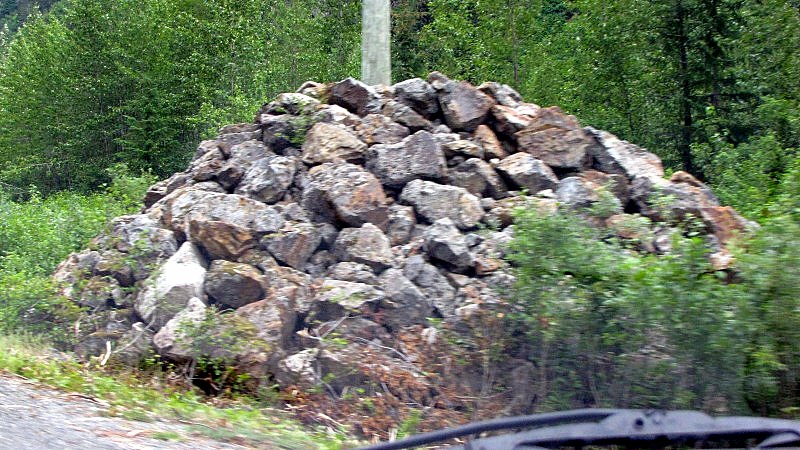 The main glacier on this highway is the Bear glacier. We stopped both times and admired it. 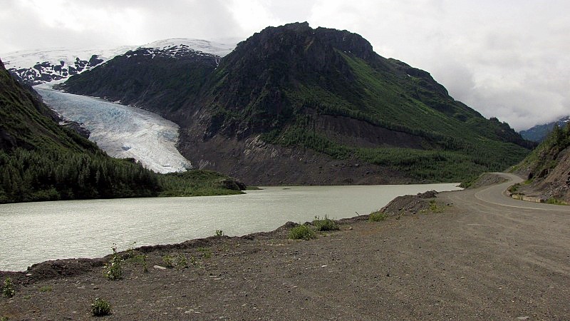 It was really cold at the highway near the glacier, in the morning. 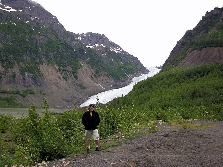 More of Bear glacier: 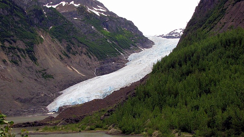 Top: 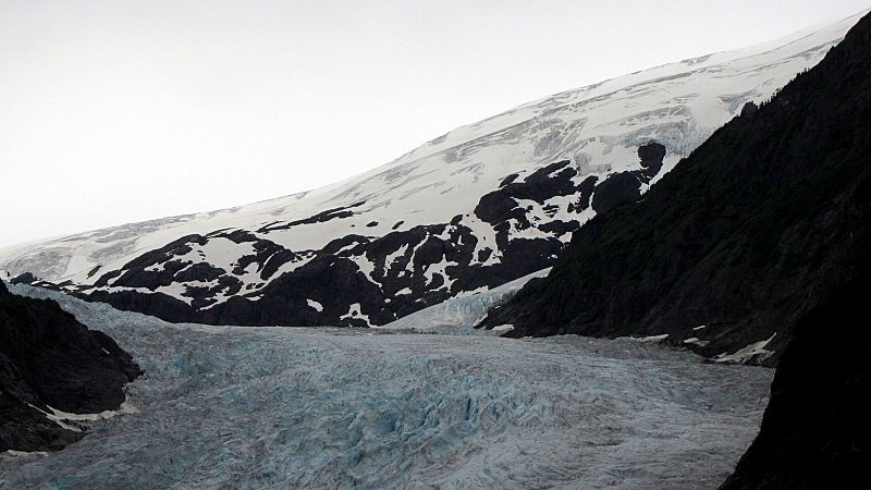 Bottom: 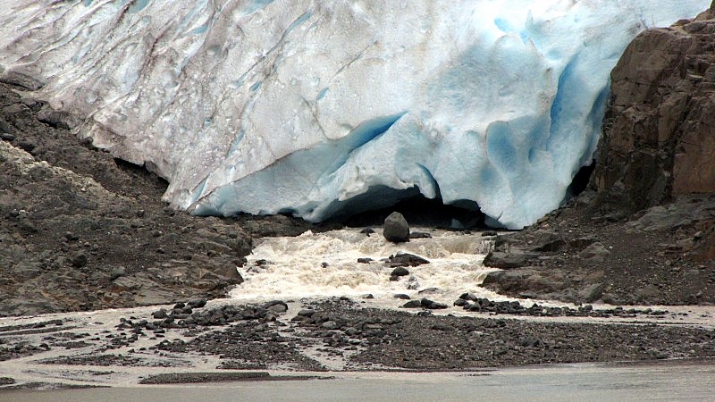 Nice blue, like a cut-open smurf. 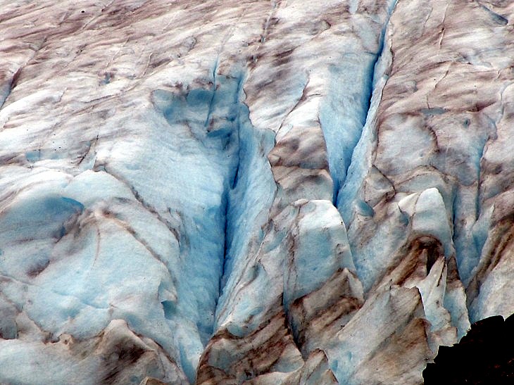 |
|
|
|
Post by Low Light Mike on Aug 6, 2010 17:50:10 GMT -8
Stewart BC is a small remote port town, that feels like a semi ghost town. It's at the head of the Portland Canal, and is a shipping port for exports of ore (which comes from mines near Vanderhoof via truck). To the north, around a mountain, is Alaska and the town of Hyder. 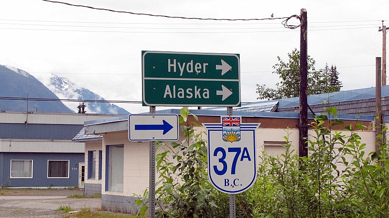 The mountain on the Canada / USA border is on the right side of this pano picture. We're facing the ocean. 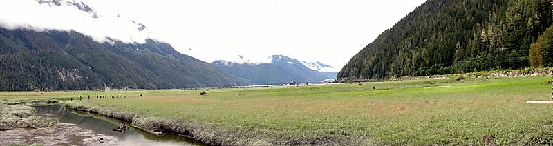 A close-up of the shipping wharf, at the base of the border mountain. 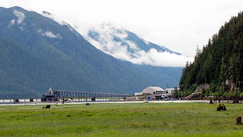 Here's the base of the border mountain, looking back at Stewart. - this is the road near to the Canada customs office.  ----------------- Views of the spectacular mountains are from everywhere in Stewart, as long as the clouds aren't hiding them.  Stewart has an industrial area, a residential area, and a downtown street. They're just all really small, and each zone appears 1/2 abandoned. Downtown Stewart:  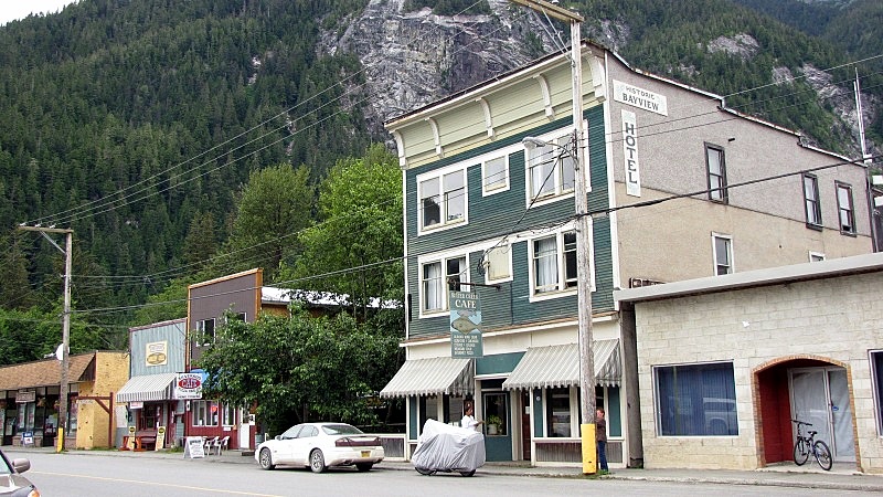 Who needs the Quickee Mart ? 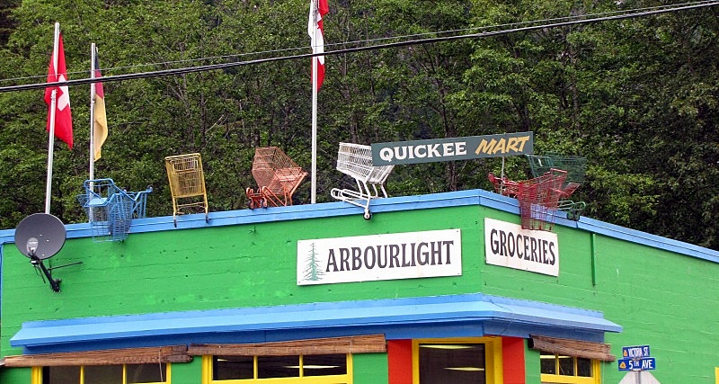 The abandoned building that was once Stewart's Empress Hotel. 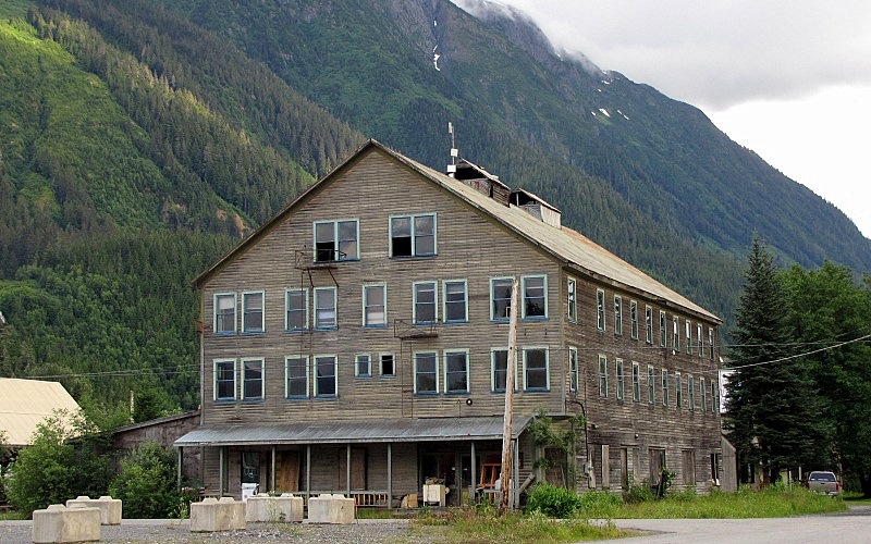 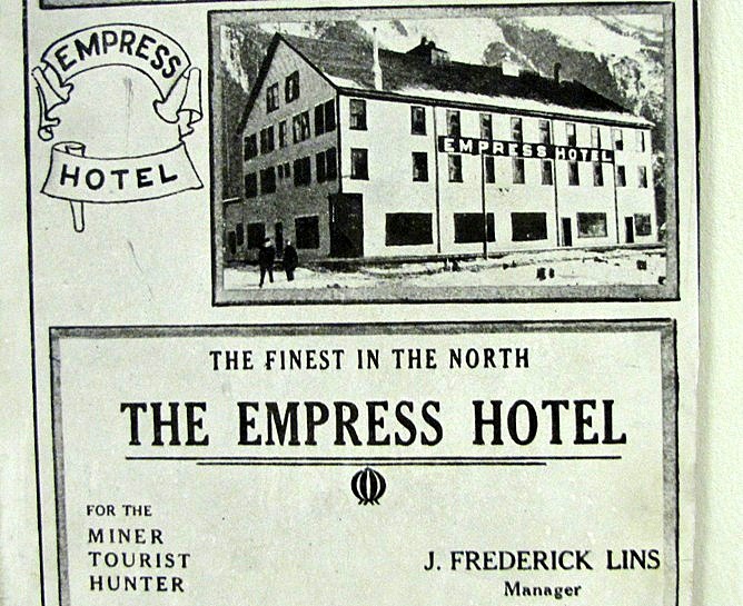 Old ore-carts are now used as decorative planters in Stewart, and some just rust in the shadows: 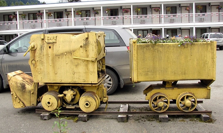   A plaque near the Tourist info-centre, regarding a sad historical event. 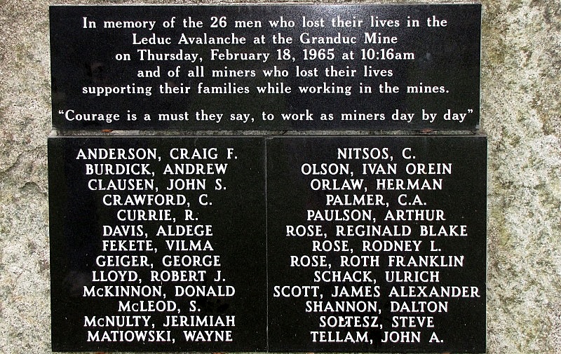 A peek inside the closed "Toaster Museum". It wasn't open to the public this year, because of lack of staff. 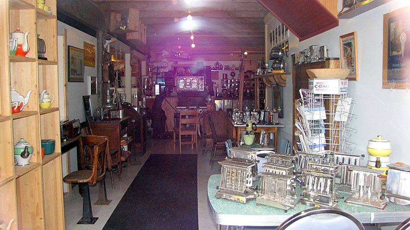 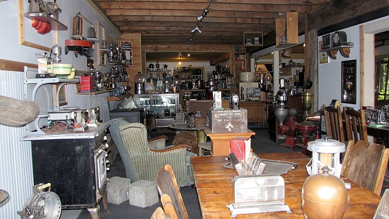 We spent both nights in the King Edward Motel (shown in the background of one of the mining-cart photos above). The King Ed has a hotel on once side of the main street, and a 20-Unit motel directly across the street. It was clean and ok, with a small kitchen. - Next time, we'd stay at a complex of restored houses called "Ripley Creek Lodging". --------------- Did I mention that Stewart is the "Cardiff of the Pacific"? 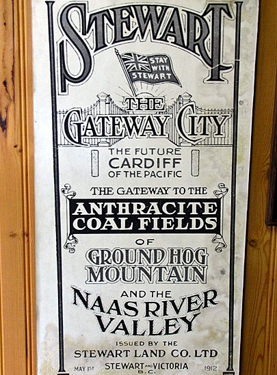 |
|
|
|
Post by Low Light Mike on Aug 6, 2010 19:56:31 GMT -8
Hyder, Alaska is a semi ghost-town, that maybe just comes more alive in the summer for the tourists that pour into the area from the outside world. That outside world is the lower-48 of the USA (with the Alaska-Highway style big motorhome rigs and motorcyle groups) and some crazy Canadians. One of the area's main tourism draws is the Fish Creek bear viewing area, where Grizzlies (oops, Alaska brown bears) are plentiful during mid July to the autumn). - however, when we were there on July 15 & 16, there was no horde of bears because the salmon run was late. Further up the dirt road past Fish Creek is the Salmon Glacier, one of the largest in North America. It's actually in BC, but the dirt road starts in Hyder and has a wilderness uncontrolled border crossing. - We skipped the trip to Salmon Glacier, because we were road-weary and didn't want 2 hours on a bumpy road.......we just wanted to relax for our free day in the area. We visited Hyder on both days that we were in the area. We went to Fish Creek each time, hoping to see bears, but we just walked the boardwalk instead. We also visited some of the tourist-trap stores in Hyder. And we mailed some postcards from the US Post Office. -------------- The valleys of Hyder and Stewart. The mountain that separates them has the Canada/USA border running through it. 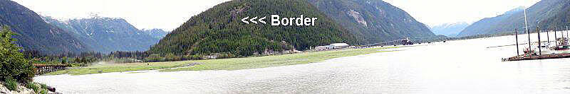 - Hyder on left, Stewart on the right. The border cairn. - I'm standing in Canada, looking into the USA. 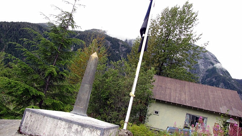 From the wharf in Hyder: - looking down the Portland Canal 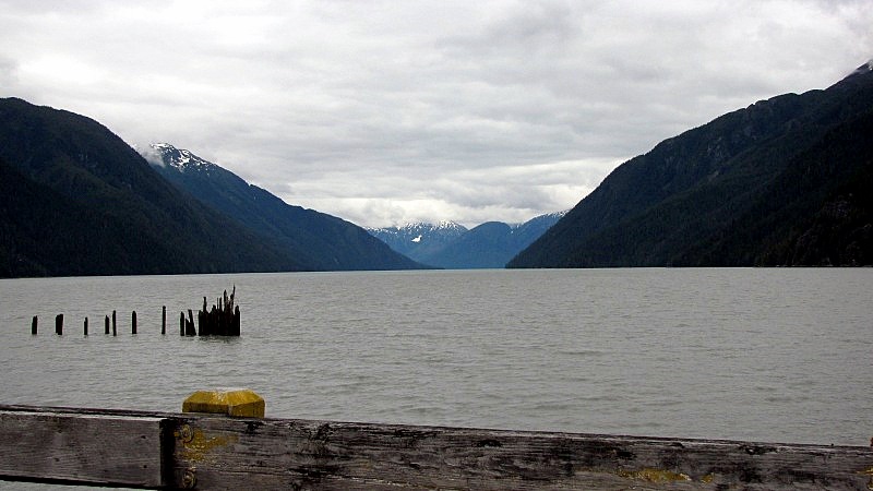 Looking up the valley into Hyder 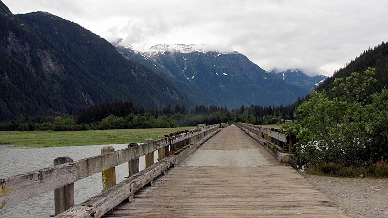 Main street. Looking back at Canada's mountains. 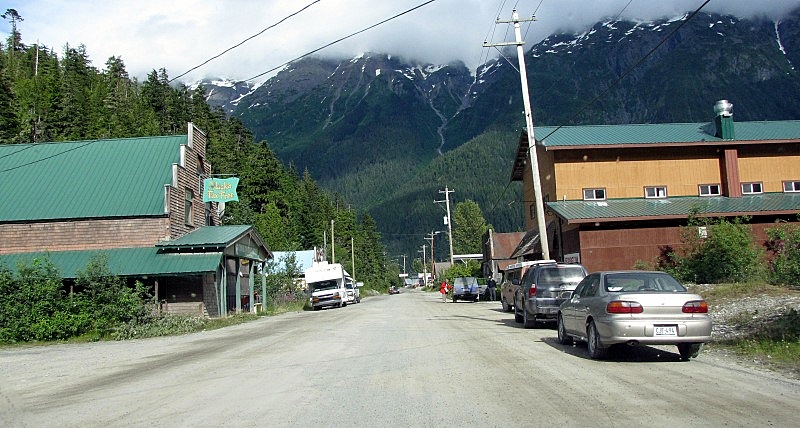 Hyder commerce: 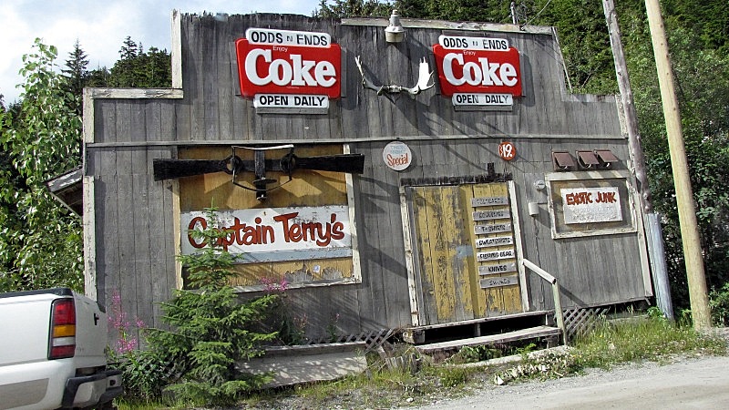 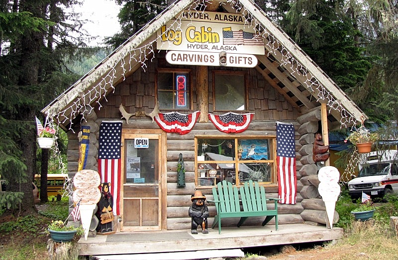 I did not get Hyderized at the Glacier Inn (or anywhere else). 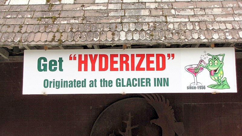 The post office. - the mail arrives/departs daily via Beaver floatplane to/from Ketchikan. 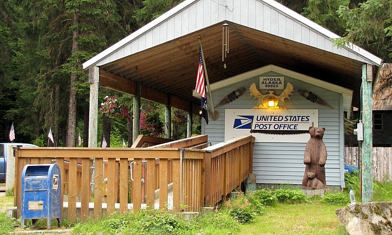 Entering the Tongass National Forest, on our way to Fish Creek bear viewing area. 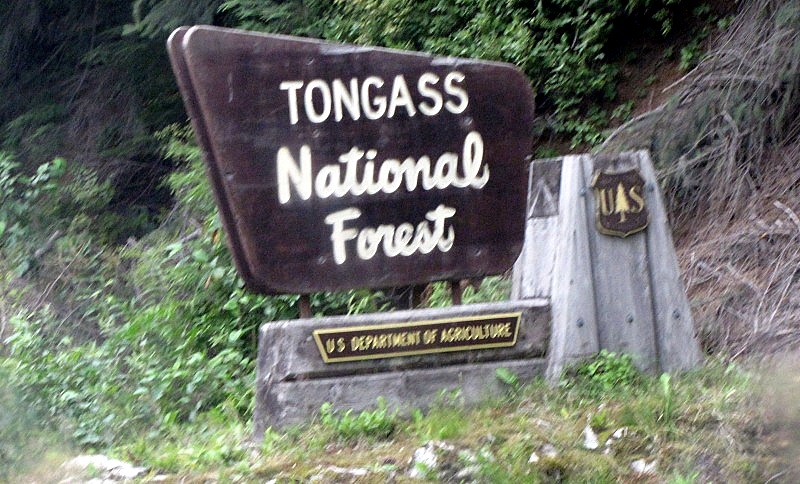 The boardwalks at (no) Fish Creek. 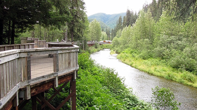 I guess that any town can claim to be "Mile Zero" for some route. - Merville can be "Mile Zero" of the Merville - Black Creek highway, right Paul? 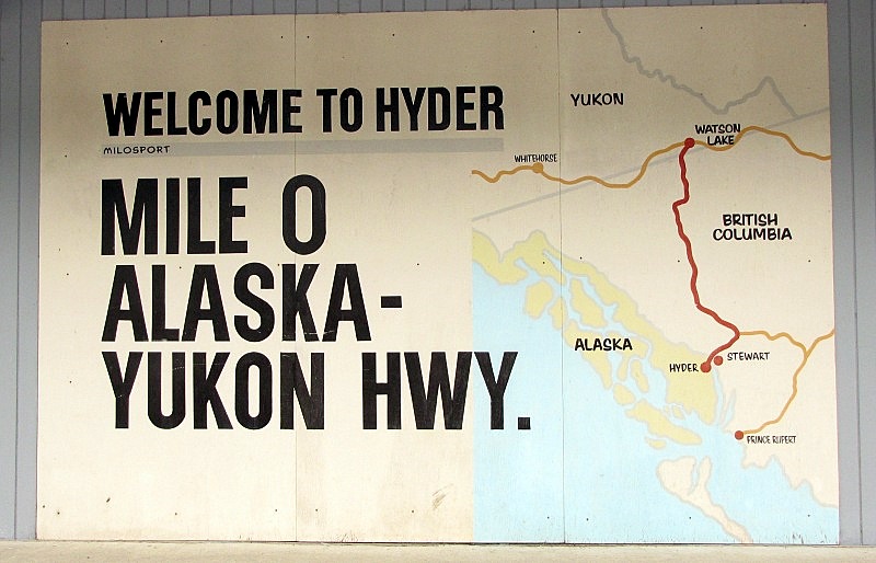 Leaving the USA, with the Canada Customs office ahead. The Canadian mountains on the south side of Stewart are in the background. 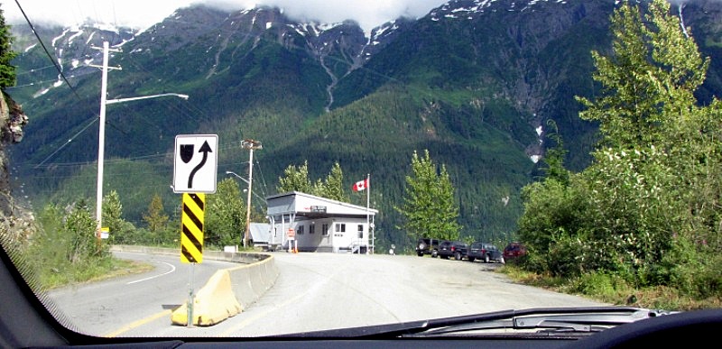 |
|
|
|
Post by dofd on Aug 6, 2010 22:27:20 GMT -8
Great to see these pictures. I spent my twenties flying in to a lot of those towns. But have only been to the airports. It was: UPS , Purolator, the Canadian Blood Bank, picking up live prawns in Ketchikan- AK or on Prince of Wales Island at Klawock,-AK to ship them out to Vancouver for the midnight Cathy flight to Hong Kong. When I flew for the BC Para-attack test season we hit mostly interior towns. We had Air Spray from Alberta out that year.
Sorry went way off post!
|
|
Koastal Karl
Voyager
Been on every BC Ferry now!!!!!
Posts: 7,747
|
Post by Koastal Karl on Aug 7, 2010 10:52:49 GMT -8
What was the border like??? Just a customs building??? I wouldent think it would be too big up there! lol!
|
|
|
|
Post by Low Light Mike on Aug 7, 2010 11:31:12 GMT -8
What was the border like??? Just a customs building??? I wouldent think it would be too big up there! lol! Driving into Alaska was just a road, no stopping, no building, no nothing.......just a sign to say "welcome to Hyder". Driving back into BC is a stop at a Canada Customs trailer (an ATCO trailer). - the agent walks to your car, and talks for a bit. (one of my pictures shows the customs trailer) On one day, he just asked us where we from from and what we were doing. On the 2nd day, he asked us for our passports, and asked us more personal questions about our jobs and relationship. It seemed pretty random. |
|
|
|
Post by Low Light Mike on Aug 7, 2010 11:57:18 GMT -8
On Saturday July 17th, we drove from Stewart BC to Vanderhoof. This was the first of 2 consecutive days of 650km driving to get us home to the south coast. We started the day wearing toques at the Bear glacier near Stewart, and ended it with a hot high-20's evening at the geographic center of the Province at Vanderhoof. In between we saw a profound change in the land that we were driving through. From glaciers and high mountains on Highway 37A, to bushland on the remote Highway 37, to the canyon of the Bulkley River at Hagwilget bridge at Hazelton, to the mountains falling away as we emerged into the Cariboo near Moricetown, to the big sky country around Francois Lake. What an amazingly diverse province! As we drove south on Hwy 37 and neared the junction with the Yellowhead Hwy 16, we felt a sense of loss of wilderness. I really enjoyed the remote highway feeling of Hwy 37. Just north of the Hwys 16/37 junction are 2 Gitxsan villages: - Kitwancool, or Gitanyow, is 15 km north of Kitwanga - Kitwanga, or Gitwangak (“place of rabbits” now known as "place of golfs"), at the Hwy junction. We drove the short distance off the highway into Gitanyow, a place that Emily Carr visited in 1928 to paint the scenes of totem poles. 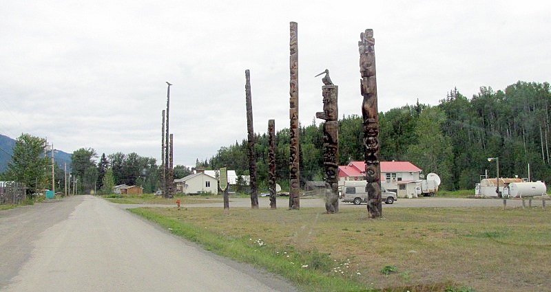 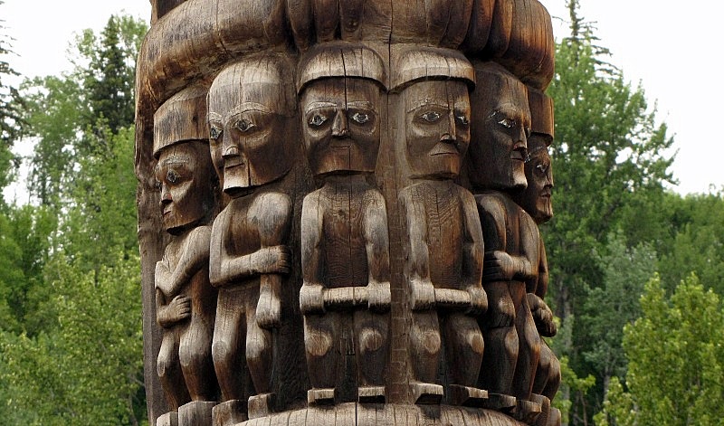 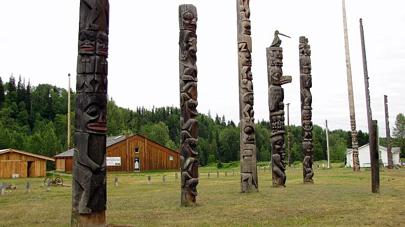 - Regarding the landmark sign below, at first I was taken aback by the seemingly political-incorrectness of the term "primitive art". But in my reading of an academic book on anthropologists and museums, I've learned that this is an academic term used to distinguish certain art from "High art". It still seems pretty subjective, but at least I now know the intended use of the phrase. - I also like the reassurance to the puritans that the totem pole images weren't worshipped by those heathen savages. ahhh, the 1960's were a great time for enlightened understanding. ;D 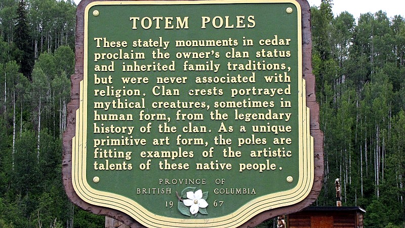 Between the 2 towns, we stopped at a marked National Historic Site, which I had never heard of before. 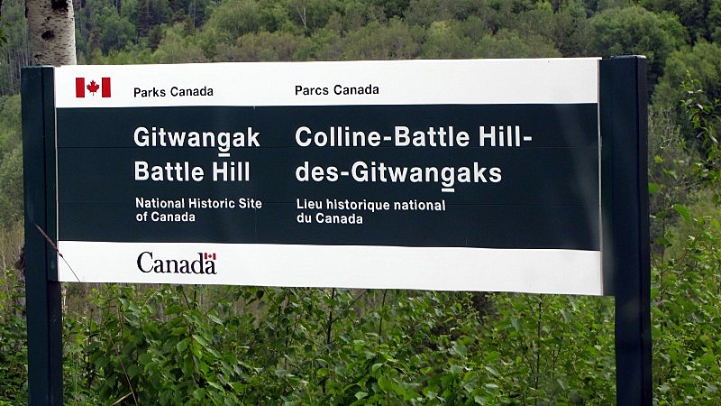 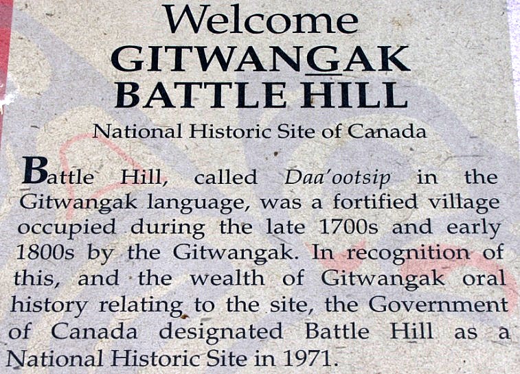 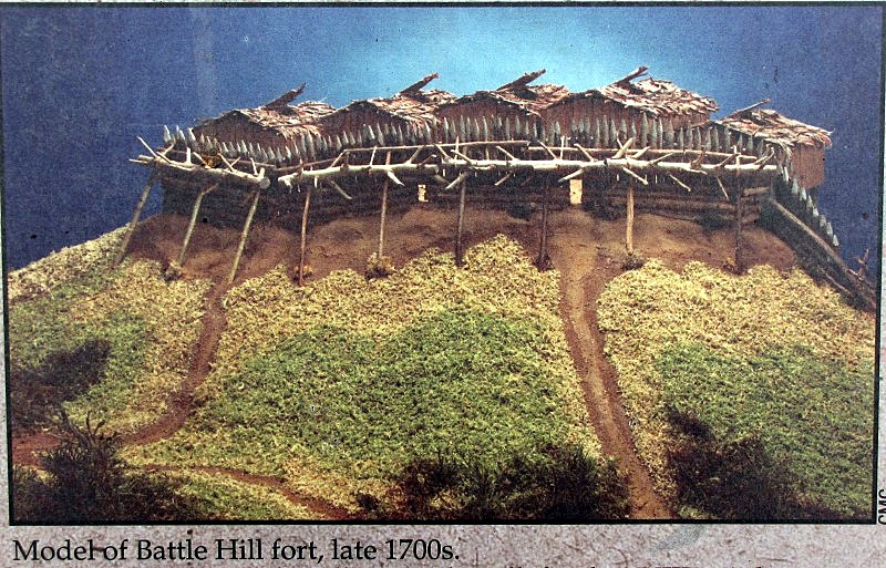 - we didn't walk the trail to the site, we just took these photos from our car. We were a bit "behind schedule" and needed to get moving again. Shortly after reaching Hwy 16, we turned off north to see Hazelton and K'San. - Hazelton is a Gitxsan 1st-Nation community and is home to many artists and a prominent Native Arts school. - The town is near the confluence of the Bulkley and Skeena rivers. - No "Seven Sisters" mountain sighting for us because it was too cloudy. We drove across that wonderful Hagwilget bridge, and then into Hazelton. 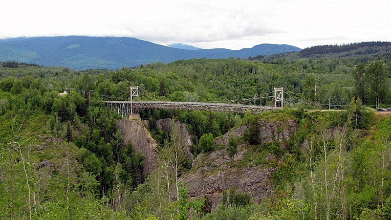 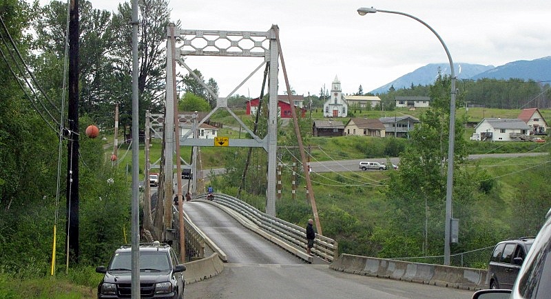 - view back across the bridge; I like the church on the hill Down on the banks of the Skeena at Hazelton is one of the old paddle-wheeler ships, now a pizza restaurant. ;D 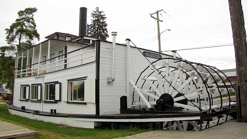 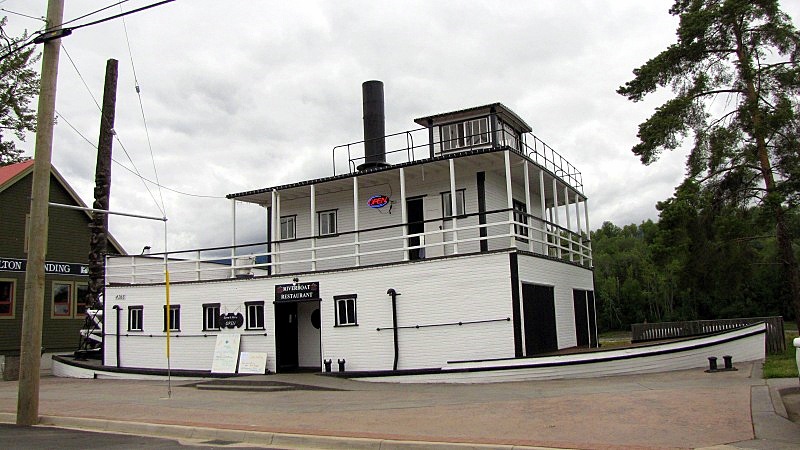 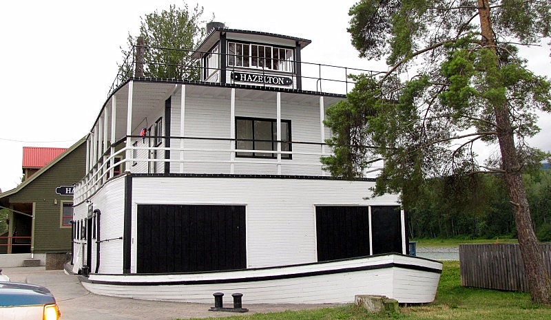 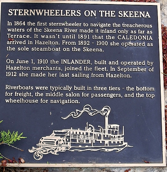 Then we went to the K'San village (a native culture & arts museum), but we just went to the giftshop. - We were starting to feel a bit over-cultured and were in "just get home" mode. At Smithers we found our first Tim Hortons of our trip, and picked up some lunch that we later ate at a nice rest-stop at a gazebo along the Bulkley River in Telkwa: 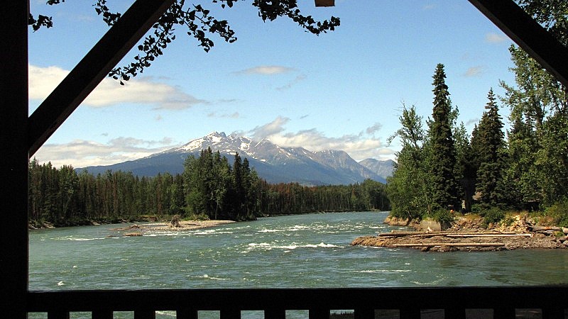 Simpsons fans will be amused to realize how close the town of Burns Lake is to Smithers.... When we got to Burns Lake around 3:00pm, we realized it was a good time to take a diversion on Hwy-35 south to Francois Lake (approx 15 km drive) to ride the free-ferry. - What a beautiful drive it is from Burns Lake to Francois Lake on a sunny summer's day. Big sky country with the rolling hills. 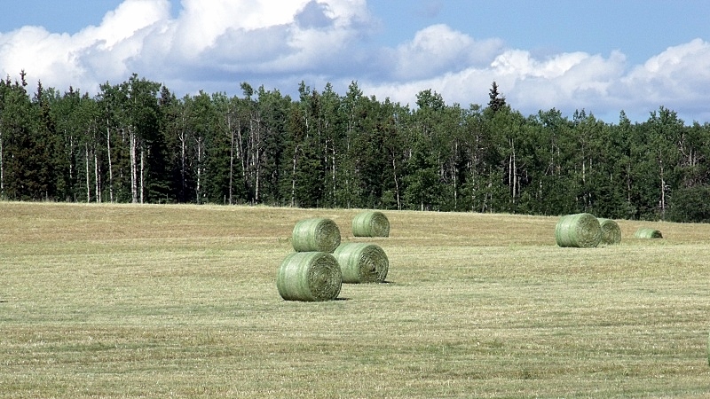 - I've posted my Francois Lake ferry photos in the "Inland ferries photos" thread. Back at Burns Lake (with cell coverage), we phoned Vanderhoof and secured the last available room in the simple-but-comfortable "North Country Inn" motel. - a long day of travel and a good night's sleep. |
|
|
|
Post by lmtengs on Aug 7, 2010 14:56:17 GMT -8
What was the border like??? Just a customs building??? I wouldent think it would be too big up there! lol! Driving into Alaska was just a road, no stopping, no building, no nothing.......just a sign to say "welcome to Hyder". Driving back into BC is a stop at a Canada Customs trailer (an ATCO trailer). - the agent walks to your car, and talks for a bit. (one of my pictures shows the customs trailer) On one day, he just asked us where we from from and what we were doing. On the 2nd day, he asked us for our passports, and asked us more personal questions about our jobs and relationship. It seemed pretty random. Back in the '80s and earlier (not sure about the '90s) Hyder was a pretty big hub for the US/Canada drug trade, as there was absolutely no customs between Hyder and Stewart. People would take the Alaska ferry up from Washington, then boat out to Hyder, then truck the drugs into Canada, and the other way around. I don't have any proof of that, as it was a story told to me by a relative of mine who had friends up there. |
|
|
|
Post by Low Light Mike on Aug 7, 2010 20:20:20 GMT -8
Sunday July 18, 2010 was the 2nd-to-last day of our trip. It involved some strategy, because of some logistical constraints: - We started the day in Vanderhoof, and were returning to the south coast. - We were getting road weary and wanted to go home. - We didn't have to deal with forest fires or landslides, and our desired route (Highway 99 Lillooet to Pemberton, and down to Horseshoe Bay) seemed possible. - If we pushed it and got to Horseshoe Bay by evening, we likely wouldn't get a ferry because it would be Sunday night in summer on Route-2. - If we laid-up and spent a night in say 100 Mile House, we'd have a longer trip the next day when we'd have to carefully manage our time to arrive at Horseshoe Bay terminal within a reservation window. - If we pushed ahead and spent the night in Pemberton, we'd have an easily manageable next-day trip to Horseshoe Bay to meet a reservation, but we'd also be traveling on a Monday which is more expensive than coast-saver Tuesday. So many decisions..... We decided to keep our eyes on our clock and on the highway mileage signs, and make a decision by noon regarding a hotel reservation for the night and a ferry reservation. As it turned out, we made our hotel decision while we were on lunch break at Williams Lake. We decided that driving to Pemberton was do-able, to have us arrive there at say 6:00pm (after my bridge photo-op stop in Lillooet, of course). So we booked a room at the Pemberton Valley Lodge, which turned out to be great value and our finest accommodation of our entire trip. If you're ever in Pemberton and it's not washed-away, stay there, you'll like it. Then at 100 Mile House, we stopped at a tourist info-centre and I checked the Internet for BCF RBI. It showed that the next day's sailings (Monday) from Horseshoe Bay were starting to sell out, and so I phoned and made my reservation for the 12:50pm sailing on Monday, feeling confident that it would be an easy drive the next morning to get from Pemberton to Horseshoe Bay by noon. With those detail secured, it was time to drive and make it happen. But first, how did we get to that point? --------------- We started the day in Vanderhoof, where we were on the road by 7:25am. I like the rolling hills topography of this area of Hwy 16. 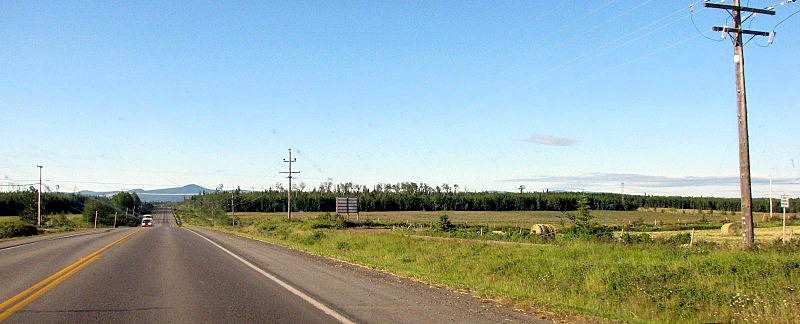 At Prince George, we took a short-cut road to get us to the Simon Fraser Bridge across the Fraser and onto Hwy 97 south. This was Ferry Ave., and I wondered if it was so named because there used to be a ferry across the Fraser nearby in the pre-bridge days. 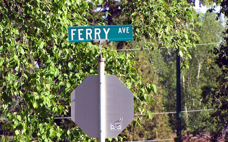 The Fraser River, near Ferry Avenue in Prince George. 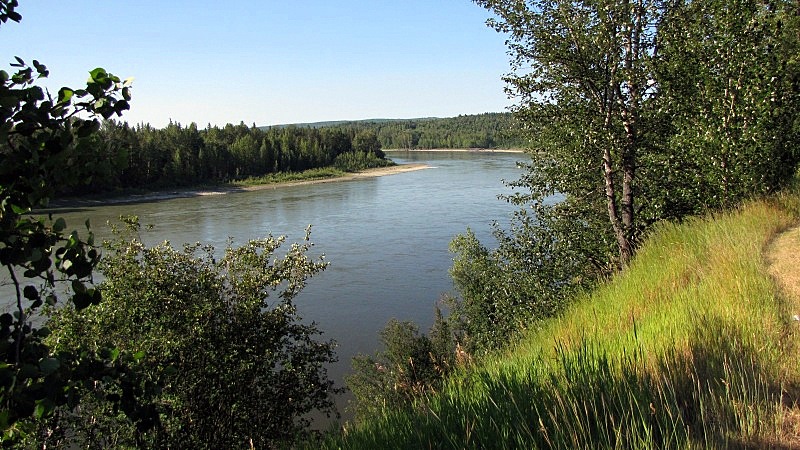 Highway 97 between Prince George and Cache Creek had several improvement projects underway. There was a large project just south of Prince George, and another just south of Clinton. Between Clinton and Cache Creek, we made our turn-off onto Highway 99 and headed for Lillooet. East of Lillooet was a favourite highway landmark of mine, the railway overpass with sharp S-curve on the highway. 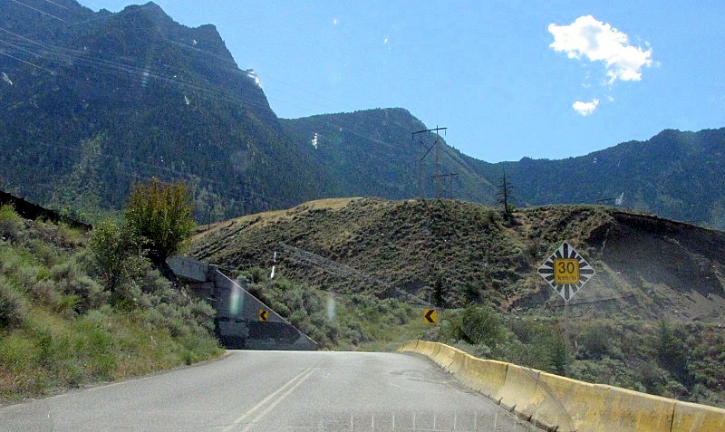 What wonderful beauty that you see as you near Lillooet. 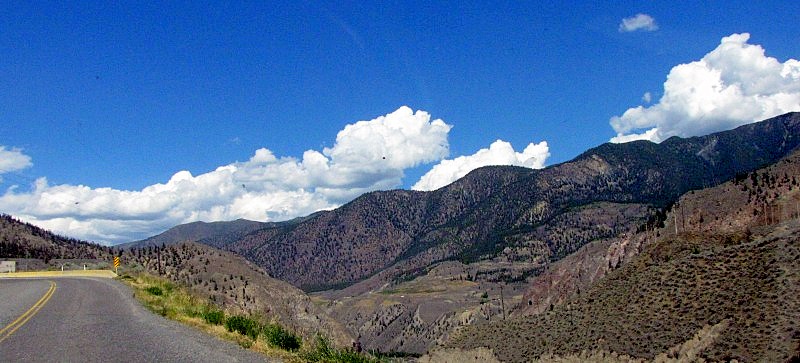 You known that you're in remote BC, when you see this gas station brand: 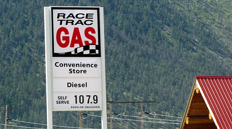 Seton Lake is always worth a stop to admire the beauty of the fake-lake, its colour, the mountains, and the BC Rail track winding around the foot of the mountains. 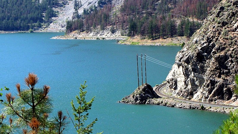 View from the Duffy Lake Rd (Hwy 99), before the big hill down to Mt. Currie reserve.  For the very long and steep downhill on the Duffy Lake Rd, we took caution and used low gear to save our brakes (I had cooked our brakes here on an earlier trip in 1999). We pulled over where we could to let cars behind us pass. This long stretch of road is very steep and lots of people don't give it the respect that it deserves. We happened upon the aftermath of an MVA on this hill, where the police were already there and the ambulance and fire rescue truck were on their way from Pemberton. We saw a car flipped in the ditch, and people standing beside it. At the end of our day on the road, we enjoyed our hotel, and the amenities. 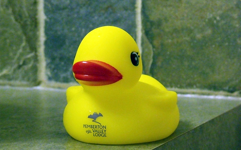 |
|
|
|
Post by Northern Exploration on Aug 8, 2010 6:57:36 GMT -8
What was the border like??? Just a customs building??? I wouldent think it would be too big up there! lol! Driving into Alaska was just a road, no stopping, no building, no nothing.......just a sign to say "welcome to Hyder". Driving back into BC is a stop at a Canada Customs trailer (an ATCO trailer). - the agent walks to your car, and talks for a bit. (one of my pictures shows the customs trailer) On one day, he just asked us where we from from and what we were doing. On the 2nd day, he asked us for our passports, and asked us more personal questions about our jobs and relationship. It seemed pretty random. Random questions can be just chit chat. But a key interviewing technique is to ask random questions, that people may or may not have thought about answers to, beforehand. You both listen to the answer but you watch the person discretely for "tells" of nervousness or lying. It is harder for someone to mask their reactions to unexpected questions and try and think up their answer when they are being deceptive. Useful in poker, law enforcement, but more common in job interviewing  . |
|
|
|
Post by lmtengs on Aug 8, 2010 9:10:17 GMT -8
Highway 97 between Prince George and Cache Creek had several improvement projects underway. There was a large project just south of Prince George, and another just south of Clinton. They stillhaven't finished those?? They were working on that highway last summer when I drove it, and according to my grandfather, the summer before as well... |
|
|
|
Post by Low Light Mike on Aug 8, 2010 16:19:34 GMT -8
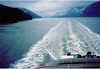
The 16th and final day of our trip was Monday July 19, 2010. We started the day at the lovely Pemberton Valley Inn hotel and ended it at our home in Nanaimo. A nice easy day that started with a drive-around in Pemberton to see the small town, which includes a traffic circle  We built in enough time between our Pemberton departure and our required arrival time at Horseshoe Bay (for that elitist reservation on the ferry), and so I had time to miss the turn-off for various photo locations, and to double-back (that was for Darrell Bay ferry dock in Squamish). At the Tim Hortons drive through in Squamish, I took this picture of the lovely Mt. Garibaldi: 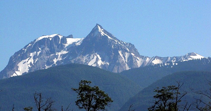 A few moments later, we saw the Squamish Chief. 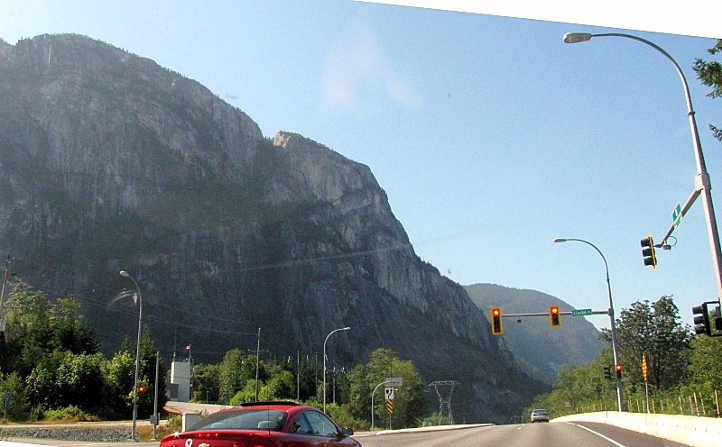 Then later down the road is the famous sight of the Britannia Beach mine. 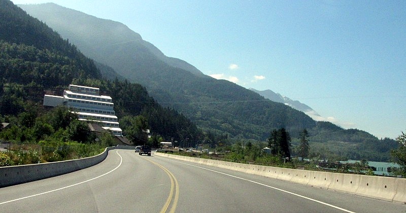 For me, these sights are common from media images, but it was only the 4th time that I'd ever driven the Sea-to-Sky highway. Back on Hwy 16 west of Terrace, we encountered a stretch of road where highway and railway shared a narrow gap between cliff and water. - Here's the Porteau Cove version of this. 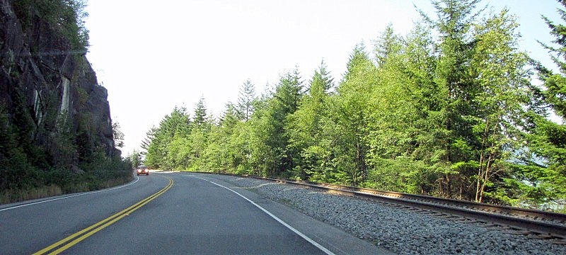 Speaking of Porteau Cove, it and Howe Sound is really quite lovely: 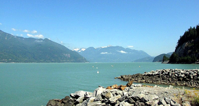 One of the travel info kiosks, this one near Lions Bay. - designed to look like a 1st Nations cedar-bark hat and to allow the Olympic highway to pass over this part of land. 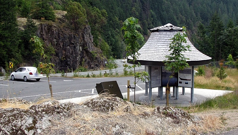 Soon it was time for the turn-around on the Upper Levels Highways and then we followed the signs to the ferry toll booth. 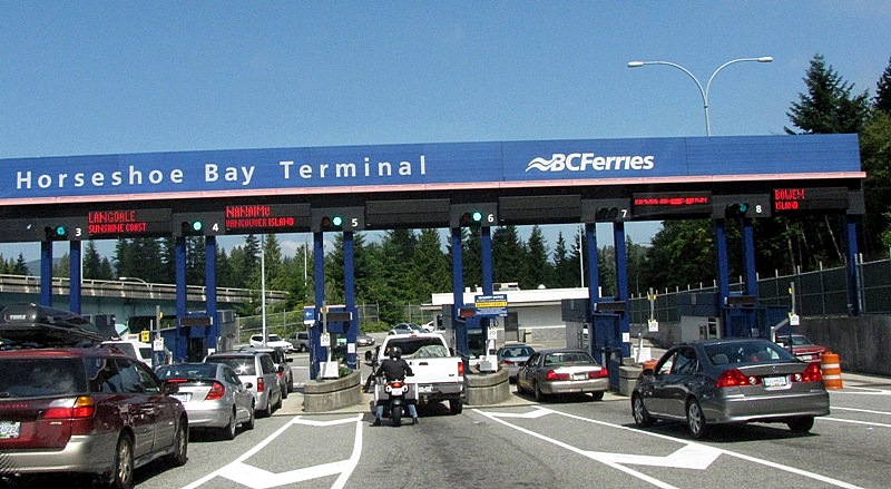 Once inside the ferry terminal compound, we ate our Timmy's sandwiches which we had packed into the cooler in Squamish, and waited for the MV Coastal Renaissance to arrive. - we were quite far back in a holding-lane at Horseshoe Bay. The sight of the arriving ferry was through the lovely prison-styled fence. 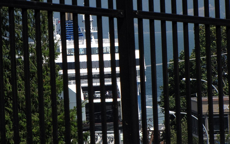 Once on board we went up to the passenger decks to enjoy the various amenities such as the Coastal Cafe with its variety of hot and cold entrees and the Sitka Coffee Place. We learned how to properly fasten a life-jacket, and then I settled into my outside seat on a life-jacket locker on the port-side of the covered promenade deck. From here, I enjoyed the view of Horseshoe Bay. 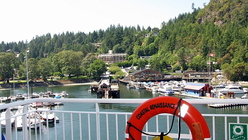 We saw more of the beauty of the Olympic legacy: 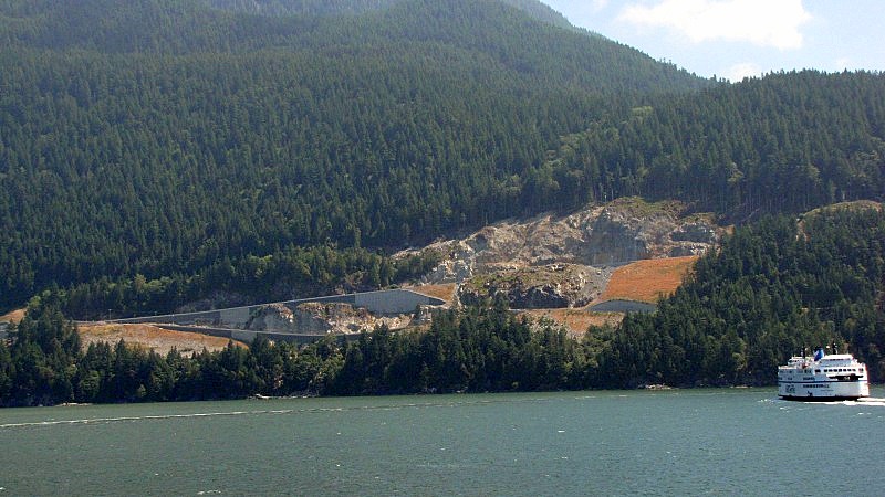 Here's a city that was no part of our vacation plans and that we only saw from a smoggy distance in this particular instance. 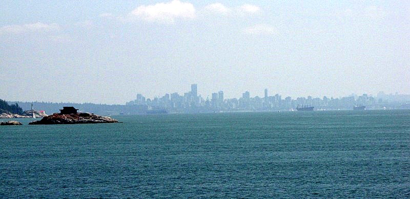 - the only thing that currently intrigues me about that place is perhaps a visit to the UBC Museum of Anthropology sometime this fall, to nurture my interest in 1st Nations art & culture. Finally, home was in sight.... 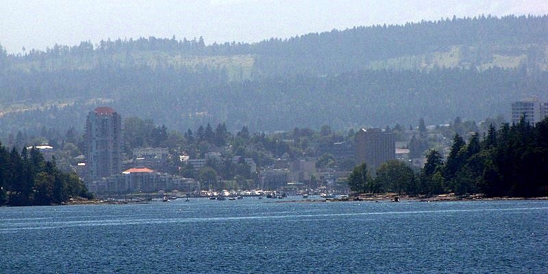 |
|
|
|
Post by Low Light Mike on Aug 8, 2010 17:42:00 GMT -8
Thanks to all who have read this trip-blog and hopefully enjoyed it. I do this kind of work to help me to remember my trip details and to organize my "thoughts and conclusions" on various things that I encountered on my trip. Here is a collage of road-signs, to end this report: 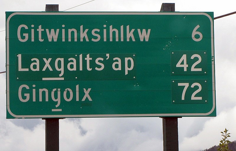 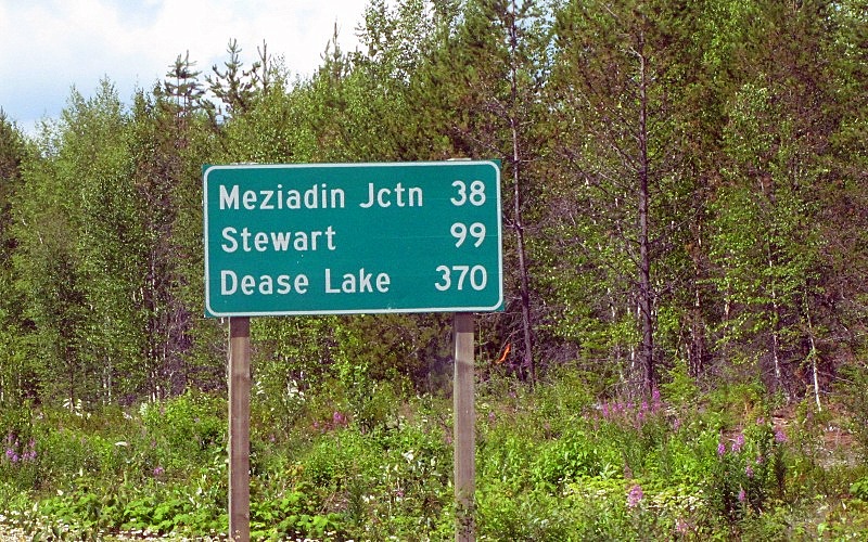 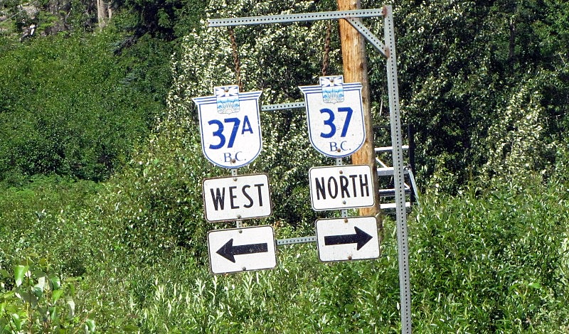 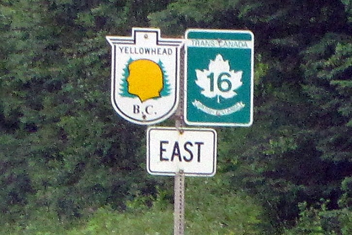 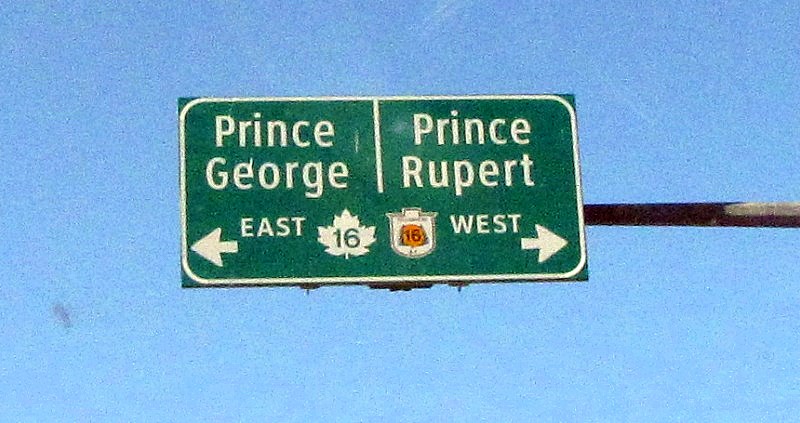 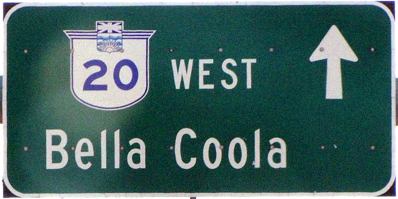  --------------- - This sign is a bit odd. Where on all of Haida Gwaii would there be a sign where the village of Queen Charlotte City and Masset are in the same direction? Those 2 towns are at opposite ends of the main road ! 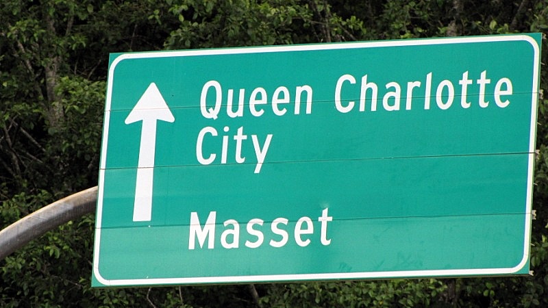 Here's the context: - it's at the ferry terminal in Skidegate Landing, and it's purpose is to direct ALL arrival traffic into the lane-in-the-woods, so that traffic doesn't back up because people are trying to turn in various directions. - It confused me, when I arrived  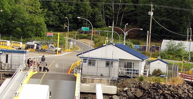 |
|
Nick
Voyager
Chief Engineer - Queen of Richmond
Posts: 2,078
|
Post by Nick on Aug 8, 2010 17:56:15 GMT -8
Thank you very much for putting the effort into sharing your trip with us, Mike. I know it takes a fair amount of time to do these posts, and I for one really do enjoy seeing them.
Thanks.
|
|
|
|
Post by lmtengs on Aug 8, 2010 18:25:35 GMT -8
T - This sign is a bit odd. Where on all of Haida Gwaii would there be a sign where the village of Queen Charlotte City and Masset are in the same direction? Those 2 towns are at opposite ends of the main road !  Before I scrolled down to that last part, I instantly remembered that sign as the one that made my mom actually stop the car and wonder what the heck was going on. For people who haven't driven there before, here's a little self-made road map. Attachments:
|
|


 .
.


