|
|
Post by Low Light Mike on Jun 6, 2013 7:53:02 GMT -8
Re the other issue: - it's all in the planning and discipline.  And 'Depends' .... the videographers' secret haha, hopefully it never comes to that. Seriously though, I do quite enjoy the quiet contemplation of "simply being where I am." Just being quiet and enjoying the moment and having a good time for thinking and peaceful contemplation of life. So those extended video shoot times are enjoyable for me and are yet another example of why I seem to prefer solo trips over group trips (although I can enjoy both). And I think that the results are worth the effort. I've really enjoyed doing long-form video that I can speed-up into some fun YouTube moments. |
|
|
|
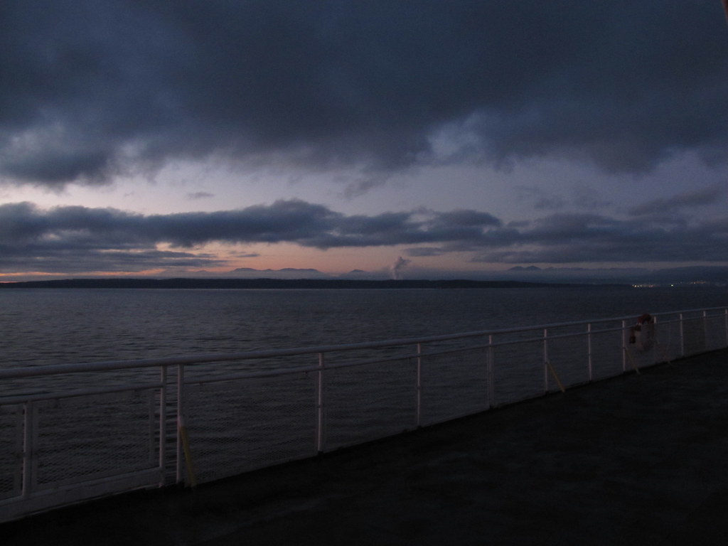
Post by Low Light Mike on Jun 11, 2013 15:00:39 GMT -8
What does route-17 look like?
Here's a sped-up video of a return trip on the Comox - Powell River ferry route.
- 100x and then 20x.
This captures 92.7% of the total round trip.
- from June 8 & 9, 2013.
....and it looks like there was a shaky Quartermaster at work for both sailings. Or maybe the wobbly course direction is because of problems with the ship, which are mentioned in the BCFS report to the Commissioner re the need for a new ship?
|
|
translinkfan
Oiler (New Member)
 'Bout them Alcoa's!
Posts: 48 
|
Post by translinkfan on Jul 11, 2013 14:29:35 GMT -8
|
|
|
|
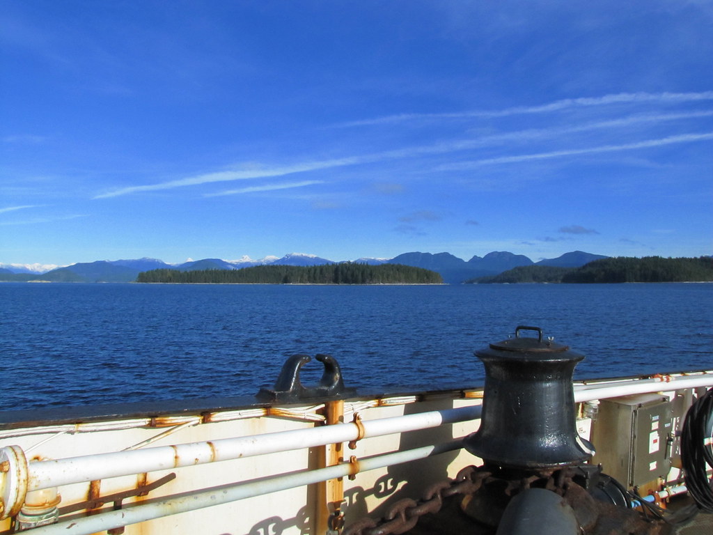
Post by Low Light Mike on Aug 10, 2013 19:45:07 GMT -8
Scenery from Route-24, on the Quadra-Cortes route.
- from July 24, 2013.
The coast mountains behind the Desolation Sound islands are lovely. Sutil Channel is a great place to gaze at nature in the summer.
|
|
|
|
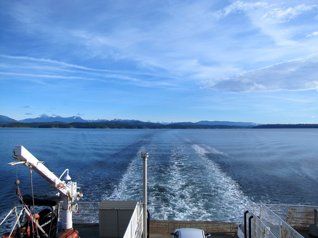
Post by Low Light Mike on Aug 16, 2013 11:48:21 GMT -8
Discovery Passage with Campbell River in the background. - seen from the Powell River Queen ferry. July 26, 2013 The current was ripping pretty good in the middle of the channel.  |
|
|
|
Post by Low Light Mike on Sept 24, 2013 13:19:07 GMT -8
Coastal Inspiration's version of "Canadian Sunset" experienced by me on September 13, 2013.
- 5:45pm sailing from Tsawwassen to Duke Point.
....look for a quick Voyager cameo at 2:53 of the video.
|
|
|
|
Post by Low Light Mike on Oct 22, 2013 21:58:18 GMT -8
The ferry trip from Swartz Bay to Fulford Harbour, on the Skeena Queen.
- a foggy October 21, 2013.
|
|
|
|
Post by Low Light Mike on Oct 23, 2013 21:35:33 GMT -8
A video of mine from October 19, 2013 on a Mayne Queen trip from Swartz Bay to Saturna Island.
- a ferry foggy morning.
|
|
|
|
Post by Low Light Mike on Oct 28, 2013 6:02:26 GMT -8
My video of a trip on Queen of Cumberland from Saturna Island to Swartz Bay.
- stopping at Village Bay and Otter Bay, along the way.
|
|
|
|
Post by Low Light Mike on Jan 12, 2014 19:31:35 GMT -8
Route-17B scenery seen by me for the first time. - 8:35am sailing on the Island Sky from Saltery Bay to Departure Bay - January 12, 2014 ------------- I'm going to need some help with the landmark names... Exiting Jervis Inland, about to enter Malaspina Strait. - Texada Island straight ahead, barely visible in the fog - Hardy Island on the left side - The point near Stillwater on my right side  - Not much of a photo, but I stood in a very cold & strong wind, with rain. The southern tip of Texada Island, with Lasqueti Island behind it.  ========================== In Georgia Strait: Lasqueti Island on far-left, and Texada is to the right of it.   - Texada Island is just to the left of the wake.  I was very happy to see Malaspina Strait from the water; a view I'd never seen before. |
|
Deleted
Deleted Member
Posts: 0
|
Post by Deleted on Jan 17, 2014 17:40:38 GMT -8
|
|
Deleted
Deleted Member
Posts: 0
|
Post by Deleted on Jan 17, 2014 23:12:46 GMT -8
|
|
|
|
Post by Mike on Jan 21, 2014 11:26:20 GMT -8
|
|
|
|
Post by Low Light Mike on Feb 18, 2014 19:54:03 GMT -8
Island Sky cruising into Blubber Bay. - morning of February 18, 2014  - Photo by Mrs. Horn |
|
|
|
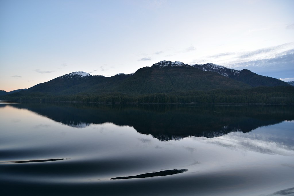
Post by Low Light Mike on Mar 10, 2014 15:41:42 GMT -8
Scenes from Island Sky on her 5:40am sailing from Little River to Saltery Bay. March 9, 2014 Crossing Georgia Strait and looking at Powell River. - mill Townsite on left, Westview on right. In the dark, you can see how they used to be considered separate towns. 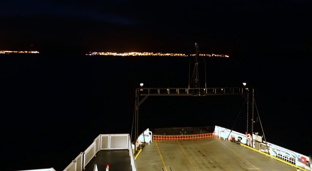 Making the turn into Malaspina Strait  Heading further south down Malaspina Strait, and diagonally moving towards the east side  Heading east towards the entrance to Jervis Inlet  Heading up Jervis Inlet towards Saltery Bay, and sunrise colours are appearing. 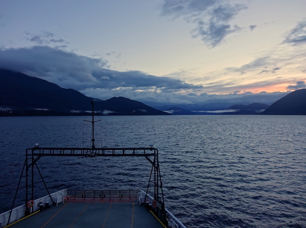 A closer shot of Jervis Inlet sunrise  |
|
|
|
Post by Low Light Mike on Mar 12, 2014 13:46:36 GMT -8
Looking out to Harbour Point from the ferry at Saltery Bay, BC. - sunrise time on March 9, 2014 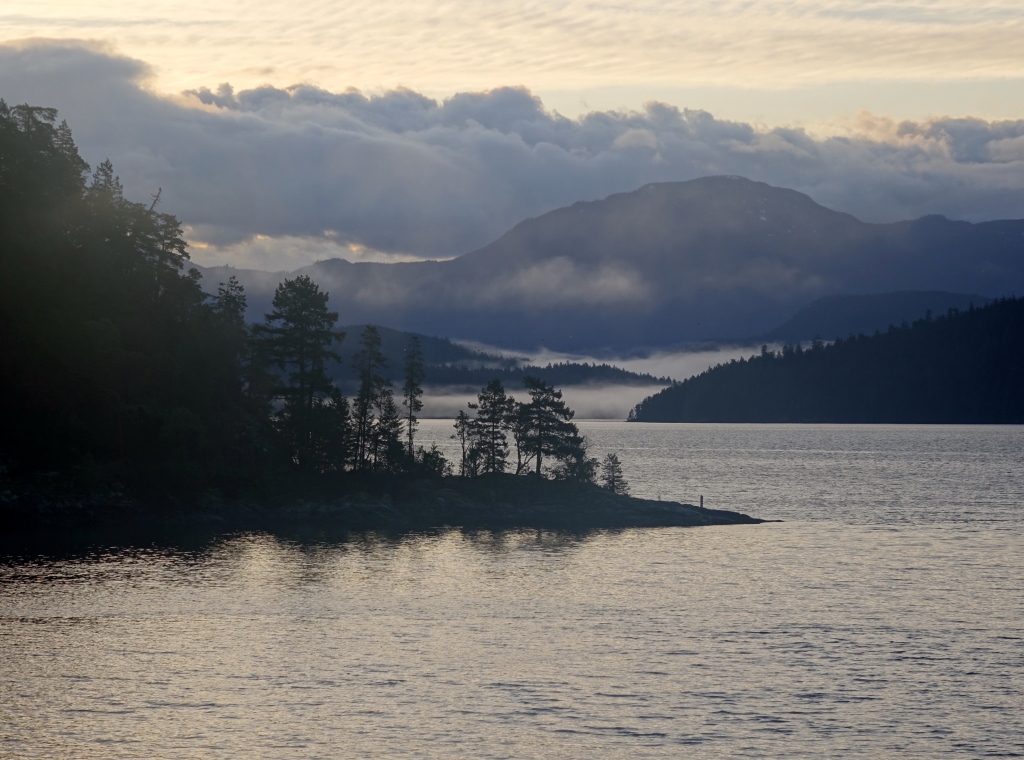  -------------- The Saltery Bay terminal area used to be a rare visit for me. But thanks to Route 17's alternate service, I was able to get there twice in two months, in early 2014. |
|
|
|
Post by Low Light Mike on Mar 12, 2014 16:13:15 GMT -8
Here are 3 photos of the Island Sky's bow-gantry, which houses various navigation and docking lights. - but the beauty is in the backgrounds. These are from morning of March 9, 2013 on the Island Sky's trip from Saltery Bay to Comox. First up, in Jervis Inlet, headed for Malaspina Strait. - Hardy Island on the port side, and the Stillwater peninsula is straight ahead. We'll pass between them to exit Jervis Inlet. Texada Island is in the left background. 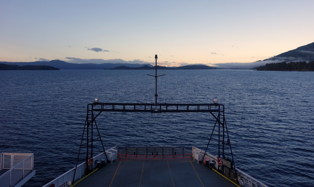 Heading up Malaspina Strait  Lastly, as we are off of Powell River's Grief Point (unseen, on our starboard), there is Texada on our port side, and Harwood Island straight ahead.  |
|
|
|
Post by Low Light Mike on Mar 15, 2014 17:49:33 GMT -8
My next instalment in the " Chronicles of Route 17A: The Blubber Bay Call-In" Entering the bay, where there is no alternate escape   This would have been more interesting if Nimpkish or Tachek were in the tie-up slip  You can see that we're at the top end of the Island. - I wonder if the small old wharf is still used, and for what?  Taking on traffic bound for Comox  from morning of March 9, 2014 |
|
|
|
Post by Low Light Mike on May 24, 2014 21:15:43 GMT -8
Here is a bow view of the ferry ride from Gabriola Island to Nanaimo harbour terminal.
- seen by me on May 24, 2014, afternoon sailing. The clouds were ominous.
On a 20-minute crossing, this type of video is easy to shoot. The end of a fun day on Gabriola Island.
|
|
|
|
Post by Low Light Mike on Jun 7, 2014 18:14:37 GMT -8
I took June 6th's 8:15pm ferry trip on Coastal Inspiration mainly so that I could enjoy the sunset. I did. Deck-7 was my kingdom for 2 hours.  I love the texture in the wake  |
|
|
|
Post by Low Light Mike on Jun 8, 2014 9:26:00 GMT -8
I enjoyed many scenes from a ferry, on the evening of June 6, 2014. I was on the Coastal Inspiration for a round-trip (8:15pm & 10:45pm) and here is what I saw:
It was a lovely evening to be out on the water. The first leg was the sunset and dusk time, spent by me entirely outside on port side of Deck-7.
The return leg was in darkness, so it was a combination of things:
- some late night food in the Coastal Cafe
- some time-exposures shot with the starry-sky over the bridge
- some attempts at photographing the passing freight traffic (unsuccessful at a clear shot) - we passed by a couple of the pusher-tug & barge combos. Seaspan's late night service to its Duke Point terminal and perhaps a fuel barge. Tough to tell, in the dark.
- filming the arrival at Duke Point.
ps: on the 10:45 pm sailing, the upper car deck was partly filled (maybe 25% full) but the main vehicle deck was full with trucks. That's the route-30 demographic.
|
|
|
|
Post by Low Light Mike on Jun 8, 2014 12:25:53 GMT -8
Night scenes from Route-30, on the Coastal Inspiration. - June 6, 2014 View of the lower mainland  --------- An HDR time-exposure shot from the stern of the upper vehicle deck.  |
|
|
|
Post by paulvanb on Jun 8, 2014 22:16:50 GMT -8
Some photos from yesterday's trip to see the Evergreen State - some scenes from a ferry,
Orcas Island ferry landing.
Not knowing my way around too much, I believe this is Wasp Passage.
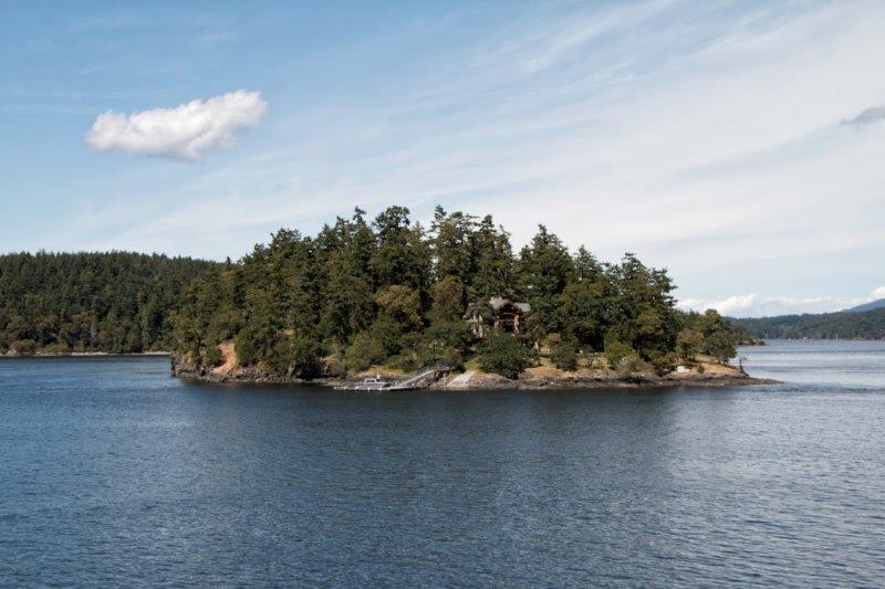
A big house on it's own island!
|
|
|
|
Post by Kahloke on Jun 9, 2014 6:50:31 GMT -8
Not knowing my way around too much, I believe this is Wasp Passage. Nice photos! We were in Wasp Passage on the ferry. The scene in this photo is Pole Pass between Orcas and Crane Islands. Here are a couple of my San Juan scenic photos: Speiden Island 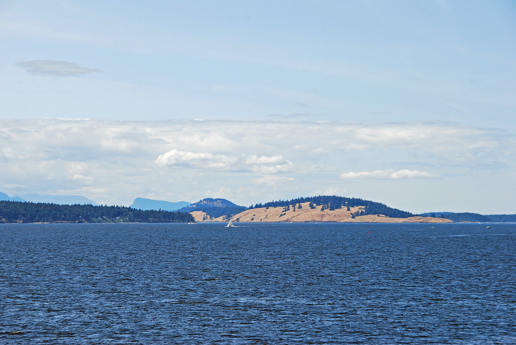 Deer Harbor and Mount Turtleback as seen from the ferry just as we were entering Wasp Passage 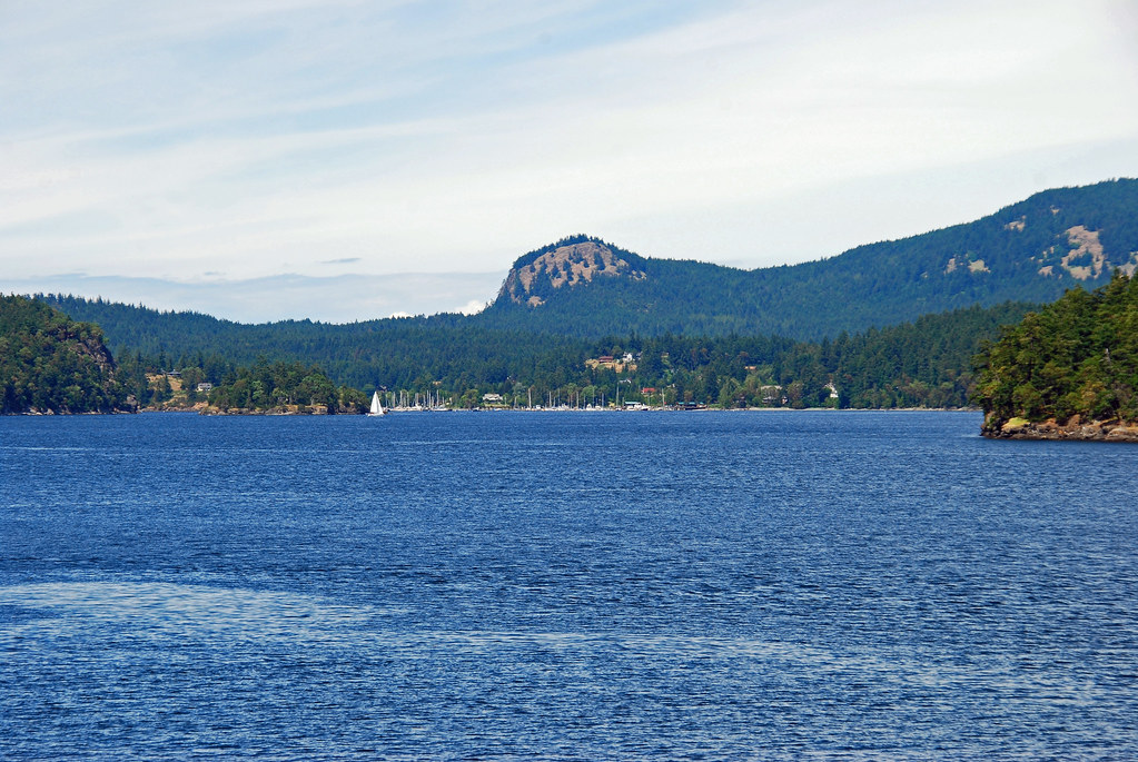 |
|
|
|
Post by paulvanb on Jun 9, 2014 7:13:48 GMT -8
Nice photos as well! I enjoyed my time there so much I would like to spend a few days there - probably on Orcas Island.
|
|