|
|
Post by Low Light Mike on Jul 15, 2011 10:03:10 GMT -8
Sunset on night-1 of my recent Route-40 trip. - this is Saturday night at 10:05pm, just out from Port Hardy. Our ship left Hardy Bay, and then headed for the passage up Goletas Channel and then out to QC Strait from between Balaklava and Hirst Islands, passing close to Scarlet Point lighthouse, as we entered Queen Charlotte Strait. But these first 2 pictures are from shortly after we left Hardy Bay, before we got into the small island group. - Sunset is high in the horizon in early July.  - light at the tip of the Gordon Islands group is seen at right-side of photo.  |
|
|
|
Post by Low Light Mike on Jul 15, 2011 19:16:53 GMT -8
Immature bald eagle at the waterfront in Klemtu, BC. - July 10, 2011. He/she is on a utility pole above the boat ramp, which is just next to the downtown ferry landing.     |
|
|
|
Post by Low Light Mike on Jul 16, 2011 20:48:50 GMT -8
The ravens of Klemtu. - July 10, 2011. Solitary raven on top of a utility pole  Animals peacefully co-existing in Klemtu. - notice the fine-looking tourism office in the background.  - a couple of ravens flying around. These was some fish-guts nearby that a bunch of ravens were gathering at. The bottom-left raven has a mouth-full.  VIDEO VIDEO of ravens talking and flying about. www.facebook.com/v/10150251695783647-------------- And the Monday crowd on the direct Bella Coola - Port Hardy trip enjoys watching some Pacific white-sided dolphins. - meanwhile, the dolphins were quite excited to see so many German tourists in one place.  |
|
|
|
Post by Low Light Mike on Jul 17, 2011 21:53:54 GMT -8
Route-40 sunset, at 10:20pm, near Hirst Island, north of Port Hardy.   And at 10:40pm  |
|
|
|
Post by lmtengs on Jul 18, 2011 7:01:44 GMT -8
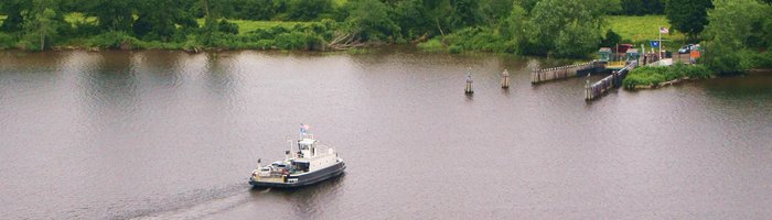
I think you caught the Queen of Kelsey Bay in this shot! Looks like she's sailing away from you. Good photo  |
|
|
|
Post by Low Light Mike on Jul 18, 2011 8:19:34 GMT -8
I think you caught the Queen of Kelsey Bay in this shot! Looks like she's sailing away from you. Good photo I was hoping it was the rarely seen QKB. I had fun with the late-night photos, but tough to do on a moving ship. I usually used a trash-can as a pod support for my camera (less vibrations than from the ship's rail). |
|
|
|
Post by Low Light Mike on Jul 19, 2011 8:46:38 GMT -8
Sunset near Scarlett Point lighthouse, north of Port Hardy - 10:55pm  Sunrise in Fitz Hugh Sound, near Hakai Pass area, but of course looking east, not west. - 4:55am  |
|
|
|
Post by Low Light Mike on Jul 24, 2011 17:37:24 GMT -8
Sunrise in Fitz-Hugh Sound at 5:30am on Sunday July 10, 2011. - from Route-40's Queen of Chilliwack. -------    A few minutes later, at 5:40am  ---------------- Not much of a sunset on the Sunday night in Milbanke Sound and Seaforth Channel. - here's Milbanke Sound scene at 8:00pm on Sunday night. I like the clouds for effect  |
|
|
|
Post by Low Light Mike on Jul 25, 2011 17:58:12 GMT -8
Sunday July 10, 2011, between 7 & 8:00am, northbound on the Queen of Chilliwack in Lama Pass. At the southern entrance to the pass, looking back south at Fitzhugh Sound:  The lovely islet at the entrance to the pass  Nice morning light effects in Lama Pass   A look at Bella Bella, with a line of cloud above the town.  |
|
|
|
Post by Low Light Mike on Aug 1, 2011 17:20:01 GMT -8
When the route-40 ferry sails to/from Shearwater, the rider sees scenery that the inside-passage people miss. Here is some of that, and some of the scenery nearer to Bella Bella: - July 10, 2011 -------------------- Across the channel from Bella Bella's Campbell Island is Shearwater's Denny Island. On Denny Island's west shore is the coast-guard station and an old cannery:    A look back to the village of Bella Bella (and the topography of Campbell Island) as we head off-the-beaten-track towards Shearwater.  As we continue along the north shore of Denny Island, on our way to the Shearwater berth, we pass a fish processing plant. - the sign says something like "Pacific Canadian Fish Products"  The Shearwater Marine Center is a busy place in summer. - there's a boat pull-out lift on the left-side of the photo.  Beautiful islet scenery near Shearwater  ================ And now for something completely different: - sunset near God's Pocket Marine Provincial Park, just north of Port Hardy. - this is near the end of my wonderful July 9-11 route-40 journey. 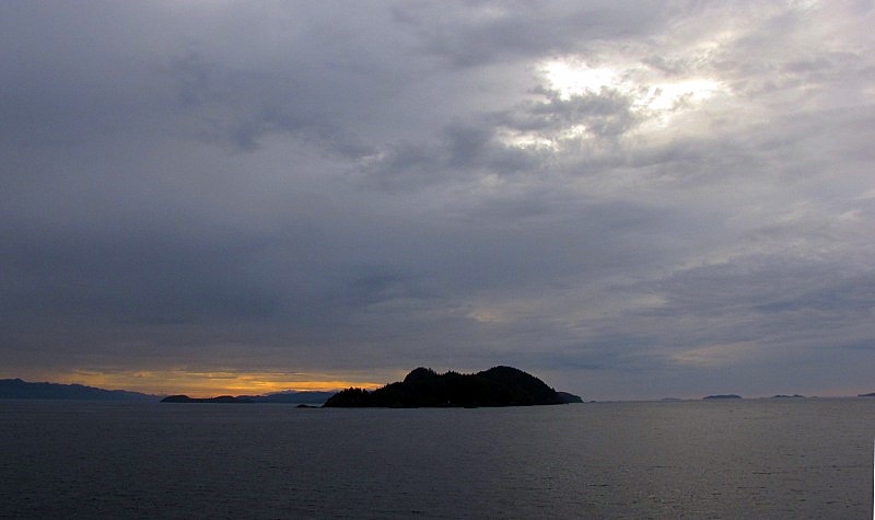 |
|
|
|
Post by Low Light Mike on Aug 5, 2011 21:18:31 GMT -8
Scenes from the Route-40 Queen of Chilliwack near Klemtu on Sunday July 10, 2011 Approaching Cone Island. - the narrow channel to Klemtu is just to the left of the aptly named Cone Island.  Approaching Klemtu from the south in that narrow channel.  And VIDEO of the scenery south of Klemtu and Cone Island, from the 'Chilliwack, on our way back south towards Milbanke Sound: www.facebook.com/v/10150268114563647 |
|
|
|
Post by Low Light Mike on Aug 6, 2011 9:30:05 GMT -8
One of the loveliest places on the Monday route for Discovery Coast is the intersection of Burke Channel and Dean Channel. - this is just an hour west of Bella Coola, and so you see it in the morning light on the Monday (also on the Friday, also on the Wednesday morning....) The standard-script that the bridge officer reads to the passengers is that its a high-wind area. - my standard script is to think that the mountain on the south side is a giant bear, with a paw sticking forward. Here's what it looked like on July 11, 2011. VIDEO of the area www.facebook.com/v/10150268447798647Looking north to the Dean Channel entrance - you take this to get to Ocean Falls and the north side of King Island.  Looking west, down Burke Channel - that's where we are heading, on our way towards Namu  Looking south, at the crouching bear. - front paw is extended into the channel, on the right. - his resting head is behind the extended paw. 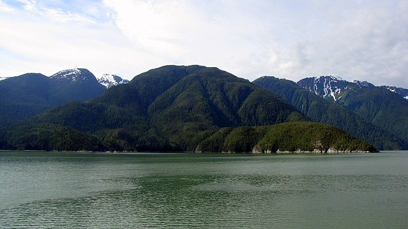 |
|
|
|
Post by Low Light Mike on Aug 9, 2011 18:58:14 GMT -8
More beautiful Route-40 scenery from Burke Channel, 1-2 hours west of Bella Coola. - from my trip on July 11, 2011. I like this glacier, one of the nicest on the trip.   Nice mountain on King Island  This is called "Gibraltar" rock, or at least that's what is in the route-40 script.  And here's a short VIDEO from that area www.facebook.com/v/10150271321553647 |
|
|
|
Post by Low Light Mike on Aug 11, 2011 13:53:01 GMT -8
More views from the ferry at Bella Coola terminal. - morning on July 11, 2011. The estuary of the Bella Coola river  Some gorgeous mountains, in every direction that you look.   Looking across North Bentinct Arm, towards the Tallheo cannery 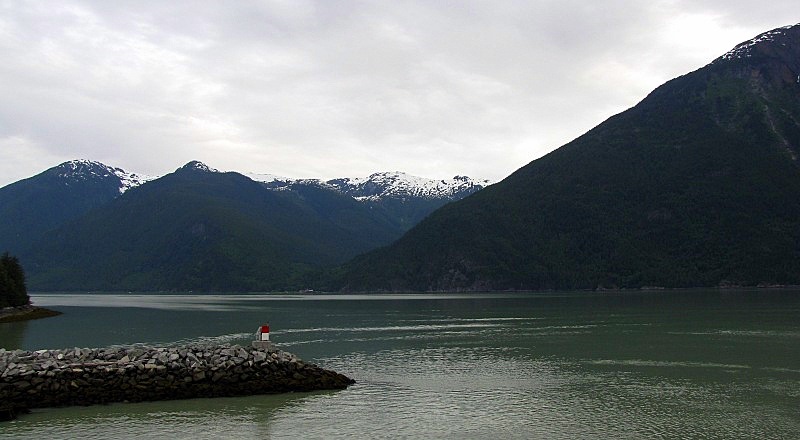 Looking west in the direction of the open-Pacific, which is still over 6 hours away from here.  |
|
|
|
Post by Low Light Mike on Aug 11, 2011 18:06:17 GMT -8
Some north Vancouver Island scenes from a ferry, from July 11-12, 2011 From the route-40 ferry (can see same thing from the NorEx) - some nice islands, near Pine Island  A pretty unremarkable shot. - but I wanted to see the extent of our 3-hour crossing of open water at Queen Charlotte Sound. - we're at the south part of the sound, near Pine Island. On the left of the photo you can see Calvert Island in the distance.  -------------------- Sointula, BC: The co-op store, one of BC's oldest  The shipyard, haha   |
|
|
|
Post by Low Light Mike on Aug 11, 2011 19:20:06 GMT -8
Some more advertisements for the scenery of Route-40: - from July 2011 Approaching Dryad Point:  Up the narrow channel between Swindle & Cone islands, approaching Klemtu:  |
|
D'Elete BC in NJ
Voyager  Dispensing gallons of useless information daily...
Posts: 1,671
|
Post by D'Elete BC in NJ on Aug 12, 2011 4:01:00 GMT -8
LOL...mid to late 70s Reinell 26' Sun Bridge cruiser... |
|
|
|
Post by Low Light Mike on Aug 23, 2011 17:52:45 GMT -8
One more Discovery Coast Passage scene from July 2011. - this is the marina at Shearwater. A nice place to see nice boats  |
|
|
|
Post by Low Light Mike on Oct 30, 2012 16:18:01 GMT -8
Compilation of video clips from the Discovery Coast route-40.
- from July 2011.
|
|
|
|
Post by Low Light Mike on Aug 5, 2015 9:23:33 GMT -8
Just setting up this new, specific thread for photos of from-ferry scenes of these specific Routes 40 and 10-S
I will also move-over relevant items from our existing "General Scenes" thread.
------------
purpose is to easier showcase our photos from these incredibly scenic routes.
|
|