Nick
Voyager  Chief Engineer - Queen of Richmond
Posts: 2,078 
|
Post by Nick on Nov 16, 2009 16:45:04 GMT -8
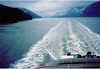
Here's an article from BC Hydro about a photo contest they held. Looks like a shot from the NorAd won. This is the winning shot..  Shot of B.C.'s Inside Passage wins Team Power Smart Photo Contest Shot of B.C.'s Inside Passage wins Team Power Smart Photo ContestRob Klovance bchydro.com On a ferry ride through B.C.'s picturesque Inside Passage in August of 2008, Larry Paris was so enthralled by the natural beauty that he kept taking photos until he ran out of light. And one of his prized shots is the grand prize winner in the Team Power Smart Photo Contest. "It was so surprising, the pristine wilderness we went through," says the Chilliwack social worker, looking back at the trip from Port Hardy to Prince Rupert. "I took over 100 pictures on the 16-hour trip. We had a berth, but I hardly used it. I stayed up until it started to get dark around 9:30 or so. We were just out there the whole day – it was glorious." Paris figured he had a pretty good shot – a ferry deck, clouds, mountains and water – when he first took it with his Pentax K20D digital camera. But when he saw it at home on his computer monitor, he knew he had something special. "Just right out of the camera it popped out at me," said Paris, who uses no filters on his camera. "I did a little bit of sharpening and fine-tuning, and no cropping." Amid tough competition, a panel of judges including former B.C. Lion and current Team Power Smart leader Lui Passaglia chose Paris's shot [JPEG, 68 Kb] as the best. Not only does he win a Nikon D90 digital SLR camera and a Nikkor 18-105 mm lens as the grand prize winner, but Paris' photo will be among the 12 featured in an upcoming contest calendar. Calendars can be ordered through the London Drugs-hosted contest site by mid-November. "I'm thinking of ordering a dozen of them and giving them away as Christmas presents," said Paris, a longtime member of Team Power Smart who credits conversion to a tankless water heater for a big chunk of his current 8% home electricity consumption decrease from the previous year. "Why not?" Why not, indeed. The other 11 photos from Team Power Smart members across the province illustrate a passion for the outdoors that perfectly fit the theme of the contest: I joined Team Power Smart because... " London Drugs - Ski hillNanaimo's Louise Massey won with a shot of a Mount Washington ski run back in 2006 that reminded her of why she has decided to reduce her ecological footprint. "It was a great year for snow and skiing, and I took the picture because of the combination of the snow ghosts, and the view down into the Comox Valley and the ocean," she wrote in an email. "I hope that we can stop global warming so that we can continue to have beautiful skiing like the day that the picture was taken." Sometimes, a subject we've seen a thousand times emerges as something breathtaking. This is what Burnaby's Vincent Jiu had to say about his winning shot of a fern at Vancouver's Van Dusen Garden. "She was, dancing in her afternoon gown, tossing her head, swaying in the sun," he wrote. "I stopped to see the music." The contest judging panel of Passaglia and BC Hydro managers Michael Newland, Jim Nelson, Cynthia Dyson and Larina Lopez took longer than expected to make the choices of one grand prize winner and 11 other shots for the calendar, which will soon be available by pre-order – at $9.99 – on the contest site hosted by London Drugs. The judges saw numerous images elsewhere of the amazing south coastal B.C. storm that brought lightning and crazily-coloured skies to Vancouver and other places in the region. But in the end, a lightning shot made the cut for the calendar. Ryan Planinshek of Vancouver didn't even have to leave home to get his winning storm shot. He took it from the balcony of his Yaletown home. "I had never seen a weather event like this in the 20 years I have lived in Vancouver," he wrote. |
|
|
|
Post by Low Light Mike on Jul 21, 2010 23:45:11 GMT -8
Some more beauty that I saw on the inside passage ferry on July 5, 2010: Hakai Pass, between Calvert & Hunter islands. It's a BC Provincial Marine Park  Cruising up Fitz Hugh Sound:  Glimpse of Namu, between islands. Once a busy summer canning site. - Discovery Coast ferry used to stop here for a brief tour in the early years of Route-40. 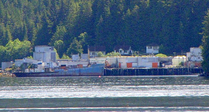 Glimpse of Bella Bella, from south in Lama Passage  The wharf in downtown Bella Bella. - the Queen of the North used to dock here, using a side pax door. 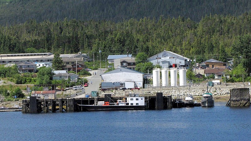 Pacific Coastal plane headed for Bella Bella airport airport.  Common scene in Grenville Channel  Prince Rupert grain terminal at Ridley Island, lit by the setting sun.  Speaking of a setting sun...  |
|
|
|
Post by Low Light Mike on Jul 25, 2010 15:50:14 GMT -8
Route 12 is Prince Rupert - Haida Gwaii, and this route has some spectacular scenery, especially if the weather is clear. I had clear, sunny weather for my 2 trips on this route, on July 8 and 13, 2010. =================== Here are some scenes from the Prince Rupert / Chatham Sound end of things: The south harbour area is called Fairview, and is overshadowed by mountains on Kaien Island (the island that Prince Rupert is located on). 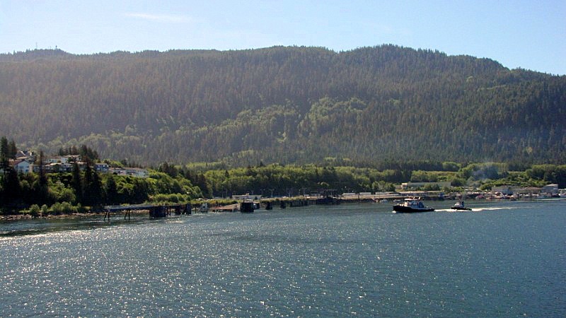 North of the BCF berth is a rail berth on a short spur off the VIA line.  - seems like an awfully short bridge to deal with tidal changes.  The new container port at Fairview gives lots of interesting viewing at the start or end of your journey.   Obviously this is a port to change between rail and sea.   Just a bit south of the container port is the Ridley Island coal (and grain too) port.  ...and the view of Ridley Island coal/grain port, as we're heading west in Chatham Sound. 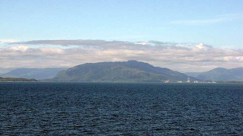 The view eastward in Chatham Sound.  Approaching our exit from Chatham Sound, to Hecate Strait. - looking north, as we travel between Porcher Island and Stephens Island.  3 smaller islands at our route's entrance/exit to Chatham Sound are named Henry, William and Arthur. Sounds pretty royal (and "colonial") to me. The mountains and beaches at these royal islands are wonderfully typical west-coast.    |
|
|
|
Post by Low Light Mike on Jul 25, 2010 19:43:56 GMT -8
Continuing my Route-12 Haida Gwaii journey, here are some scenes from Hecate Strait: Nice islets guarding the approach to Chatham Sound 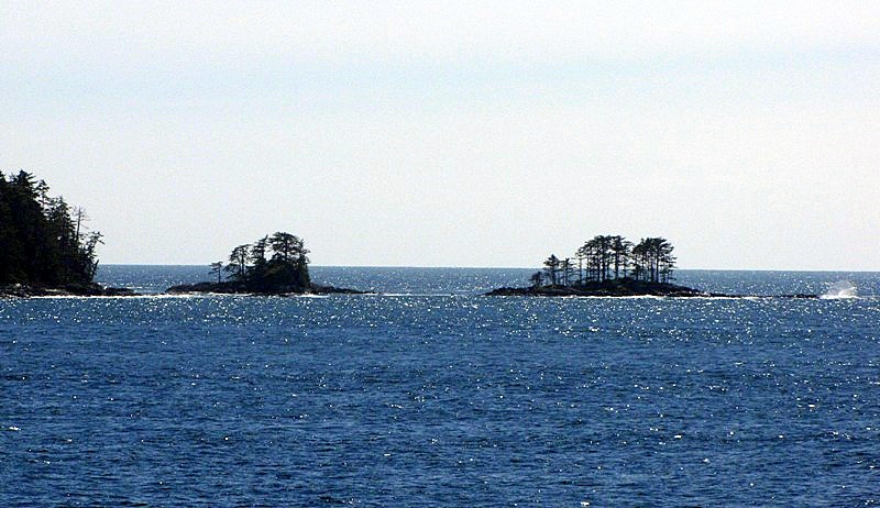 We saw a Gov't Fisheries & Oceans plane headed west. 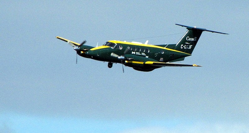 This light-marker shows some rocks, on the eastern edge of Hecate Strait:  This Cosco container ship was way out in the middle of Hecate Strait, traveling north to south. I presume that she came from Anchorage or Juneau. 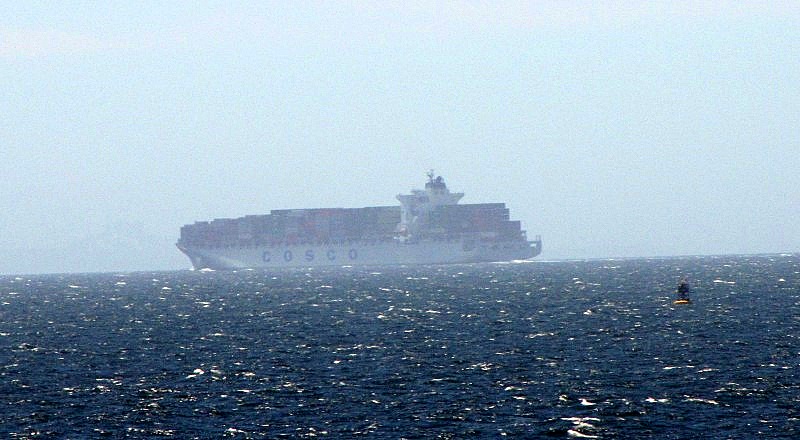 Middle of strait scenes, with interesting clouds:    The view back towards Haida Gwaii, from mid-strait  Heading towards Haida Gwaii: - the Tlell-turn (I like the barely visible NorAd smoke, to the left of the wake)  The approach to Haida Gwaii - just 1 level of land clearly visible from this distance  - now we can see the mountains of the Queen Charlotte range, plus some lowlands by the east coast.  We can see the eastern entrance to Skidegate Channel (thanks Luke), where we'll be heading.  |
|
|
|
Post by Low Light Mike on Jul 26, 2010 21:11:32 GMT -8
Scenes from the Route-12 ferry, as you approach and arrive at Haida Gwaii: - photos taken July 8 & 13, 2010. Some where on eastbound trip, some westbound, hence the different perspectives.: ------------- Cruising down the coast, between Tlell and Skidegate village.  Here's that coast:  You may think that shape on the beach is the Pesuta wreck (like I did, until I saw the road behind it). It's a big rock.  Approaching the entrance to Skidegate Channel   There's Skidegate Village. - If you have an open-mind about different cultures with Canada, it's a great place to visit, observe and learn about the Haida people. 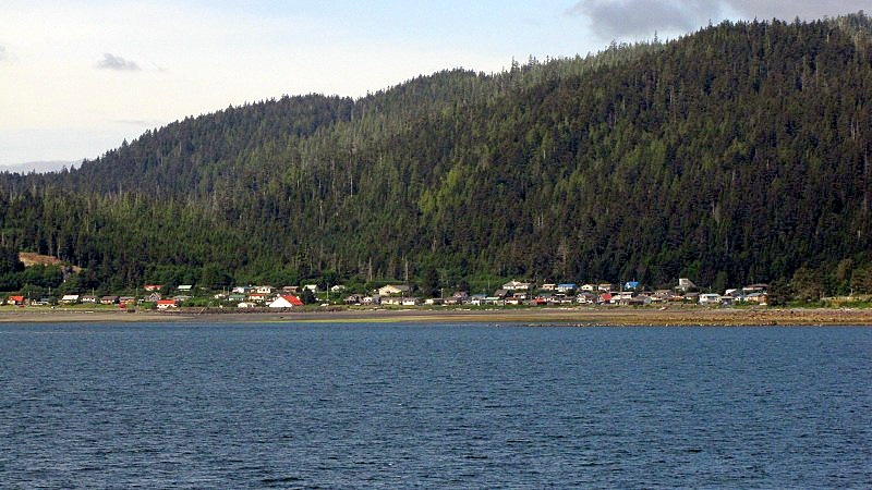 A few close-ups as you pass the village, in between some small islands.    There's a Bill Reid pole, at Skidegate village.  Looking back at where we've come from, as we enter Skidegate Channel:  Next item visible is the Haida Heritage Centre (and museum) at 2nd Beach (aka "Kaay Llnagaay"):  - a closer look at the beautiful heritage centre (a must-see visit)  www.haidaheritagecentre.com www.haidaheritagecentre.com |
|
|
|
Post by Low Light Mike on Aug 10, 2010 7:47:33 GMT -8
From the BC Ferries Inside-Passage route, the sights as the ferry passes Butedale, on Princess Royal Island. Faithful readers of my trip-blog will recall that I was asleep for this landmark (I'm still peeved at that), but my wife was standing on guard for our photo album and took these shots. - approaching Butedale from the south.   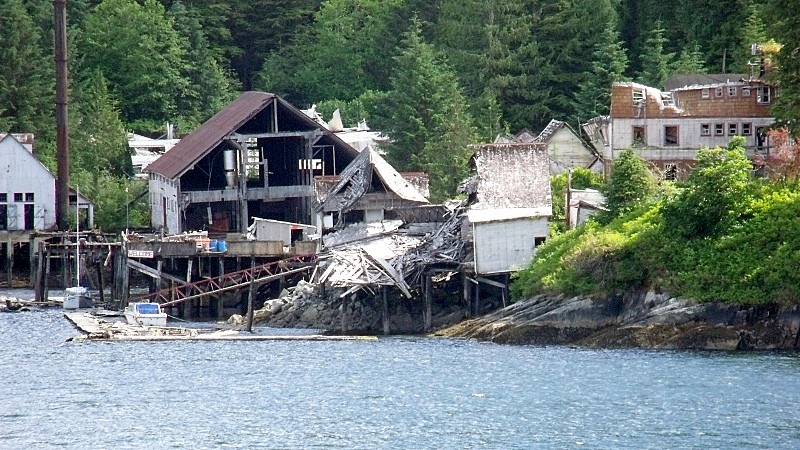 |
|
|
|
Post by Northern Exploration on Aug 10, 2010 7:55:52 GMT -8
From the BC Ferries Inside-Passage route, the sights as the ferry passes Butedale, on Princess Royal Island. Faithful readers of my trip-blog will recall that I was asleep for this landmark (I'm still peeved at that), but my wife was standing on guard for our photo album and took these shots. - approaching Butedale from the south.    I had posted in another thread a little while ago that Butedale had been up for sale for a few million and change. Those pics of the increasingly collapsing buildings make me wonder how deep the pockets of whoever bought it. Unless of course the owners just took it off the market waiting for land prices to improve. The site still has some key benefits, one of which is the ability to generate a substantial amount of hydro electricity. But to make the site safe to live at, a lot of those buildings will have to be pulled down as they are way beyond repair. *BTW good thing you were already defrocked from the Coastal Orthodoxy because sleeping on an Inside Passage trip would be definite grounds for discipline. |
|
|
|
Post by sebsbcferries on Sept 25, 2011 18:14:56 GMT -8
Inside passage trip time lapse
it only takes 9 minutes and 9 seconds long!
|
|
|
|
Post by Low Light Mike on Nov 5, 2011 14:23:48 GMT -8
Banner contest reject: - from July 2010 in Wright Sound, on my Northern Expedition  |
|
Nick
Voyager
Chief Engineer - Queen of Richmond
Posts: 2,078
|
Post by Nick on Nov 5, 2011 14:55:12 GMT -8
Banner contest reject: - from July 2010 in Wright Sound, on my Northern Expedition  That's a really nice shot, Flugel! I'm really missing those mountains out this way. |
|
|
|
Post by Low Light Mike on Nov 5, 2011 14:57:03 GMT -8
Banner contest reject: - from July 2010 in Wright Sound, on my Northern Expedition That's a really nice shot, Flugel! I'm really missing those mountains out this way. Thanks. I like the layered effect of the mountains as we head into Grenville Channel. - some day soon, this will be your office-view. |
|
|
|
Post by Mike on Oct 30, 2012 16:24:01 GMT -8
Sunrise as viewed from the NorEx. October 13, 2012.   |
|
|
|
Post by WettCoast on Jul 11, 2015 13:56:59 GMT -8
Lookin' out my back door... View through the Northern Adventure's rear car deck door @ Fairview Terminal, Prince Rupert, to the Alaska Marine Highway System's M/V Matanuska - 30 June 2015. You don't get many opportunities to photograph other ferries through your car window while your car is parked on the NoRad car deck...  © WCK-JST by JST, on Flickr © WCK-JST by JST, on Flickr |
|
Deleted
Deleted Member
Posts: 0
|
Post by Deleted on Aug 1, 2015 18:20:25 GMT -8
Lookin' out my back door... View through the Northern Adventure's rear car deck door @ Fairview Terminal, Prince Rupert, to the Alaska Marine Highway System's M/V Matanuska - 30 June 2015. You don't get many opportunities to photograph other ferries through your car window while your car is parked on the NoRad car deck... © WCK-JST by JST, on FlickrIs that a Deck Cadet handling the lines?  |
|
|
|
Post by WettCoast on Aug 1, 2015 19:27:00 GMT -8
Is that a Deck Cadet handling the lines? For a higher resolution look go here. |
|
|
|
Post by Low Light Mike on Aug 5, 2015 9:21:52 GMT -8
Just setting up this new, specific thread for photos of from-ferry scenes of these specific Routes 10/11.
I plan on posting many videos and pics, in the coming weeks.
I will also move-over relevant items from our existing "General Scenes" thread.
This new thread allows us to showcase these unique and incredibly scenic route scenes.
|
|
|
|
Post by Low Light Mike on Aug 6, 2015 18:03:19 GMT -8
|
|
|
|
Post by Low Light Mike on Aug 9, 2015 17:28:08 GMT -8
What you see in the first 30 minutes of a northbound Route-10 trip. This is leaving Hardy Bay. - shot from aft Deck-6 on Northern Expedition - August 4, 2015 - with Disney Wonder in middle background: 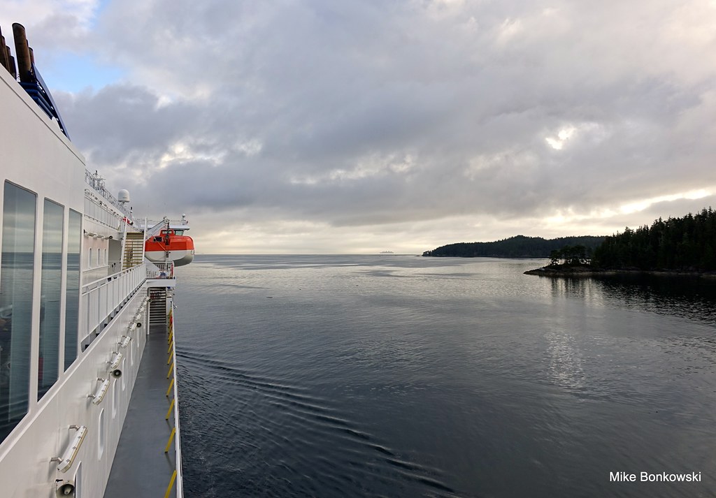 030 030 by Mike Bonkowski, on Flickr The rain has started, and wouldn't end for another day... 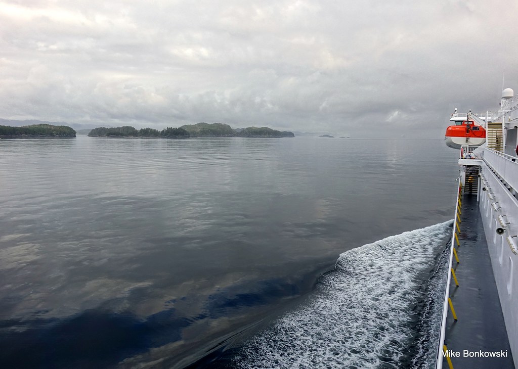 040 040 by Mike Bonkowski, on Flickr |
|
|
|
Post by Low Light Mike on Aug 10, 2015 13:15:04 GMT -8
My video of leg-1 of my trip-1 on Inside Passage: Port Hardy to Pine Island - the first hour or so of the trip. - August 4, 2015 ---------- 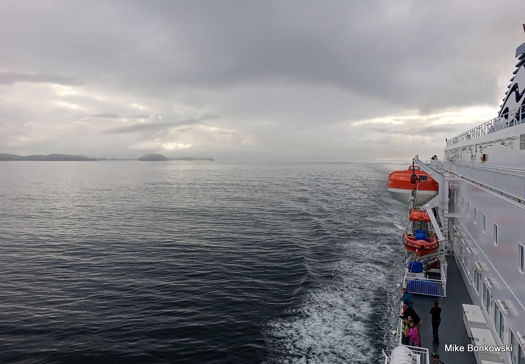 042 (2) 042 (2) by Mike Bonkowski, on Flickr |
|
|
|
Post by Low Light Mike on Aug 11, 2015 14:18:56 GMT -8
Scenes near Bella Bella, on cloudy August 4, 2015: The evidence of a ship slowing down - on our approach to McLoughlin Bay, in Lama Pass  . . by Mike Bonkowski, on Flickr After Bella Bella, we make the turn at Dryad Point into Seaforth Channel, which will lead us to Milbanke Sound. - the lighthouse at Dryad Point is very pretty. 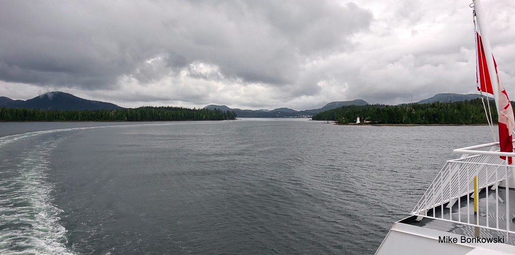 133 (2) 133 (2) by Mike Bonkowski, on Flickr |
|
|
|
Post by Low Light Mike on Aug 12, 2015 0:23:47 GMT -8
Here's part-2 in my series of a trip up the Inside Passage.
This episode takes us from the north end of Fitz Hugh Sound, to the middle of Seaforth Channel. Along the way, we see Lama Pass, McLoughlin Bay, Bella Bella, and Dryad Point.
It's a long video, and the stop at McLoughlin Bay shows a lot of detail of what happens when the big ship stops there.
Enjoy.
-------------
Next up, in a few days, will be Tolmie Channel to McKay Reach.
|
|
|
|
Post by Low Light Mike on Aug 12, 2015 7:34:26 GMT -8
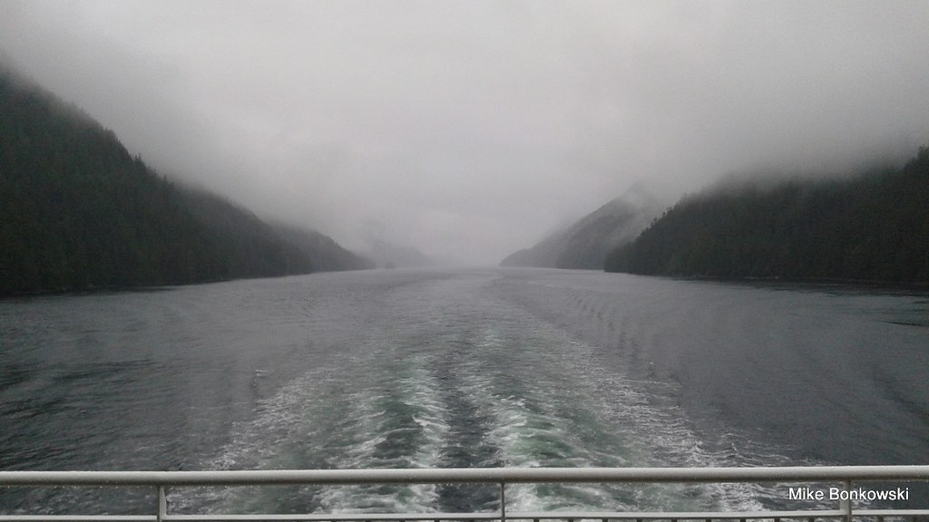
Butedale is on the north-east side of Princess Royal Island, approximately 100 minutes of ferry travel time north of Boat Bluff (or 90 minutes south of Grenville Channel). It's one of the iconic scenes on the Inside Passage route. The large waterfall was running pretty low, according to crew members I talked with. Info here: Butedale---------- Here's how I saw it, at 5:45pm on a misty August 4, 2015, from Deck-5 of Northern Expedition: 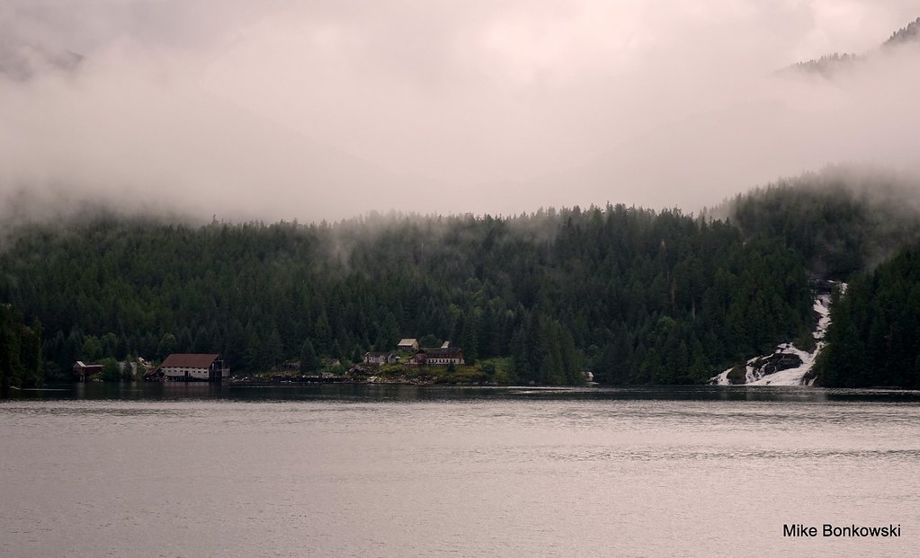 189 189 by Mike Bonkowski, on Flickr 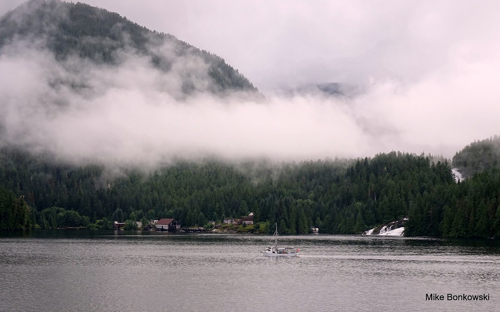 192 192 by Mike Bonkowski, on Flickr 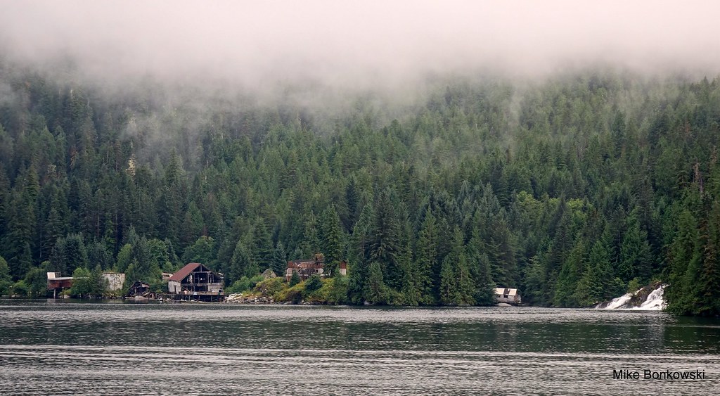 195 195 by Mike Bonkowski, on Flickr ------------ The ferry doesn't get too close to the site, and we slow down to minimize wake. It is slowly disappearing... |
|
|
|
Post by Low Light Mike on Aug 12, 2015 9:58:51 GMT -8
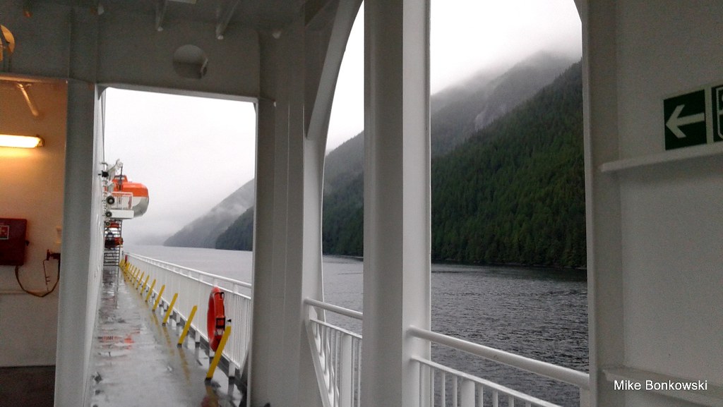
Continuing in the area near Butedale, in the narrow channel between Princess Royal Island and the mainland. These are from my southbound trip on August 7, 2015 - similar weather to what I experienced here on my northbound leg. However, after this, I had a nap, and when I awoke near Boat Bluff, there was sunshine (which stayed with us for the remainder of our southbound voyage). But here's the misty scenes: 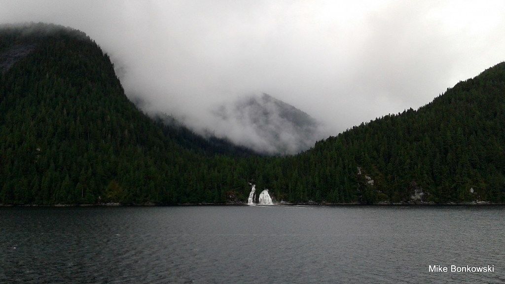 20150807_121522 20150807_121522 by Mike Bonkowski, on Flickr  20150807_122609 20150807_122609 by Mike Bonkowski, on Flickr The "blue zone" on Deck-7 becomes the rain zone 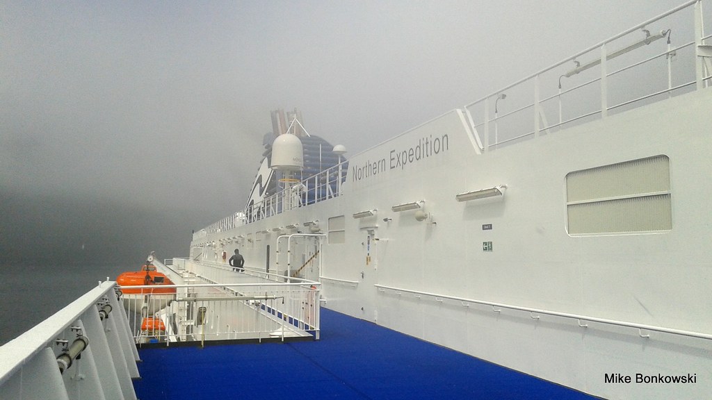 20150807_123345 20150807_123345 by Mike Bonkowski, on Flickr |
|
|
|
Post by Low Light Mike on Aug 15, 2015 11:25:05 GMT -8
Here is Part 3 of my video series on the Inside Passage. This continues the northbound journey and is from Boat Bluff to McKay Reach. So it's mainly the eastern edge of Princess Royal Island.
- a misty time on August 4, 2015
Butedale is the feature item in this video.
|
|
|
|
Post by Low Light Mike on Aug 15, 2015 17:54:29 GMT -8
Misty northbound scenes between Boat Bluff and Wright Sound, along the eastern edge of Princess Royal Island. - August 4, 2015 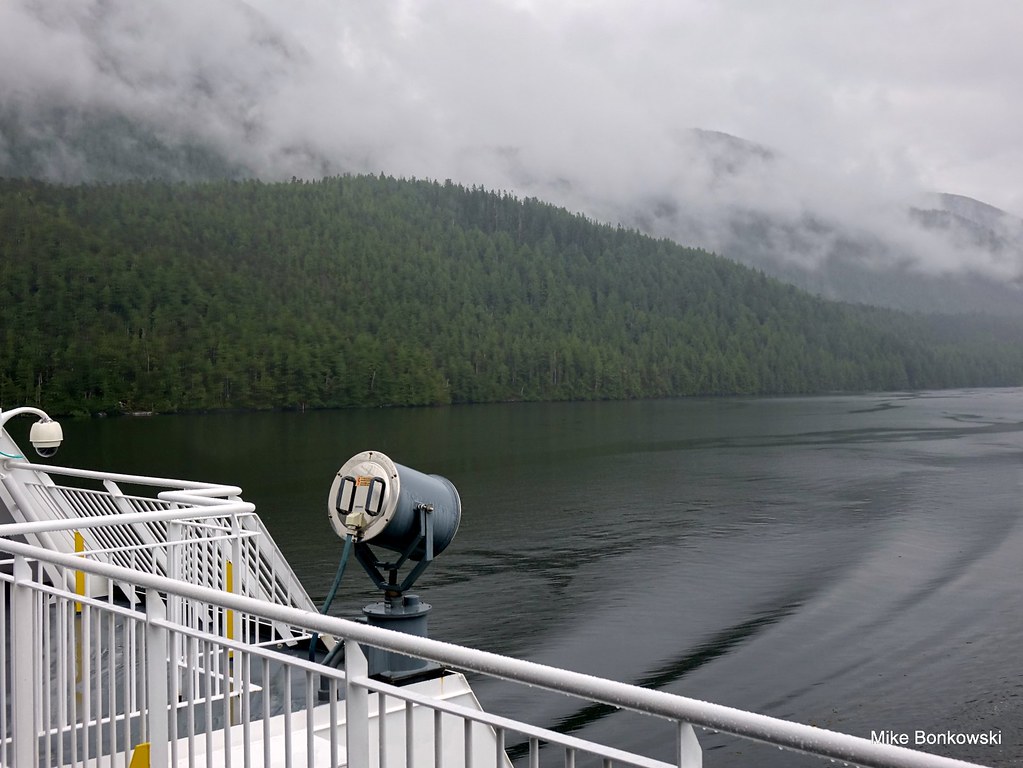 . . by Mike Bonkowski, on Flickr Finding shelter and a view can be a tough combination. My thoughts at the time were this: " The storm is threatening my very photo-life today. I told the purser that if I don't get some shelter, I'm gonna fade away. But photo success for this trip is just a shot away, just a shot away...." - Here I am at deck-6 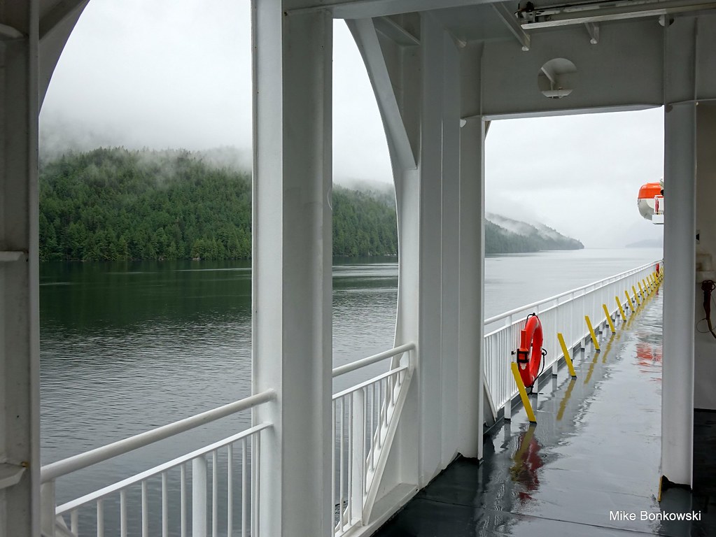 . . by Mike Bonkowski, on Flickr Looking back at the top-end of McKay Reach 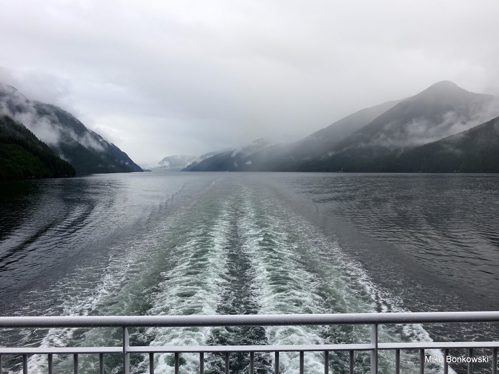 . . by Mike Bonkowski, on Flickr 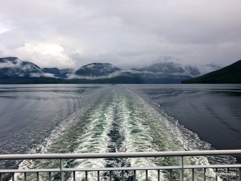 . . by Mike Bonkowski, on Flickr |
|