|
|
Post by suspensionstayed on Nov 12, 2011 6:46:53 GMT -8
|
|
|
|
Post by suspensionstayed on Nov 12, 2011 6:59:56 GMT -8
|
|
|
|
Post by suspensionstayed on Nov 12, 2011 7:19:33 GMT -8
While I understand this is a West Coast Ferries site catering to those primarily in WA & BC. My BC travels that include bridges visited are from a single 2003 drive to Alaska from Pennsylvania here and then back through BC to WA before heading back east. I didn't get to bridges in the Vancouver vicinity that trip. I have been to Vancouver previously in 1996, but have since lost all the photos of that trip. I did get to the Capilano and Lynn Canyon Suspension Footbridges. I also visited the Lion's Gate Bridge well before the major deck overhaul. The bridges I was most impressed with were the Alex Frazer and the SkyTrain cable-stayed bridges. These were the first major cable stayed bridges I've visited. I had a very nice early evening, mid-September walk across the Alex Frazer during my visit and even got to ride the SkyTrain across its bridge. The slenderness of the SkyTrain bridge is what I recall being its most striking feature. I must get back that way soon to revisit them all and to add them to the 1,053 suspension / cable-stayed bridges I've visited since keeping track starting in 2002. Then there is the new Golden Ears Bridge as well as a dozen or so other footbridges I can visit within a few hour's drive.
|
|
|
|
Post by Low Light Mike on Nov 12, 2011 10:00:22 GMT -8
Yes, I agree. I drove over that bridge in 2004, on my way to Kasan & Hazelton. I was impressed too. I must say that this bridge impresses me. I did not know it was there. Next time I am travelling to or from Kitimat I must check it out. I wanted to see more pics so I googled it and here is what I found. 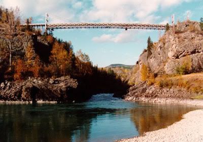 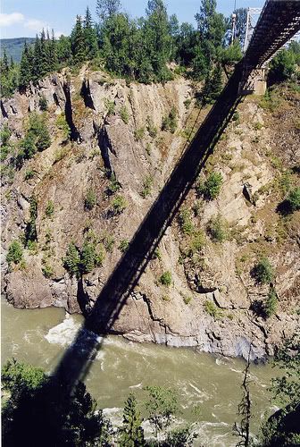 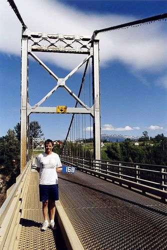 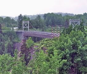 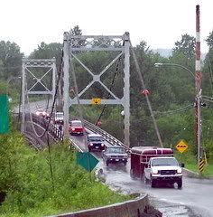 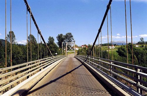 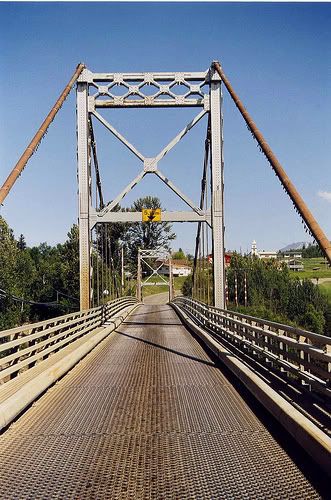 Now most of the photos that I posted above are from one person who has a huge collection of bridge photos. That is him holding the sign that says 168. The link below is to his flickr site and it is worth checking out. www.flickr.com/photos/suspensionstayed/collections/72157602580932940/Here's the post made a few years ago with our new member's photographs and Flickr site link. - haha, that was back in the old days when your bridge-count was still in the 3-digits. Mr. Stayed-Suspension: thanks very much for joining our forum and for posting today about some of your favourite bridges. Happy travels. |
|
|
|
Post by suspensionstayed on Nov 13, 2011 7:05:14 GMT -8
Hello Flugel Horn, thanks for the warm welcome. I'm happy to see the first two bridges on your list in your original post are suspension bridges. Historic ones at that! There once was a suspension bridge at the Sheep Creek Bridge location. One of its foundations / pier base can still be viewed, although deteriorating rapidly. It is visible on the right edge of this image, just below the half way point.  Sheep Creek Bridge over the Fraser River, BC Sheep Creek Bridge over the Fraser River, BC by Wayne Weber, on Flickr Here is an image (~1903) of the old Sheep Creek Bridge from this website... www.oldphotos.ca/archivos/record.php?collectionID=2&recordID=723217102 You can see those foundation / piers that I mentioned previously. It has a very "Lillooet" feel to it.  |
|
|
|
Post by suspensionstayed on Nov 13, 2011 7:31:56 GMT -8
In between the Sheep Creek Bridge (~50km to its south) and Lillooet Bridge (~95km to its north) is the Gang Ranch Suspension Bridge over the Frazer that still handles motor vehicle traffic! It appears to be a modernized version of the original Sheep Creek and Lillooet Bridges. It is also the only crossing of the Frazer in that ~150km stretch. 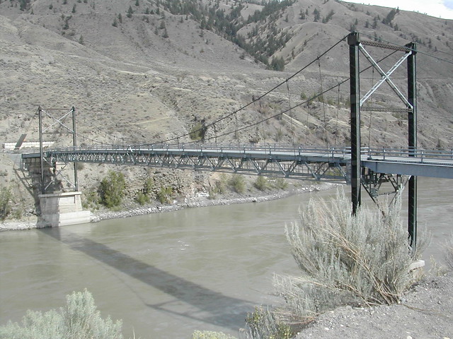 Gang Ranch Bridge Gang Ranch Bridge by superwebdeveloper, on Flickr 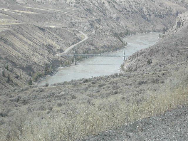 Gang Ranch Bridge Gang Ranch Bridge by superwebdeveloper, on Flickr 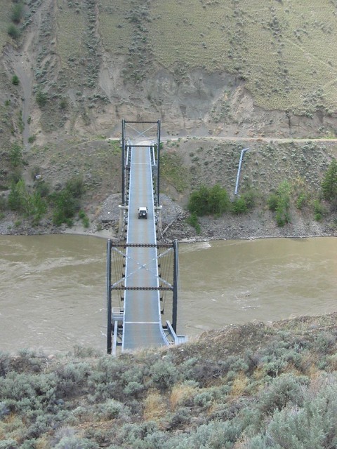 IMG0005 IMG0005 by Steve@VICruisers, on Flickr 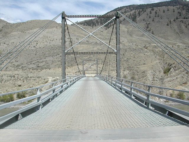 Gang Ranch Bridge Gang Ranch Bridge by superwebdeveloper, on Flickr This map has the three bridges marked with the Gang Ranch Suspension Bridge obviuosly in the middle of them. mapper.acme.com/?ll=51.52583,-122.28333&z=8&t=M&marker0=51.98385%2C-122.27551%2Cunnamed&marker1=51.52752%2C-122.28491%2Cunnamed&marker2=50.71152%2C-121.91141%2Cunnamed |
|
|
|
Post by suspensionstayed on Nov 13, 2011 8:44:56 GMT -8
Flugel Horn, Did you know there are two other suspension bridges over the Frazer between the Old Alexandria Bridge and the Lillooet Bridge. I'm sure you may have heard of the Hells Gate Suspension Bridge. Its located at the tourist attraction with the tram that descends into the Hells Gate Canyon from the Trans Can Highway.  Bridge 172-1 Bridge 172-1 by suspensionstayed, on Flickr  Bridge 172-2 Bridge 172-2 by suspensionstayed, on Flickr  Bridge 172-4 Bridge 172-4 by suspensionstayed, on Flickr The second one is in the next post - it's rather unique. |
|
|
|
Post by Low Light Mike on Nov 13, 2011 8:52:00 GMT -8
In between the Sheep Creek Bridge (~50km to its south) and Lillooet Bridge (~95km to its north) is the Gang Ranch Suspension Bridge over the Frazer that still handles motor vehicle traffic! Thanks for those images. I think the correct order (from South, up to North) on the Fraser River is: - Lillooet Bridge - Gang Ranch Bridge - Sheep Creek Bridge (up near Williams Lake, BC) |
|
|
|
Post by Low Light Mike on Nov 13, 2011 8:56:11 GMT -8
The second one is in the next post - it's rather unique. I'm guessing that it will be the Lytton tramway. |
|
|
|
Post by suspensionstayed on Nov 13, 2011 9:13:57 GMT -8
The second bridge is a very little known suspension bridge that I found to be one of those hidden gems. It is ~6km NNW of Lytton. It is one of those narrow, "droopy" footbridges along the lines of Capilano / Lynn Canyon, except it also carries a water supply pipeline on its underside. I guess technically rather it's more like a water supply pipeline with a walkway attached to its topside. It's length of 656 feet, - er 200 meters makes it longer than the Capilano and Lynn Canyon Bridges combined, or ~50% longer than the Capilano alone. It's nowhere near as high as them, but its remoteness and little traffic far makes up for it. It ranks well up there in my most unique suspension bridge visits of all time.  Bridge 170-01 Bridge 170-01 by suspensionstayed, on Flickr  Bridge 170-04 Bridge 170-04 by suspensionstayed, on Flickr  Bridge 170-05 Bridge 170-05 by suspensionstayed, on Flickr  Bridge 170-06 Bridge 170-06 by suspensionstayed, on Flickr  Bridge 170-07 Bridge 170-07 by suspensionstayed, on Flickr  Bridge 170-10 Bridge 170-10 by suspensionstayed, on Flickr  Bridge 170-09 Bridge 170-09 by suspensionstayed, on Flickr  Bridge 170-08 Bridge 170-08 by suspensionstayed, on Flickr What made this visit truly unique it that my research of this bridge lead me to believe that I would not have the chance to walk across it due to it being a narrow pipeline crossing. I parked just off Route 12 approximately 4km north of its junction with the Trans Can at Lytton, then walked just under 2km into the bridge via a very obvious pathway that had benches every now and then. About 100 meters of trail left prior to my arrival at the bridge I had already noticed the high barbed wire fencing that would prohibit setting foot on this one. Ah! once at the bridge I was greeted by this odd break in the fencing enclosure around the bridge's anchorage / abutment. There was another bench inside this enclosure and the whole enclosure on the far side was nearly identical. Actually you can take the ferry crossing the Frazer at Lytton and drive north 6km to within about a few hundred meters of the west end of the bridge.  Bridge 170-03 Bridge 170-03 by suspensionstayed, on Flickr This site mentions the bridge... www.lyttonfirstnations.ca/index.php/about-us/infrastructure/ "The community is cross by Trans-Canada Highway and Highway # 12. Both Canadian Pacific Railroad and Canadian National Railroad also cross the Lytton First Nation lands. A reaction ferry connects the east and west side communities. A walk-in bridge becomes the only means of transportation between the east and west side communities during winter ferry shutdown periods." |
|
|
|
Post by suspensionstayed on Nov 13, 2011 9:34:48 GMT -8
In between the Sheep Creek Bridge (~50km to its south) and Lillooet Bridge (~95km to its north) is the Gang Ranch Suspension Bridge over the Fraser that still handles motor vehicle traffic! Thanks for those images. I think the correct order (from South, up to North) on the Fraser River is: - Lillooet Bridge - Gang Ranch Bridge - Sheep Creek Bridge (up near Williams Lake, BC) You are correct. The Gang Ranch Bridge is ~95km north as the bird flies of the Lilooet Bridge. The Sheep Creek Bridge is ~50km further north of the Gang Ranch Bridge. |
|
|
|
Post by suspensionstayed on Nov 13, 2011 10:34:14 GMT -8
|
|
|
|
Post by suspensionstayed on Nov 13, 2011 12:49:56 GMT -8
|
|
|
|
Post by Low Light Mike on Nov 13, 2011 21:12:37 GMT -8
Mr. Stayed Suspension: Thanks for all your posts again today. Very much appreciated here, by all of us here who love bridges and who love this part of the world. Cheers! ps: Here's a pedestrian bridge across the Nass River, northwest of Terrace BC, in the Nisga'a First Nation: While in the Nisga'a 1st-Nation, we visited Canyon City (now known as "Gitwinksihlkw"), which is on the opposite bank of the Nass River from the Highway, and previously the only access for the village was by a foot-traffic suspension bridge. And the view of the old bridge is barely visible, downstream from the new. 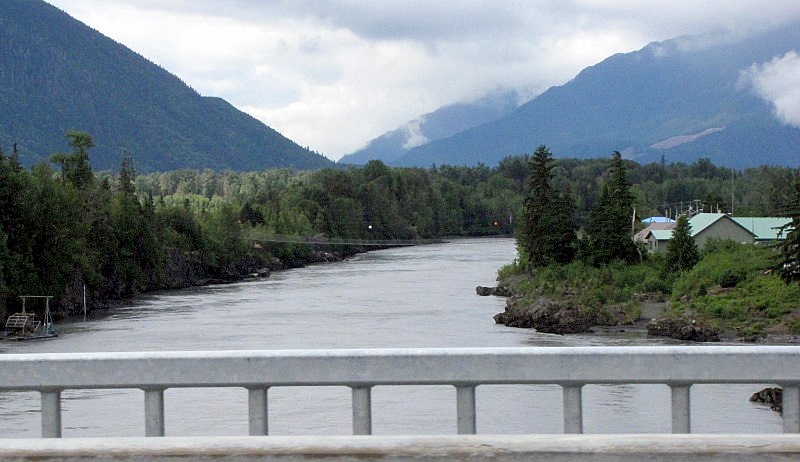 A better view of the suspension bridge.  As I was walking across the bouncy bridge...  |
|
|
|
Post by WettCoast on Nov 13, 2011 23:12:30 GMT -8
Over the next few days I will put up a few photos here of railway bridges & tunnels that can be seen in western Canada. First off is CP's Lower (Mt Ogden) Spiral Tunnel in Yoho National Park near the Continental Divide. Date: 21 September 1981  photo © JST - hosted on my Flickr site photo © JST - hosted on my Flickr siteThe Via train seen above the tunnel entrance is train #1, the west bound Canadian. Once upon a time it ran over the Canadian Pacific route through Rogers Pass & Banff, not on the CN line as happens in the present. The train you see will soon arrive at the upper tunnel portal (out of this photo several hundred metres to the left) and will then circle around inside the mountain. In about one minute the locomotive's headlight will be seen in the tunnel at the lower portal.  photo © JST - hosted on my Flickr site photo © JST - hosted on my Flickr siteVia's eastbound train #6, the Skeena, seen crossing the Porphyry Creek Bridge, on the BC North Bulkley Subdivision near Hazelton, BC - 14 September 1983 |
|
|
|
Post by suspensionstayed on Nov 15, 2011 12:42:12 GMT -8
|
|
|
|
Post by suspensionstayed on Nov 15, 2011 13:27:12 GMT -8
A few other British Columbia suspension bridges I'be been to. Peace River Suspended Pipeline at Taylor, BC:  Bridge 158-1 Bridge 158-1 by suspensionstayed, on Flickr  Bridge 158-3 Bridge 158-3 by suspensionstayed, on Flickr  Bridge 158-4 Bridge 158-4 by suspensionstayed, on Flickr Hudson's Hope - Hudson's Hope, BC:  Bridge 159-04 Bridge 159-04 by suspensionstayed, on Flickr  Bridge 159-01 Bridge 159-01 by suspensionstayed, on Flickr  Bridge 159-02 Bridge 159-02 by suspensionstayed, on Flickr  Bridge 159-11 Bridge 159-11 by suspensionstayed, on Flickr Laird River, Alaska Highway in BC:  Bridge 160-4 Bridge 160-4 by suspensionstayed, on Flickr  Bridge 160-6 Bridge 160-6 by suspensionstayed, on Flickr Hope Golf Course - Hope, BC This one lane motor vehicle bridge is no longer standing.  Bridge 174-2 Bridge 174-2 by suspensionstayed, on Flickr  Bridge 174-1 Bridge 174-1 by suspensionstayed, on Flickr  Bridge 174-7 Bridge 174-7 by suspensionstayed, on Flickr |
|
|
|
Post by WettCoast on Nov 21, 2011 23:08:33 GMT -8
Here is a different sort of suspension bridge, now gone... 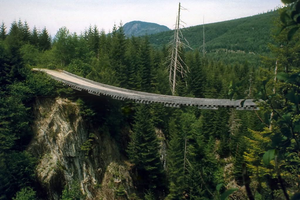 photo © JST - Fujichrome 76-3-2 - Nikon-VueScan photo © JST - Fujichrome 76-3-2 - Nikon-VueScanThis bridge spanned Williams Creek on the Shawnigan Lake to Port Renfrew Road, on southern Vancouver Island. It was known as a reverse curve bed spring suspension Bridge. It was removed a few years after this photo was taken on 6 June 1976. Yes, I have crossed it in a car, and on foot. At one time loaded logging trucks used it. |
|
|
|
Post by WettCoast on Dec 7, 2011 16:32:48 GMT -8
|
|
|
|
Post by SS San Mateo on Dec 12, 2011 9:20:40 GMT -8
A few months ago the Ruston Tunnel closed after nearly 100 years of service. It was narrow and has a low overhead clearance (resulting in trucks getting stuck on occasion). Here's a video I took of it in early 2010:
|
|
|
|
Post by lmtengs on Feb 5, 2012 22:02:32 GMT -8
A photologue of the Alexandria Suspension Bridge and the new, but still fifty years old, Alexandra Bridge, near Spuzzum: Warning: sorta kinda a little bit slightly photo heavy!We'll start with a photo of both bridges, taken from the CP mainline on the West side of the Fraser Canyon:  Now some of the new Alexandra Bridge, built in 1962 to replace the aging and narrow Alexandria Suspension Bridge: Detail of a bust of a salmon. There are four of these, one at each corner of the bridge:  The bridge's builders plaque:  A lumber truck drives across:  Taken from above the Alexandria Suspension bridge, on the CP Mainline. You can barely see the old bridge camouflaging from sight near the bottom of the picture:  Taken from the deck of the Alexandria Bridge:  ...and here's where we get photo-heavy... The original Alexandria Suspension Bridge, built in 1926-ish: Taken from the new Alexandria Bridge:  Looking West:   I'm actually a little bit concerned about this bridge's future. There are large gaps such as this one at both end of the bridge deck, and large cracks you could stick your pinky finger into on the bridge towers. I'm surprised it hasn't been shut down due to safety issues. If any kind of earthquake occurs, the bridge will disintegrate.  Looking East:  Detail of the deck surface:  Detail of the bridge rails:  Looking West onto the bridge: those barriers ensured that vehicles driving onto the bridge realized that the road narrowed and didn't crash into the cables holding the bridge in place:     80+ years worth of graffiti leaves it's mark... the 1962 bridge is in the background:  Two shots showing the deck. It's a long, scary drop if you were to fall:   You can see the river below through the holes in the deck at the bottom of the picture:  One last parting shot before we leave:  |
|
|
|
Post by Low Light Mike on Feb 5, 2012 22:22:47 GMT -8
Detail of the deck surface:  I love the effect of scrolling down this photo. Luke: thanks for this wonderful photo essay. Much enjoyed. |
|
|
|
Post by lmtengs on Feb 5, 2012 22:58:48 GMT -8
I love the effect of scrolling down this photo. Luke: thanks for this wonderful photo essay. Much enjoyed. So I'm not the only one! I was playing with zooming it in and out and scrolling it up and down, and with a large enough copy of it, scrolling has the same effect as zooming. It's a fun time-waster. ;D And thanks! 
Does anyone have any idea why the 'i' in Alexandria was dropped when the new bridge was built? We've got the Alexandria Bridge and the Alexandra Bridge, with only one letter making the difference... |
|
|
|
Post by WettCoast on Feb 5, 2012 23:03:43 GMT -8
|
|
|
|
Post by lmtengs on Feb 5, 2012 23:12:06 GMT -8
A quick note for CV. The bridges you were looking at today at Alexandra in the Fraser Canyon are actually bridges 2 & 3. Bridge #1, the original, lasted from the 1860's to the early 1900's, was part of the original Cariboo wagon road, and was also a suspension type. I am sure more info on it can be found on Wiki. A nice photo essay, BTW. JST Yea, the original bridge was finally taken apart in 1912 after sitting damaged for a few years. A replacement wasn't built for years after, and is the old one you see today. Apparently the foundations of the original bridge are still visible, but after two visits in the past year, I've yet to find them. |
|