|
|
Post by Northern Exploration on Sept 3, 2010 19:18:47 GMT -8
Hope there wasn't too much PDA on the LPD or someone might blush PDQ.
|
|
|
|
Post by Low Light Mike on Sept 3, 2010 22:01:30 GMT -8
The Gold River side of things, on 8/28/2010: - If you take a trip on the Uchuck-III (and you should), you should stay overnight at the Gold River Chalet motel. It's clean, comfortable basic accommodation with approx 40 units. Near a grocery store and a couple of restaurants. It is a 20 minute drive from the town to the wharf.  - Crossing the Gold River, on the way to the wharf. 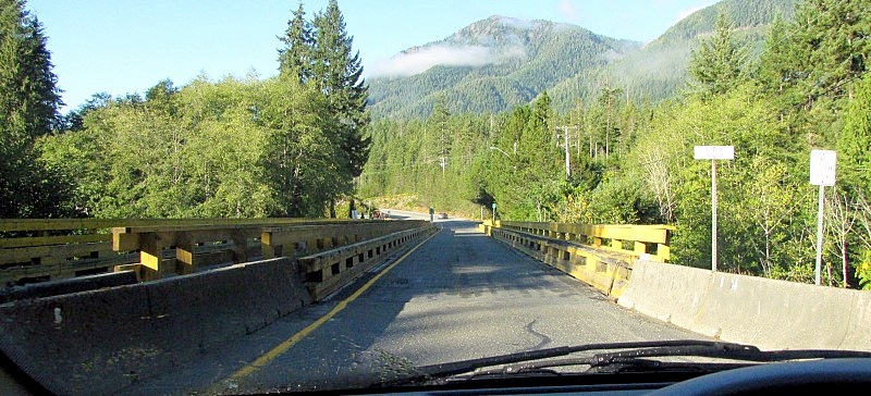 At the end of the road after you pass the boat-ramp, you need to find a parking spot on the side of the road. It's free. - looking back towards Gold River 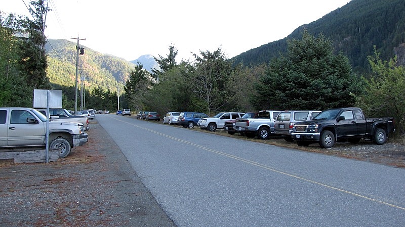 Turning around and looking at the end of the road. - Uchuck wharf is on the right, Air Nootka is on the left. 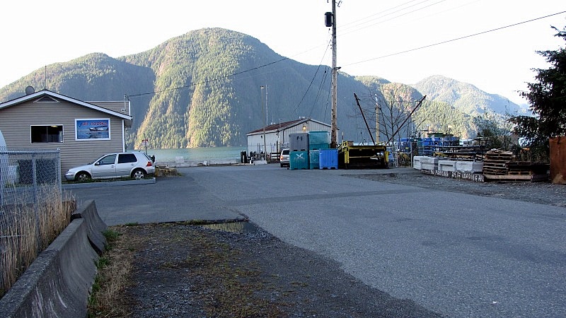 Planes of Air Nootka 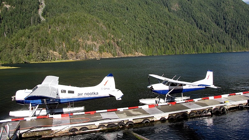 View of the Uchuck's part of the wharf, as we leave. Similar to Lady Rose Marine Services, the Nootka Sound Service company has a warehouse on the wharf, with forklifts at-the-ready and pallets and dumpsters coming & going. 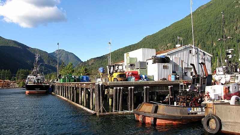 There's a log-sort next-door to the Uchuck wharf. 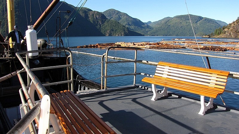 As we leave the wharf, you can see the industrial waterfront. 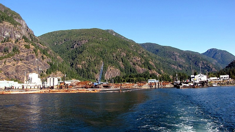 Old pulp-mill on the left (might become a garbage incinerator site) and log-sort on the right. 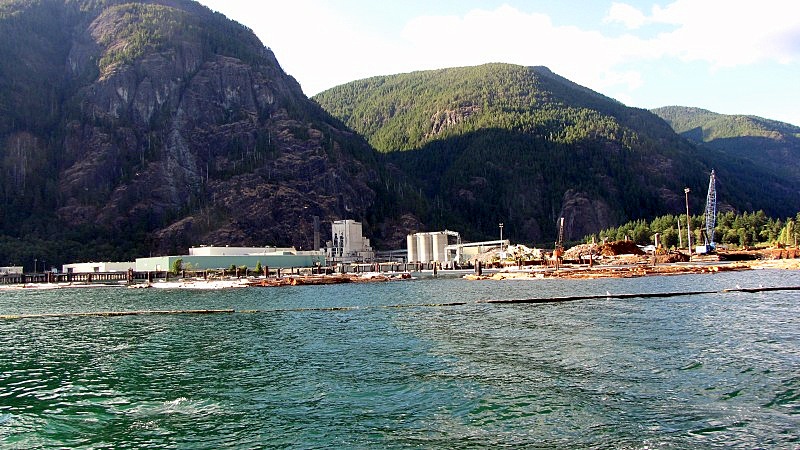 Loading slips from the old pulp mill. - the one on the right is wide enough for vehicles. I wonder if the left & middle ones are for conveyor-belt pallets? 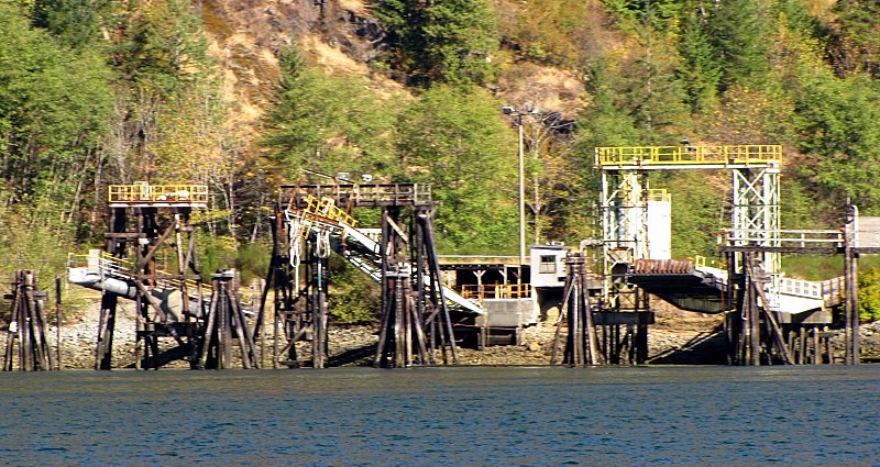 Leaving the Gold River wharf area behind.... 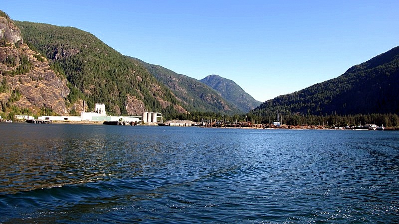 |
|
|
|
Post by dofd on Sept 3, 2010 22:20:37 GMT -8
WOW, you have sold me on that trip. Great photos and what a great spot to kayak.
|
|
|
|
Post by Low Light Mike on Sept 3, 2010 22:28:37 GMT -8
WOW, you have sold me on that trip. Great photos and what a great spot to kayak. Gold River and the Uchuck-III seems to be a portal to adventure. I've heard that the sea-kayakers love the area near Kyuquot, with all the sea-otters playing nearby. I'd like to do the Kyuquot overnight trip, maybe next summer. I'll post my Friendly Cove photos tomorrow. |
|
|
|
Post by Low Light Mike on Sept 4, 2010 9:49:25 GMT -8
Friendly Cove (also known as Yuquot) is located on the south-west corner of Nootka Island. - photo from the Uchuck-III, as we approach the cove, which is just below the bottom-right red-roofed building. 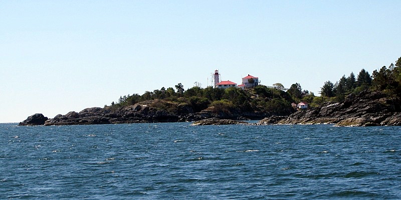 - Pano-stitch photo of the cove, as seen from the Lighthouse.  Nootka Island is a large island on the west coast of Vancouver Island, located between 2 prominent west-coast landmarks: the Brooks Peninsula to the north, and Estevan Point to the south. - and then just south of Estevan Point is Hot Springs Cove, Ahousaht, and then eventually Tofino. - here is the view south, with Estevan Point in the hazy distance. 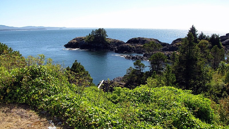 Friendly Cove is a place of historic significance to the colonial history of Vancouver Island and British Columbia. It was here in the late 1700's that Captain Cook landed and spent some time here, and interacted with Chief Maquinna. Later in 1792, the cove was the site for a mediation conference between Spain (Capt. Quadra), England (Capt. Vancouver) and Chief Maquinna regarding colonial tensions in the area. Of course, the Muchalat people were at this area long before the Spanish & English showed up. The 1st-Nations like to say that they've been in the "hospitality business" at Friendly Cove for over 200 years now. ;D - Here are photos of a fallen totem-pole. Tradition is that these poles eventually fall and are left as-is to return to the earth. 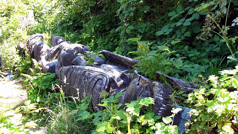 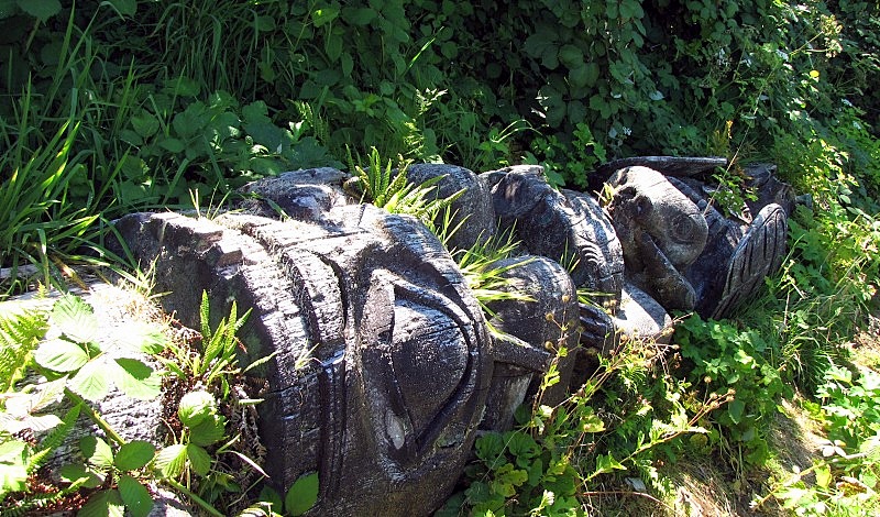 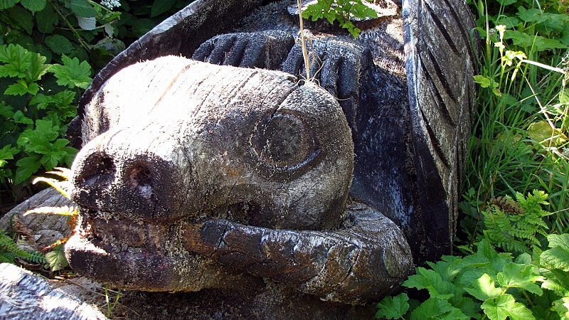 This history is presented to Uchuck-III travelers by a Muchalat member, who invites the arriving U-III passengers to join her at the church building at Friendly Cove. 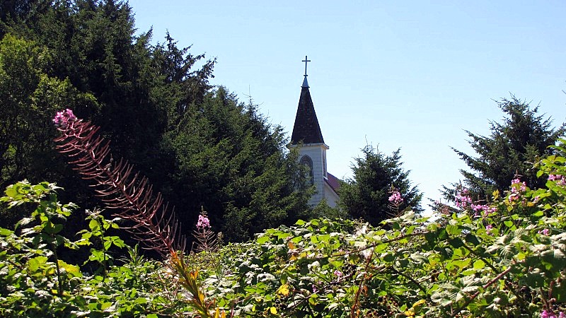 There, she (Margarita was her name) gives a short talk on the area's history and significance. The church is now used to house replica artefacts and for tourism & social gatherings. 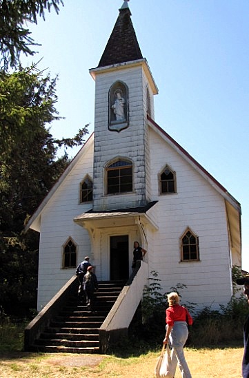 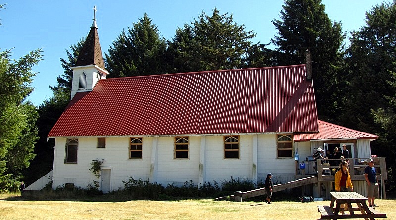 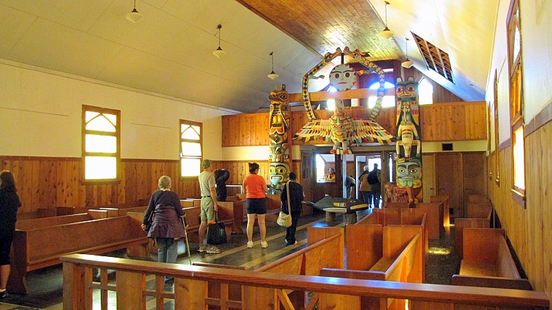 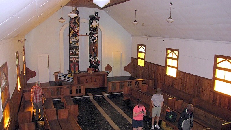 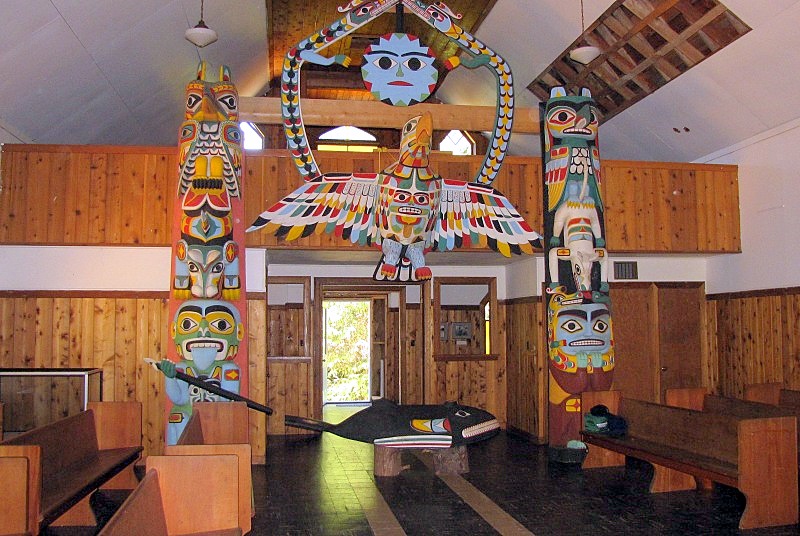 There's also some colonial history depicted in stained-glass in the church. 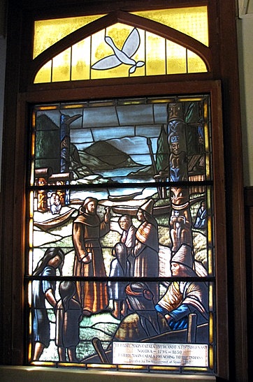 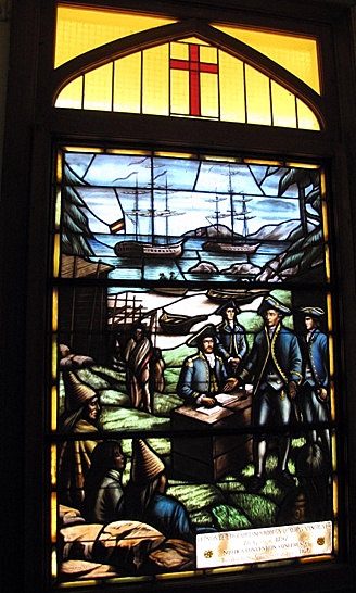 Then, we're invited to walk around and enjoy the area. On summer Saturday Uchuck trips, we have 3 hours ashore at Friendly Cove. For the summer Monday trips, there are only 90 minutes ashore. Multi-day hikers use this as a starting point for trails along the shore on Nootka Island. Kayakers use the boat trip for the same thing, a starting-off point. Today, Nootka Island is inhabited by the lighthouse keeper, and by one First-Nations family who live in a house overlooking the cove (including Mr. Sanford Williams, a carver). There used to be more people living on the island, as evidenced by the cemetery, near the church. 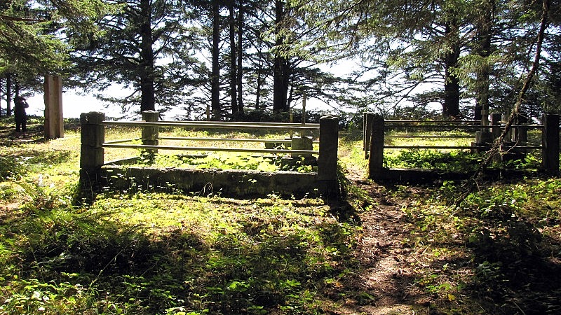 ---------- The beach on the open west-coast of Nootka Island is beautiful. 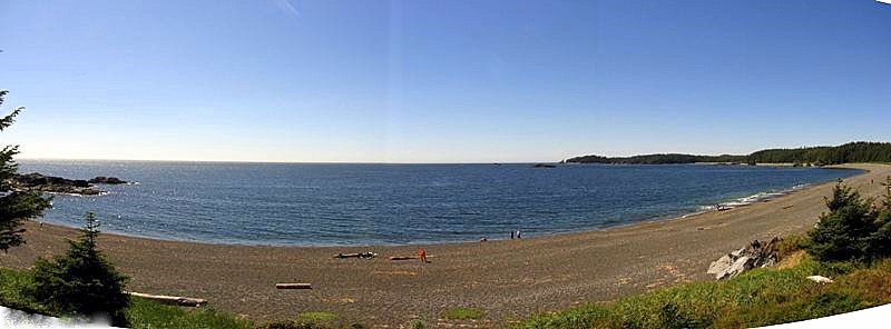 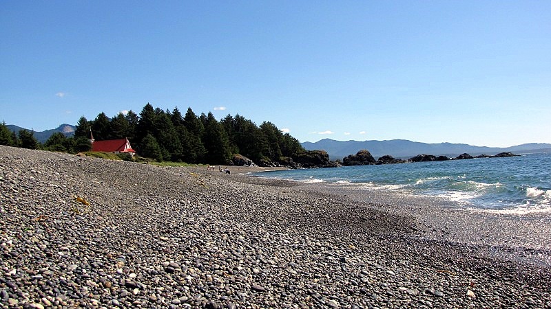 The beach is terraced, with different levels of pebbles. You can see this by comparing the elevation of the 2 people in this photo. - this couple is from Port Townsend, so they are getting used to things being un-even, not-on-the-level, leaning, etc. ;D ;D 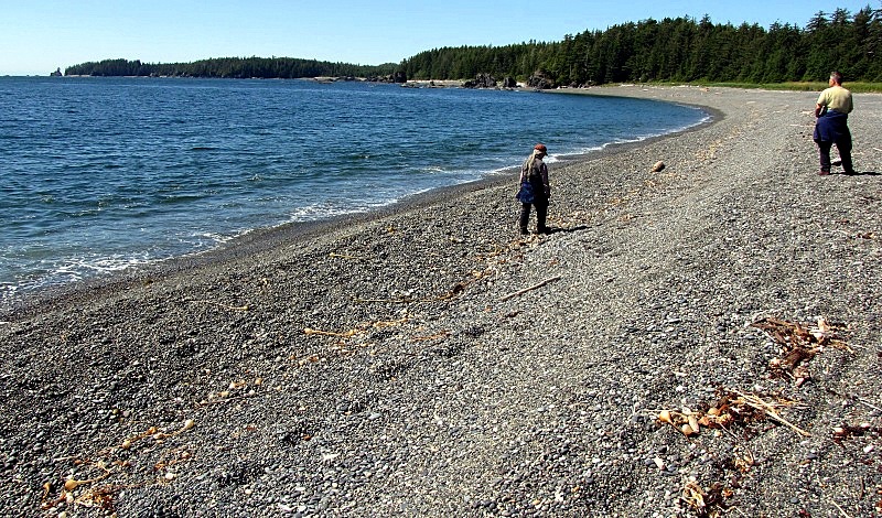 Looking across the grassy fields at the cove. The tops of the boom-cranes on the Uchuck-III are playing peek-a-boo. 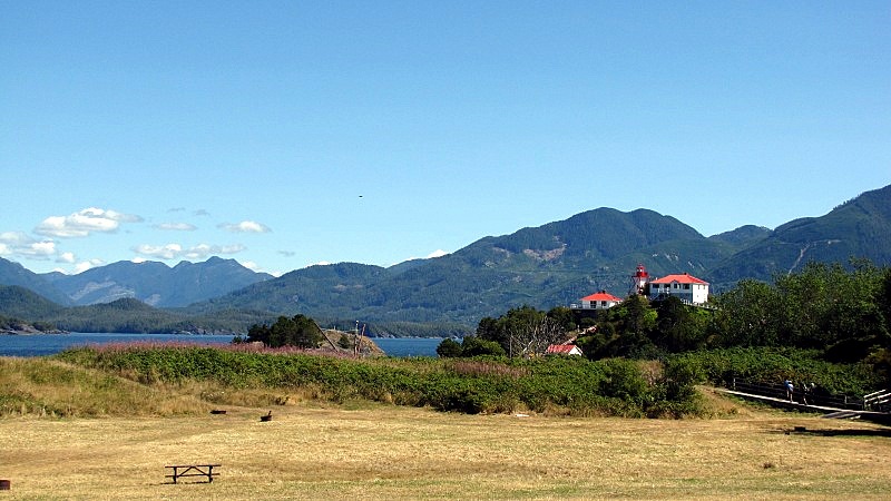 |
|
|
|
Post by Low Light Mike on Sept 4, 2010 11:10:11 GMT -8
Nootka Island lighthouse, as seen on 8/28/2010: Isn't it funny how lighthouses are always built on exposed rocky outcroppings, instead of inside a sheltered area. You'd think that they were intended to be for the benefit of ships out at sea, instead of just a nice place to visit from ashore. ;D Nootka Island's lighthouse is built on a rocky outcropping which shelters part of the cove, and that's tied to the rest of the island by a thin isthmus of beach. 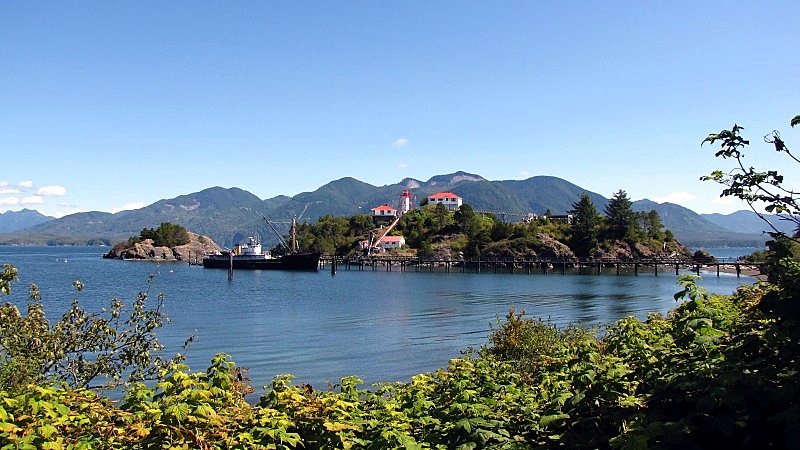 Because it's built on a rocky outcropping, some engineering for getting-around is required. - a high-&-narrow bridge walkway to bridge the gap between the houses and the helicopter pad - a steep cable-car-line to ferry supplies from the shore up to the houses. 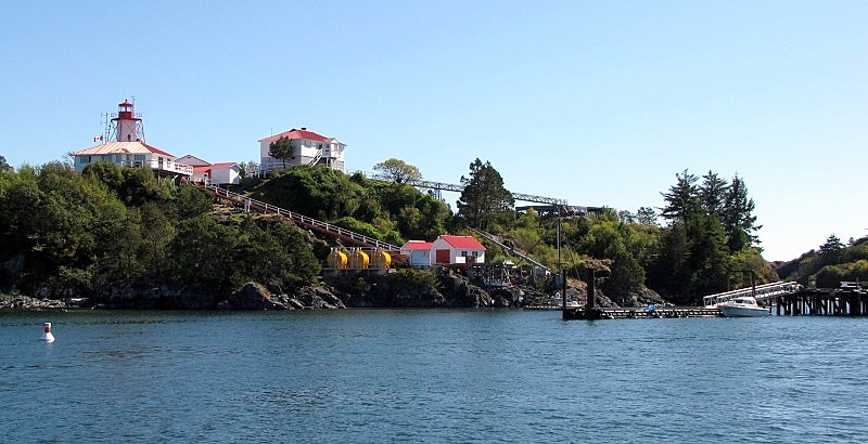 - Here's the bridge from the wooded helicopter platform to the houses. 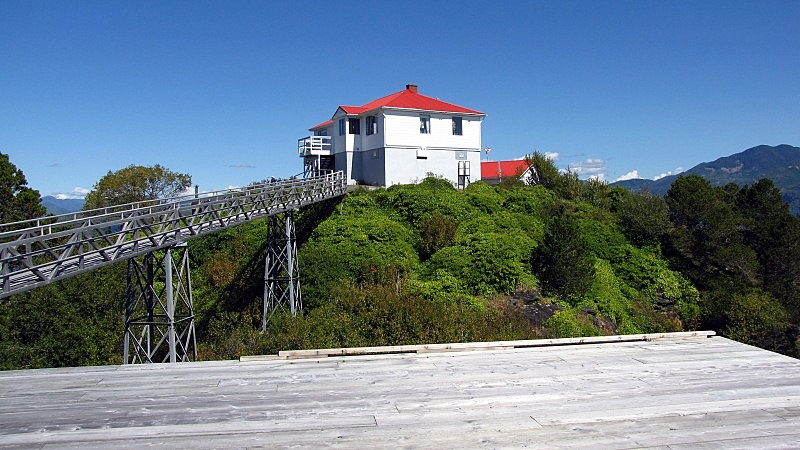 The houses and the light. 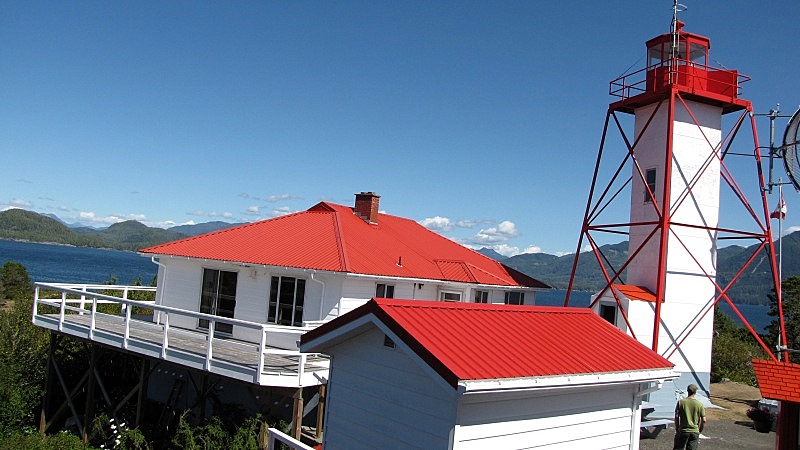 The cable-car-way from shore to the houses: 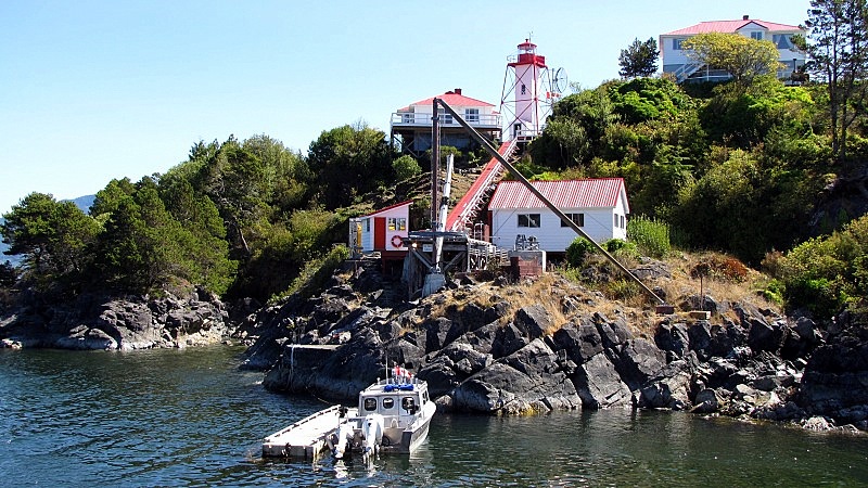 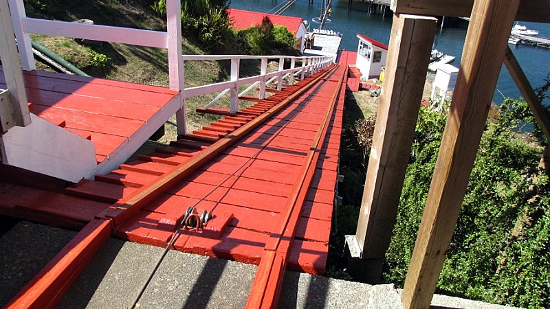 - and the cable-car itself. 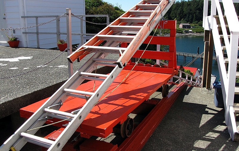 The view from the top of the cable-car-way, of the cove and the grassy area by the church. 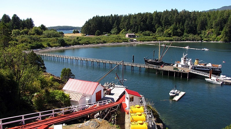 |
|
|
|
Post by lmtengs on Sept 4, 2010 12:19:03 GMT -8
Did you see the Swift when you were on your trip? We were in Nootka right around that time.
|
|
|
|
Post by Low Light Mike on Sept 4, 2010 15:53:30 GMT -8
Did you see the Swift when you were on your trip? We were in Nootka right around that time. No Swift sightings by me, on last Saturday. I was looking, but didn't see her. |
|
|
|
Post by Low Light Mike on Sept 5, 2010 16:57:36 GMT -8
Here are some highlights of the scenery from the Uchuck-III's day trip to/from Friendly Cove, as she runs up Muchalat Inlet, around Bligh Island and in Nootka Sound. - these photos are all from 8/28/2010. Visible from near the Gold River wharf is what I think is Matchlee Mountain. 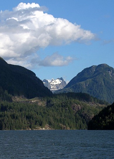 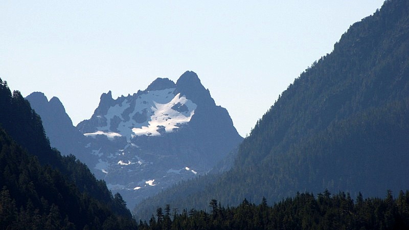 ------------------ Cruising up Muchalat Inlet, through narrow King Passage between the south-east corner of Gore Island and the south-shore of Muchalat Inlet. 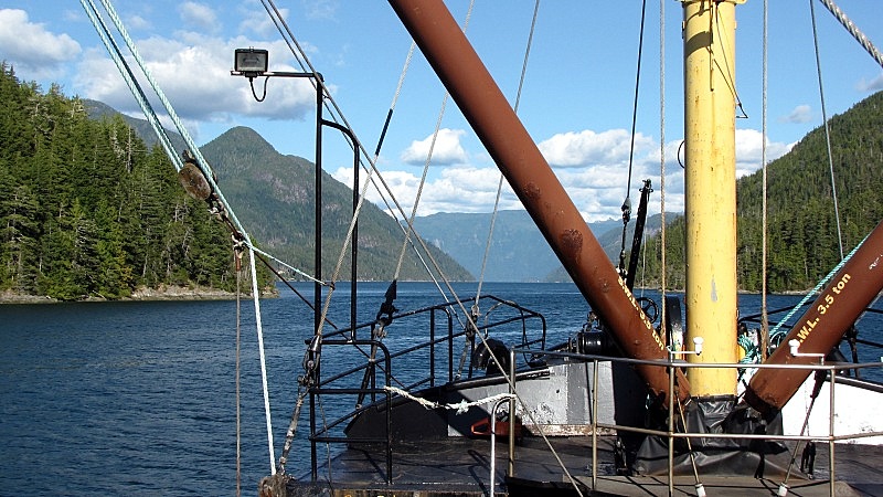 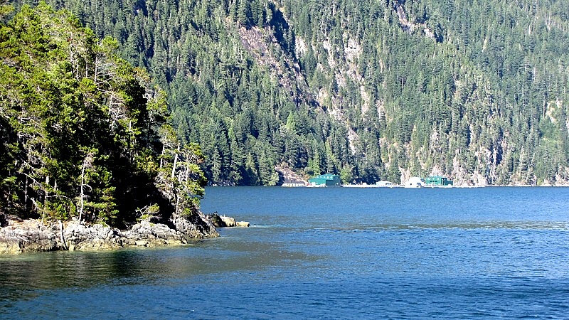 ------------------ The mountain that dominated the viewing near Bligh Island in Nootka Sound is Conuma Peak; known as "the Matterhorn of Nootka Sound". This mountain is located on Vancouver Island, near between Gold River and Tahsis, at the head of the Tlupana Inlet. members.shaw.ca/beyondnootka/articles/conuma.html- here are some views of Conuma peak, from the Uchuck-III in Nootka Sound. 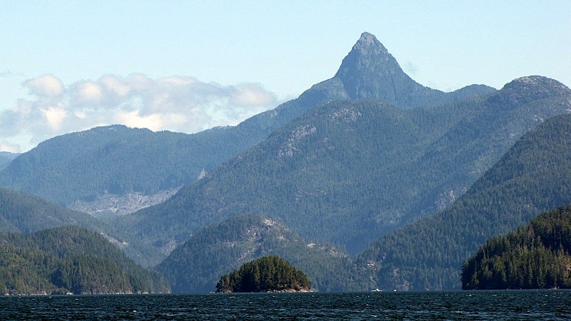 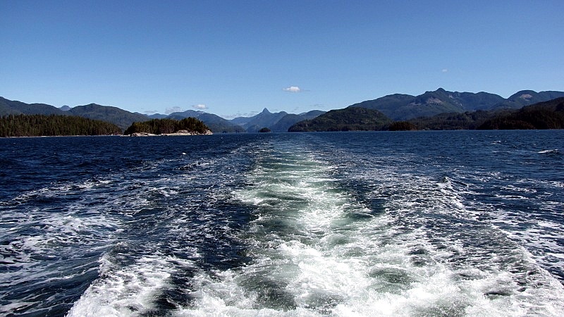 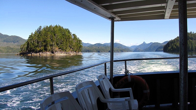 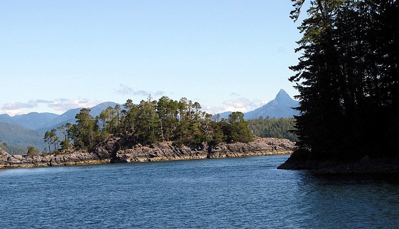 ----------------------- Some more pictures of our beautiful cruise at Nootka Sound. 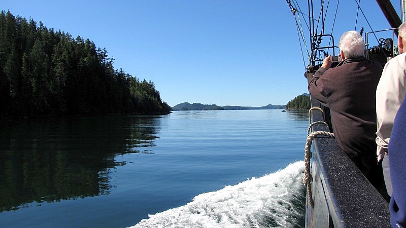 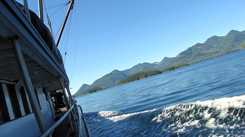 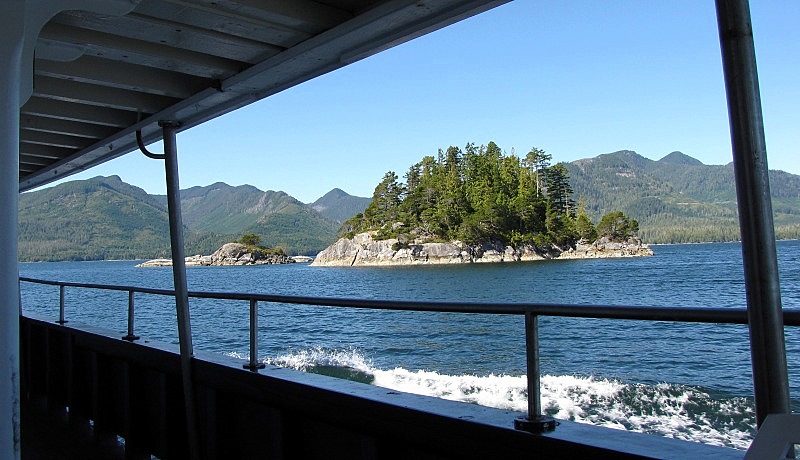 - That's a fish-farm in the foreground, and those are wild mountains in the background. 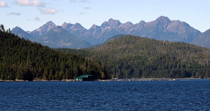 |
|
|
|
Post by Low Light Mike on Sept 5, 2010 20:59:55 GMT -8
Memorable wildlife encounters from my 8/28/2010 Uchuck-III trip were a breaching humpback whale (sorry, no picture), and a pair of sea otters playing/eating at a cove beside the Friendly Cove lighthouse. Here are the otters playfully enjoying their sea-urchin meals. 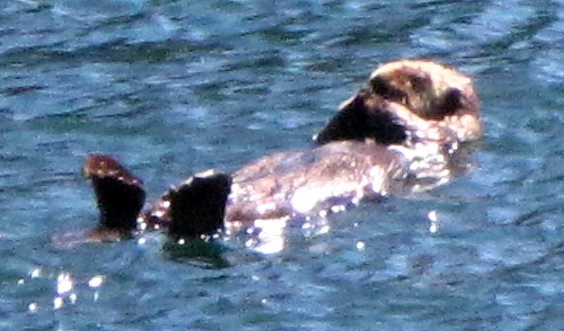 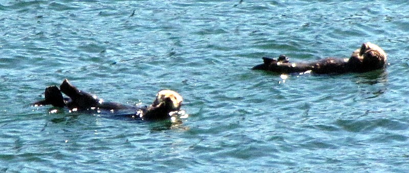 |
|
|
|
Post by dofd on Apr 29, 2011 20:46:40 GMT -8
Putting it here since this might be the same run. RFP 02-06-2011 Rte 53 Gold River Passenger & Freight Marine Transportation This RFP identifies an opportunity for the successful Proponent to provide passenger and freight marine transportation services between Gold River and Tahsis/Esperanza and Gold River and Kyuquot, including all way ports as required. This service is known to BC Ferries as Route 53 “Gold River”. These services include, but are not limited to: vessel provision, operation and maintenance for both passenger and freight service; terminal facilities access, operation and maintenance, as applicable; crew provision; and ticketing (the “Project”). Key Dates Published: March 2, 2011 Closing Date: April 15, 2011 Closing Time: 2:00 pm Primary Contact Leo Mol 12800 Rice Mill Road Richmond, BC V6W 1A1 Phone: 604-204-2220 Fax: 604-277-0483 leo.mol@bcferries.com www.bcferries.com/bcf-apps/business_opportunities/index.php?action=show&comp_id=310 |
|
|
|
Post by Low Light Mike on Apr 29, 2011 20:57:33 GMT -8
Putting it here since this might be the same run. RFP 02-06-2011 Rte 53 Gold River Passenger & Freight Marine Transportation That most definitely is the same run. Similar RFPs were done recently for the Lady Rose Marine Services run (the MV Frances Barkley), and the Centurion ferry run to Lasquiti. Also for water-taxi runs to Digby Island and to Alert Bay. |
|
|
|
Post by dofd on Apr 29, 2011 22:05:44 GMT -8
Putting it here since this might be the same run. RFP 02-06-2011 Rte 53 Gold River Passenger & Freight Marine Transportation That most definitely is the same run. Similar RFPs were done recently for the Lady Rose Marine Services run (the MV Frances Barkley), and the Centurion ferry run to Lasquiti. Also for water-taxi runs to Digby Island and to Alert Bay. How often would these contracts come up? |
|
|
|
Post by Low Light Mike on Apr 29, 2011 22:30:28 GMT -8
How often would these contracts come up? My guess is every 5 years. |
|
|
|
Post by Dane on Sept 1, 2012 16:05:28 GMT -8
Just under a month ago I read The Uchuck Years, a great book by author and more importantly former employee/part owner David Young. It was such a fantastic read that I completed it easily in two days. The book brings you through the author's entire life, more-or-less, as he grew up with the company through its technical and geographical evolutions. It brings to life a time I wish I had experienced, and shares the type of story I hope continues to be well documented. For the marine transportation fan there is considerable detail on the vessels, route choice, staffing, and various other technical aspects of the operation. For myself West Coast marine transport was something I was (and continue to be) fairly ignorant of. Robert Turner's Princesses was the only reading I had done on it, and that was brief, and of course the forums. This added to the 'excitement' of the book, as I can say I learned a lot and it really created that desire to see and experience new things. Such a great feeling to take away from a book. Riding the Uchuck III has surely be added to the agenda of my next trip home. www.harbourpublishing.com/title/TheUchuckYears |
|
|
|
Post by Low Light Mike on Sept 1, 2012 16:12:20 GMT -8
Just under a month ago I read The Uchuck Years, a great book by author and more importantly former employee/part owner David Young. It was such a fantastic read that I completed it easily in two days. Thanks for the review. That book is sitting on my kitchen table right now. My mom read it last week, and it's my turn next. When you do your Uchuck trip, there are a few choices, especially in summer. - A tourist orientated trip to Friendly Cove, including a visit to the church there (which houses 1st Nations carvings and has some other great history). - A freight orientated trip around Nootka Sound. Of course, they also have their overnight trip out to Kyuquot. I've only done the Friendly Cove day trip, and the ship alone is worth it. |
|
|
|
Post by Low Light Mike on Oct 30, 2012 9:51:18 GMT -8
A compilation video of various clips from my August 2010 trip on the MV Uchuck-III
2 years later, I still think that the covered promenade deck is "lovely."
|
|
|
|
Post by Low Light Mike on Oct 31, 2012 20:27:54 GMT -8
If you take the MV Uchuck-III to Friendly Cove, you can see this beach on the west-side of Nootka Island.
|
|
|
|
Post by Low Light Mike on Dec 2, 2012 20:43:16 GMT -8
I am a third of the way through the Uchuck Years book, and I concur with Neil and Dane that it's a very good read.
I didn't realize that the Uchuck-II was the former West Vancouver No.6 ferry.
I really like the look of her as the Uchuck-II, and I've found a new destination for when I finally build my time-machine. ;D
|
|
|
|
Post by Low Light Mike on Jul 22, 2013 14:57:32 GMT -8
I was on the MV Uchuck III on July 20, 2013, for a return trip between Gold River and Friendly Cove. Straight on view from the beach at Friendly Cove   ----------------- Lovely telegraph from the Princess Victoria, now on the Uchuck III. 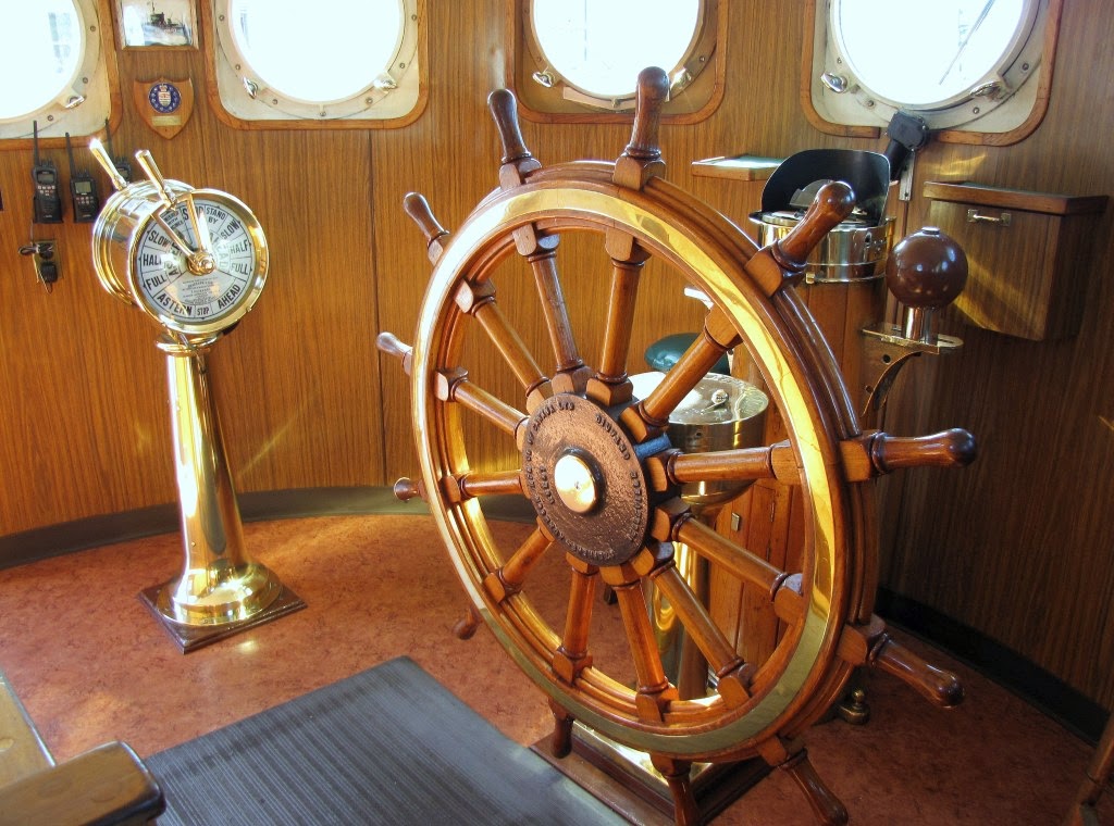 ------------------- View from Friendly Cove of the Uchuck III. 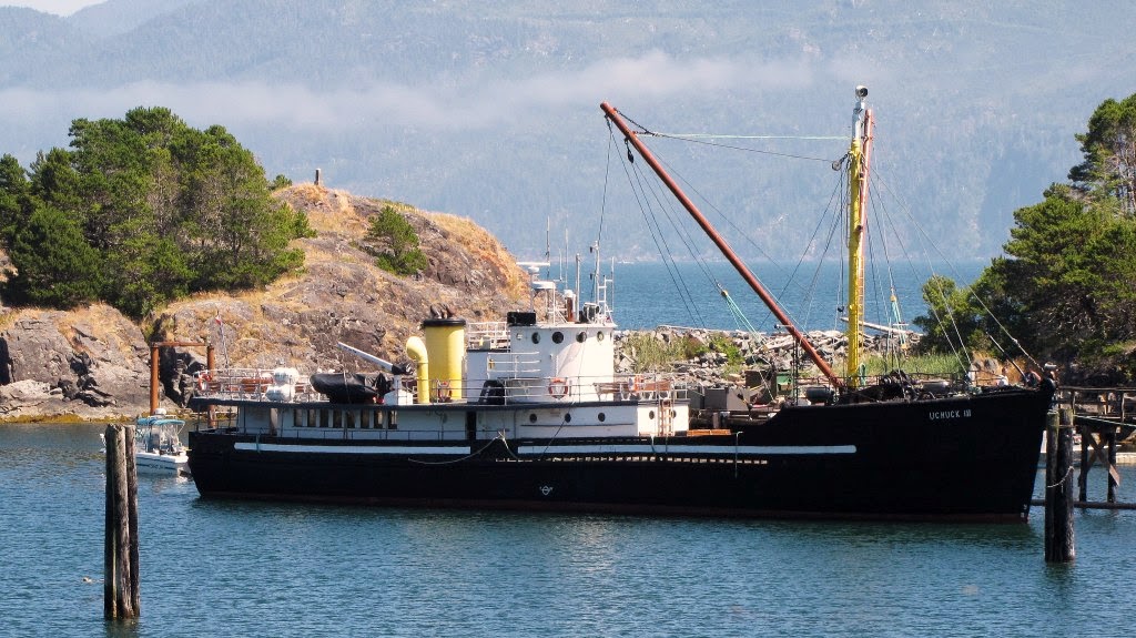 |
|
|
|
Post by Low Light Mike on Jul 27, 2013 12:53:52 GMT -8
YouTube video compilation, of some footage of the ship from my July 20, 2013 trip on the Uchuck III:
- bridge equipment
- loading some freight
- series of stills from the beach at Friendly Cove.
---------------
later to come will be a "not-quite-full-trip" sped-up video.
|
|
|
|
Post by Starsteward on Jul 28, 2013 11:25:08 GMT -8
Lovely to see the telegraph from the old CPR ship being used and itsn't that big wooden ship's wheel just scream, Old Boat!!!  Love it! Great update story and pictures Mr. Flugel Horn. |
|
|
|
Post by Low Light Mike on Jul 28, 2013 22:33:03 GMT -8
July 20, 2013 return trip on the MV Uchuck III from Gold River to Friendly Cove: This is a typical trip done on Wednesdays and Saturdays during the June-September season. Do it, if you're able.
- I shot video for almost the entire voyage, with the intent of doing this kind of sped-up video. Most is sped-up 8 or 10 times, but the important stuff, including bridge announcements, are shown in real speed.
I hope that you enjoy this.
|
|
|
|
Post by Low Light Mike on Aug 26, 2013 19:01:45 GMT -8
3 years after the above photo, here is another one from me, from approximately the same angle, at Friendly Cove. - Can you spot the difference in the ship? 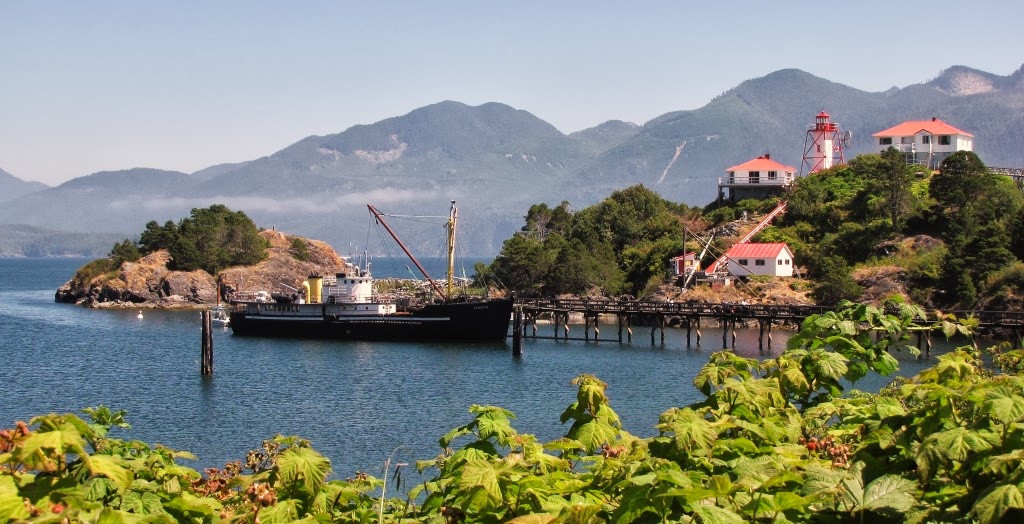 ------------------- A few more photos from my July 20, 2013 trip from Gold River to Friendly Cove (Nootka Island): Approaching Friendly Cove, where I captured the Nootka lighthouse in my frame.  Approaching Gold River wharf. - we berth on the left side, stern towards the shore, with the wharf along our port-side. 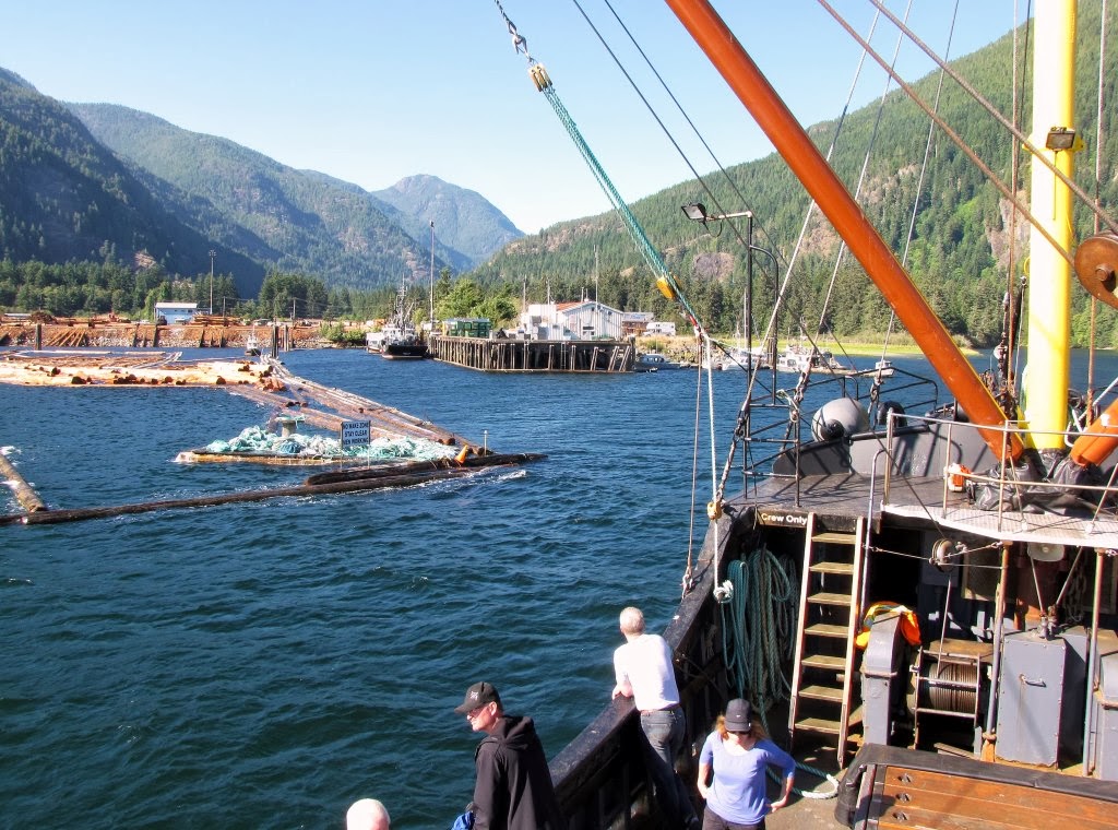 A couple of views from Friendly Cove: - showing her forward quarter 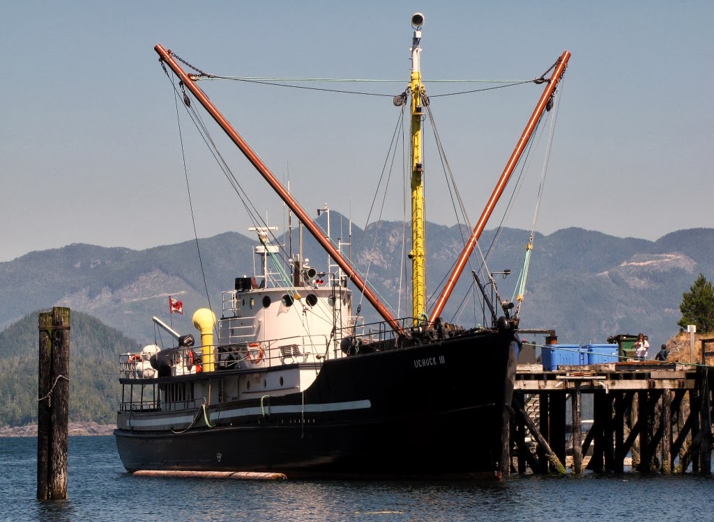 View from the lighthouse 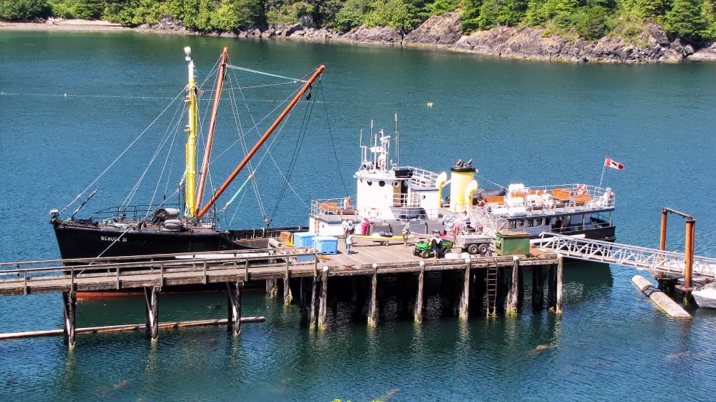 ------------------- Interesting anecdote about my trip: - There was a film crew on board (a guy operating a professional video camera and a guy giving directions). Mrs. Horn and I observed them during the round-trip and noted that they were filming this one elderly lady in a variety of situations on board (such as gazing out at the ocean, talking with people, etc). We thought that it was a crew doing a promo film for the Uchuck ship. - After disembarking, we happened to be walking next to the "film director" guy as we walked down the road to our vehicle. So I asked him what they were doing. - They were from Knowledge Network TV station (now known as "K:") and they were doing a pledge-drive promo film featuring one of their prolific philanthropists who is also part of their planned-giving program. So they rewarded her with a trip and used the occasion to highlight her philanthropy in a short vignette which they will play during an upcoming pledge-drive this autumn. - We told the guy that we were "Parners in Knowledge" and he corrected my terminology telling me what my wife already knew, that we are now called "Knowledge Partners" (KPs) You meet interesting people when you travel... |
|
SolDuc
Voyager   West Coast Cyclist
SolDuc and SOBC - Photo by Scott
Posts: 2,055
|
Post by SolDuc on Aug 26, 2013 21:04:43 GMT -8
3 years after the above photo, here is another one from me, from approximately the same angle, at Friendly Cove. - Can you spot the difference in the ship?  Yes. The big pipes on either side of the funnel have switched direction. The one on starboard was facing forward and is now facing aft and vice-versa for the other one. |
|