Post by Mill Bay on Jul 22, 2008 22:38:13 GMT -8
Coastalize this!
Just a little article posted in relation to the ongoing debate over how to pronounce various coastal names.
Tsawwassen
By Amanda Growe
Publish Date: September 20, 2007
Tsawwassen's view remains unclouded.
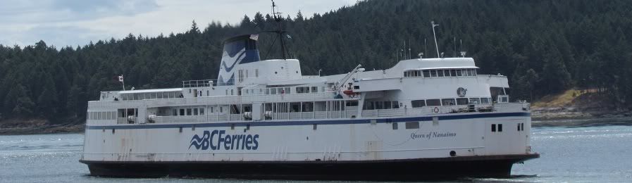
So you've been to the ferry terminal. Think you've been to Tsawwassen? Think again.
The one thing most people know about Tsawwassen is that there's a trick to its name. Ferry announcements use "suh-woss-en", and many say that's also how people from the Tsawwassen First Nation say it. But if you venture to Tsawwassen, you may be surprised to discover that locals pronounce the T, as in "tuh-woss-en". Further emphasizing the T, many of the younger residents refer to it as T-town.
Tsawwassen, a community of about 20,000, may be one of the most ignored parts of the Lower Mainland, as hundreds of people each day rush past it on their way to the ferry terminal, and then on to the Gulf Islands or Vancouver Island. Located about a 45-minute drive south of Vancouver, Tsawwassen is part of the municipality of Delta, along with North Delta and Ladner.
If you were to head south from Vancouver on a clear day, across the Oak Street Bridge, through Richmond on Highway 99, through the Massey Tunnel, and then onto Highway 17 heading toward the ferry, you might be fortunate enough to see Mount Baker, snowcapped and Mount Fuji–like, hovering not far away in Washington state. After a bend in the road, you come to the intersection of Highway 17 and 56th Street. Letting the ferry traffic fly past, you turn into Tsawwassen.
You may notice a certain emphasis on weather in the town–good weather, in particular. The sign on the highway indicating the turnoff features a sun. In places, Tsawwassen's main street, 56th Street, has palm trees growing in the median. The town's yearly celebration is called the Sun Festival. Promotional materials claim that Tsawwassen gets three days of sunshine for every one in Vancouver.
A low blow was dealt in 2004 when an article about Point Roberts in National Geographic called Tsawwassen a "strip-mall hell", but that doesn't hold true today. As a community where a large number of residents commute to work in Richmond and Vancouver, and many go elsewhere to shop, sustaining business is a challenge. Although 56th Street may not appear to be that different from the main streets of other areas of the Lower Mainland, with branches of a number of chain stores, it has many one-off shops and restaurants worth exploring. If you're looking for a book to take to the beach (see below), Albany Books (1240 56th Street) is pleasant and full of well-chosen volumes. After a day of exploring, why not have dinner at a Tsawwassen original? Local favourites include Alfa (1097 56th Street) and Mario's Kitchen (1105 56th Street).
Settlers came to the area in the latter part of the 1800s, but First Nations groups have been there for thousands of years. You may cherish childhood memories of visiting Splashdown Park, but you likely didn't know that it's built on land leased from the Tsawwassen First Nation. The group also leases out land on which an enclave of upscale homes has been built. The Tsawwassen made the news in July when members approved the first urban treaty in Canada. The treaty involves land–particularly in the Agricultural Land Reserve–and is controversial.
Use of land has long been a flash point in Tsawwassen. Although less of it is used for agriculture than in neighbouring Ladner, development proposals can be contentious, such as the Southlands proposal that was defeated decades ago. The Gateway Program is also causing concern since it involves an expansion of the Roberts Bank port, sometimes called Deltaport or Superport, and an increase in traffic through the region.
Until 1959, Tsawwassen was accessible only by water. A ferry ran across the Fraser River until the George Massey Tunnel opened that year. Before the tunnel, many used it as a place to vacation in the summer, but the tunnel brought in year-round residents. Tsawwassen also became a major gateway to the islands when the BC Ferries terminal opened in 1960. But rather than just a jumping-off point, Tsawwassen can be a destination.
© 2008 Vancouver Free Press
www.straight.com/article-110581/tsawwassen
Just a little article posted in relation to the ongoing debate over how to pronounce various coastal names.
Tsawwassen
By Amanda Growe
Publish Date: September 20, 2007
Tsawwassen's view remains unclouded.
So you've been to the ferry terminal. Think you've been to Tsawwassen? Think again.
The one thing most people know about Tsawwassen is that there's a trick to its name. Ferry announcements use "suh-woss-en", and many say that's also how people from the Tsawwassen First Nation say it. But if you venture to Tsawwassen, you may be surprised to discover that locals pronounce the T, as in "tuh-woss-en". Further emphasizing the T, many of the younger residents refer to it as T-town.
Tsawwassen, a community of about 20,000, may be one of the most ignored parts of the Lower Mainland, as hundreds of people each day rush past it on their way to the ferry terminal, and then on to the Gulf Islands or Vancouver Island. Located about a 45-minute drive south of Vancouver, Tsawwassen is part of the municipality of Delta, along with North Delta and Ladner.
If you were to head south from Vancouver on a clear day, across the Oak Street Bridge, through Richmond on Highway 99, through the Massey Tunnel, and then onto Highway 17 heading toward the ferry, you might be fortunate enough to see Mount Baker, snowcapped and Mount Fuji–like, hovering not far away in Washington state. After a bend in the road, you come to the intersection of Highway 17 and 56th Street. Letting the ferry traffic fly past, you turn into Tsawwassen.
You may notice a certain emphasis on weather in the town–good weather, in particular. The sign on the highway indicating the turnoff features a sun. In places, Tsawwassen's main street, 56th Street, has palm trees growing in the median. The town's yearly celebration is called the Sun Festival. Promotional materials claim that Tsawwassen gets three days of sunshine for every one in Vancouver.
A low blow was dealt in 2004 when an article about Point Roberts in National Geographic called Tsawwassen a "strip-mall hell", but that doesn't hold true today. As a community where a large number of residents commute to work in Richmond and Vancouver, and many go elsewhere to shop, sustaining business is a challenge. Although 56th Street may not appear to be that different from the main streets of other areas of the Lower Mainland, with branches of a number of chain stores, it has many one-off shops and restaurants worth exploring. If you're looking for a book to take to the beach (see below), Albany Books (1240 56th Street) is pleasant and full of well-chosen volumes. After a day of exploring, why not have dinner at a Tsawwassen original? Local favourites include Alfa (1097 56th Street) and Mario's Kitchen (1105 56th Street).
Settlers came to the area in the latter part of the 1800s, but First Nations groups have been there for thousands of years. You may cherish childhood memories of visiting Splashdown Park, but you likely didn't know that it's built on land leased from the Tsawwassen First Nation. The group also leases out land on which an enclave of upscale homes has been built. The Tsawwassen made the news in July when members approved the first urban treaty in Canada. The treaty involves land–particularly in the Agricultural Land Reserve–and is controversial.
Use of land has long been a flash point in Tsawwassen. Although less of it is used for agriculture than in neighbouring Ladner, development proposals can be contentious, such as the Southlands proposal that was defeated decades ago. The Gateway Program is also causing concern since it involves an expansion of the Roberts Bank port, sometimes called Deltaport or Superport, and an increase in traffic through the region.
Until 1959, Tsawwassen was accessible only by water. A ferry ran across the Fraser River until the George Massey Tunnel opened that year. Before the tunnel, many used it as a place to vacation in the summer, but the tunnel brought in year-round residents. Tsawwassen also became a major gateway to the islands when the BC Ferries terminal opened in 1960. But rather than just a jumping-off point, Tsawwassen can be a destination.
© 2008 Vancouver Free Press
www.straight.com/article-110581/tsawwassen