|
|
Post by Canucks on Aug 10, 2008 19:25:01 GMT -8
I just got back from vacation through the Rockies and thought I'd share some of the pictures I took there. There is only one word to describe them: SPECTACULAR. If you think that the pictures are neat they are not even close to the real experience but give a good sense of what it is like. If anyone else has pictures from that area I'd be thrilled to see them too.
|
|
|
|
Post by Low Light Mike on Aug 10, 2008 19:47:33 GMT -8
I look forward to seeing your pictures.
I also recently returned from a Rocky Mountain road trip. Here was my route:
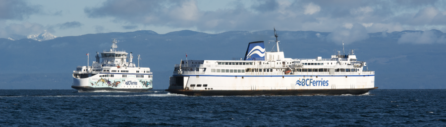
- Ferry Route-30 from Nanaimo to Tsawwassen.
- Tsawwassen to Hope, via Zero-Avenue and Highway 1.
- Hope to Merritt via hwy 5 Coquihalla
- Merritt to Peachland via hwy 97c (including a very long down-hill from Penask Summit to Peachland, or so it seemed....)
- Peachland to Vernon on hwy 97 (including the WR Bennett bridge). (ps: I hate Kelowna traffic, with that lack of a bypass through town).
- Vernon to Nakusp via Hwy 6 (including Needles ferry)
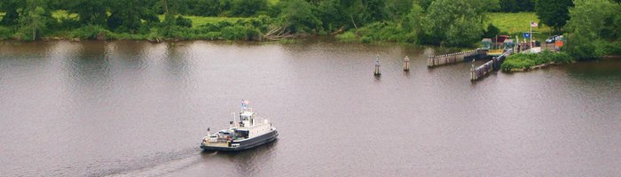
- Nakusp to Revelstoke via Hwy 23 (including Galena/Shelter ferry. I said "Gimme Shelter", and that's the smaller ferry that I got to ride on.....)
- Revelstoke to Lake Louise on Hwy 1. (I loved the stop at Rogers Pass visitor center, and we spent a day at Golden too).
- Lake Louise to Banff on Bow Valley Parkway hwy 1A (including Morant's Curve and views of Castle Mountain).
- Hwy 1 from Banff to Calgary. (then 3 nights in Cow Town).
- Hwy 1 from Calgary to Castle Junction.
- Hwy 1A from Castle Junction to Lake Louise (to see Morant's Curve 1 more time).
- Hwy 93 Icefields Parkway to Jasper
- Hwy 16 from Jasper to Tete Jaune Cache
- Hwy 5 from Tete Jaune Cache to Little Fort
- Across Little Fort ferry, and drive on back road from Little Fort to Barierre (on east side of N.Thompson river).
- Hwy 5 from Barierre to Kamloops
- Hwy 1 from Kamloops to Cache Creek, and down to Hope. (including a stop to photograph the old Alexandria bridge).
- Hwy 7 from Hope to Mission
- Hwy 11 from Mission to Abbotsford
- Zero avenue, hwy 99 and hwy 17 from Abbotsford to Tsawwassen.
- BC Ferries Route-9 (yes, it does exist) to take Q-Nanaimo milk run through the gulf islands, disembarking at Long Harbour.
- Drive across Salt Spring, and then take Vesuvius- Crofton ferry home to Vancouver Island..................
2,830 km, all enjoyable. I'll post pics, once my scanner starts to co-operate.
|
|
|
|
Post by Canucks on Aug 10, 2008 20:13:13 GMT -8
Sounds like a great trip Flugal! My trip went like this: -Flight on Westjet from Abbotsford to Calgary. -3 nights in Calgary. -Drive through the parkway on Hwy 1A to see Morants curve as well.  -Drive through the park on hwy 93. -Stop in Jasper for a few pictures. -Carry on Hwy 16 to Hinton for the night. -Drive on Hwy 16 to Edmonton for three nights. -Drive down Hwy 2 back to Calgary and hop on a flight back to Abbotsford. Here are the pictures: Peyto Lake: 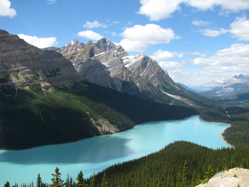  A mountain as seen from the road. I though it was neat with the trees and then mountain with nothing on it. 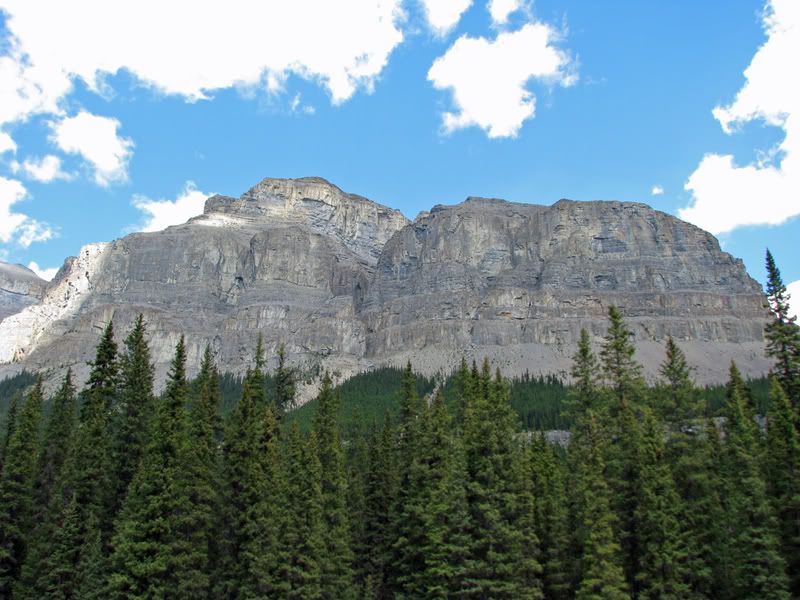 Columbia Ice field. I believe this is the Athabasca glacier but I'm not sure. 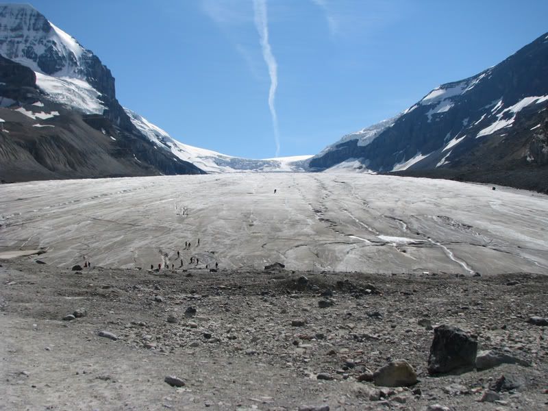 Ice scraped rocks. 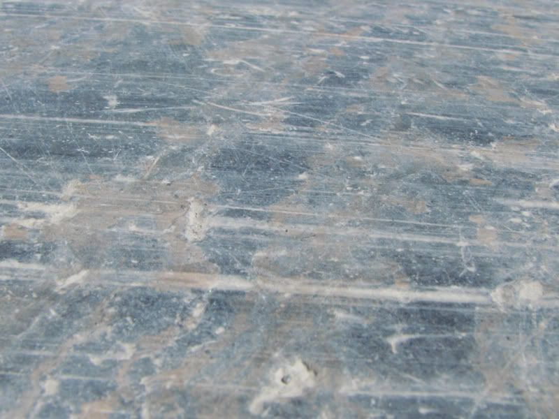 Morant's curve minus a train.   Some pictures from the parkway. The mountains stick up from everywhere. You can see about 4km ahead. 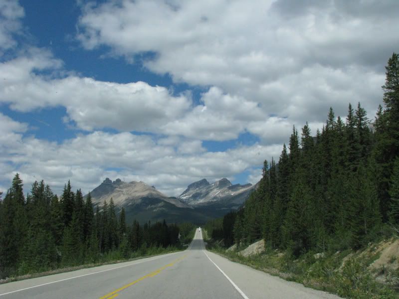 I think this is the continental divide but I'm not sure. 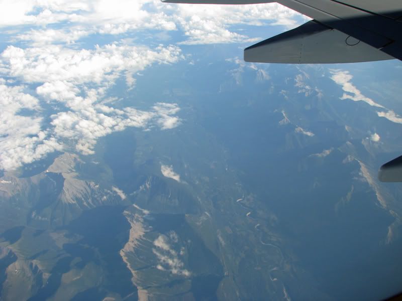 Finally Athabasca falls. 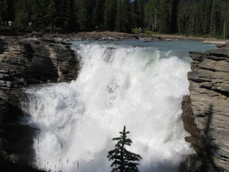 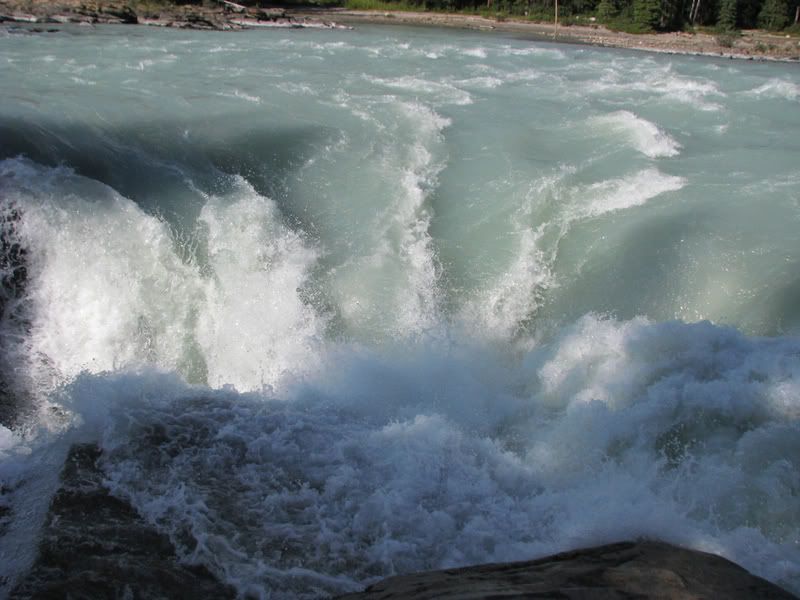 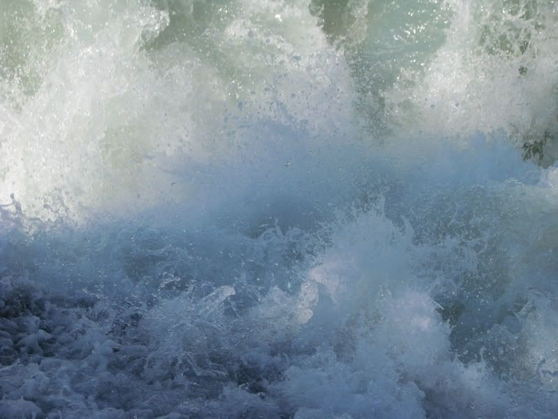 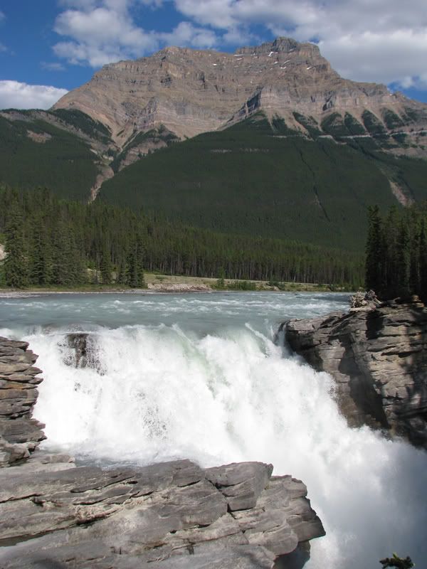 See the rainbow? 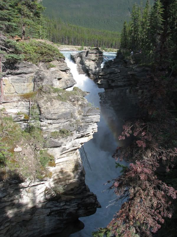 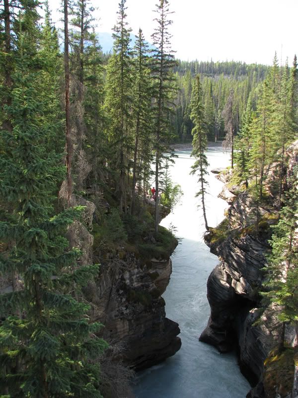 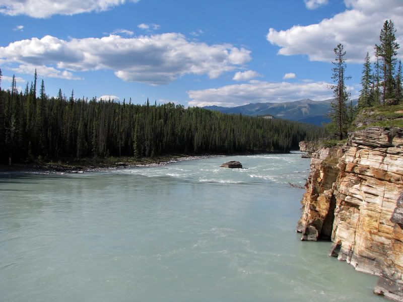 Enjoy! |
|
|
|
Post by Low Light Mike on Aug 10, 2008 20:21:34 GMT -8
When I was at Peyto Lake, some American tourists remarked how the right-side of the lake looked a bit like Texas.
You can see that in your 2 Peyto Lake pics, in the above post.
All your other pics are very familiar to me, with the exception of Athabasca Falls, which we didn't stop at.
Yes, the glacier that you can walk on, at Columbia Icefields centre, is the rapidly-retreating Athabasca Glacier.
nice pics.
|
|
|
|
Post by Balfour on Aug 10, 2008 20:40:44 GMT -8
Awesome photos of such a gorgeous part of our country.
I've never been up the Icefields Parkway or to the Columbia Icefied, which is surprising considering I go through that region once every year.
Thanks for sharing those
|
|
|
|
Post by Canucks on Aug 10, 2008 21:03:32 GMT -8
When I was at Peyto Lake, some American tourists remarked how the right-side of the lake looked a bit like Texas. You can see that in your 2 Peyto Lake pics, in the above post. All your other pics are very familiar to me, with the exception of Athabasca Falls, which we didn't stop at. Yes, the glacier that you can walk on, at Columbia Icefields centre, is the rapidly-retreating Athabasca Glacier. nice pics. I always heard that the lake looks like a wolf's head but I supose it looks a bit like Texas. That's too bad you couldn't see the falls, personally I think it is the neatest because you can get so close to it to see how the water has carved out the land. I'm not sure whether they had barriers up at the icefield but when I was there they had it blocked off because of a lake that has developed quite close to the edge. Everyone just disobeyed this and walked on it anyways. I am currently piecing some panoramas together and hope to have them up soon. |
|
|
|
Post by Canucks on Aug 10, 2008 21:42:14 GMT -8
Okay here are the panoramas of some areas through the Rockies. If you want to view a larger image just click on the picture and it will open a link to a bigger one. I had to keep the size below 1950 px wide so it would be under 1 mb but they still look half decent considering a few were 700 px wide. First is Morant's curve. 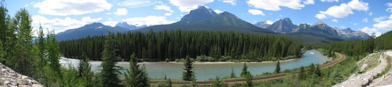 Next is the icefield. 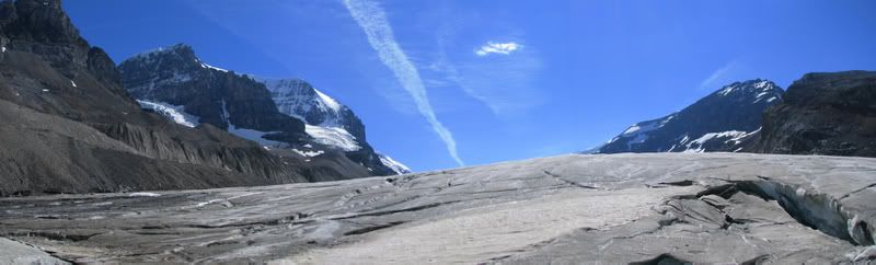 Lastly is Peyto Lake. 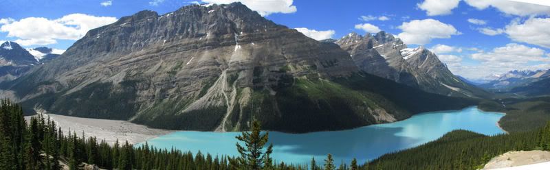 |
|
Koastal Karl
Voyager  Been on every BC Ferry now!!!!!
Posts: 7,747
|
Post by Koastal Karl on Aug 11, 2008 11:54:52 GMT -8
wow that lake is beautiful with the color of the water. I am leaving on Sunday on our big 3 week trip which eventually will take us through the Rockies and Icefields. I have been through there once before but we were rushed so this time should be better seeing we have lots of time now.
|
|
|
|
Post by WettCoast on Aug 11, 2008 16:08:20 GMT -8
I too, have just been traveling in the Blue Canadian Rockies... Here is a panorama from Top of the World Provincial Park near Invemere, BC  I am currently traveling in the West Kootenay. |
|
|
|
Post by Low Light Mike on Aug 12, 2008 19:42:56 GMT -8
Peyto Lake: And here's the flats part of the same lake area, on the left-side (south).  |
|
|
|
Post by Northern Exploration on Aug 12, 2008 20:01:22 GMT -8
Peyto, Moraine and Maligne Lakes are all stunning lakes. No picture seems to truly capture that glacial blue of the water. If anyone hasn't seen them I highly recommend it. Lake Louise is the most seen and great to see but doesn't match the others in my opinion. Thanks for all the mountain pics guys.
|
|
|
|
Post by Low Light Mike on Aug 12, 2008 20:23:05 GMT -8
|
|
|
|
Post by Low Light Mike on Aug 12, 2008 20:48:57 GMT -8
Fleet of "water taxi's" at Maligne Lake, in Jasper park.  ( Maligne Link Ferries......watch the water) |
|
D'Elete BC in NJ
Voyager
Dispensing gallons of useless information daily...
Posts: 1,671
|
Post by D'Elete BC in NJ on Aug 13, 2008 6:09:39 GMT -8
Here's a grouse / partridge / ptarmigan that we saw on the mountain top. I like how the bird's colours blend into the vegetation/rocks.   Having almost stepped on a ptarmigan "hiding" in the middle of the trail while hiking on Baker, I really appreciate these two photos. ;D |
|
|
|
Post by WettCoast on Aug 13, 2008 7:20:42 GMT -8
Here is a panorama taken from Parker's Ridge in the northern part of Banff National Park. 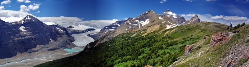 Just to the left of centre is the Saskatchewan Glacier, one of the outlet glaciers from the Columbia Icefield. |
|
|
|
Post by Scott on Aug 14, 2008 17:14:38 GMT -8
We were in the Rockies for a few days in mid-May. I wasn't sure whether there would be too much snow up Whistlers Mountain (Jasper Tramway) at that time, so we didn't go that far. I've done it before and the view truly is spectacular. We opted to stay in one place for a few days and stayed in a nice place just outside of Mt. Robson Provincial Park. We only got one glimpse of the whole mountain in the two days;) I'd definitely go back.. and stay a little longer to see some more of the sights.
|
|
Deleted
Deleted Member
Posts: 0
|
Post by Deleted on Aug 14, 2008 17:50:30 GMT -8
We drove through the Rockies via Hwy 1 on our route to the prairies. On our way back we went via Hwy 16. We saw lots of animals around Banff. Very beautiful scenery. We were very lucky that we went by Valemount on Thursday, before the road was closed. On the Friday or Saturday of that week there was a bad accident, and people had to detour, through the ice fields, in order to reach BC. My brother-in-law told me that it took him 7 hours longer to travel, because of the detour. With the gas crisis in Alberta and some parts of the interior of BC, it might be difficult for some people who were traveling to get home. For those of you who don't know, The Petro Can Refinery in Edmonton has a problem and has been shut down for awhile.
|
|
|
|
Post by Northern Exploration on Aug 15, 2008 8:08:51 GMT -8
It has been a few years since I have been to the Rockies. I took my Grandmother from Edmonton to Jasper, down the Ice Fields Parkway, to Banff and then Calgary and then back up to Edmonton. It was for her birthday in May and Mother's Day combined. Her birthday dinner was at the Mount Edith Cavell Room of the Jasper Park Lodge, looking at Mount Edith Cavell - my grandmothers first name is Edith. The cabin we stayed at is just south of Jasper on the Athabasca River. Reasonable because it had two bedrooms and it is still off season in May. Quite chilly in the mornings though. When my grandmother wanted to rest she was very happy to stay at the cabins and feed the chipmonks, Whiskey Jacks and watch the elk on the property. I would then go on short hikes or do things she didn't want to do. The Tramway was one thing she wanted to do. We had Pica's running all around us only 50 metres or so along the trail above the Tramway.
That early you see a lot of wildlife that you don't see later in the year. Saw a Moose and a grizzly along the Ice Fields Parkway. Three coyotes, porcupines, and then the usual suspects. She still talks about the trip and is wanting me to come out and do it again this fall. I am a little hesitant beause I think the trip may be past something she can handle now but we will see.
|
|
|
|
Post by WettCoast on Aug 17, 2008 22:14:23 GMT -8
We did some short hikes around Mt. Edith Cavell while in Jasper two weeks ago. Here is a view of the mountain taken from the start of the Astoria Valley Trail with Cavell Lake in the foreground. 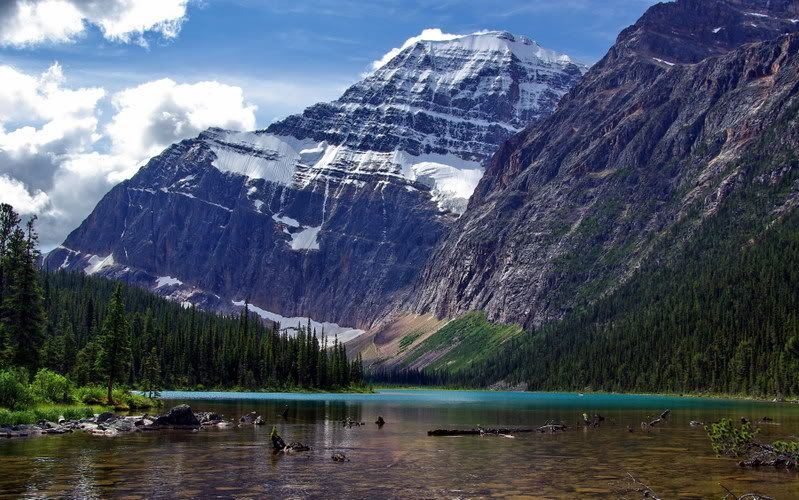 JST photo © JST photo © BTW, the Astoria Valley leads into one of the Canadian Rockies most spectacular backpacking areas, the Tonquin Valley. |
|
|
|
Post by Balfour on Aug 18, 2008 16:26:42 GMT -8
Wow what a gorgeous spot!
Thanks for sharing that.
|
|