FNS
Voyager  The Empire Builder train of yesteryear in HO scale
Posts: 4,948
|
Post by FNS on Feb 4, 2009 8:00:47 GMT -8
By suggestion by a forum mate, I am placing most of my Flight Sim trip photos on this new thread and migrating some currently placed on other threads. I have created this thread not just for me, but for anyone who wish to share their Flight Sim experiences with long and short presentations.
Yes, there is a thread in this Lounge: "Airline Photos and Videos". However, this should be reserved for the real things people actually see, buy tickets for, and ride.
The image collection I'll be posting on this thread will be long and short. There is so much I want to share. I think there are those out there who wish to do the same.
So, here we go!
|
|
FNS
Voyager
The Empire Builder train of yesteryear in HO scale
Posts: 4,948
|
Post by FNS on Feb 4, 2009 8:02:37 GMT -8
Originally posted on the NE Delivery thread on Jan 24, 2009, 6:22
Mr. Keenleyside has suggested to me that I do a flight on my MS Flight Sim X from the Northwest to Germany before embarking on the trip from there and flying over the MV NORTHERN EXPEDITION's routing from FSG to British Columbia. This is a great idea. So, I did the first step yesterday. Instead of flying directly from CYVR aboard a German Airbus airliner, we begin from KPAE, the birthplace of the Boeing 747, which is in my back yard. 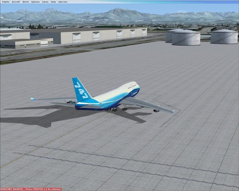 My chosen plane is a Boeing 744 in Boeing's house colours. We are at Paine Field. The Cascades are in the background. The largest buildings (by volume) are here. The 767 was next to be added to the production line. Then, the 777. Next up is the 787.  Now lined up on Runway 16R. We have been cleared for takeoff. By the way, I won't be charging you front window fees! ;D  We are off from KPAE.  That's Seattle from our copilot's seat.  Instead of going direct to our first stop at CYYJ, we will do a bit of flight seeing and to show off MegaSceneryEarth's new photo real scenery. There are ten tiles so far here in Washington State. That's Mount Rainier to our port.  This is beyond unbelievable! The photo real scenery speaks for itself. I have never seen Mount Saint Helens this incredibly accurate in any flight sim. She blew her top off on May 18, 1980. This was days from my high school graduation and the year the PRINCESS MARGUERITE took the year off. The QUEEN OF PRINCE RUPERT stood in with a Boeing jetfoil on the Seattle-Victoria run. The new ISSAQUAH entered service on the Vashon Island run that summer and ended the year on December 29 celebrating her first birthday by bashing into Fauntleroy, sending Vashon traffic through downtown Seattle for a good number of days.   Equally stunning is Mount Rainier. This is her south side. We fly north to Stevens Pass. 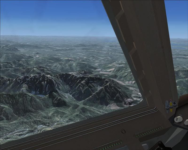 That's Mount Index and Mount Persis below. Yes, that's a small lake midway up Mount Index. From time to time, you'll see a small waterfall on her side.  We leave the photo real scenery behind. But, not before taking another look at the wealth of beauty of the Stevens Pass highway. My question for Mr. Brinkmann: How can you live in a flat area without seeing mountains?  We now make our decent with the San Juans ahead.  "Boeing 744, Runway 27 cleared to land". CYYJ is in view.  Here at Victoria International Airport (CYYJ). After the airstairs arrives, we'll pick up our lower Vancouver Island forum members.  We are off from CYYJ. We used Runway 09.  That's Active Pass off our port side.  Active Pass, Saanich Peninsula, Olympic Peninsula. Off our port side out the passengers window.  That's the "Bathtub Races Capital of the World". Departure Bay is in view, where all three Coastal Class ferries met Canadian Customs upon arrival from FSG. We are heading to our next stop at CYQQ (Comox).  In our study of the areas the NE will sail soon after her arrival from FSG, we have Texada Island in view.  Now making our decent. That's Quadra Island ahead along with the narrow passage leading up the Inside Passage.  We are doing a manual landing at CYQQ's Runway 12. Lots of turns.  Now at Comox awaiting airstairs. All aboard, our northern Vancouver Island members.  Runway 12 cleared for takeoff.  Texada Island and Powell River. CYVR is next.  Beautiful Howe Sound.  Burrard is ahead.  As well as Vancouver.  Our "Child of winter" moderator has been teaching skiing on that great Grouse Mountain.  At last, our first leg of our worldwide journey to see the areas the NE will sail from FSG is drawing to a close. CYVR Runway 26L cleared to land.  At the gate in Vancouver. We'll await for the rest of our forum members to board here for the trip to Germany. PHOTOS FROM THAT TRIP ARE NOW BELOW. |
|
FNS
Voyager
The Empire Builder train of yesteryear in HO scale
Posts: 4,948
|
Post by FNS on Feb 4, 2009 8:09:28 GMT -8
Originally posted on the NE Delivery thread on Jan 25, 2009, 3:43
Welcome aboard my flight sim trip from CYVR for EDDF. Fasten your seat belts, please!  Away from the gate at CYVR with Mount Constitution watching from the distance.  All lined up on Runway 26L. Nav systems are set to GPS Mode, which will guide us all the way to Germany. Auto throttle is set to 250IAS and an initial altitude setting of 15000. The controller has just informed me that "Boeing 744, Runway 26L cleared for takeoff". So, here we go! Germany, here we come!!  We are off! Orcas Island is ahead of us. We are turning to the port from west to east and have passed the 7000 foot mark.  CYVR, Vancouver, and Howe Sound are off my left shoulder.  Looking out the passenger window on the port side.  From the copilot's seat, we see Abbotsford and Mount Baker. The closer you get to mountains, the more detail they get on FSX.  Passing Harrison off the port side.  Sun is in golden mode. Mount Baker, Mount Rainier, Mount Adams, and Mount Saint Helens are off our starboard side.  We are nearing the 35000 cruising flight level. I have switched from IAS mode to Mach mode and have set it to our cruising speed of .85 Mach. The IAS decreases as we get higher. We are nearing Okanagan.  Okanagan. Penticton is by my pencil. We have reached our flight level of 35000 and you can now move about the cabin as I've turned off the seat belt sign.  Penticton. I've been there once in real life for a cousin's wedding. The night lighting is taking affect now.  Under the winglet is Kelowna. I stayed there when I went to the wedding mentioned above. Went to a hockey game in their old barn (before their new rink opened). Saw about a half dozen fisticuffs between the Kelowna and Spokane hot heads. Busy night for the zebras. Spokane won in overtime. Great game and a fun experience watching a hockey game in a beautiful little old barn.  Past Okanagan and we still could see Mount Rainier. The sun is now setting.  Looking at the aft end.  The forward end and Mount Baker in the background.  The sun is adding a bit of "gold paint" on my panels.  Daffy and Donald, are you listening? Duck Lake is off our starboard side. Elmer Fudd is down there waiting for his dinner. ;D  Now passing over the Cranbrook area. This is a favourite waypoint for scheduled airliners.  It's dark enough for me to have the panel lights on now.  I turn them off so you can barely see the Alberta Rockies.  Sun is completely down now. We are now in night mode in FSX.  Calgary can be barely seen in the distance off our port side. I place my camera down for a good while.  You'll need to brighten your screen a bit. We are nearing the Atlantic and will be crossing a little town of Nain.  We are coming up to Waypoint PRAWN. This is the last named waypoint until we get to the other side of the Atlantic. FLIGHT PHOTOS OF OUR TRIP TO GERMANY WILL CONTINUE... |
|
FNS
Voyager
The Empire Builder train of yesteryear in HO scale
Posts: 4,948
|
Post by FNS on Feb 4, 2009 8:20:46 GMT -8
Originally posted on the NE Delivery thread on Jan 25, 2009, 22:02
...WE CONTINUE THE PHOTO JOURNAL OF OUR JOURNEY TO GERMANY. 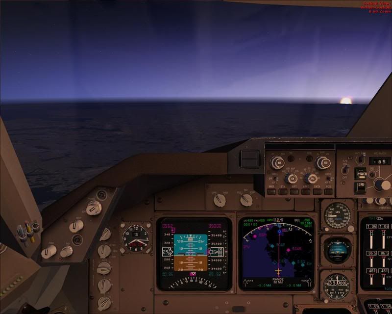 We are now reaching the east side of the Atlantic. Ireland is now in view. Sun is also rising. The sun will be in our eyes most of the way from here on. 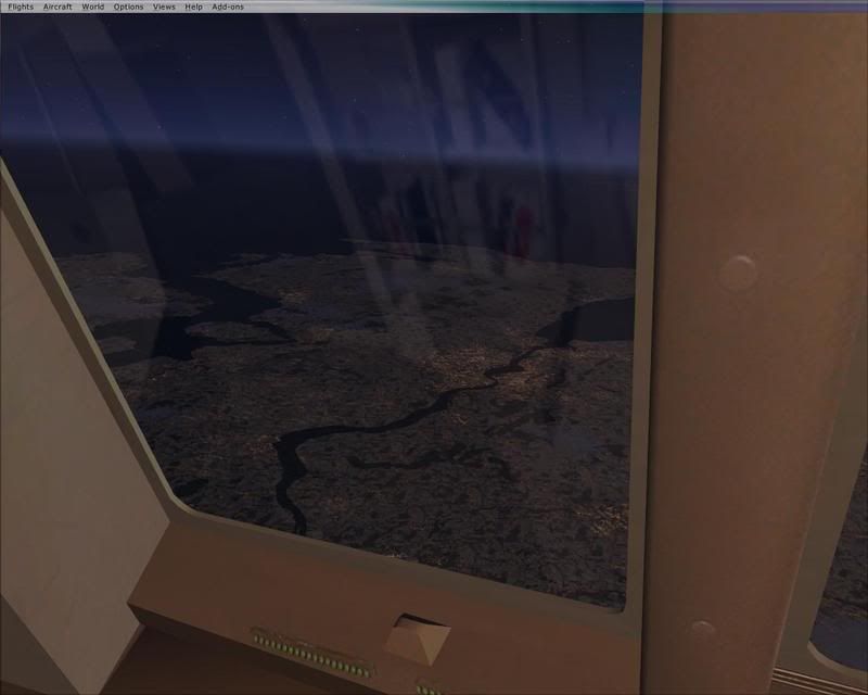 Lough Swilly and Londonderry.  That's Belfast approaching our port side.  Northeastern side of Ireland off our starboard side.  Mull of Galloway.  Now over the Isle of Man.  Britain is ahead.  City of Kingston-upon-Hull.  Now over the waterway the NORTHERN EXPEDITION will sail. To our starboard is the English Channel.  Here comes the Netherlands.  Coming up to Markermeer, looking east. The NE will skirt around those islands and will sail under us.  Markermeer.  Flevoland.  Now over Waypoint ARNEM. We are now preparing to make our decent to EDDF. I will now turn on the seat belt sign.  Now under 28000. End of the line is shown.  Now under 8000.  Now at final altitude and speed before intercepting the ILS glide slope.  That's the Rhine River.  Turning final. Runway 07R cleared for the approach.  "Boeing 744, Runway 07R cleared to land". The city of Frankfurt is in view.  Welcome to Frankfurt. Time to get your passports ready. This concludes this flight. We'll spend the night here, then hop over to Hamburg where we'll begin our trip to follow the courses the NORTHERN EXPEDITION sails after her "ferrywell" from Flensburg. END! |
|
FNS
Voyager
The Empire Builder train of yesteryear in HO scale
Posts: 4,948
|
Post by FNS on Feb 4, 2009 8:39:32 GMT -8
Originally posted on the NE Delivery thread on Feb 1, 2009, 6:27
While the NORTHERN EXPEDITION is heading out to the Atlantic, I decided to take out one of my float planes in FSX and do a flight over the Kiel Canal. I place my camera on one of the floats to get an unobstructed view. 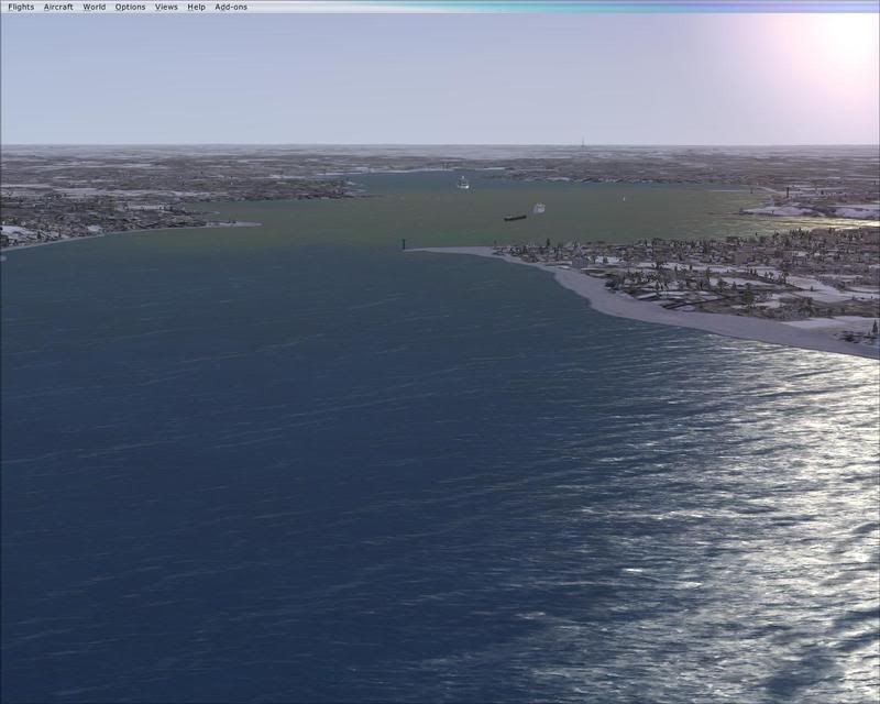 Here we are entering the channel leading to the east locks.  The locks are nearing sight.  Here we are at the locks. This is my re-creation of the locks using FS Design Studio. The scenery is from an add-on called German Landmarks by Aerosoft.  Another view of the locks. The NORTHERN EXPEDITION used the north side of the big locks.  We proceed down the Kiel Canal.  Wittensee is ahead.  Nearing Rendsburg.  Rendsburg.  The famous Rendsburg Bridge is now in sight.  I decided to land on the Canal. This may not be allowed in real time. But, I can do this on FSX. This is looking east.  The Rendsburg Bridge is supplied by German Landmarks. The ferry is my rendition in FSDS. It took me a good week to do this using available photos and the scale from Google Earth.  How the crew of the NORTHERN EXPEDITION would have seen this in daylight.  I take off again and turn around to see Rendsburg one more time.  One more fly over of Rendsburg.  We continue down the Canal.  Nearing the end of the Canal. The beginnings of the North Sea are now in view.  Brunsbuttel Locks are ahead. Another of my re-creations using FSDS. Most of the ships are placed by German Landmarks. Additional ships are placed in the locks using Flight One Software's Instant Scenery.  One more look at Brunsbuttel Locks. I will return this plane to where I boarded her and get ready to go back to Hamburg to get aboard my 744. The seat belt sign will have been turned on when I get there. Hope you enjoyed my tour of the Kiel Canal from a flight sim perspective. Flight level was at 1000. All in daylight and in Coastal Skier's favourite season (he is the "Child of winter"). This shows a close perspective of the NE's routing through the Canal. Aboard my 744, we'll be higher. |
|
FNS
Voyager
The Empire Builder train of yesteryear in HO scale
Posts: 4,948
|
Post by FNS on Feb 4, 2009 8:49:20 GMT -8
Originally posted on the NE Delivery thread on Feb 3, 2009, 11:01
Well, it's time for my Boeing 744 to leave German soil and start our aerial survey of the courses the MV NORTHERN EXPEDITION is taking from FSG on her big trip to British Columbia. The flight attendants have given me the passenger load manifest and all should be aboard at this time. We expect clear skies all the way and easterly winds for takeoff here at EDDH, so we will be using Runway 05 for takeoff. Welcome aboard, and please fasten your seat belts. 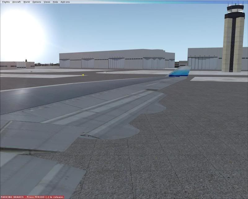 Pushback is now complete. Engines have been started. Flaps are set to ten for takeoff. “Boeing 744, taxi to Runway 05”.  “Boeing 744, Runway 05 cleared for takeoff”. Leaving 3000 feet, we’ll be turning starboard to join our track as seen on the multi function display. Auto throttle has been set to 250 knots.  We are off!  Part of Hamburg, Germany. 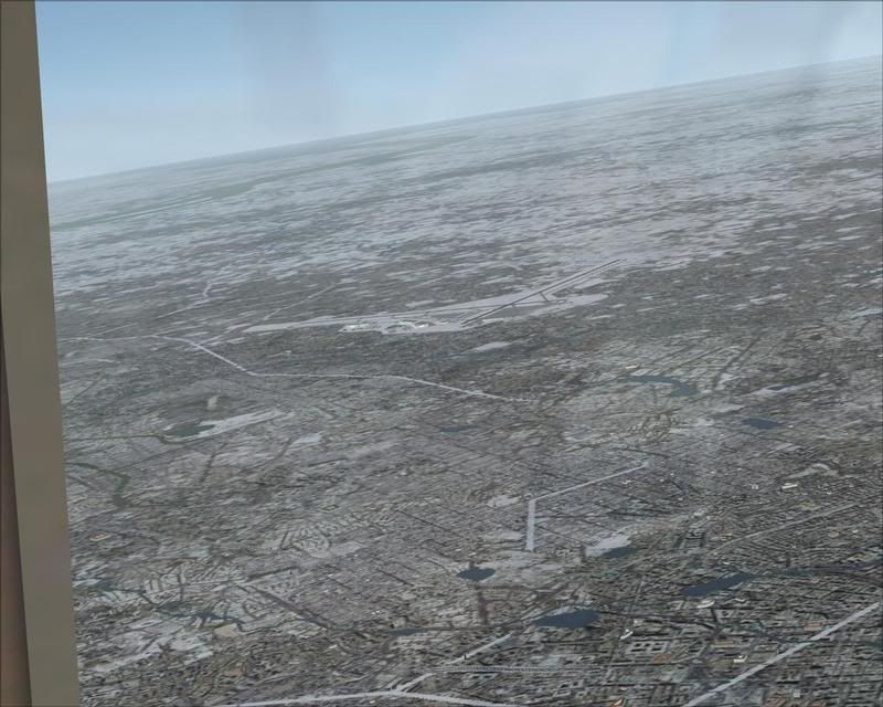 That’s EDDH off our starboard side.  GPS navigation is selected. I press the NAV button on the autopilot. We join the track that will take us all the way to Gran Canaria. At this time, the landing lights will be turned off, the flaps retracted, and the speed will be set to 310. We’ll be cruising at 15000 feet for awhile.  We are now at 15000. Instead of us going direct to FSG, we’ll do a bit of sightseeing of Germany. We’ll be flying over Leipzig and Berlin. Then, we’ll be back tracking to FSG as seen on the MFD.  Now over Leipzig. That’s a major train station as well as a sports stadium. Somewhere down there is the famous Thomaskirche, where legendary master musician Johann Sebastian Bach was music director for many years.  Now over Berlin. We are now heading to FSG. Neat airport!  Off our starboard side is one last look at the NORTHERN EXPEDITION’s testing areas.  We are now descending to 5000 feet with a speed of 220 knots. This is what we’ll use over FSG and the Kiel Canal. That’s Kiel ahead. Landing lights are on (they’re required to be on 10000 feet and below).  We now officially start our aerial survey of the NE’s routing.  We now are turning starboard. The entire Flensburg Fjord can be seen. Flaps are set for 220 knots.  We are now heading out of the fjord.  After passing that point ahead, we’ll be turning to the starboard and will head for Kiel.  Kiel is now ahead.  Now entering the Kiel harbour area. The MFD shows that we’ll be flying over the Kiel Canal.  We are now making our gradual turns to the Canal.  The locks can be see now. The NE used the north locks in the south set. Another neat German airport!  Wittensee. The North Sea can now be seen.  Now coming up to Rendsburg. Depending on your computer screen’s resolution, you can see the rest of the Canal to Brunsbuttel.  That famous Rendsburg railway bridge and ferry.  My plane, Rendsburg, the Canal, and the North Sea.  Continuing down the Canal.  Nearing the end of the Canal.  Now nearing Brunsbuttel.  Brunsbuttel Locks. The NE used the left locks in the north set.  We are now heading out to the North Sea.  The North Sea.  “Boeing 744, climb and maintain three-five-zero”. Flaps are set to 5 and speed is set to 250 knots.  Now past 10000 feet. Flaps are up. Landing lights are off. We throttle up to 310 knots. You cannot go faster than 250 knots under 10000 feet on these aircraft. Otherwise, you get a damaged airliner. The air gets thinner when you go higher, thicker when you go lower.  Looking back at where we left behind.  Now past 25000 feet. The Netherlands are off our port side.  My primary flight display shows we are now reaching 35000 feet. The autopilot is leveling off our plane. I have set the speed hold at Mach 0.85.  The Netherlands.  The English Channel is ahead. According to Mr. Nelson, the NORTHERN EXPEDITION passed over the Chunnel at about 0027UTC, February 1, 2009 (1627PST, January 31, 2009).  Now over the Chunnel. Beyond the horizon is the Atlantic Ocean. This shows you the perspective of how wide the body of water is ahead.  Great Britain off our starboard side. The southland is basically flat. The northern, especially Scotland, has mountains. You can see the waterways the MV COASTAL CELEBRATION took on her London visit. This is a jolly good time for a break in this aerial survey of the NORTHERN EXPEDITION’s courses on her trip from FSG to Las Palmas. We’ll continue on later… |
|
FNS
Voyager
The Empire Builder train of yesteryear in HO scale
Posts: 4,948
|
Post by FNS on Feb 5, 2009 2:02:22 GMT -8
We now continue our journey to the Gran Canaria city of Las Palmas.  My plane and the English Channel.  The Atlantic Ocean is now in view. The French and the British coasts are seen.  The British coastline.  The French coastline.  Our final look at Great Britain before turning south.  We are now turning south.  We look back to the English Channel. The next landscape will be Spain.  As we approach the Spanish coastline, we'll give you a treat. 41000 feet!  As we reach 41000 feet, we see the Spanish coastline.  This coast has some neat formations.  Looking back.  One last look at this coastline. Beyond the horizon is Gibraltar where the MV SONIA, now MV NORTHERN ADVENTURE, came out of the Mediterranean.  We have 450 NM to go. With a ground speed of 489, we have less than an hour until arrival over Las Palmas. We are following the same straight line the NORTHERN EXPEDITION has been taking to Las Palmas from the Spanish coastlines.  Madeira Island off our starboard side.  We now have the Canaries in sight. We'll now start down. The island next to the centreline is where the SONIA (NA) refueled. 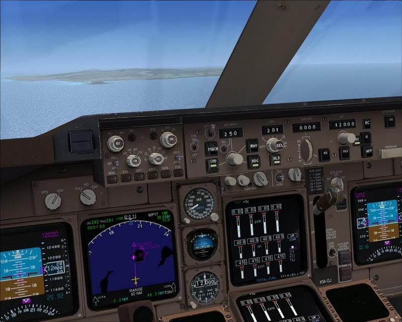 Our island is getting closer.  Las Palmas harbour, where the NORTHERN EXPEDITION will berth for replenishment.  The island where the SONIA (NA) refueled. We are doing a counter-clockwise tour of Gran Canaria before landing to the north.  The coastlines of this amazing island are fascinating.  Beautiful island! This is the west side.  Off the port passenger window. Flaps are down and we are at 170 knots. 3000 feet. Final approach is coming.  A detailed look at our undercarriage (landing gear).  "Boeing 744, Runway 03L cleared to land". Yes, they have wind power there like you see at Copenhagen, Denmark.  Welcome to the Canary Islands! We'll be staying here for quite awhile. My next flight in this aerial survey of the NORTHERN EXPEDITION's courses will come after she passes into the Caribbean. Enjoy your stay! END |
|
FNS
Voyager
The Empire Builder train of yesteryear in HO scale
Posts: 4,948
|
Post by FNS on Feb 15, 2009 10:20:59 GMT -8
Greetings, once again! After a good long vacation here in the Canary Islands, it is time for us to take off for Curacao. We now know where the NORTHERN EXPEDITION entered the Caribbean. So, it's time to go! The flight attendants have passed me the manifest of load and all should be aboard. We expect clear skies all the way. Ladies and gentlemen, please fasten your seat belts.  Jetway is retracted. Time to push back.  "Boeing 744, Runway 03L cleared for takeoff".  We are off!  Las Palmas harbour.  As a treat, we are going to give you a tour of Tenerife. We will cruise at 15000 feet at 310 knots. We've past the 8000 foot mark.  Beginning our clockwise tour.  This is quite a neat island.  Now on the north side of this island.  Tenerife harbour (I added the docks in this default FSX scenery).  Tenerife. This is where the MV SONIA, now the MV NORTHERN ADVENTURE, had been replenished.  We now head back to Gran Canaria.  Gran Canaria is ahead.  Gran Canaria is a beautiful island.  Las Palmas harbour. We officially begin our tracing of the NE's courses to the west.  GCLP and the coastline. "Boeing 744, climb and maintain four-one-zero".  As we begin our climb, we take one more survey of Gran Canaria.  We now join the track that will take us to Curacao.  This image speaks for itself.  Now past the 24000 feet mark.  My plane and Gran Canaria. Contrails are now seen.  Thank you for serving BC Ferries well.  Now at 41000 feet. I'll turn off the seat belt signs now. Approaching the first of eight waypoints of 2300PST plots. This is the 2-6-2009, 2304PST, 26.5642, -18.5689 plot.  One final look at the Canary Islands.  This is the 2-7-2009, 2305PST, 24.7426, -24.1908 plot.  This is the 2-8-2009, 2304PST, 22.9817, -29.7383 plot.  This is the 2-9-2009, 2305PST, 21.3786, -35.3544 plot.  This is the 2-10-2009, 2305PST, 19.8806, -40.9622 plot.  This is the 2-11-2009, 2305PST, 18.3167, -46.5286 plot.  This is the 2-12-2009, 2304PST, 16.7961, -51.9878 plot.  This is the 2-13-2009, 2305PST, 15.2711, -57.4081 plot. We now see land on the multi function display. It took us an average of about 40 minutes to cover each of these waypoints.  That's Saint Lucia to your port, Martinique to your starboard.  Martinique.  Saint Lucia.  Beyond Martinique is Dominica.  Out the passenger window.  Now over the Caribbean Sea. Less than an hour to go now.  End of the line is now seen.  The South America coastline. I will now turn on the seat belt signs as we will begin our descent to TNCC.  Now nearing the 32000 feet mark.  Approaching the 17000 foot mark.  Curacao.  Willemstad. The swing bridge and the road bridge are included in this FSX default scenery.  Turning final.  "Boeing 744, Runway 11 cleared to land".  At the gate. Welcome to Willemstad, Curacao! END |
|
|
|
Post by DENelson83 on Feb 15, 2009 20:59:45 GMT -8
You could also see Saint Vincent near Saint Lucia, which is where the NE is temporarily flagged for her delivery voyage.
|
|
FNS
Voyager
The Empire Builder train of yesteryear in HO scale
Posts: 4,948
|
Post by FNS on Feb 17, 2009 1:02:20 GMT -8
Greetings, ladies and gentlemen! After this brief stop here in Willemstad, Curacao, it's time to take to the skies again. A short hop over to Panama. We expect clear skies again and fine visibility. So, if you haven't done so, please fasten your seat belts, once again. Flight attendants, please prepare the cabin for takeoff.  "Boeing 744, Runway 11 cleared for takeoff". After takeoff, we will be making starboard turns and join the NORTHERN EXPEDITION's routing to Panama.  My plane on the runway.  Willemstad. A bit of the airport can be seen.  We've passed 19000 and heading between the Paraguana Peninsula and Aruba. We'll be cruising at 33000 this flight.  Paraguana Peninsula.  One last look at Curacao.  We are now at 33000 feet at 0.85 Mach. That's Punta Gallinas where our next way point is. The point is also where the NE was at the end of the day, 02-16-2009.  Now turning to follow the Colombia coastlines.  Colombia.  Colombia coastlines.  Same.  Big Marsh of Santa Marta.  We are nearing Panama. We'll start down in a few minutes and we'll give you a tour of the Canal at 2200 feet.  Now under 19000 feet.  5000 feet. Our routing over the Canal is seen on the multi function display.  Now at 2200 feet at 170 knots indicated air speed.  Gatun Locks. The folks who put this sim together made the locks a bit too big and placed the Gatun Locks in reverse order. But, we'll take what we will get.  We see the channels the NORTHERN EXPEDITION will use in her transit of the Panama Canal.  I sure love turns!  The final stretch.  Centennial Bridge, Pedro Miguel Locks, and Miraflores Locks, Pacific Ocean. I had to find a suitable bridge from Instant Scenery to place as there is no bridge on the FSX default scenery. That's it for the photo tour of the Canal. Time to prepare for the landing.  "Boeing 744, Runway 3R cleared to land".  Welcome to Panama! We will now await the NORTHERN EXPEDITION's transit. |
|
|
|
Post by DENelson83 on Feb 17, 2009 6:47:57 GMT -8
Hmmm... I was just fantasizing about a new ferry being delivered by aircraft... And then that bubble popped when I realized that such an endeavour would be impossible. Ships of that scale are just way too heavy to be transported by air.
|
|
FNS
Voyager
The Empire Builder train of yesteryear in HO scale
Posts: 4,948
|
Post by FNS on Feb 17, 2009 8:27:49 GMT -8
Hmmm... I was just fantasizing about a new ferry being delivered by aircraft... And then that bubble popped when I realized that such an endeavour would be impossible. Ships of that scale are just way too heavy to be transported by air. Interesting thought, Mr. Nelson! Some ships can be transported by air. Ship models, that is.I took one of my ship models with me to California in one of my vacations a while back. |
|
|
|
Post by cobblehillian on Feb 17, 2009 9:27:49 GMT -8
Mr. Ferrynutseattle, you've done some great flying and we are having a nice virtual vacation. You didn't notice me back in the cabin, I'm was the one drinking gin and tonics on the way over from the Canary's and always asking "Where's the NorEx?"
I was wondering if on a segment you haven't flown we might overfly the NorEx and check her out from the air. I did come for some R & R, but I also put some money down to track the ship and I'll bet a lot of the other passengers (some who I know are from this forum) have the same wish. Perhaps, you and and Mr. Keenleyside, the Nor Ex navigation officer, could arrange a near land rendezvous with a nice scenic background for a 'birds- eye' view of the NorEx.
Don't get me wrong, we are enjoying the delivery cruise/flight, especially the long visits to the Canary's, and the quicker visit to Curacao but I and a lot of the other passengers expected at least one flyover. I somehow remember just before BC Ferries chartered this flight and gave the complimentary seats to Ferry Forum members we were told we would see the ship.
God give me a break from these blasted Gin and Tonics. Now, are we going to stay in Cristobal or go over to Panama City while we kill time waiting for the NorEx?
|
|
FNS
Voyager
The Empire Builder train of yesteryear in HO scale
Posts: 4,948
|
Post by FNS on Feb 18, 2009 0:57:09 GMT -8
Twas the night before the NORTHERN EXPEDITION's arrival at Panama, I did "cobblehillian" a requested favor. You'll see the clue in this person's recent message on this thread. So, once again, we're at MPTO and ready to do a ferry spotting. We expect some fine flying conditions for this bonus flight. So, it's seat belts time again!  On the runway. "Boeing 744, Runway 21 cleared for takeoff".  We are airborne once again. Panama City is below. I had to find a suitable bridge to place for the Bridge of the Americas using Instant Scenery.  We've crossed Panama and heading east.  We're at 21000 feet and heading to the Santa Marta area to find the NE.  Now getting close, We'll slow down for the descent.  Now under 10000 feet. We'll be flying at 1200 feet in our search.  Now under 5000 feet. We see the Colombia landscape.  And, there she is! Off the port side!!  Off the port side passenger window.  We'll turn and give the folks on the other side a view of her.  Off the starboard side passenger window. Now, I think "cobblehillian" should be satisfied. We'll head back to MPTO and await the NE's transit of the Panama Canal. I'll let the pictures in the TNCC-MPTO flight do the coverage of the return to MPTO which is virtually the same. |
|
|
|
Post by cobblehillian on Feb 18, 2009 10:53:01 GMT -8
Bravo! Three cheers for Captain Ferrynutseattle. Great flying! We should all receive a complementary beverage after that.
Now lets get back to Panama City and await the Nor Ex transit of the canal. Boy, some of my fellow passengers are pretty quiet.
|
|
|
|
Post by Northern Exploration on Feb 18, 2009 12:52:28 GMT -8
Your fellow travelers are sleeping off the rum picked up at the last refueling stop. Beware - they may be grumpy and hungover when they wake up.
|
|
|
|
Post by Low Light Mike on Feb 18, 2009 14:59:20 GMT -8
Now lets get back to Panama City and await the Nor Ex transit of the canal. Boy, some of my fellow passengers are pretty quiet. When the captain & officers are at work, it is important for the passengers to stay silent and out of sight. Out of sight, out of mind: we don't want the captain & officers to know that there are people on-board. They might throw us overboard... ;D Best to stay quiet and let them think they're the only ones on-board. ;D |
|
FNS
Voyager
The Empire Builder train of yesteryear in HO scale
Posts: 4,948
|
Post by FNS on Feb 23, 2009 2:06:36 GMT -8
Well, it's time for us to leave Panama. We have seen the NORTHERN EXPEDITION through the Canal. Our next airport of call is Manzanillo, Mexico. The flight attendants have given me the manifest of passenger load and all should be aboard. The door will now be closed for flight. The seat belt sign is now on. We expect clear skies all the way. So, welcome aboard!  The jetway is retracted. Time to leave the gate.  "Boeing 744, Runway 21 cleared for takeoff".  Good bye, Panama!  We are going to fly at 2000 feet until after rounding the southern shores of Panama. This is for spotting the NORTHERN EXPEDITION. Islas en Panama ahead of us.  Over Islas en Panama. Punta Chame is in the distance.  Hold on. We'll be turning to the starboard shortly. Looking up the Panamanian coast.  Turning to the starboard.  And, there she is! Off our starboard side. Have a great voyage, MV NORTHERN EXPEDITION!  "Boeing 744, climb and maintain three three zero".  Another starboard turn forthcoming. Past the 13000 foot mark.  Isla Jicarita and Isla de Coiba. Coiba is the largest island in Central America.  Coming up to Burica. Costa Rica is ahead of us.  Passing Burica. We say good bye to Panama. Also, one last look at the waterways on the Caribbean side of Panama. Our views of the waters on the east side of the American continents are over.  Costa Rica.  Costa Rica.  Off El Salvador.  Approaching the Mexican mainland coastline.  Nearing Acapulco, Mexico  Acapulco, Mexico.  Acapulco as seen from the passenger window. The PRINCESS PATRICIA II visited this city on her winter cruises from Los Angeles in the early 1960s.  Continuing up the Mexican coastline. The end of the line is in view of the multi function display.  Zihuatanejo.  We are approaching the time for the descent. Flight attendants, please prepare the cabin for the landing.  Now nearing 16000 feet. Manzanillo is ahead of us.  Manzanillo.  Turning final. "Boeing 744, Runway 28 cleared to land".  Runway 28. We are doing a manual landing as there is no ILS at this airport (in FSX).  Welcome to Manzanillo, Mexico. We'll be staying here until after the NORTHERN EXPEDITION leaves here or passes by. |
|
FNS
Voyager
The Empire Builder train of yesteryear in HO scale
Posts: 4,948
|
Post by FNS on Mar 1, 2009 3:41:21 GMT -8
Now that the MV NORTHERN EXPEDITION has departed Manzanillo, we will do the same. This flight was started on Saturday, February 28, 2009, in the morning. It was decided to do this as where we're going to has to be landed in daylight. Hope you enjoyed your brief stay at Manzanillo. We'll turn on the seat belt sign and get ready for takeoff. Once again, we expect clear skies all the way. We hope you'll enjoy this flight. Oh, by the way, you'll need sweaters when we land. If you forgot yours, our flight attendants will give you one.  It's time again for departure. Sun has risen. A nice day to fly!  "Boeing 744, Runway 28 cleared for takeoff".  We are off. Undercarriage is being stowed.  Good bye, Manzanillo!  Manzanillo landscape.  Blue Bay.  Past 8000 feet. Turning shortly.  Now turning. Past 12000 feet. "Boeing 744, climb and maintain three three zero".  Past 27000 feet. Passing Cabo Corrientes.  Now at 33000 feet. I'll turn off the seat belt sign. Those are the islas of San Juanico, Maria Madre, Maria Magdalena, and Maria Cleofas off our starboard side.  There's our ship! That's the NORTHERN EXPEDITION below us.  Now getting closer to Baja California.  Cabo San Lucas.  Cabo San Lucas.  Coming up to Magdalena Bay.  Magdalena Bay.  Magdalena Bay.  Nearing Punta Eugenia.  Isla Cedros.  Looking back.  San Quintín.  Ensenada. US waters are ahead of us as well as San Diego.  San Diego.  Turning up the channel.  San Diego. Washington State Ferries' Superferries were built there. The HYAK, KALEETAN, YAKIMA, and ELWHA went to Puget Sound under their own power. We will make a different turn when we are over Juan De Fuca Strait. Mission Bay is also seen.  Catalina Island.  Terminal Island and Long Beach. The QUEEN MARY I can be seen.  Catalina Island.  KLAX.  The Channel Islands are ahead of us.  Islands of San Miguel, Santa Rosa, and Santa Cruz, top to bottom.  Point Conception.  Turning to the starboard.  Monterey.  San Francisco Bay.  San Francisco Bay, KSFO, KOAK.  San Francisco.  San Francisco Bay, KSFO, KOAK.  The Golden Gate Bridge and San Francisco.  Point Reyes and San Francisco Bay.  Continuing up the coast.  Eureka.  Mount Shasta.  Crescent City.  Now along the Oregon coast.  Newport and Mount Hood.  Tillamook area. Since we left, MegaSceneryEarth has completed the State of Washington. You can see this beyond the state line. Mount Rainier can be seen.  The mouth of the Columbia River.  Washington's own Long Beach.  Ocean Shores and Westport.  Same out the passenger window.  Juan De Fuca Strait is coming up. Cape Flattery is ahead of us.  We can now see the straits of Juan De Fuca and Georgia. Nearing home waters again.  We will now descend to 15000 feet for the duration of this flight until landing.  Juan De Fuca Strait.  We are now turning.  Now under 19000 feet.  Victoria. We are now turning to fly over Haro Strait.  CYYJ and the Gulf Islands.  The lower mainland and Tsawwassen.  Departure Bay is off our port side. We will continue north.  CYQQ. We are now turning and heading to Seymour Narrows.  Entering Seymour Narrows. Campbell River is in view.  Turning up through Johnstone Strait.  Johnstone Strait.  Continuing up Johnstone Strait. Port Hardy is ahead.  Approaching Port Hardy.  Port Hardy.  We now enter a stretch of open waters.  After briefly flying over the open waters, we enter more of the Inside Passage.  Now coming up to Bella Bella.  Course adjustments.  Now flying over Swindle Island.  Continuing up the Inside Passage. Grenville Channel can be seen now.  We are now descending to 10000 feet with a few turns that will take us up Grenville Channel.  Now entering Grenville Channel.  Grenville Channel.  We are clearing Grenville Channel. We'll be starting down and getting ready for the final approach. Seat belts time. Flight attendants, please prepare the cabin for landing.  We are now at 3000 feet and 170 knots. After passing Prince Rupert, we'll turn off the GPS navigation and take the stick.  That's what FSX gives us for Prince Rupert. We'll take what we get.  Turning final.  "Boeing 744, Runway 13 cleared to land".  Welcome to Prince Rupert, British Columbia! We'll spend a night or two and then fly to CYYJ to await the arrival of the NORTHERN EXPEDITION. Our aerial survey of the NORTHERN EXPEDITION's routing from FSG to British Columbia is complete. Plus, I added her routing she'll be taking up to Prince Rupert. Two more flights will take place. CYPR to CYYJ, and CYYJ to KSEA and KPAE. |
|
|
|
Post by DENelson83 on Mar 1, 2009 3:51:36 GMT -8
You can't just pause a flight in mid-air, ferrynut. If you want a break, you need to land first.
|
|
FNS
Voyager
The Empire Builder train of yesteryear in HO scale
Posts: 4,948
|
Post by FNS on Mar 6, 2009 2:16:26 GMT -8
After a short stay at Prince Rupert, we will depart now for Victoria. The seat belt sign is turned on. Flight attendants, please prepare for takeoff.  Ready for departure.  "Boeing 744, Runway 13 cleared for takeoff".  Entering Grenville Channel.  Inside Passage.  Inside Passage.  Inside Passage.  Bella Bella.  Coming up to Port Hardy.  Entering Johnstone Strait.  Coming down Johnstone Strait.  Turning over Quadra Island. Campbell River can be seen.  Now coming down the Georgia Strait.  Vancouver.  Now at 3000 feet and 170 knots. Approaching Orcas Island.  Passing Camp Orkila. The gulf islands are beyond.  Passing Turtleback Range.  "Boeing 744, welcome back to Victoria, Runway 27 cleared to land".  Welcome to Victoria! It's been great having all of you on board these flights. Enjoy watching the NORTHERN EXPEDITION's arrival! It will be just myself and my attendants going back to the Seattle area tomorrow. |
|