|
|
Post by Ferryman on May 31, 2008 8:32:39 GMT -8
On my way down the Sea to Sky highway last night, I drove through a new section of highway that was opened up this week. No, it's not the Eagleridge Bluffs section. This new road will eventually be the off ramp to Horseshoe Bay, for people coming from Squamish, and points above. It diverts off the the regular highway not far South of Ansell Place, and bypasses the growing amount of construction for the overpasses and off ramps to the Eagleridge Bluffs section. It dips down, almost to the Railway tracks at a pretty steep grade, and levels out at the turn off to Pasco Road, and then rises back up to the main highway again to the 'S' curve above the village.
So, if any of you are in the area, and are wanting to get some good photos of Horseshoe Bay Ferries from a unique angle. here's what you do:
Head North on the Sea to Sky Highway, and make a U-turn on the overpass at Ansell Place. Ansell Place is only about 5 mins north of Horseshoe Bay. Now head back South on the highway, as this is the only way that goes through the new section of road. Keep an eye out for Pasco Road on the the right side of the road, as this is where you will be able to park, and walk. Once you've parked, you have a 180 degree view of Howe Sound at your dome, ranging from the mouth of Horseshoe Bay, to Anvil Island. This is actually perfect for getting an Aerial like view of the Route 3 ferries, as they pass right in close to this cliff side.
I'll get some photos of this tomorrow afternoon, when I return home.
|
|
|
|
Post by Mike C on Jun 4, 2008 13:43:16 GMT -8
Thanks Chris. I've always been curious to know where to get good pictures of the ferries from the Sea-to-Sky corridor. I sense stop here on future forum trips.  |
|
|
|
Post by Nickfro on Jun 4, 2008 14:37:03 GMT -8
I drove down from Whistler last Sunday evening. That is quite the 'roller coaster' detour that they have setup right now!
I don't recall it detouring before Pasco Rd though, but about 500m after it, along that straight stretch just south of the Pasco residential area. Maybe they have expanded the detour since Sunday. Very true though. . .some great vantage points of the Bay right now from that area!
|
|
|
|
Post by Ferryman on Jun 9, 2008 22:47:16 GMT -8
In case anyone is still interested, here are some photos I took from this location on my way out to Tsawwassen yesterday morning. 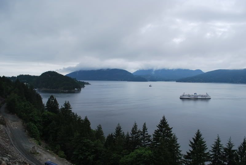 In this photo, you can see the original highway being the highest ledge. The new detour was recently built, and will be the off ramp for traffic wanting to go into Horseshoe Bay coming Southbound on the Sea to Skid highway. Then you see the railway being the near the bottom. This area is likely where the new section from the Eagleridge Bluffs will connect into, with a series of overpasses leading up the cliff. The opposite end of the Bluffs (West Van side) the overpasses to the Eagleridge Bluffs sention is now taking shape fast. So it won't be long, and that will be the new way on to the Sea to Sky highway. 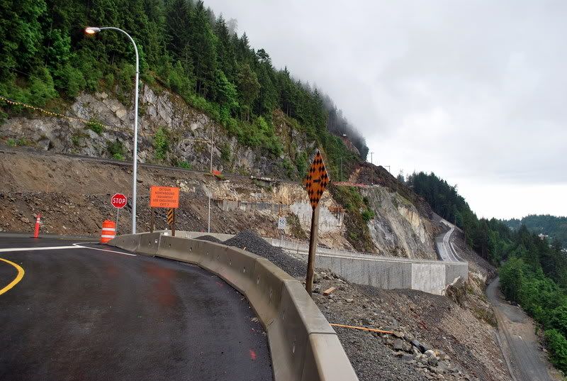 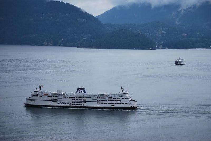 |
|


