|
|
Post by Low Light Mike on Jul 18, 2012 20:16:01 GMT -8
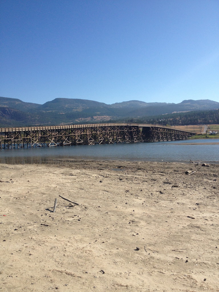
The Blueberry Paulson bridge, on Highway 3 between Christina Lake and Castlegar, in BC. - July 2012.  Of course, they had to paint it blue.  |
|
|
|
Post by Low Light Mike on Jul 21, 2012 13:31:40 GMT -8
|
|
|
|
Post by Low Light Mike on Jul 21, 2012 20:37:49 GMT -8
1961 highway bridge over the Columbia River at Revelstoke, BC. - seen in evening on July 9, 2012.  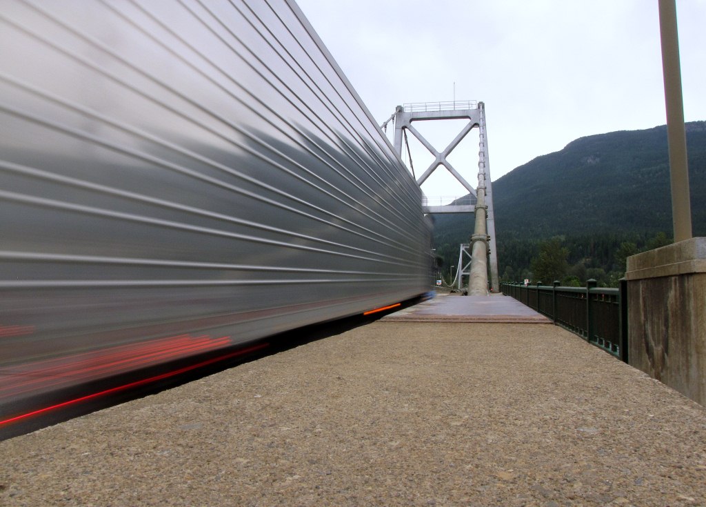 |
|
|
|
Post by Low Light Mike on Jul 23, 2012 18:23:12 GMT -8
Early morning views of 3 bridges at Revelstoke over the Columbia River. - July 10, 2012. The 1-lane street bridge, seen from the west-bank 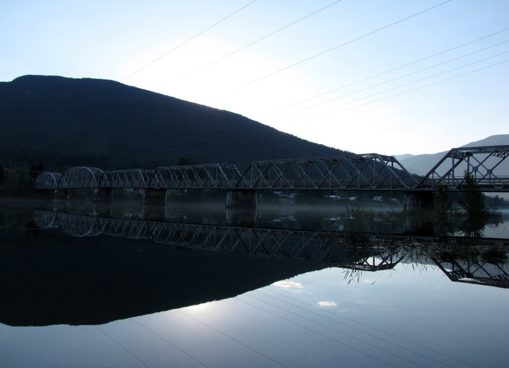 The CPR double-track rail bridge, seen from the west-bank 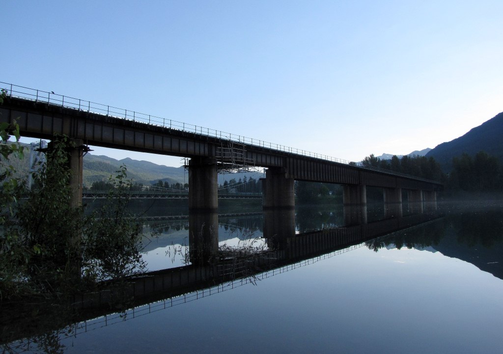 The 3 bridges, seen from the east-bank. - I like how only the reflection of the 1-lane street bridge is visible, except for the top of the arch. 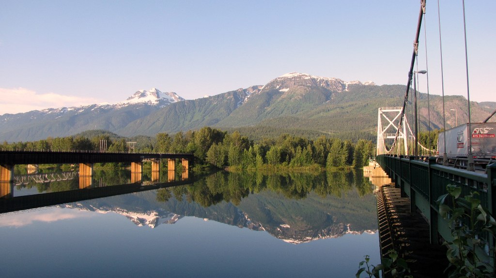 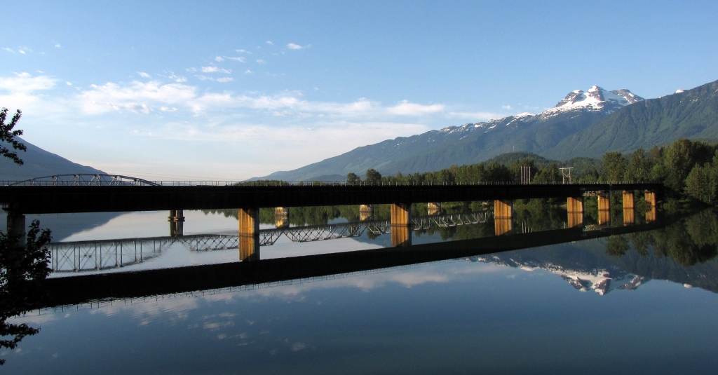 3 vehicles on the 1-lane bridge; I love the reflection. 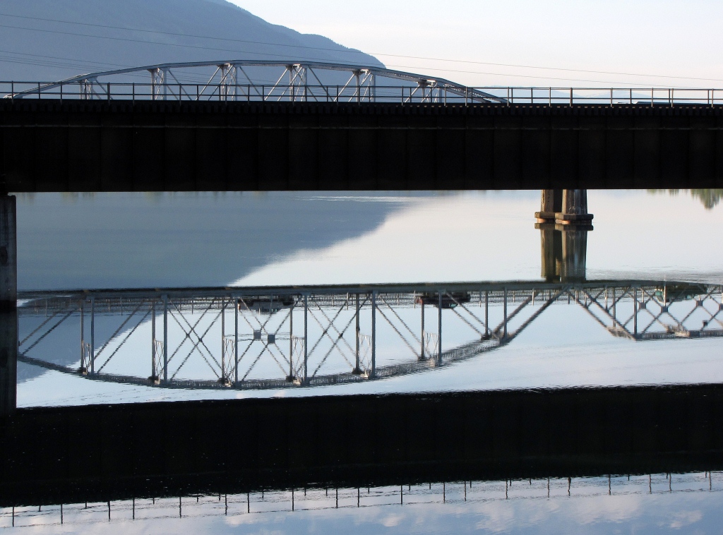 What a lovely place to be on a summer morning. 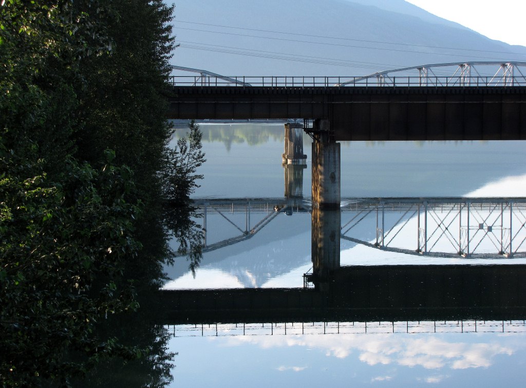 |
|
|
|
Post by Low Light Mike on Jul 24, 2012 19:23:50 GMT -8
Glacier National Park (Canada) has a campground named "Loop Brook Campground". It's named for the brook, which was named for the figure-8 loops of the 1885 rail line that was on the west side of Rogers Pass. The bridges over the brook (3 crossings) were originally timber bridges, but were replaced with fine stone-mason bridge pillars in 1906. - Approximately 10 years after that, the bridges and line were abandoned by the CPR, when they opened the Connaught Tunnel. The stonework bridge pillars are still visible, with 2 sets in the Loop Brook campground, and are connected with a short trail that follows the 1885 rail grade. --------------------------- Here is how we saw it, on July 10, 2012: When you first see the pillars in the woods at the campground, you're struck by their silent size, standing like sentinels of the past. Really, they are quite amazing to behold.  With me beside one, for scale. 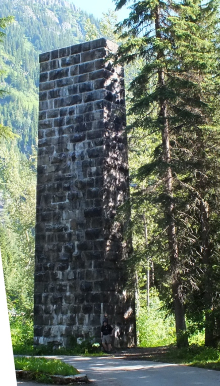 The row effect is quite interesting 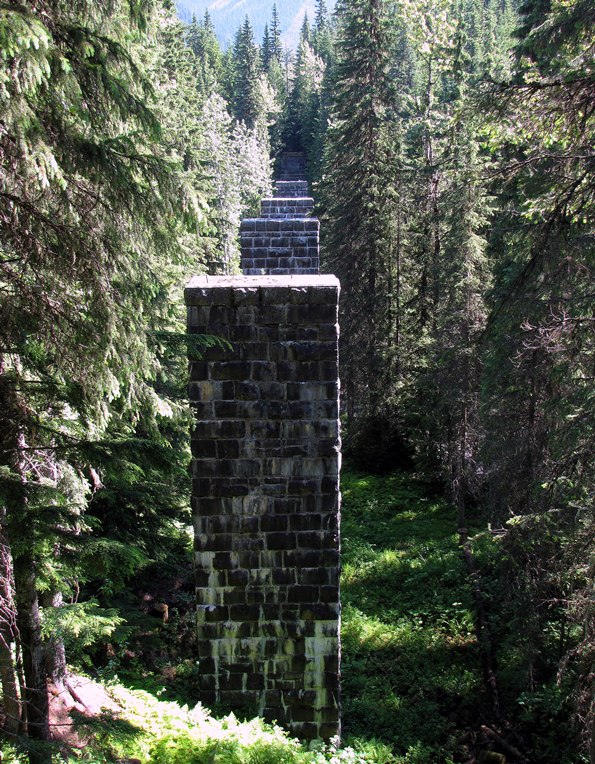 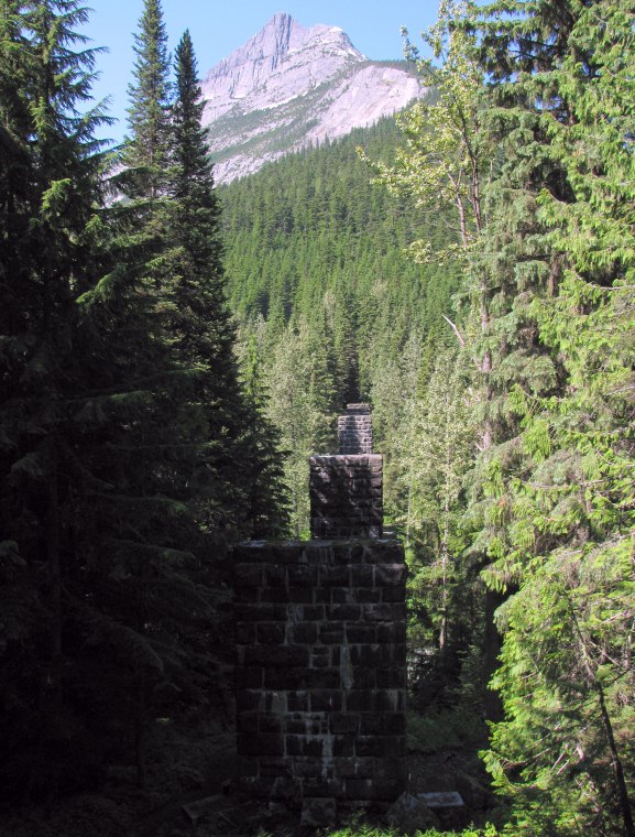 The trail is obviously the old grade. 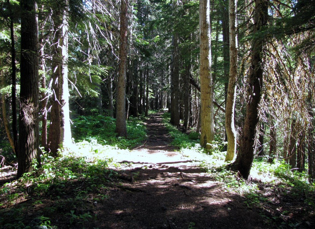 ...and you can see the old ties making a ribbing effect on the trail.  And the remains of a crushed snowshed, from that early era. 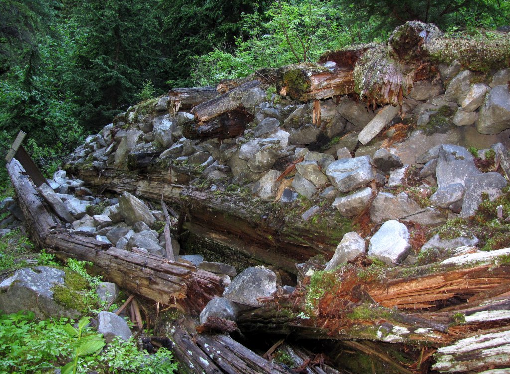 |
|
|
|
Post by Low Light Mike on Jul 24, 2012 19:54:05 GMT -8
A few more photos from Loop Brook campground: The scenery is wonderful  The logo on the interpretive signs 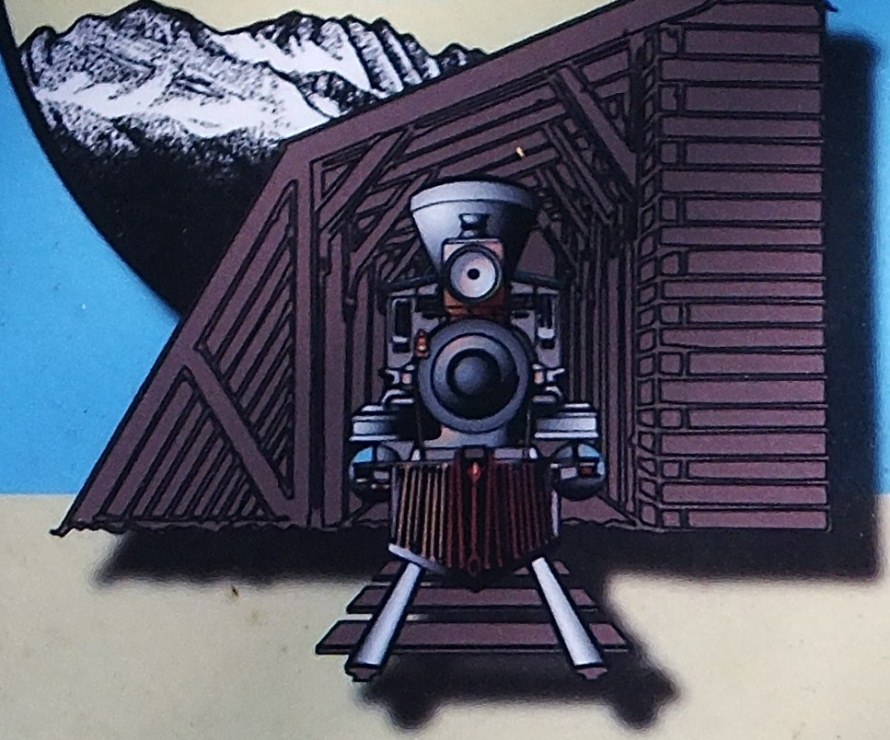 A nice image on a plaque 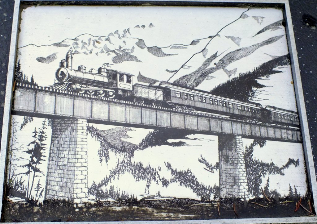 |
|
|
|
Post by Low Light Mike on Jul 25, 2012 17:52:33 GMT -8
Diorama of the Rogers Pass rail route, as seen at the Rogers Pass visitors centre. - I love this place! Stoney Creek bridge 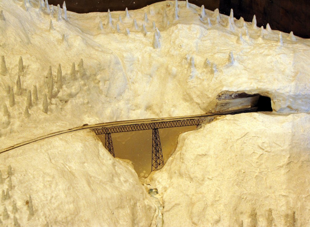 Loops on west slop of pass. (where the stone pillars are) 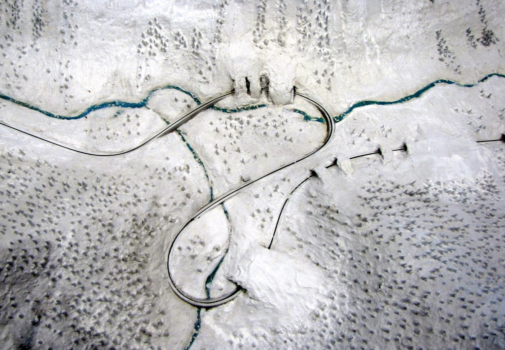 Glacier House hotel. 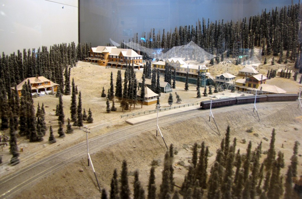 |
|
|
|
Post by Low Light Mike on Jul 28, 2012 16:05:45 GMT -8
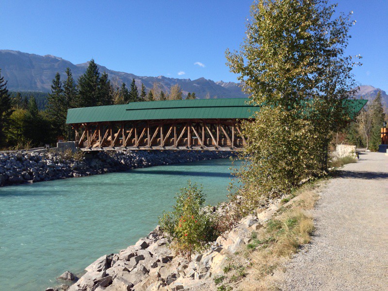
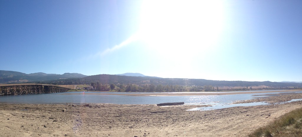
The Kicking Horse Pedestrian Bridge, in Golden BC - July 10, 2012   |
|
|
|
Post by Low Light Mike on Jul 29, 2012 17:41:00 GMT -8
The CPR old-bridge on the Big Hill line, over Mr. Hector's river.  - This is the stone/steel bridge that replaced the temporary original. The bridge was later used for the auto road, after the Spiral Tunnels were completed in 1909. Today, it's a road-side pullout, with a fence across it. Located on the BC/Yoho side of the Continental Divide, just west of Wapta Lake. I stopped here just before 7:00am on July 11, 2012, after I had spent just over an hour at Morant's Curve at sunrise. Wow, what a fun early morning that was.... 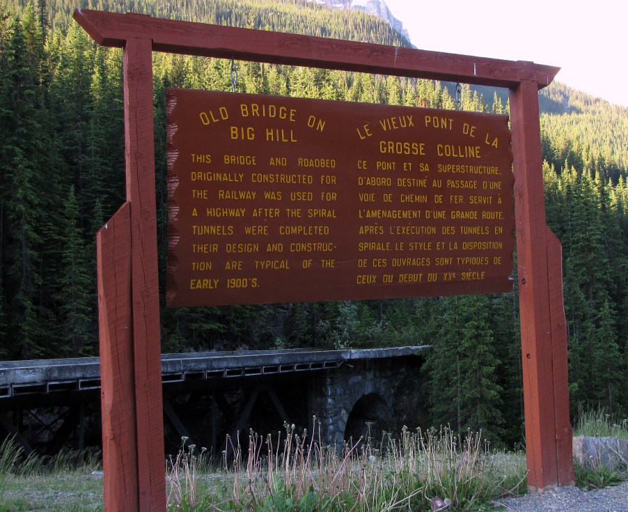 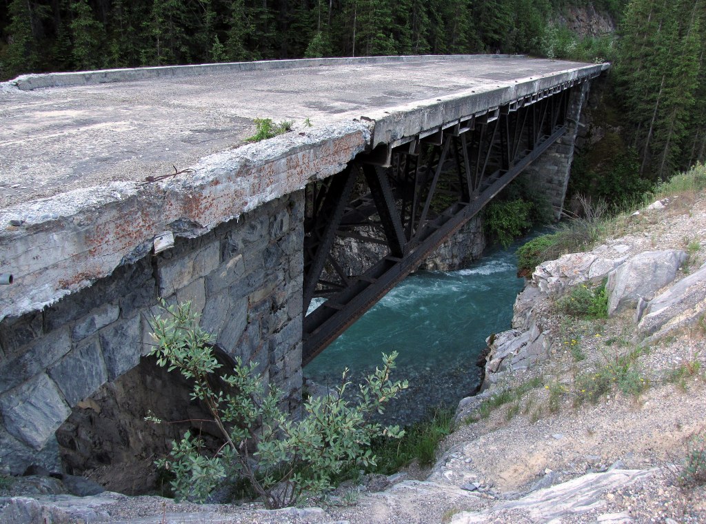 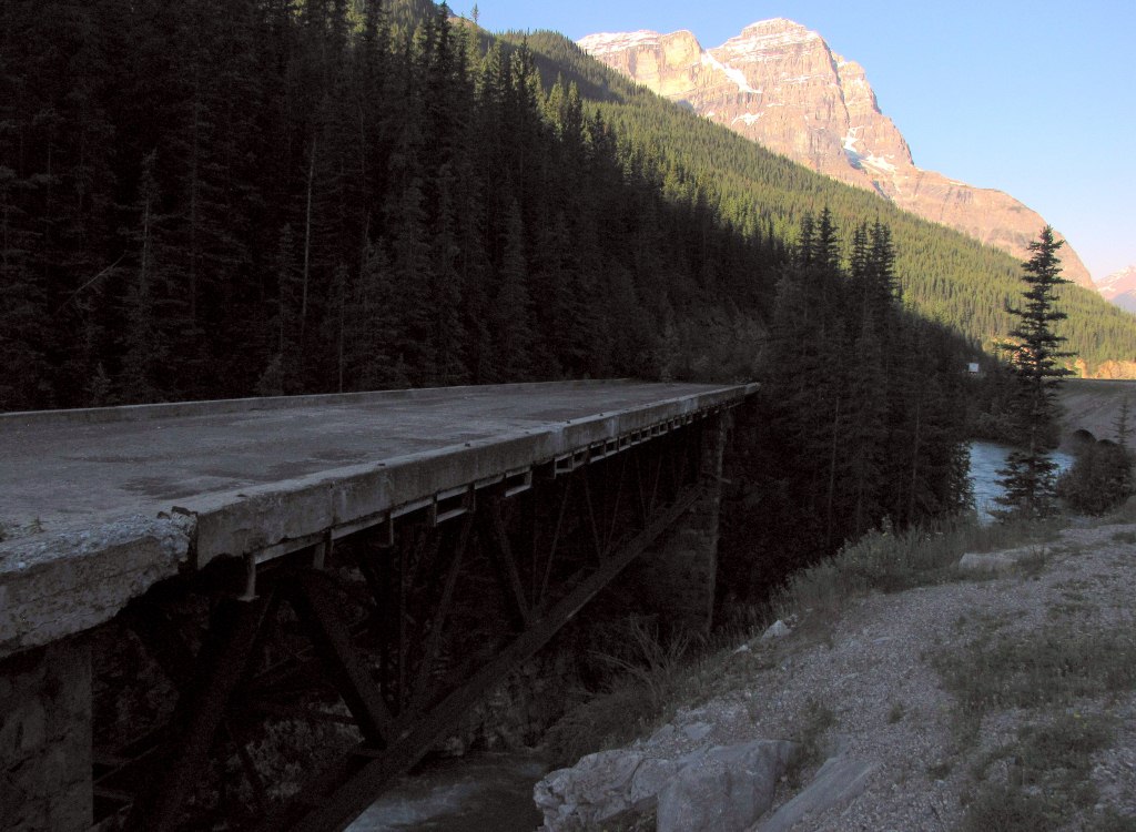  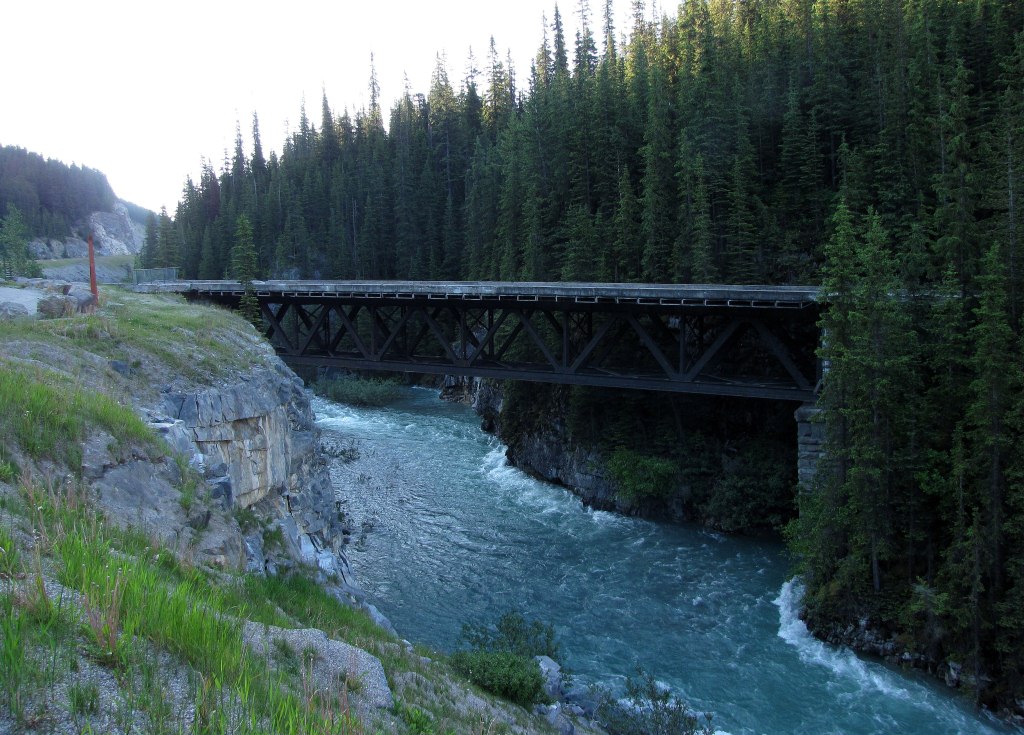 |
|
|
|
Post by lmtengs on Jul 29, 2012 22:08:58 GMT -8
I'm somewhat surprised about the fence. It looks to be in better condition than the Alexandria Suspension Bridge, yet the latter is still open to public. I wonder how many years those bridges have left in them, considering the obvious lack of maintenance to both by the governments responsible? I've been enjoying your trip reports, by the way.  |
|
|
|
Post by Low Light Mike on Aug 17, 2012 20:37:27 GMT -8
Rail bridge over the Clark Fork River, seen from Highway #135 in Montana (near St. Regis)  |
|
|
|
Post by Low Light Mike on Aug 17, 2012 21:08:15 GMT -8
Westbound on the Going-to-the-Sun road in Glacier National Park, Montana. - July 16, 2012. View from the East side of Logan Pass, looking west. - tunnel is visible 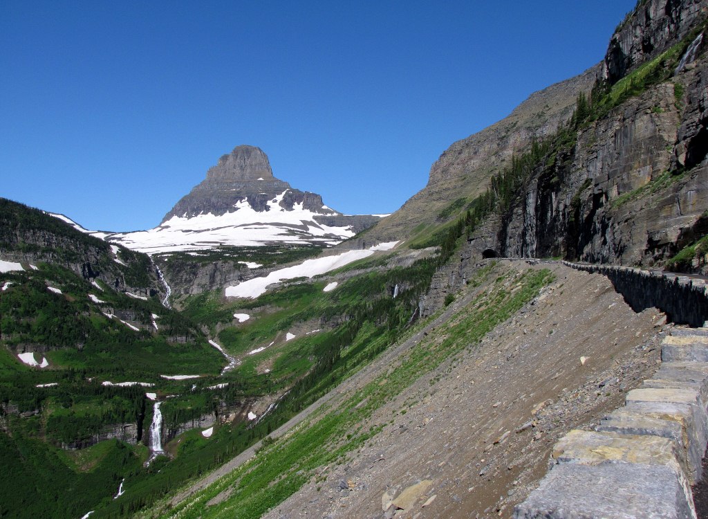 There is that tunnel 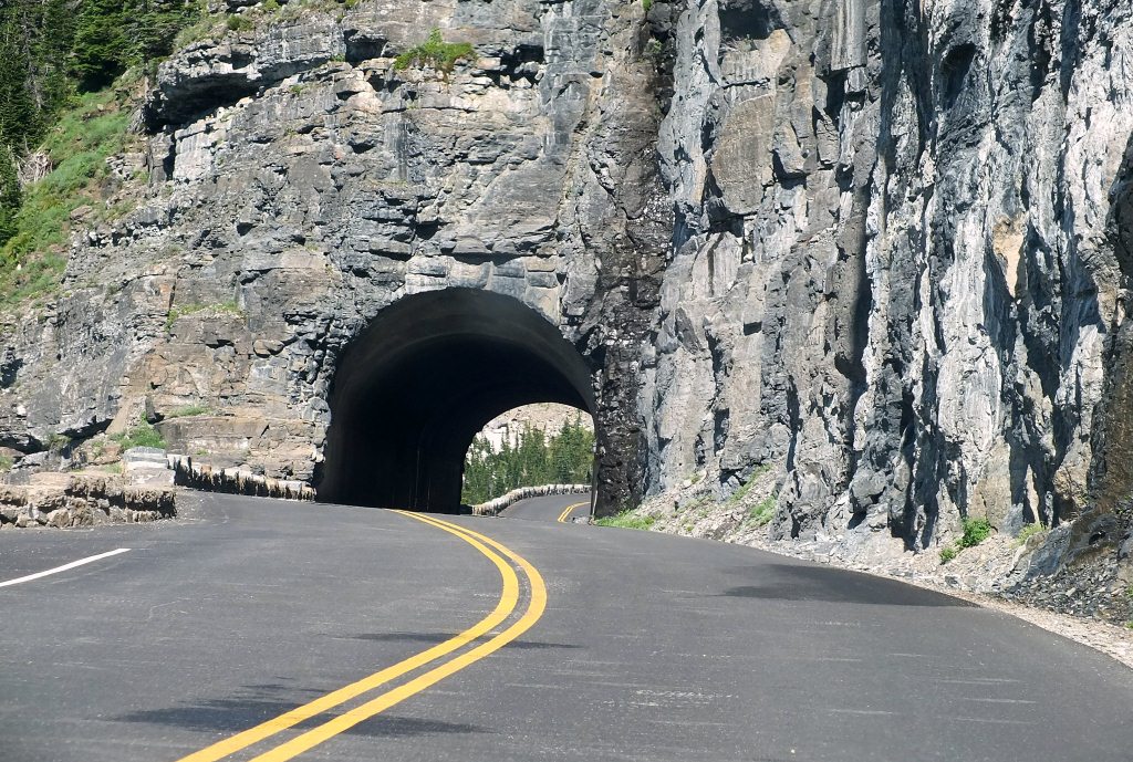 |
|
|
|
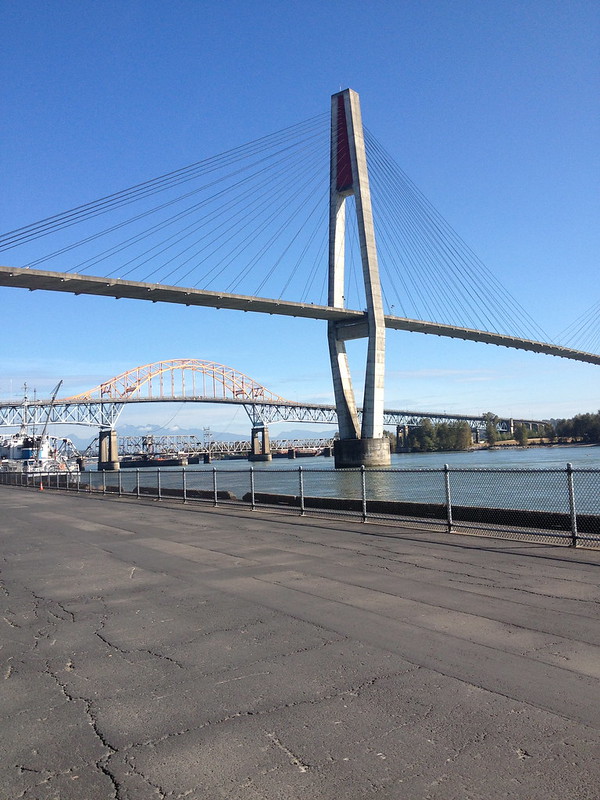
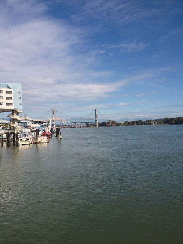
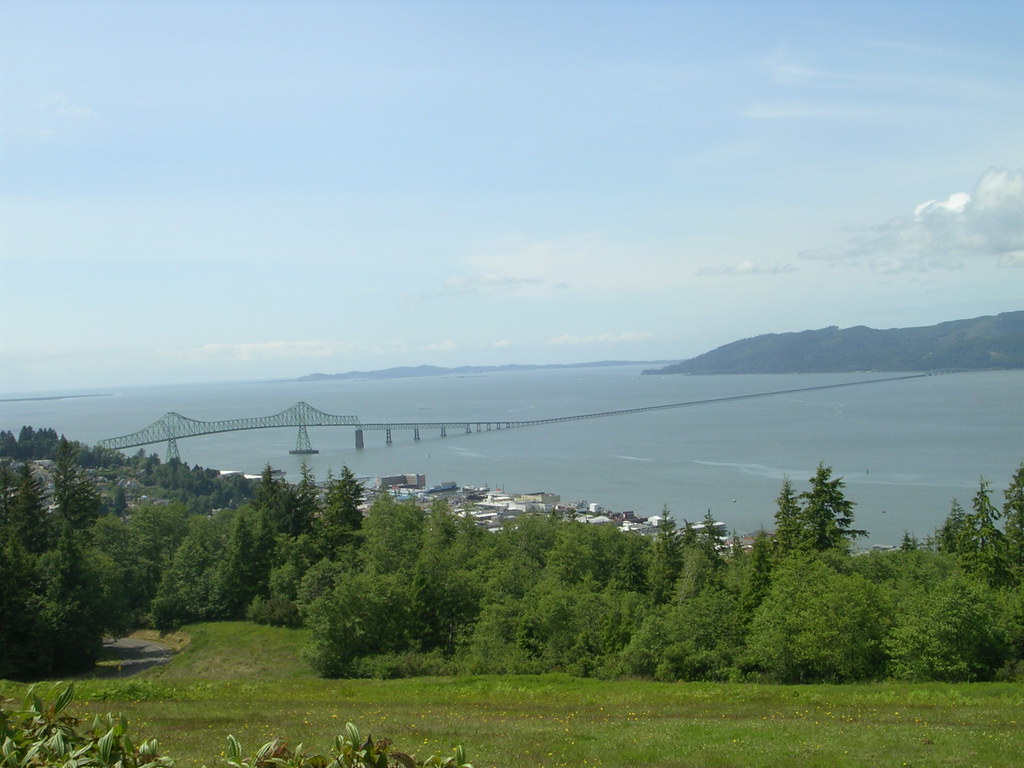
Post by Low Light Mike on Aug 30, 2012 11:42:14 GMT -8
2 bridges over the Kootenay River, just west of Castlegar, on Hwy3A. - seen July 18, 2012 by me. Seen from the tomb of Peter Lordly Verigin, in Brilliant BC, the view east. - the highway bridge is seen on left-side of the photo.  A better view of the highway bridge, with the old Brilliant suspension bridge visible behind it. 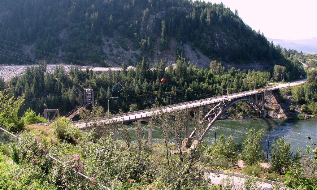 ---------- The old bridge, used for traffic from 1913 until the 1960s: Here is some information on it, from the Doukhobor's webpage: www.usccdoukhobors.org/brilliantbridge/bbridge.htm The old bridge is currently being repaired, for use as a pedestrian trail bridge. - This is as close as I was allowed to get. Here is a history paper on the old bridge, from the HISTORIC SITES AND MONUMENTS BOARD OF CANADA. www.usccdoukhobors.org/brilliantbridge/1995_Agenda_Paper.pdf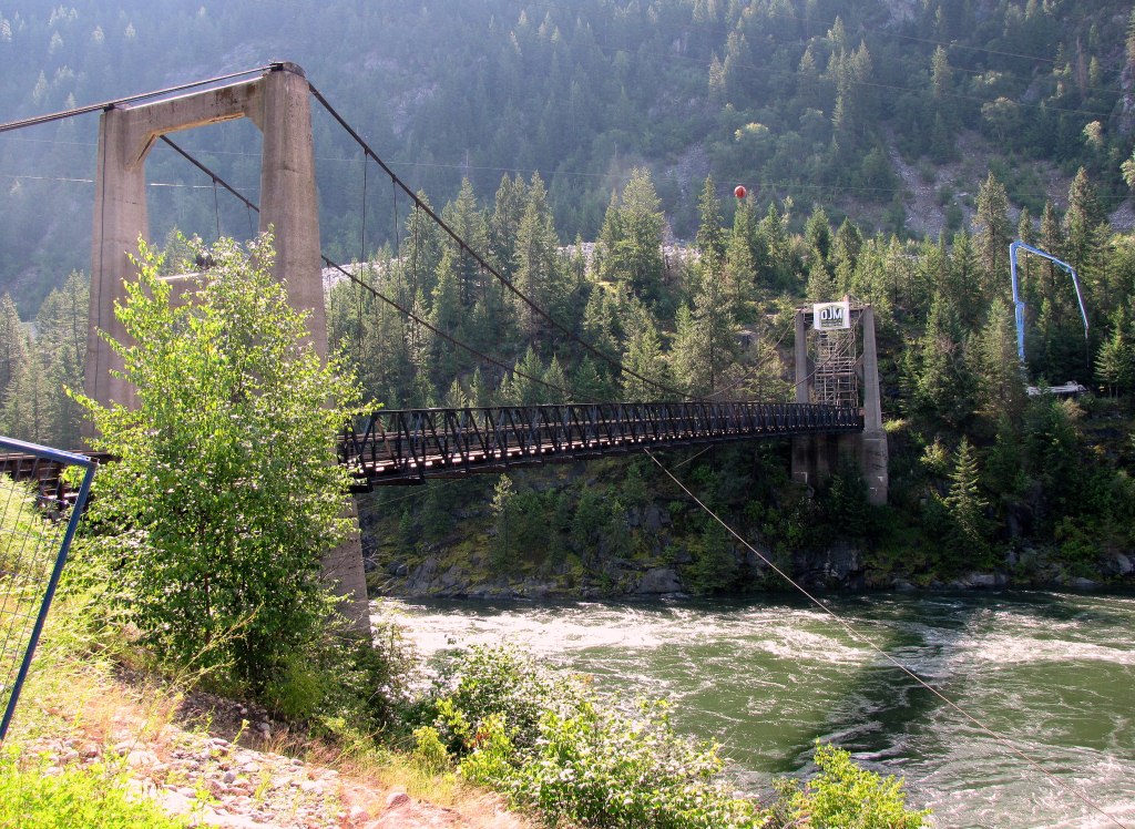 The current highway bridge over the Kootenay River. - the CPR track is right behind me.  |
|
Deleted
Deleted Member
Posts: 0
|
Post by Deleted on Aug 30, 2012 12:06:47 GMT -8
|
|
|
|
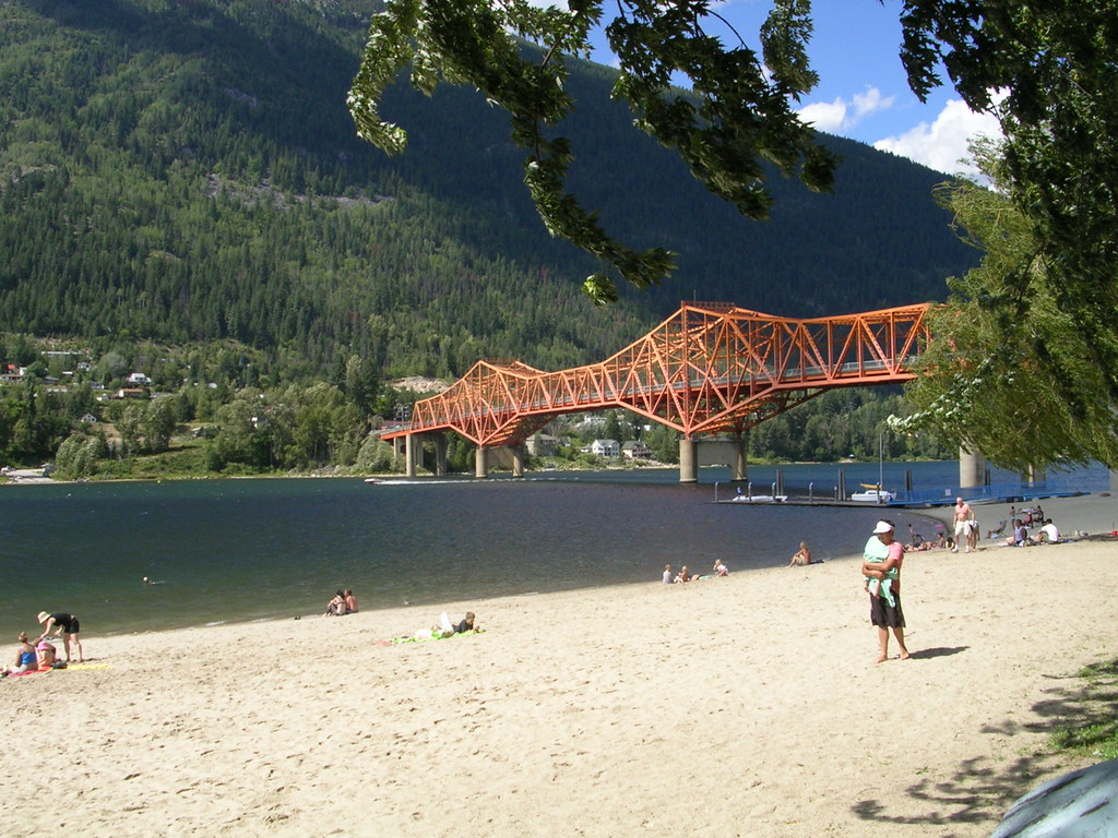
Post by Low Light Mike on Aug 31, 2012 13:56:44 GMT -8
Blueberry Paulson bridge, on Hwy-3, between Castlegar & Christina Lake, BC. - seen July 18, 2012   The road between Castlegar & Christina seem like one big hill: up one side, and then down the other, and you're at the next town. |
|
|
|
Post by Low Light Mike on Sept 2, 2012 19:22:22 GMT -8
Ashnola bridge, over the Similkameen River, just west of Keremeos, BC. - seen by me in morning on July 19, 2012. Currently a one-lane road bridge, and although it might look like a covered bridge, it's really just a "walled bridge". I'll let the sign tell you the rest of the story:  ---------------------- VIDEO of me driving across the bridge, complete with wood-bridge sound www.facebook.com/v/10151114371488647------------------ Stills: View from Hwy-3 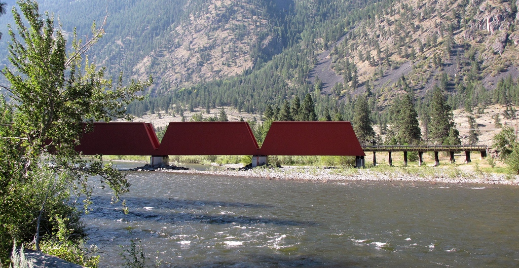 View from the river bank 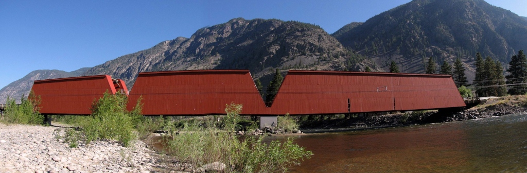 Approaching on Ashnola Road.  View from the Ashnola side. - on the road, someone had written, in chalk, the phrase "The lunatic is on the grass". I guess that the words help to keep the loonies on the path (to the bridge). And later I took photos of the dark side of the bridge.  On the bridge deck.  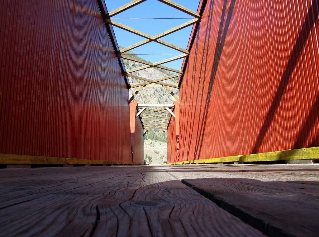 ------------------- Do you remember the old green "Point of Interest" signs at various BC highway viewpoints? Well, here is the new metal sign style. Not the same beautiful style as before (side note: I have a small book on the various old BC Highway viewpoint signs). 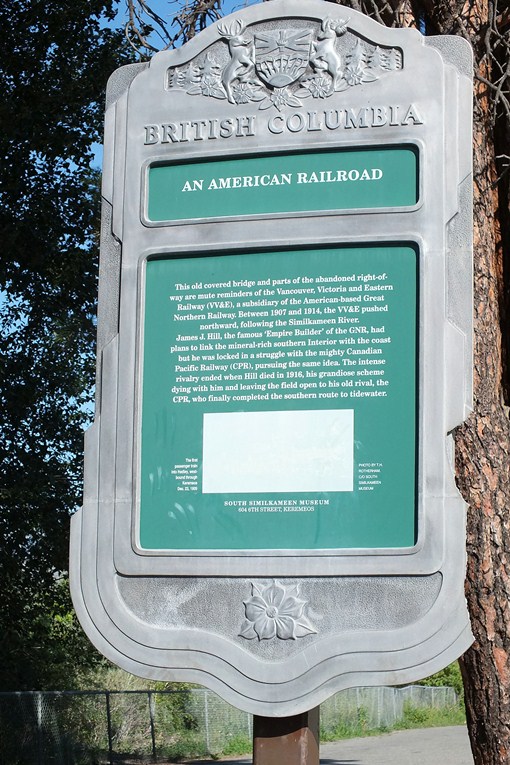 |
|
|
|
Post by Low Light Mike on Sept 3, 2012 7:46:30 GMT -8
When I drove through Princeton, BC near the end of a July holiday roadtrip, I thought to myself, "CPR's KVR railway went through here, so there probably are the remains of a bridge over the Tulameen River to be seen." So we drove to the Tulameen Highway bridge and found the rail bridge right beside it. - July 19, 2012. The 2 bridges. The CPR KVR rail bridge is now a bridge for the TransCanada Trail.  Some history on the highway bridge, on the road from Princeton to Aspen Grove/Merritt. 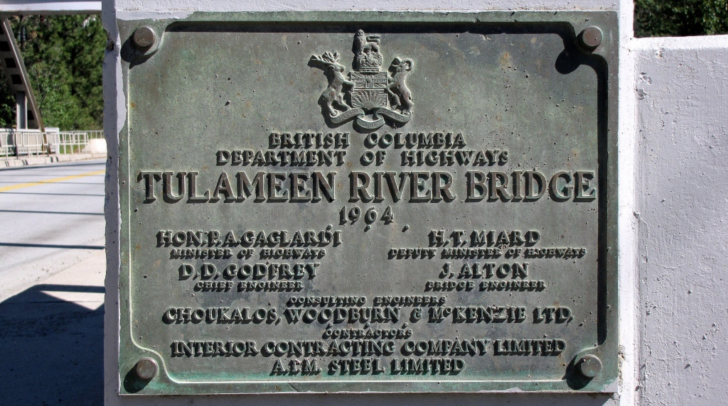 The lovely old-rail / new-trail bridge. 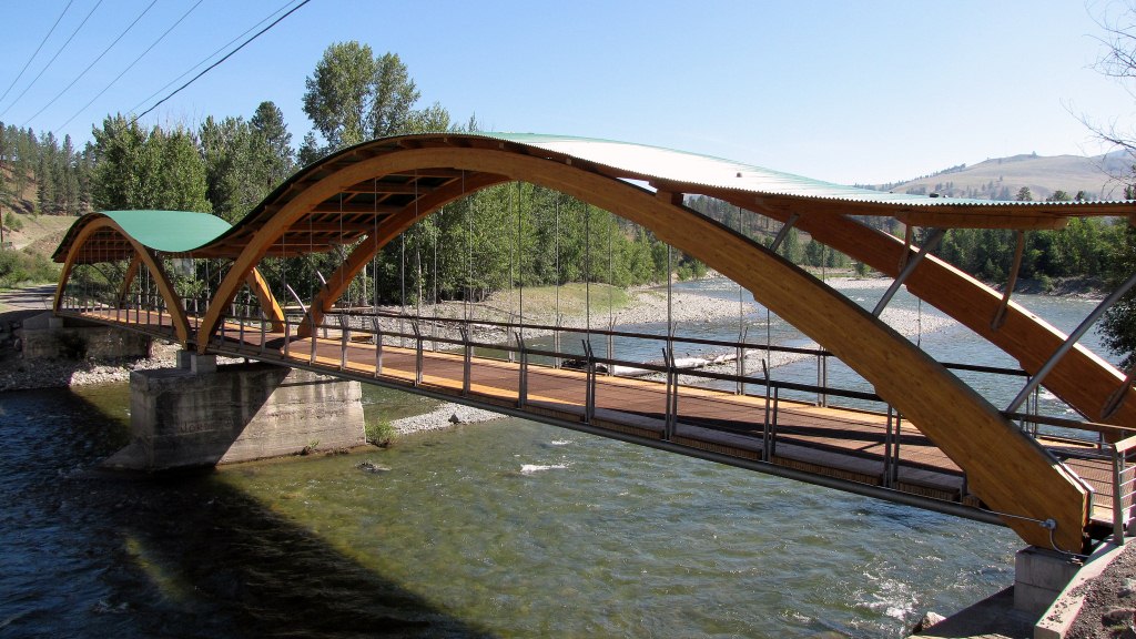 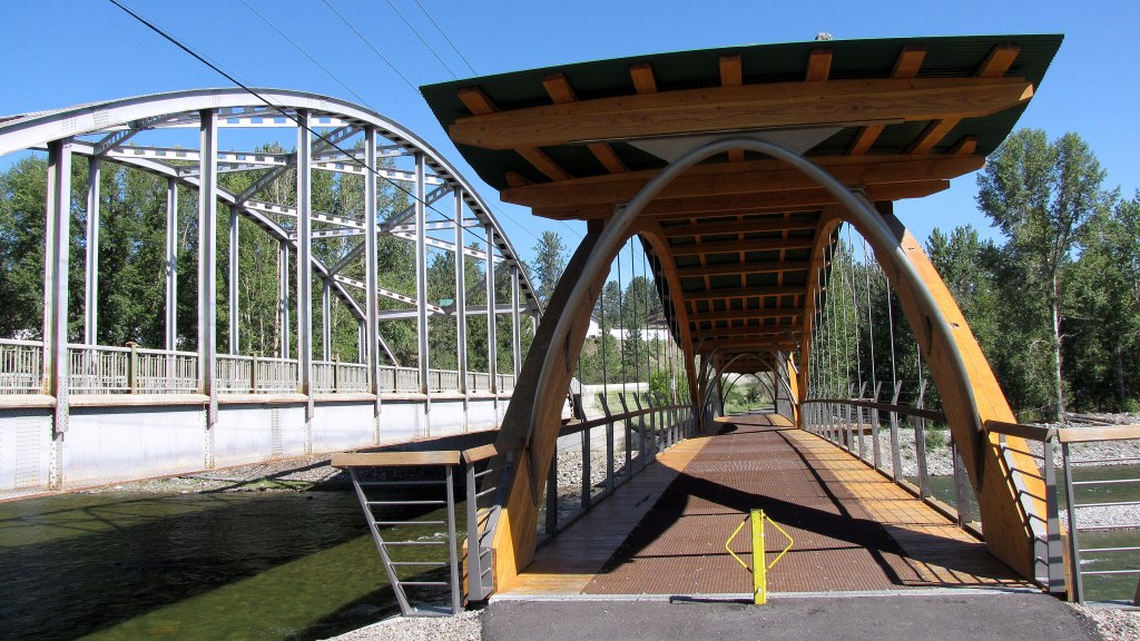 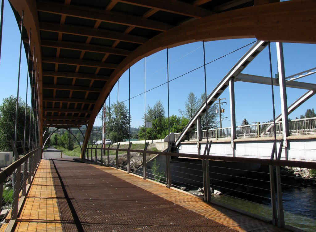 ------------- Some information on the rail-to-trail bridge: - in 1915, the people constructing the CPR KVR rail bridge nicknamed it the "Bridge of Dreams". It was the last big piece in the KVR's construction. www.structurecraft.com/mobile/project.php?id=29www.bclocalnews.com/news/131628463.html |
|
|
|
Post by Blisswood on Sept 3, 2012 12:09:19 GMT -8
I've also got the book about the Stops of Interest. Some of those signs have even been quoted in Bill Coo's "Scenic Rail Guide to Western Canada". These include "The Overlanders of 1862" (with a colour photo), and "The Last Spike" (Craigellachie), where the message on the sign is quoted.
MW
|
|
|
|
Post by Low Light Mike on Sept 3, 2012 12:16:26 GMT -8
The Stop of Interest signs were originally a project in the early 1960s to encourage tourism to tie into the 1966/1967 years of celebrations. Most were completed by 1967. Some have a year on them 19 (dogwood) 66 for example. Many thanks for sharing that history, Paul. Much appreciated. |
|
|
|
Post by Low Light Mike on Sept 3, 2012 13:09:48 GMT -8
Comparison of old and new: |
|
Deleted
Deleted Member
Posts: 0
|
Post by Deleted on Sept 8, 2012 19:11:28 GMT -8
|
|
Deleted
Deleted Member
Posts: 0
|
Post by Deleted on Sept 23, 2012 16:34:44 GMT -8
|
|
Deleted
Deleted Member
Posts: 0
|
Post by Deleted on Sept 30, 2012 15:02:53 GMT -8
|
|
Deleted
Deleted Member
Posts: 0
|
Post by Deleted on Oct 8, 2012 14:53:44 GMT -8
|
|
|
|
Post by Low Light Mike on Oct 8, 2012 18:11:14 GMT -8
A Golden Bridge An old bridge could the Lafarge Bridge. It is about 5 mins out the city Kamloops. 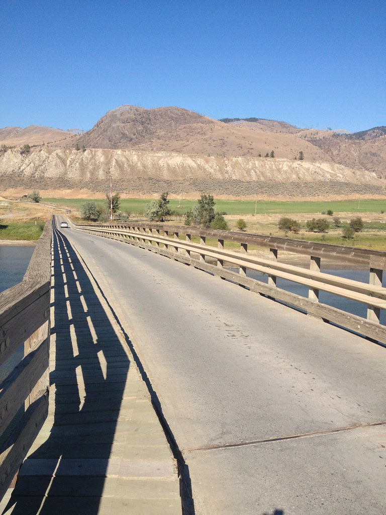 IMG_0501 IMG_0501 by Mr. Awesome photos, on Flickr This is probably a good time to remind you that the height limit for photos is 768-tall. You have been posting portrait-style photos at 768 wide and 1,024 tall, which is too tall. - Please limit the height to 768px tall. |
|


 [/url]

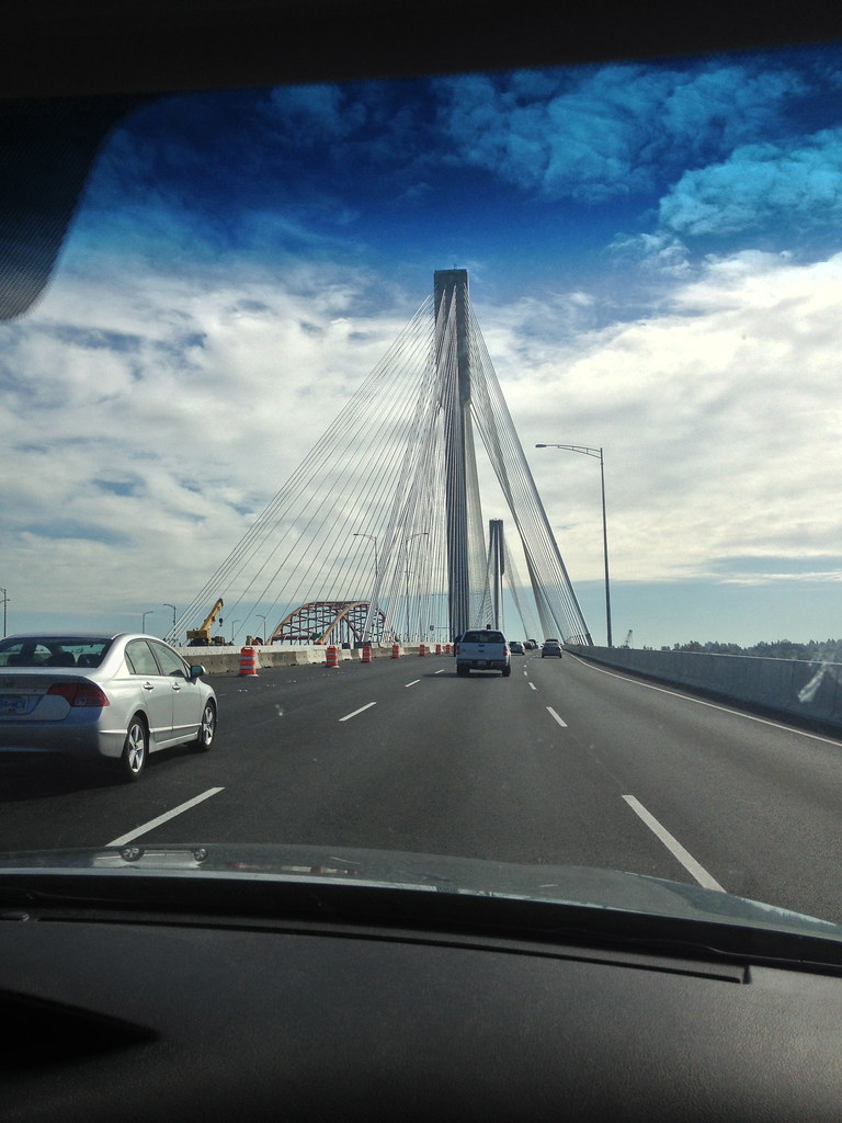
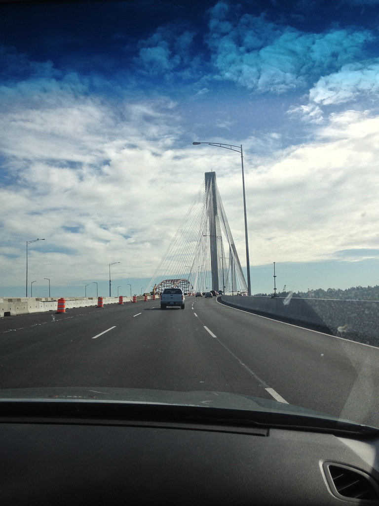
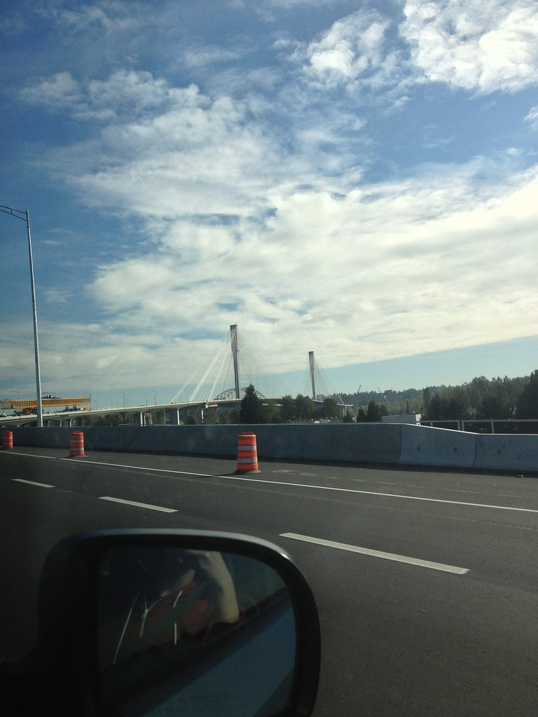
 By the way the New Port Mann Bridge with 10 lanes is widest bridge in the world.