|
|
Post by Retrovision on Mar 16, 2008 10:23:15 GMT -8
I was fortunate enough to find a copy of the second issue ever of Beatiful British Columbia magazine at my favorite Johnson Street used bookstore in Victoria. Featured in this issue is the opening of what was then named the Deas Island Tunnel (now attributed to the designer and known as the George Massey Tunnel, drop by his marine shop legacy in Ladner at the northern foot of Delta Street). Quick Trivia Fact: Queen Elizabeth (ERII) opened 'the tunnel' Here's the spread...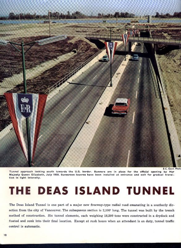 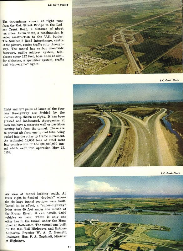 Ever wonder how 'Deas Dock' looked before any ferries or related infrastructure? Take a look at the last image on the second page. I assume that the first image on the second page is of the original interchange with Westminster Hwy. (now quite different since reconstruction during the 1990s) in Richmond facing south from the air, but I'm still guessing about the second image on the same page. The on/off ramps in the second image don't seem to match the Westminster Hwy. interchange, yet my next best guess of the interchange with Hwy. 10 in Delta almost can't be as there is no road where is should be aside from the featured highway. Any guesses? |
|
|
|
Post by SS San Mateo on Mar 16, 2008 14:05:45 GMT -8
My guess would be what is now the interchange with the Richmond Freeway (Hwy. 91).
|
|
|
|
Post by Mike C on Mar 16, 2008 14:12:09 GMT -8
'Holy 'Crap Graham, that's awesome.
Did it say anywhere in there how much the toll was back in the day?
|
|
|
|
Post by Retrovision on Mar 17, 2008 14:59:32 GMT -8
My guess would be what is now the interchange with the Richmond Freeway (Hwy. 91). It could be, though the East-West Connector, as we know the portion of Hwy. 91 through Richmond to be, except this magazine was published decades before it was built and overshaddowed the parallel Westminster Hwy. I'm next to certain that the first in that set of three photos is the interchange with Westminster Hwy., looking southwest, I'm just not positive that the second of those three images of of the same interchange looking northwest, though there are few if any other parts of the same highway that had two overpasses so close together (the one in the distance, if this is indeed the Westminster Hwy. Interchange was demolished once the East-West connector was completed in order to build the new interchange), I'd guess it is at Westminster Hwy. 'Holy 'Crap Graham, that's awesome. Did it say anywhere in there how much the toll was back in the day? No word in here about the cost of the toll, though for some perspective this, the second, issue of Beautiful British Columbia Magazine is priced at 50 cents. Here's an image, taken at a later date, showing part of the actual toll plaza on the north side (same side shown in the magazine, but a wider shot) where until just a few months ago the now-closed truck scales were located... 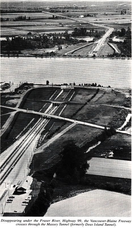 www.masstransport2010.fotopic.net/p49065718.html www.masstransport2010.fotopic.net/p49065718.htmlI've created a new collection on my Mass Transport 2010+ fotopic gallery for this and more historical images of our highways and related infrastructure that I've found in books that I've bought recently. The black and white pictures are all from a gem of book that I found in The Haunted Bookshop in Sidney recently, " Frontier to Freeway" Queen's Printer for British Columbia © Victoria 1986. Found Here:
www.MassTransport2010.fotopic.net/Highways
Including, among 13 currently...
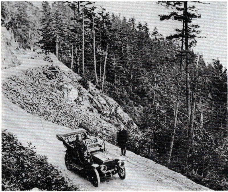
www.masstransport2010.fotopic.net/p49065724.html"Malahat Drive 10 kilometres north of Victoria around 1918. Note right-hand drive car. B.C. drove on the left side of the road before 1920." 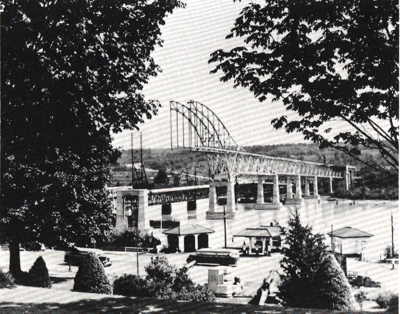 www.masstransport2010.fotopic.net/p49065730.html www.masstransport2010.fotopic.net/p49065730.html"Pattullo Bridge over the Fraser at New Westminster under construction around 1933."  www.masstransport2010.fotopic.net/p49065716.html www.masstransport2010.fotopic.net/p49065716.html"Shot of Port Mann Bridge over the Fraser River on Highway 1, during construction. Structure is 2100 metres long and 45 metres above hight water." ~ "The spectacular Port Mann Bridge is a $25,000,000 (in 1964 dollars) structure with an over-all length of 2104 metres -- [was] the world's longest high-level, stiffened, tied-arch bridge, the longest in the world with an orthotropic deck, and the first in North America to have an orthotropic plate deck." 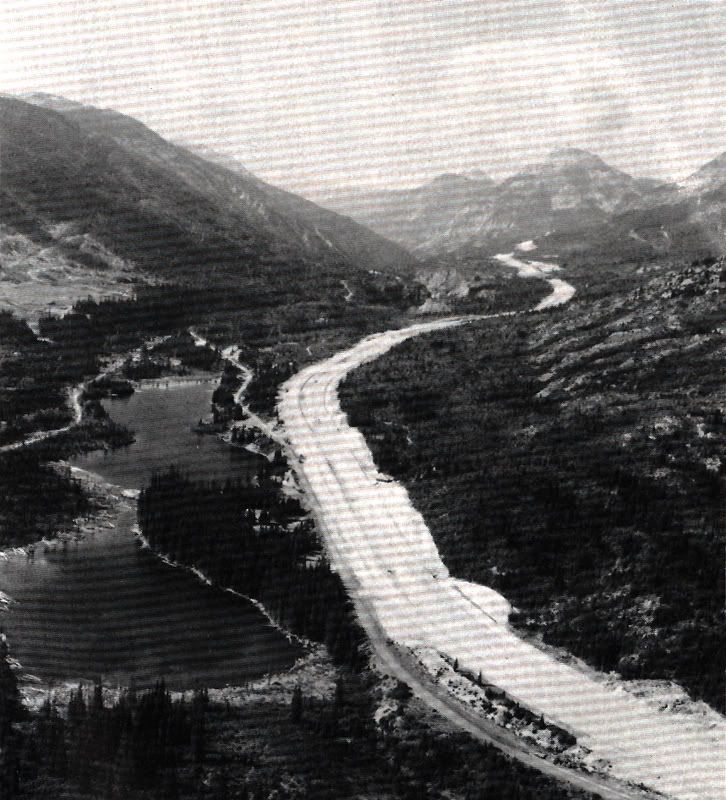 www.masstransport2010.fotopic.net/p49065713.html www.masstransport2010.fotopic.net/p49065713.html"Under construction in 1985 is this section of the new Coquihalla route at the Coquihalla Lakes section some 55 kilometres northeast of Hope." ...And this one from "Through Lions Gate" Copyright 1966 ~ Photo by Ted Czolowski
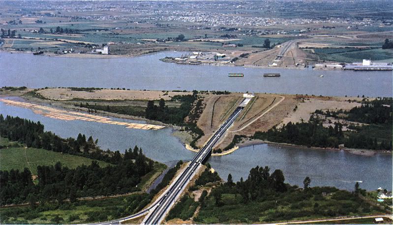
www.masstransport2010.fotopic.net/p49065722.html"The Deas Island [now George Massey] Tunnel, completed in 1959, runs a half mile under the south arm of the Fraser RIver. The Deas Thruway [Hwy. 99] and Tunnel provide a fast transportation route to the U.S., Vancouver and the Vancouver International Airport." Looking north, Deas Dock at upper-left. |
|
Neil
Voyager  
Posts: 7,306
|
Post by Neil on May 14, 2019 17:57:32 GMT -8
Before the Pattullo, and after the Brownsville ferry, there was the Fraser River Bridge, opened in 1904. Road traffic on top, rail below. The bridge is still there, just east of the Pattullo... this postcard was postmarked 1907.  Scan_20190514 (5) Scan_20190514 (5) by neophytef9, on Flickr |
|