|
|
Post by CN2972South on Oct 4, 2010 16:18:20 GMT -8
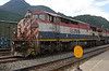
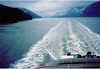
Went for a hike today along part of the TransCanada trail through West Vancouver. Explored part of the old TransCanada Highway and an abandoned stretch of the Pacific Great Eastern/BC Rail. Parked at the Nelson Canyon Park, first up was the abandoned stretch of TransCanada Highway. www.flickr.com/photos/13252585@N05/sets/72157625096912416/If the bridge looks familiar, it's been in several TV Shows and Movies shot in Vancouver, such as Supernatural and The X-Files. After a climb over the CN/BCR Horseshoe Bay Tunnel, we come to the abandoned portion of the BCR Squamish Sub. It was abandoned in 1973 when the Horseshoe Bay Tunnel opened. There are some pretty nice views of Fishermans Cove(?) that have been sadly bypassed. www.flickr.com/photos/13252585@N05/sets/72157625096783070/ |
|
|
|
Post by lmtengs on Oct 4, 2010 16:39:56 GMT -8
Neat looking area. I've seen that bridge from the passenger seat while crossing over that new highway bridge just downstream.
|
|
|
|
Post by Low Light Mike on Oct 4, 2010 16:56:02 GMT -8
Neat looking area. I've seen that bridge from the passenger seat while crossing over that new highway bridge just downstream. ....and there are a few of us who can remember travelling on that old stretch of highway and on that bridge.  |
|
|
|
Post by lmtengs on Oct 4, 2010 17:16:44 GMT -8
How long ago did they close that part of the road?
|
|
|
|
Post by Low Light Mike on Oct 4, 2010 17:24:49 GMT -8
How long ago did they close that part of the road? It was probably the mid 1970's. |
|
|
|
Post by WettCoast on Oct 4, 2010 18:45:25 GMT -8
There's a few of us who were around when it was possible to travel on BCR Budd cars along the now abandoned grade through West Van. One of the reasons to build the tunnel was a very serious derailment that occurred in West Van circa 1970. IIRC, derailed cars rolled down an embankment and smashed into houses. I believe that there were fatalities. Update 8:28 pm PDT - no fatalities - for more click here. |
|
mrdot
Voyager  Mr. DOT
Posts: 1,252
|
Post by mrdot on Oct 4, 2010 19:21:49 GMT -8
one of the people who took the budd car up to prince george several times was your brother and wife, who used that means to see sister-in-law several times, years before Gord's BC rail doublecross! but the best memories are riding the old steam royal hudson, one time I think was with you,wettcoast, as well. mrdot.
|
|
|
|
Post by Northern Exploration on Oct 4, 2010 20:01:12 GMT -8
Fisherman's Cove was always the route we took back from Troll's at Horseshoe Bay. My parents had gotten tired of the Marine Drive route and usually were content taking the highway, but I usually asked to go the long and more scenic route. We had family friends who had a house near there. Now that property is worth a bazillion dollars but was considered "quite a ways out" then. I thought that was the coolest place to live.
I also remember a similar but straighter bridge closer to West Van on the old TCH. A trip to Horseshoe Bay took at least 10 to 15 minutes longer before the upper levels was widened and improved. And the old TCH took even longer.
|
|
|
|
Post by lmtengs on Oct 5, 2010 14:29:34 GMT -8
Could somebody maybe produce a graphic image showing the old route of the Upper Levels/TCH and the New route, so we can compare distances?
|
|
|
|
Post by Northern Exploration on Oct 6, 2010 7:58:45 GMT -8
Could somebody maybe produce a graphic image showing the old route of the Upper Levels/TCH and the New route, so we can compare distances? There were a number of areas where the "highway" was improved, corners smoothed out and made more gradual. So while the old Upper Levels was slightly longer mileage wise, I would be surprized if it was much longer. The new bridge near Fishermans Cove as shown in the pic, cut the corner so saved some distance but I would guess it wouldn't add up to much distance. The greater difference was improved speed. For example, on the Horseshoe Bay side of West Van there used to be a yellow flashing light and a left turn off the west bound side of the road into the West Bay area. There also was a Shell Service station at that corner. So over time, like at this exit, under and over passes, and on and off ramps were built, that allowed higher speed limits and made the road safer. The familiy that lived off that exit, was the one I refered to earlier that moved to Fisherman's Cove, and now retired live on the bluff over TSW. I hate them for the views from all their houses. |
|