90 Miles of Rail-Trails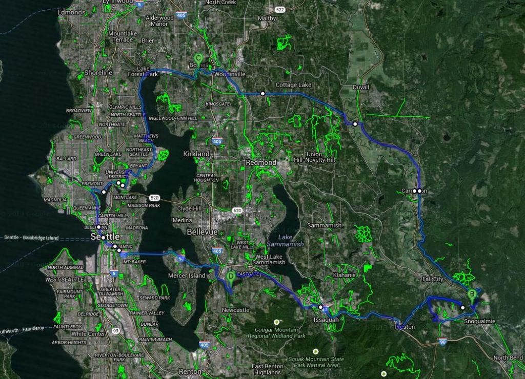
I dedicated Sunday, September 14th, no, not to touring the Kennicott like last year, but rather to ride many many bike trails in the area. In total I rode 90 miles throughout the whole day, starting at 9am and returning home at 6:30pm.
PreludeI always have had a fascination for long bike trips. Back in France, I often did what I considered "long trips" up and down the Yerres valley near my home, which had a lot of great trails. I was always pushing further and further, discovering new scenery. My third school day in America was a retreat to go rock climbing on the Iron Horse State park. The rock climbing was awesome, but what fascinated the most was the fact that that trail - the John Wayne Pioneer Trail or the Milwaukee Road of whichever name you have for it - runs from Seattle all the way to the Idaho border, an astonishing 300+ miles (now of course not all are open, but that's the length of the corridor). Back at home in Bellevue I took trips on the I-90 trail, going to East Mercer Island then West Mercer Island, then the West end of the I-90 bridge and eventually to Seward Park and Downtown Seattle. I loved doing long trips like that, but they were most often just afternoon-only trips.
Back two years ago, one of my dreams was realized: a bike commute to school. Ever since I've been in Elementary School I've wanted to do that but I'd never. ever. done it. And though the trip was only 3 miles roundtrip, I was looking forward it every day. Then something happened: Ferry Fanning. I spend most of my free time either riding ferries or ferryspotting from shore. The weekend bike trips mostly went away, except for a somewhat memorable 50-mile ride almost around Lake Washington in May (the SoK's first day in service). Then in November of 2013 it all started again. But this time, now allowed to take the DSLR on the bike, I decided to combine biking and ferries. This first trip in November was to go see the Kennewick in Lake Union, and it all ended with a bike-n-bus ride, which later would motivate me to ride buses with my bike and go on longer trips. This happened progressively. In January I made my first bike trip out to West Seattle and actually put my bike on a ferry. It was just the Spirit of Kingston but still meaningful. In April I finally rode a true WSF with my bike, the Kittitas at Mukilteo and later that day the Cathlamet, on a bike/bus trip out to Port Townsend.
May and June were major turn points. I made several bike trips out to West Seattle to see Olympic Class Progress, biked all around Seattle on bike to Work Day, a 40+ mile ride. In early June I also took my first trip far East from home - I bused to Snoqualmie and biked back via the Preston-Snoqualmie and Issaquah-Preston trails. Most of the ones before had been to the west or north (and to this day I still haven't expored anything south of Renton save for the Light Rail Expansion).
This summer I did that Port Townsend trip again, and also used my bike for a trip to go ferry Spotting on Pritchard Park - that point opposite the harbor from the ferry terminal on BI.
Late this summer I decided to give an "overhaul" to my bike. I first put in a new frame, up two sizes with my constantly-growing height, then disc brakes for a better all-weather ride, drop bars and traded my 3x7 gears for 2x10s. In other words, I got a new bike:
 Up on Somerset at Sunset
 by
SolDuc Photography, on Flickr
With this new bike I'm now exploring many many places where I've never been before. And that weekend that place was the Snoqualmie Valley. I've heard only praise about how sweet the Snoqualmie Valley Trail is, so it had been on my radar list for a long time. It took me a while to figure out a way to include it in a mega bike loop, but I succeeded at that task. The product was 90 miles of goodness.
Part One: Bellevue to SnoqualmieI left home just after 9am on Sunday, my bike loaded with full waterbottles, my camera and all. Where I was headed? Home. In 9 hours. I was doing the loop in a counter-clockwise direction, so one big part of the morning was getting to the trails in Issaquah. Issaquah is just a few easy miles down Newport Way from me, however it's not on a trail or anything, so that part was the only really big off-parth biking for the day. Newport Way at 9 on a Sunday is almost desert though, and only a dozen cars passed my during my 7-mile trek to Issaquah. Once downtown I got on the Issaquah-Preston just after Issaquah Creek under I-90. The trail is paved for a couple miles to Issaquah Highlands. It's a pretty steep hill to get up (7% grade in places), because that part of the trail is not the original RR bed, just a shortcut made above I-90 for bikes while the real RR went through Issaquah.
At the Highlands, the pavement ends and the trail picks up the Railroad bed. Except it's rough. Very rough. It's not exactly your average well-done gravel trail, it feels like it's just a bit of dirt and gravel over the Railroad ballast. It's good for mountain bikes, but rough for my road bike, which still went on it with only 28mm tires (and aluminum fork). But it's not like the trail is meant for road bikes either, so I shouldn't complain. I did appreciate the 2% grades after climbing 7+ to the highlands.
After passing High Point Way, the trail is just a few years old so it has a much smoother surface, though it is just gravel. A bit later I emerged back on High Point Way, but unlike in June it wasn't just two lanes a wide shoulders on each side, but rather a protected (by plastic bollards) trail on the South side of the road and a narrower shoulder on the other side. Much better than before.

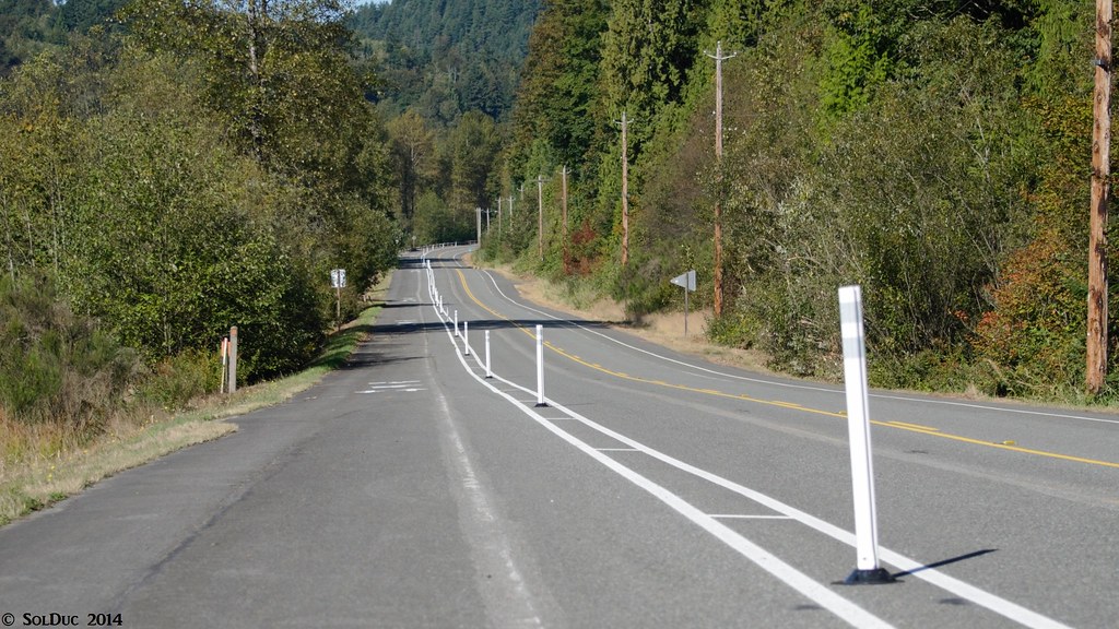 New Issaquah-Preston Trail Cycle Track
 by
SolDuc Photography, on Flickr
After nearly a mile on the roadside trail I transitioned to the Preston-Snoqualmie trail, fueled up at Preston, then went on with the paved trail above the Preston-Fall City road. A few miles in a huge trestle that used to span the valley was destructed, so I had to detour down in the valley, cross the road and then the Raging River on the bridge of what used to be the highway but now is just the trail and access to a couple of houses. It made for a great picture with its older architecture.
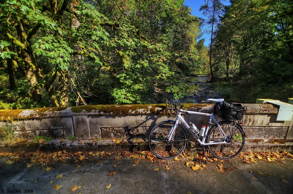 Raging River Bridge
 by
SolDuc Photography, on Flickr
After going down in the valley, I had to climb back up. And unlike the descent into the valley, which is paved and wide, going back up to the trail is a climb across "the seven switchbacks", seven really narrow and tight switchbacks. Once back on the trail it's all paved and great, and you're far from any roads and really all by yourself. I made sure to make some noise though as we were in bear country and that bear had been spotted in the area recently. The Preston-Snoqualmie is still part of the Milwaukee Road, but unlike its name would suggest it does not go all the way out to Snoqualmie, but rather stops short of the town. The small part of the Railroad between Snoqualmie Falls and North Bend is still in use by a museum, and at the time I suspected that it was the reason why the trail didn't go all the way out to Snoqualmie. But I did my research in ownership of the land and some google maps stuff too and it turns out that King County Parks owns the land all the way out to the falls, but the problem that really is stopping everything is a big trestle that appears to be in bad shape per google maps. Here's a diagram of the whole situation if you're feeling lazy:
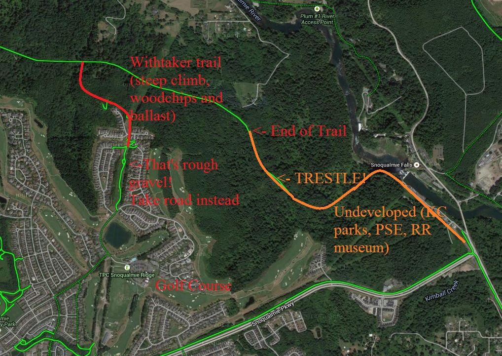
So long story short, this non-completed trail required me to part from the Preston-Snoqualmie Trail a half-mile short of the cul-de-sac end and take an unnamed trail up to Snoqualmie Ridge. I'd done the same thing in the other way back in June so I knew where to go (otherwise I probably wouldn't even have attempted to take the trail). I walked my bike for the pretty steep climb up to the crest of the hill then made my way back down to Snoqualmie Falls, a perhaps 30-minute detour versus the 5 that it would've taken me if the trail was completed...
 Part Two: The Snoqualmie Valley Trail
I tried to fill up my water bottles at Snoqualmie Falls but their fountain was not working so I just kept going. I rode for a short while on Tokul Road then at the Tokul tunnel (more like a culvert under the road) I picked up the Snoqualmie Valley Trail and started to head northbound at that point. I started in the woods, and shortly reached the Tokul Trestle. That trestle sits 100 feet above Tokul Creek, and is original from the Milwaukee Road (100+ years old). Surely an impressing thing to look at.
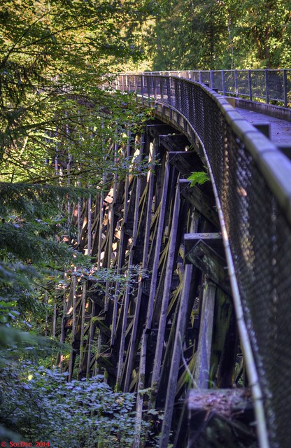 The Tokul Trestle
 by
SolDuc Photography, on Flickr
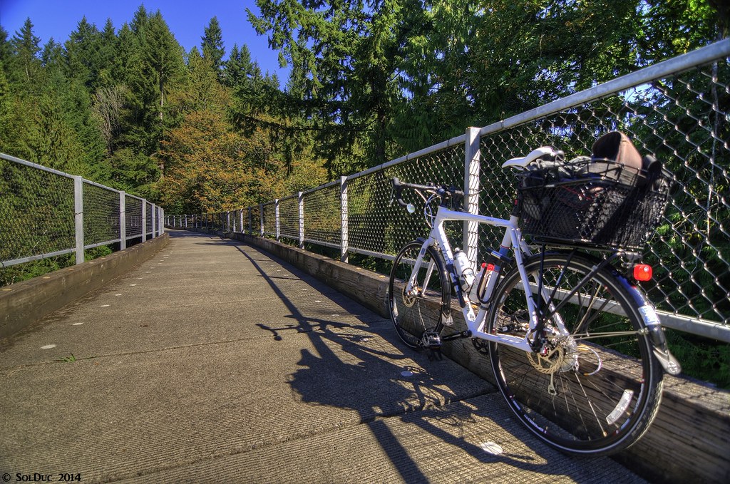 Tokul Trestle
 by
SolDuc Photography, on Flickr
There are several trestles across small creeks on this part of the trail, and all are decked "Belgian Highway Style", just concrete panels with gaps between them of varying size. Bumpy. But otherwise the SVT is very nicely packed for a gravel trail, I saw no difference between it and a paved road, except at the color of my tires. I even saw a cyclocross bike on there!
About a mile before reaching Carnation, the trail exits the forest and is in open fields. It crosses the Tolt river on a brand new bridge and then crosses several streets. I got off the trail at the first cross street and went straight downtown, to get lunch. The burger place that I'd planned to eat at was 21+, so I had to head over to the Mexican restaurant a block down the street. Arroz con Pollo lunch there was good, and in generous teen biker quantities!

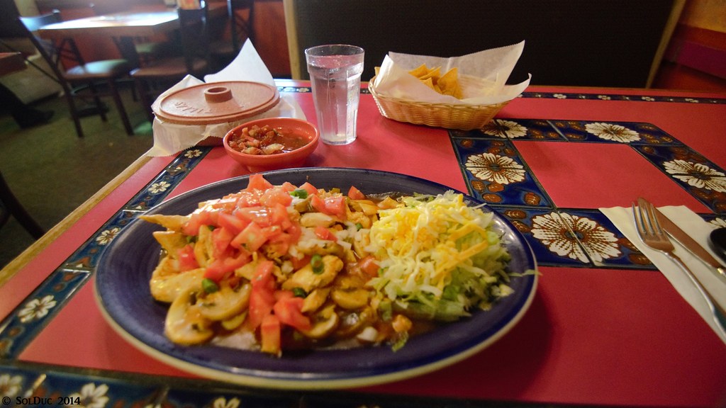 Lunch
Lunch by
SolDuc Photography, on Flickr
Leaving Carnation the trail went through some fields, crossed the State Road and passed through some fields again. Perhaps the best part of the trail, if it wasn't for crossing the state road.
 Snoqualmie Valley Trail into the farmlands
 by
SolDuc Photography, on Flickr
Only a little bit later the trail enters another forest, but this one not as dense as the one before, and not made of the typical Evergreen trees. The trail is also on the edge of some wetlands at several points. I only encountered a few people on this part of the trail.
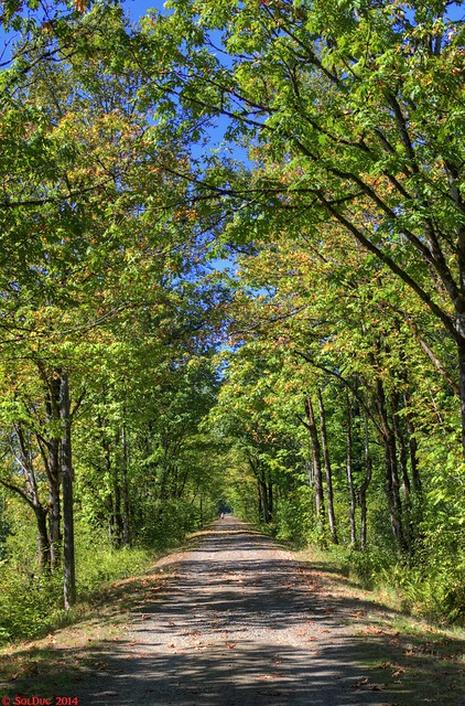 Snoqualmie Valley Trail halfway between Carnation and Duvall
 by
SolDuc Photography, on Flickr
Part Three: The Tolt Pipeline TrailThe title says 90 miles of rail-trails, but obviously that can't exactly be the case. A lot of the trails I took were rail-trails, but the Tolt Pipeline wasn't. It's somewhat related to rail-trails in that the trail sits on top of Seattle Public Utilities' Tolt Water pipeline. And because it's a pipeline it's just straight down a line with no respect to grades or whatever (more on that later).
I left the SVT at 124th, and traveled West on that street across the valley. Cars were going by very fast but the wide shoulder was still great for riding. The bridge over the Snoqualmie River reminded me a lot of similar bridges on the canals of Northern France. Now before you tell me that we have many similar bridges, it reminded me of France because the bridge didn't have huge approaches on either side of the river, it was just there. It also was pretty narrow (by american standards, of course). But most of all, it was painted blue, just like in France.
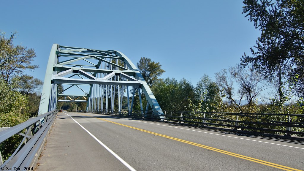 124th over the Snoqualmie River
 by
SolDuc Photography, on Flickr
Anyhow, after crossing the bridge I came up to the T-intersection on the other side of the river and went north on West Snoqualmie Valley Road. The Tolt Pipeline trail doesn't pick up at the road because of the grade but rather up 133rd, a short dead-end with a handful of houses that switchbacks to climb the hill. I made a left turn onto 133rd and the first thing I noticed was a big black and red "no tresspassing" sign. No! Why? I contemplated my option for a couple minutes: either I could use the road to reach the trail (I wouldn't be going across someone's front yard or anything, just using the access road) or climbing up Novelty Hill Road, a mile south, then going back north to catch the Tolt Pipeline. I went with the first option, hoping for the best and thinking that a young guy on a bike just trying to reach a trail isn't suspicious at all. So I started to climb up the hill, and after the first switchback there was another sign that said "no trespassing" but had a small white box underneath that said: "hikers/bikers/horses ok". Relief. I finished the climb on the road then quickly transitioned to the trail. It still climbed gently then was flat. Yes, flat. I want to empathize that.
I went a couple miles on the flat trail, with only a few street crossings. Then I encountered the first dip, for a creek. The grade must've been at least 6-7 percent down and then the same back up. I had three options to get across the gap: either I could go down walking the bike, which would've been slow and would be hard to go back up the other way. Or I could ride down at full speed, taking advantage of speed to climb up the other side. The final option was going down on the bike but braking to go at a lower speed, but with too much braking and the gravel I could easily end up locking a wheel and finishing on the ground, which on gravel is NOT good. So I went for choice #2, since the trail surface was good enough for high speed. It all went well and I ended up on the other side alive. Then it was flat again for a while with another small dip, then it was uphill for a while at a pretty good grade. Then there was a gate in the middle of nowhere and a big downhill. Like, really big, with a matching uphill on the other side. Once again I used technique #2 with success. After the uphill it was flat for an instant and then I came across this:
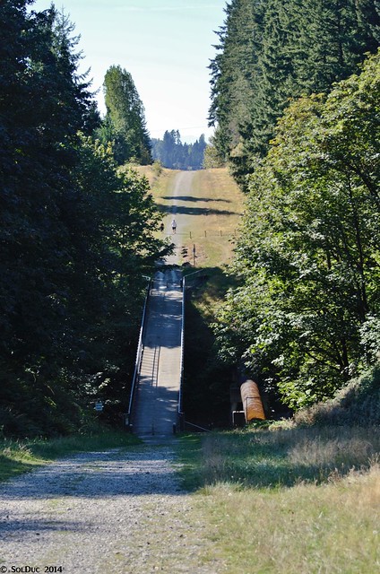 Tolt Pipeline Trail
 by
SolDuc Photography, on Flickr
The downhill would've went well and would've use method 2 again, if it wasn't for that stupid bollard in the middle of the trail right at the bottom of the hill. Had the trail been paved I totally would've went down on my bike, but here no, just no way. I don't hate bollards, they can be useful to keep cars out of trails, but here, what the heck? Why is there a bollard in the middle of this bridge? WHY? WHYYY?
So I walked my bike down the hill, then rode up the hill, only to find myself standing in front of the final descent into the Snoqualmie Valley. A road with fast-moving cars at the very bottom and the trail surface that had been eroded by horses. No way I was ever going to ride that, even on a mountain bike. The hill is very steep and getting down the hill was pretty difficult since I had to retain my (loaded bike) from going downhill on its own. Once at the bottom I had to wait a bit for a break in traffic to cross the road, but I was quickly back on the trail, cruising on a flat and straight trail to the Sammamish River Trail, right next to a rest stop where I filled my water bottles up and had a snack. I was done with hardcore climbing for the day (well, I live on a hill with a 15% grade to my house, so I shouldn't say that, but that part always has to be done so I don't even count it anymore.
 Part Four: The Sammamish River and Burke Gilman Trails
Back on asphalt on the Sammamish River trail, it first shocked me how smooth the trail was (that's what you get for 40 miles of riding gravel almost continuously) but even more how many people there were. I'd passed a handful of runners and a couple mountain bikers on the Issaquah-Preston-Snoqualmie trails, some walkers and bikers on the SVT, and just a few people on foot, a biker and some horses on the Tolt Pipeline. Now it was the full recreational crowd that was out on the trail. Aka the rich people. People on aero bikes with racing components not even making 12mph, those with clipless pedals but bikes with spider webs on them, and of course those with full cyclist clothing that totally go for the crosswalk when there's an underpass under that street. But I should shut my mouth. I made a stop at Log Boom park as usual, and took a five minute rest on the grass in the shade. Then I went on with the Burke Gilman, going through Lake Forest park, stopping at Mathew's beach to fill up with water, and then through the infamous branch segments between Sand Point and UW. My guess is that the Burke Gilman and the Lake Sammamish portion of the I-90 trail are competing for the prize of trail most covered by tree roots. But really, it's annoying and can be dangerous.
There was less and less users as we went South, and the UW detour was free of (almost) anyone. Of course we picked up quite a few people between UW and Fremont but it was still much less than what I saw on the SRT. I got off the trail at Nickerson and Stone Way to take the Fremont Bridge out to downtown Seattle.
Part Five: Fremont to Downtown to homeThis trip had been in the planning stages since summer, and I had completely neglected the part after getting back on pavement at the SRT. In my mind it was just a cruise down the BGT, crossing the ship canal at the Montlake Bridge and then following the shoreline of Lake Washington to I-90. But six days before I took the trip, the 2nd Ave Cycle Track opened. No, this was not going to be my test ride on it, since I'd already done that on the second day. However, SDOT had installed new signals during the week and I had yet to see those. So for a handful new signals I made the detour all the way across UW to the Fremont bridge, went up and down Dexter and finally reached downtown. I got to see the new signals, took a couple pictures of the cycle track and then went on my way.
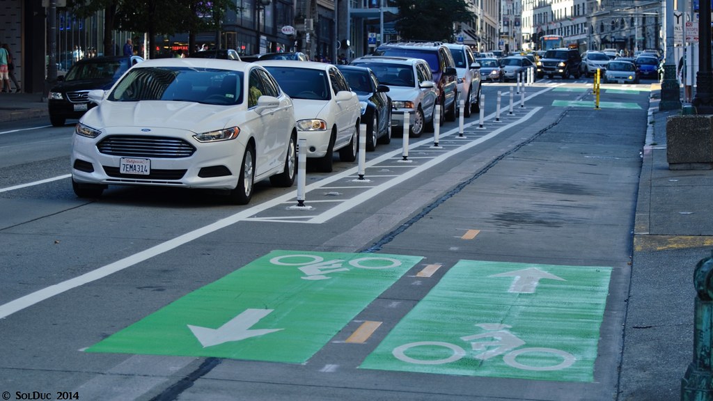 2nd Ave Cycle Track
 by
SolDuc Photography, on Flickr
I climbed up King Street to 12th, then took the bridge over Dearborn and I-90 and was on the trail in no time. I cruised along to the east portal of the bike tunnel (west end of the floating bridge) to eat the remaining of my lunch tortillas and then went on to home. I arrived tired, but less than when I did that 50-mile ride a year and a half ago (it should also be mentioned that I'd climbed a 5300-ft mountain the day before). A good ride and excellent way to spend a Sunday!
What would I do differently if I were to ride it againFirst, I'd bring more water. While I had carefully planned and spaced about 10-15 miles apart, the biggest section (Carnation to the Sammamish River) without water was also the one that was the harshest, hardest and slowest, on top of being done in the early afternoon heat. Bringing two 25-oz bottles instead of two 21-oz ones would be a quick fix.
Then, I'd avoid the two walk-your-bike segments on the Preston-Snoqualmie and Tolt pipeline trails. I'd still be taking the seven switchbacks on the first trail, but I'd get off the trail at the next trailhead (Lake Alice Rd), ride down to Fall City, up the valley just a bit on 202 and then up a side street and back on the SVT. This could save me 20-30 minutes just because that Snoqualmie Ridge detour is so long.
The second detour is at the end of the Tolt Pipeline, across those two huge downhill no-riding sections. I'd get off the trail at 168th, ride down to 145th, and take 156th/145th down to the Sammamish River Trail.
Then, with no new signs on the 2nd Ave Cycle Track to go check out, I'd get off the BGT at UW and take Lake Washington Blvd down next to the lake, and down and across Renton to make the loop an even 100 miles.
AftermathWell, first of all this trip has proved me that I can bike 90 miles at once, and surely gave me the bragging rights for that! It has lead me to plan other similar bike adventures in the 80-100 miles range (which I haven't gotten the chance to do yet, due to being hit by a stupid car a few weeks ago) as well as some light overnight bike touring (2 days) which I will do over the next few months.
But most of all, if I can do 90 miles relatively easily without preparation, anyone to ride with or bike-specific clothing, I can do STP (Seattle to Portland) next summer! GO BIKES!