SolDuc
Voyager  West Coast Cyclist
SolDuc and SOBC - Photo by Scott
West Coast Cyclist
SolDuc and SOBC - Photo by Scott
Posts: 2,055
|
Post by SolDuc on Aug 7, 2014 21:46:02 GMT -8
The Ketchikan airport, located on Gravelina Island (famed for it's bridge and road to nowhere) runs a one-ship very short route across Tongass Narrows to reach the airport. The regular ship on the route is the Ken Eichner 2 and the replacement is the Oral Freeman. Both are fairly new (2002 for the Oral Freeman, 2011 for the Ken Eichner 2), thus indicating that the bridge to nowhere is far off given the money invested in the two ships. Let's start by the Oral Freeman, here's just what she looks like, from the Ken Eicher 2. She's a twin sister to the other ship. 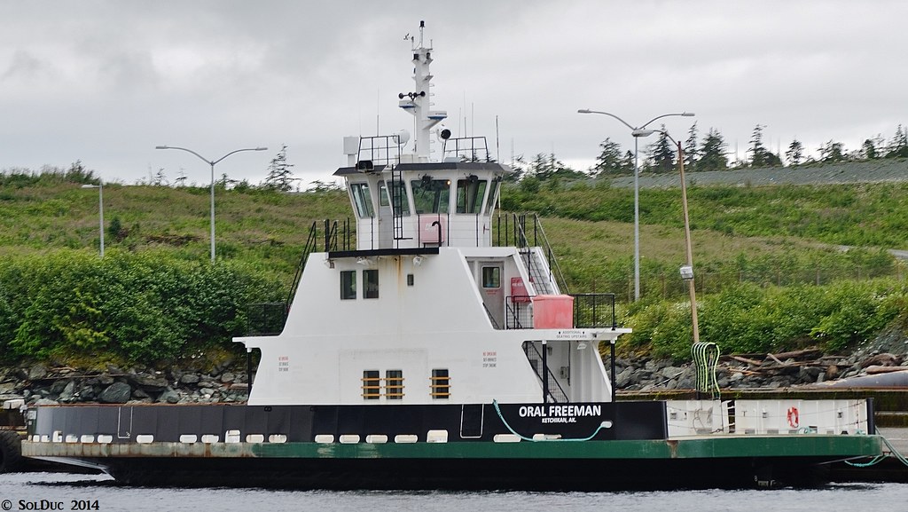 MV Oral Freeman - Ketchikan Airport Ferries MV Oral Freeman - Ketchikan Airport Ferries by SolDuc Photography, on Flickr Now moving on to the Ken Eichner 2. At the airport as seen from the Kennicott.  MV Ken Eichner 2 - Ketchikan Airport Ferries MV Ken Eichner 2 - Ketchikan Airport Ferries by SolDuc Photography, on Flickr Coming towards Ketchikan, thru shot. The light load is what has accumulated in 30 minutes, giving a good idea of the traffic a bridge would see. 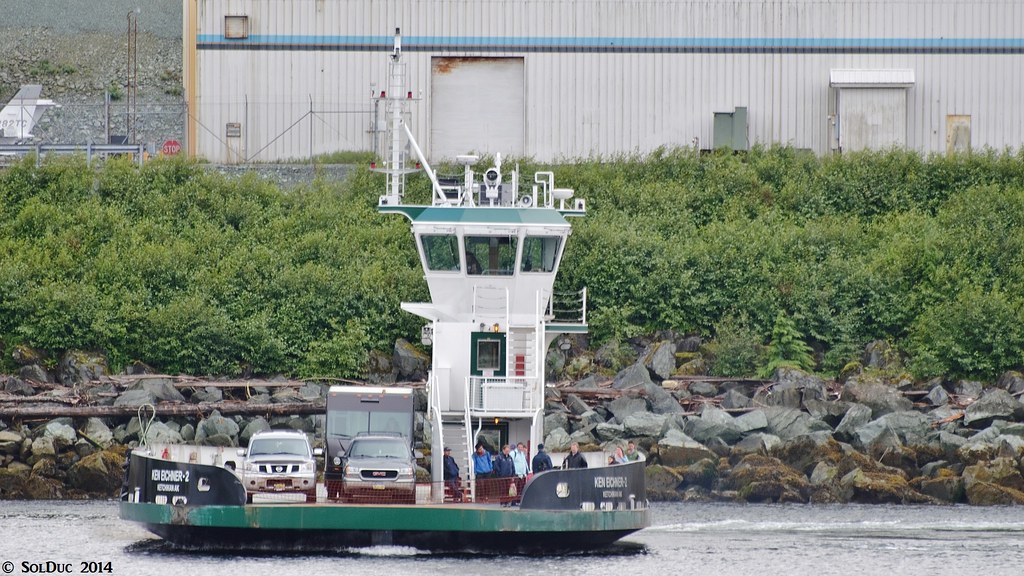 MV Ken Eichner 2 en-route to Ketchikan - Ketchikan Airport Ferries MV Ken Eichner 2 en-route to Ketchikan - Ketchikan Airport Ferries by SolDuc Photography, on Flickr 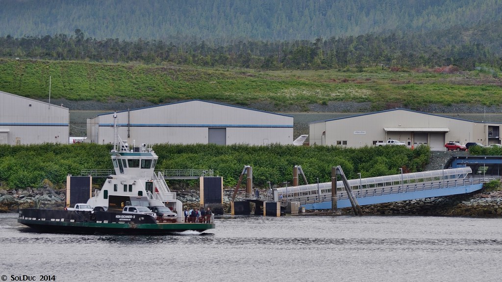 MV Ken Eichner 2 en-route to Ketchikan - Ketchikan Airport Ferries MV Ken Eichner 2 en-route to Ketchikan - Ketchikan Airport Ferries by SolDuc Photography, on Flickr Boarding the ship 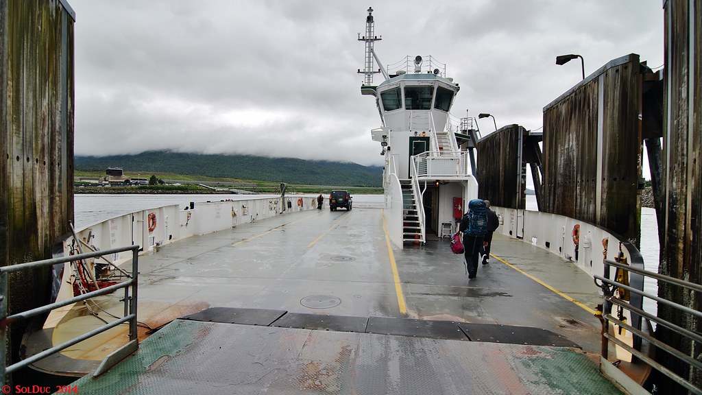 Boarding the MV Ken Eichner 2 - Ketchikan Airport Ferries Boarding the MV Ken Eichner 2 - Ketchikan Airport Ferries by SolDuc Photography, on Flickr She was built by AS&D, just a few hundred meters down the narrows from where she sails. 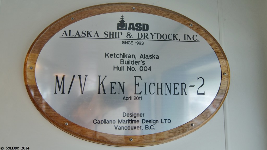 Builder's Plaque, MV Ken Eichner 2 - Ketchikan Airport Ferries Builder's Plaque, MV Ken Eichner 2 - Ketchikan Airport Ferries by SolDuc Photography, on Flickr Lifering 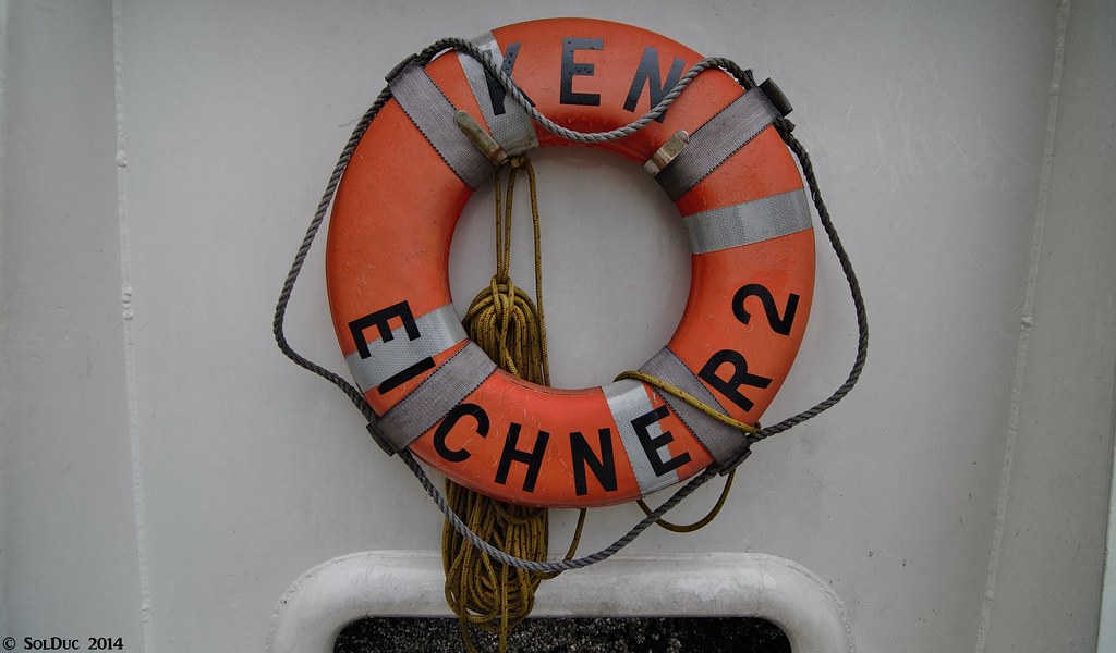 Lifering, MV Ken Eichner 2 - Ketchikan Airport Ferries Lifering, MV Ken Eichner 2 - Ketchikan Airport Ferries by SolDuc Photography, on Flickr Superstructure 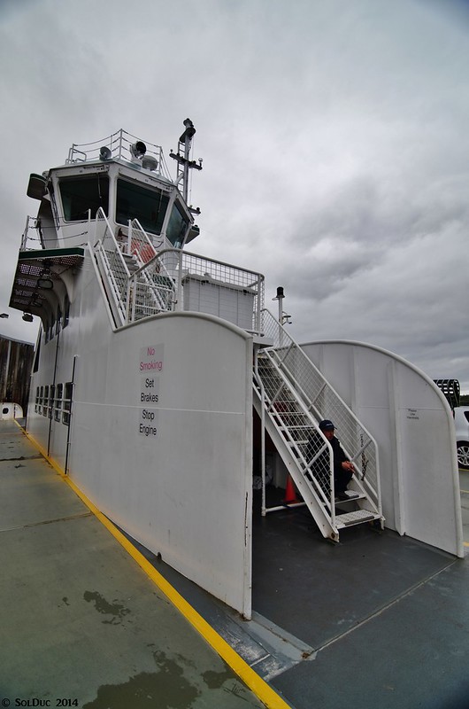 Superstructure, MV Ken Eichner 2 - Ketchikan Airport Ferries Superstructure, MV Ken Eichner 2 - Ketchikan Airport Ferries by SolDuc Photography, on Flickr Sailing away from Ketchikan 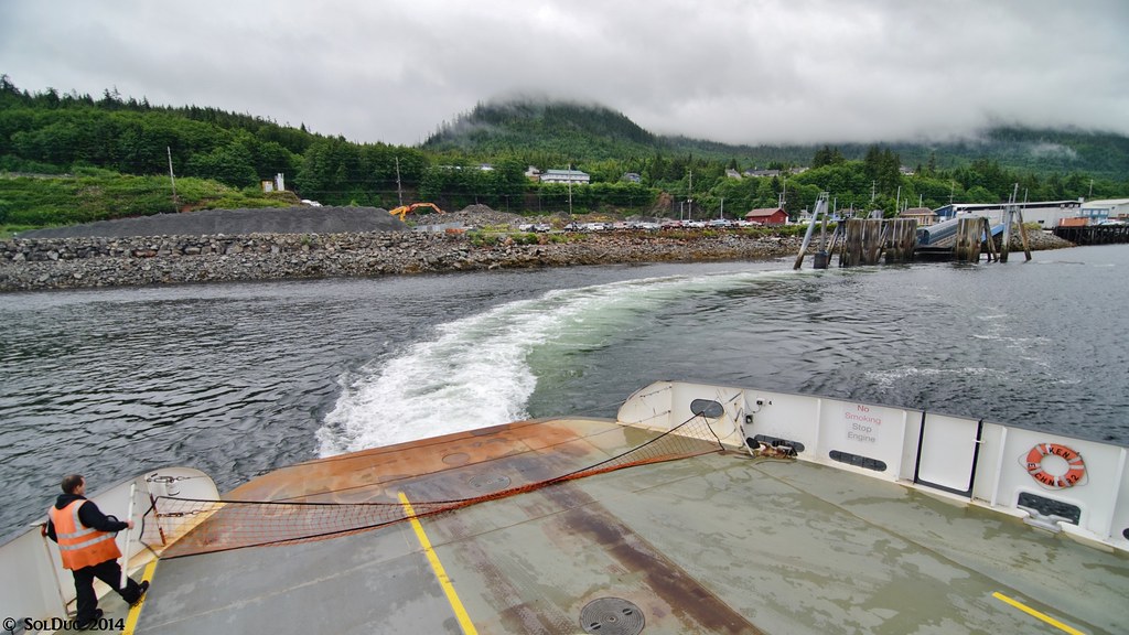 Wake, MV Ken Eichner 2 - Ketchikan Airport Ferries Wake, MV Ken Eichner 2 - Ketchikan Airport Ferries by SolDuc Photography, on Flickr A little bit of Scott fun, to finish this post 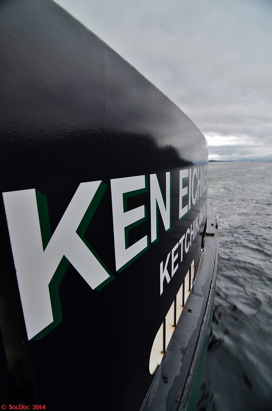 Name, MV Ken Eichner 2 - Ketchikan Airport Ferries Name, MV Ken Eichner 2 - Ketchikan Airport Ferries by SolDuc Photography, on Flickr |
|
SolDuc
Voyager
West Coast Cyclist
SolDuc and SOBC - Photo by Scott
Posts: 2,055
|
Post by SolDuc on Oct 27, 2014 21:43:55 GMT -8
So with the gloomy days of October now upon us, there's little or no ferry or 100-mile bike trips happening so I'm (finally) focusing on pictures from this summer and getting them up. While I did get Alaska stuff up here pretty early on, I still have a few ferry walkthroughs to post. I'll upload one a day until Thrusday, starting today with the Ken Eichner II.
|
|
FNS
Voyager
The Empire Builder train of yesteryear in HO scale
Posts: 4,957
|
Post by FNS on Oct 28, 2014 11:24:06 GMT -8
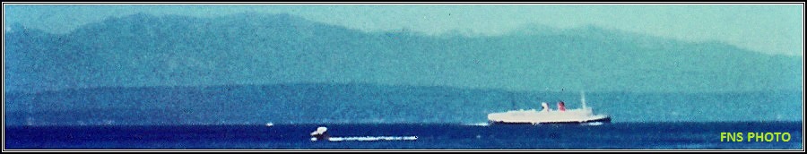
Here's my ride aboard the MV ORAL FREEMAN I took in 2009 after rides aboard the MV NORTHERN EXPEDITION and MV TAKU: 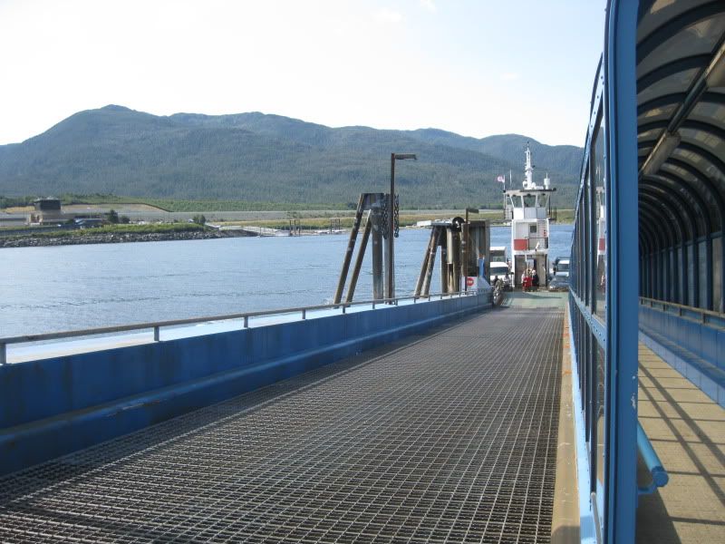 At the dock in Ketchikan. 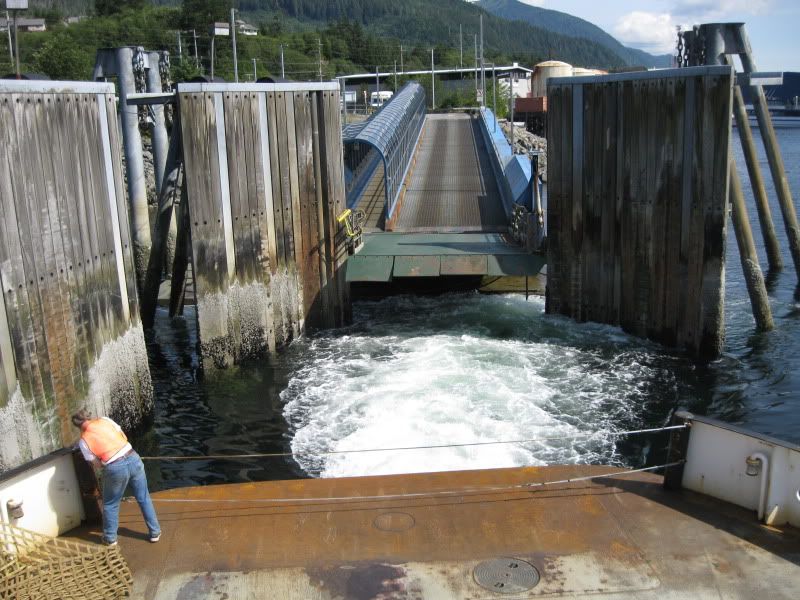 Underway for PAKT. 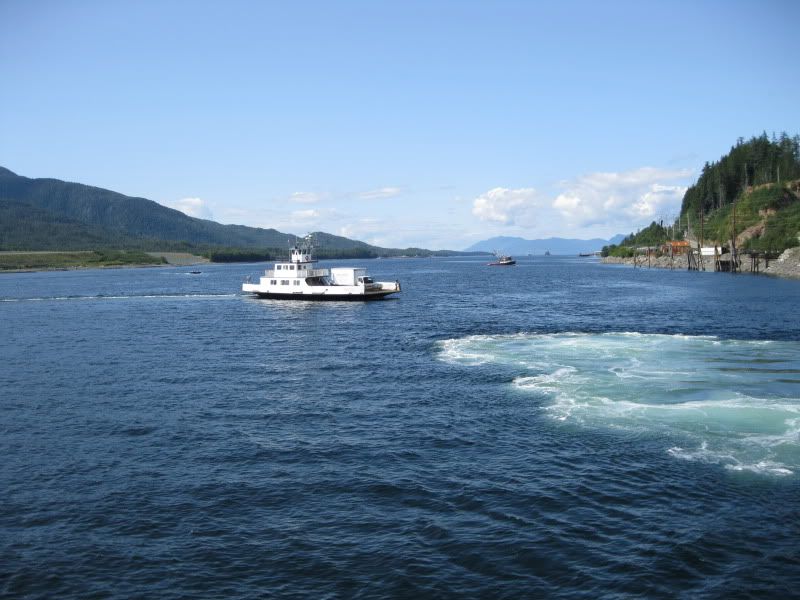 MV BOB ELLIS 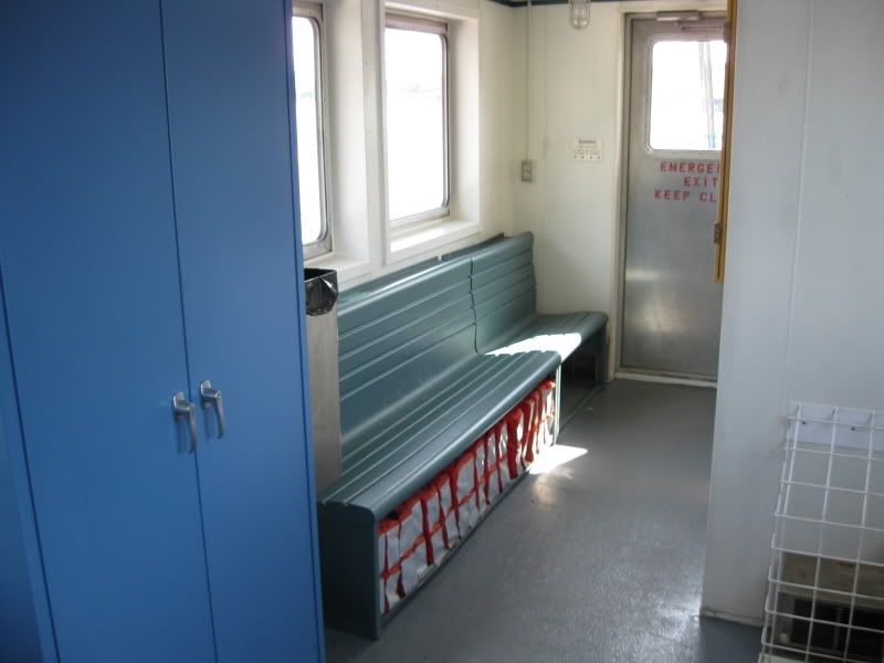 Inside the ORAL FREEMAN. No real comfort is needed as these trips last less than five minutes. 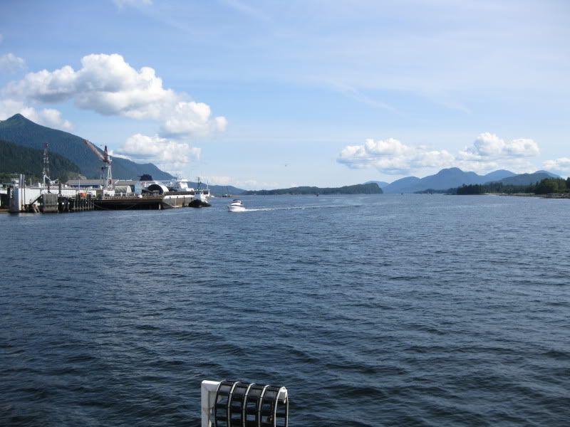 Crossing the Tongass. 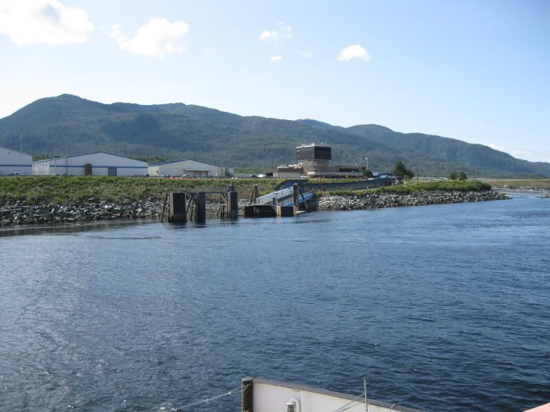 Arriving at the terminal at PAKT. 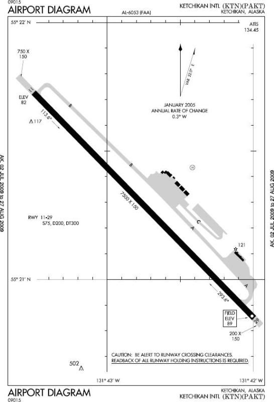 Finally, here's the runway chart of PAKT. I flew home to Seattle after these great ferry rides through the Inside Passage. |
|
KE7JFF
Chief Steward

Posts: 106
|
Post by KE7JFF on Oct 28, 2014 18:18:49 GMT -8
You know, I never understood why it was called the "Bridge to Nowhere" until one of my coworkers, who is from Alaska explained to me that the bridge would of connected the airport, but the bridge would of had to accommodate marine traffic, which I never realized cruise ships plus the AHMS use the waterway, which explained why the bridge would of been like the Golden Gate Bridge...
|
|
FNS
Voyager
The Empire Builder train of yesteryear in HO scale
Posts: 4,957
|
Post by FNS on Nov 21, 2014 11:10:42 GMT -8
You know, I never understood why it was called the "Bridge to Nowhere" until one of my coworkers, who is from Alaska explained to me that the bridge would of connected the airport, but the bridge would of had to accommodate marine traffic, which I never realized cruise ships plus the AHMS use the waterway, which explained why the bridge would of been like the Golden Gate Bridge... This is why you shouldn't span a bridge across the waterway to PAKT from the city: 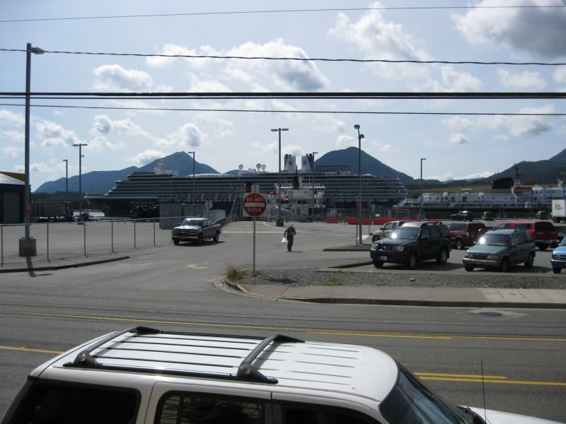 Big cruise ships use that channel. You'll never know how big and tall cruise ships will be in the future. Stick with the ferry. You can watch your friend's plane land and takeoff from this part of the city. Meet them and send them off at the city ferry dock. It's a short walk to the terminal building at the PAKT dock. And, mind you, there's only ONE gate in the terminal! I guess that's why the ticket agent didn't write down a gate number on my boarding pass for my flight to KSEA.  |
|
KE7JFF
Chief Steward
Posts: 106
|
Post by KE7JFF on Nov 25, 2014 16:31:30 GMT -8
Yup, they are big ships alright...a ferry is fine for now due to the fact the only business on the island is the airport. If that were to change since there is plenty of room on the island, I'd say a drawbridge at the location of infamous bridge would be much more practical.
|
|
|
|
Post by Name Omitted on Oct 26, 2015 6:05:04 GMT -8
|
|
|
|
Post by Low Light Mike on Aug 11, 2018 14:45:02 GMT -8
This was actually as viewed from our cruise ship as we entered Ketchikan. Unfortunately, my camera was in the cabin and no time to get down there. These were the only ferries I saw in Alaska! The Stikine was in dry dock, the Hubbard under construction, the Tazlina at dock, and airport ferry.  |
|
|
|
Post by WettCoast on Mar 20, 2021 9:19:57 GMT -8
One of the two Ketchikan (Alaska) Airport ferries, Ken Eichner-2, seen while en route across the Tongass Narrows, that separate the city from its airport. 24 July 2014  © WCK-JST by Jim Thorne, on Flickr © WCK-JST by Jim Thorne, on Flickr |
|
|
|
Post by articulated on Nov 23, 2022 19:53:14 GMT -8
WARNING: Photo-heavy post
The Ketchikan Airport ferry terminals are in the midst of some significant upgrades. The docks on both sides are being replaced; the western (Gravina) side is having its new ramp installed in the opposite direction, meaning the ferry will change from having to navigate an S-bend routing to a more simple arc between terminals. As well, the eastern (Ketchikan) side is having a significant redesign of the terminal side, with a new sheltered pick-up/drop-off area, enclosed terminal building, and a double loading lane. First to start off are the two ferries. The newer Ken Eichner 2 is still the primary ferry, operating daily:  Oral Freeman Oral Freeman, built 2001, is still the backup ferry:  Onto the terminal improvements. Looking over from the Ketchikan side to the current western (Gravina) dock, with Ken Eichner 2 loading at the current ramp.  The new structures on the western (Gravina) side; vehicles will be required to perform a U-turn from the roadway around that new concrete structure on the left down to the new ramp; the pilings for the new ramp and dolphins are in place, but the ramp itself has yet to be installed. Unfortunately I was not able to get better shots of the new terminal layout on the Gravina side due to the construction hoarding in place.  On the eastern (Ketchikan) side, there are now dedicated lanes for ferry loading and for passenger pick-up/drop-off:  The new sheltered passenger pick-up/drop-off area:  Looking up (facing north) the two loading lanes on the Ketchikan terminal. Note there is now a booth on the Ketchikan side, so fares can be collected on both sides before loading (rather than from alighting vehicles on the Gravina side, which presumably leads to delays in loading for the opposite direction):  Looking at the entrance to the ramps; this photo is just to the west and a bit south from the above photo, but still facing the same direction (north). The current dock is on the far left; the future dock will be placed in between the shore and the current dock. Vehicles from the two loading lanes will make the U-turn onto the new dock, while alighting vehicles will proceed straight to the left of the camera and exit directly to the highway. Also a bit better view of the terminal building, although it was still fenced off and under construction.  A nice glass mural on the exit lane, welcoming visitors into Ketchikan:  And finally, a minor (but necessary) improvement on the North Tongass Highway itself, the installation of a crosswalk to access the northbound bus stop. 
|
|