|
|
Post by FerryDude2012 on Aug 14, 2010 15:14:54 GMT -8
Many people living in Nanaimo may already know about this place, but for anybody wanting a view of Departure Bay Ferries, there's a park called "Kinsman Park" on Departure Bay Road. It provides a clear, and unobstructed view of the ferries arriving and leaving Departure Bay. Heres a google street view of the place: maps.google.ca/maps?f=q&source=s_q&hl=en&geocode=&q=Nanaimo&sll=49.891235,-97.15369&sspn=27.195944,78.662109&ie=UTF8&hq=&hnear=Nanaimo,+Nanaimo+Regional+District,+British+Columbia&ll=49.203537,-123.970692&spn=0,0.019205&z=16&layer=c&cbll=49.20369,-123.970654&panoid=lKIjl4IDFYteKRxNdq7owA&cbp=12,101.81,,0,6.51 |
|
Kam
Voyager  
Posts: 926
|
Post by Kam on Aug 14, 2010 20:51:23 GMT -8
Actually, a better place is just around the corner: tinyurl.com/2fvj5wzAnd if you take this beach access trail you can almost reach out and touch the ships in birth 1 at low tide: tinyurl.com/2v37j9j |
|
|
|
Post by Scott on Aug 14, 2010 21:44:20 GMT -8
And unless it's really high tide, you can walk between them (Departure Bay and Kinsman Park) fairly easily along the shore, then it's just a few more minutes to walk up Sugarloaf Mountain. Done that route twice. And here's another excellent ferry watching spot that I visited today (second time I've been here). Good thing it's hard to get to, otherwise it would be a very popular place... today it was almost deserted.  |
|
|
|
Post by lmtengs on Aug 14, 2010 21:54:31 GMT -8
I just love how you don't say where it is...  |
|
|
|
Post by Scott (Former Account) on Aug 14, 2010 21:59:39 GMT -8
And here's another excellent ferry watching spot that I visited today (second time I've been here). Good thing it's hard to get to, otherwise it would be a very popular place... today it was almost deserted. Ugh, it's quite the hill to get to that beach. I am still surprised I made it down and back up when I tackled it a few years back with a buggered knee that ended up requiring surgery. |
|
|
|
Post by Scott on Aug 15, 2010 20:45:10 GMT -8
I just love how you don't say where it is...  Hehe, was going to see if anyone could guess. Scott knows, but he wouldn't say it;) It's Matthews Point Regional Park on Galiano Island. Very nice beach there, basically deserted because of the long very steep narrow path down the side of the bluffs to the beach. On the lower part, there are ropes tied along the path to hold on to. Matthews Point Park is next door to Bluffs Park, and now there's actually a trail between the two... I saw the sign for it, but with 3 little kids, we just went to the beach for the day. The beach is mostly sandy and there are no facilities whatsoever, unless you count the old picnic table at the top of the bluffs. It's right in the middle of Active Pass, so the ferries often pass each other right in front of you and they often sound their horns right there as well. If there weren't so many wasps and sand fleas??, you might think you were in paradise, even if you didn't love ferries! |
|
|
|
Post by lmtengs on Aug 15, 2010 20:53:51 GMT -8
If there weren't so many wasps and sand fleas??, you might think you were in paradise, even if you didn't love ferries! Just go on a warm day during the winter! |
|
|
|
Post by Scott on Jan 4, 2011 22:41:36 GMT -8
From the Southern Gulf Island Terminals Photo thread: First volley of a bunch of old books I've picked up recently at used bookstores The Haunted Bookshop and Beacon Books in Sidney... Found Here: www.ferrypicsbygraham.fotopic.net/c1247705_469.html
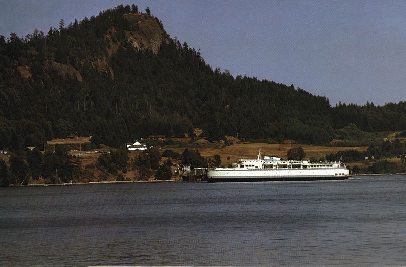
From "The Colour of British Columbia" Photographs and text by Bill Brooks - Copyright © 1980 by Bill Brooks

www.ferrypicsbygraham.fotopic.net/p49070076.html
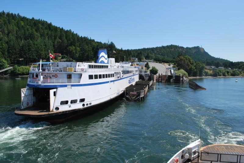
Queen of Tsawwassen departing the original single ramped Village Bay, Mayne Island, terminal in the Southern Gulf Islands before the terminal was upgraded with another berth that could be eventually double-ramped.
Has anyone been up to the top of Mt. Parke (photo above) on Mayne Island that can tell us whether it would be good for ferry photos? It seems quite accessible (compared to Mt. Galiano for instance) but maybe a bit distant from the main ferry routes. Looks like it would have a good view of Village Bay though. I'm just not sure whether the park includes the summit or not. www.crd.bc.ca/parks/mountparke/index.htm |
|
|
|
Post by WettCoast on Jan 4, 2011 22:59:09 GMT -8
That looks like a great spot with excellent views, and with fairly easy access. I do not think that it has a view down into Active Pass, however. The trails look short enough to be 'kid friendly'.
|
|
|
|
Post by Low Light Mike on Jan 5, 2011 7:27:34 GMT -8
I recently found 3 good places on Gabriola Island.
- Orlebar Point, which is just off of Entrance Island
(on Berry Point Rd, maybe 5-8 km from the ferry landing)
Good views of route 30 & 2 ships, and Seaspan too. The mountains on the mainland, and the Entrance Island lighthouse make this an interesting photo location.
- Malaspina Galleries, which is only 3 km from the ferry landing.
Good views of Route 30 & 2 ships, and Quinsam and Seaspan too.
View is of the east sides of Protection & Newcastle Islands. You can look across to the Route-2 lane behind Snake Island, and also see the Route-30 & Seaspan ships pass right before you as they make their way around the tip of Gabriola.
- Keith Rd (off of Canso Rd.), which has a lookout (accessed from a short trail at the end of the dirt road) that is above the cliffs, which are opposite Northumberland Channel from Duke Point terminal. This gives good views of Duke Point and a single-ender spin. To get to this spot, start by turning right immediately off the ferry onto Easthom Rd (it's a very narrow 1.5 lane rd).
|
|
Koastal Karl
Voyager   Been on every BC Ferry now!!!!!
Posts: 7,747
|
Post by Koastal Karl on Jan 5, 2011 9:03:30 GMT -8
I have only been to Gabriola once but there is a place directly across from that lighthouse that looks across that little light station. I dont know if it was an actual place or if we just stopped on the side of hte road. Where did you take your sig photo??
|
|
|
|
Post by Low Light Mike on Jan 5, 2011 11:20:52 GMT -8
I have only been to Gabriola once but there is a place directly across from that lighthouse that looks across that little light station. I dont know if it was an actual place or if we just stopped on the side of hte road. Where did you take your sig photo?? My sig-pic was taken from directly across from the lighthouse, in the place that you describe. - it's just a pull-off beside the road (Berry Point Rd.), with room for a few cars to park, and a bench to sit on. It's technically called Orlebar Point. |
|
|
|
Post by Ferryman on Jan 5, 2011 12:17:39 GMT -8
Re: Mt Parke I've often wondered the same about going up there. There are cell towers up there now, so there has to be at least some sort of access road up there even. Looking at more recent photos though, it looks like the tree growth is a lot thicker these days. So it's hard to say if you'll have a good view up there. Here's an aerial photo I took back in May 2010 of Village Bay from a float plane. Gives you some sort of idea of what the view could be from up there. Looks like the tallest point on Mayne Island as well. Yes, that's the Queen of Nanaimo, and the tide was indeed ebbing through the pass at the time.  Also, here's a more recent photo with Mt. Parke in the background taken in July 2008  |
|
Neil
Voyager  
Posts: 7,307
|
Post by Neil on Jan 5, 2011 12:36:31 GMT -8
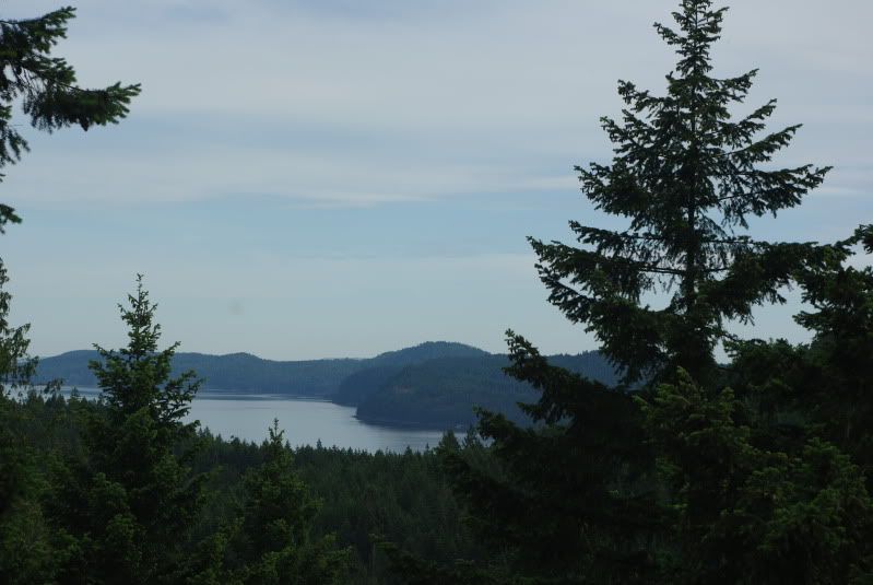
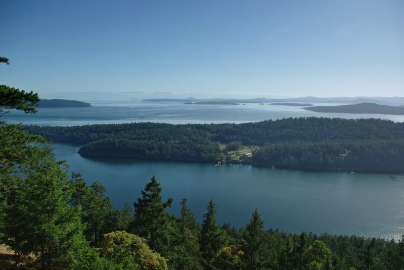
I've been to Mt Parke Park, and the view isn't that great, although perhaps there was another vantage point up there that we missed. Chris is right: trees block a lot of the view, as you can see here...  Much better viewpoint is on Mt Norman, on South Pender. It's higher, and offers much more of a sweep. This shot looks over Bedwell Harbour, with the Olympics in the distance. I believe Mt Norman also offers a view of the approach to Swartz Bay. It's also considerably higher than 'Mt' Parke, which is really just a hill.  |
|
|
|
Post by ferry2france on Feb 26, 2011 2:54:19 GMT -8
Hi All ,  Its a very good idea lets try for the legal ways first, I hope we can get a chance take the photographs |
|
|
|
Post by Low Light Mike on Feb 26, 2011 9:10:46 GMT -8
Hi All ,  Its a very good idea lets try for the legal ways first, I hope we can get a chance take the photographs ....when spambots malfunction. ;D |
|
|
|
Post by Low Light Mike on Dec 23, 2011 21:04:29 GMT -8
Here is the view from Sugarloaf Mountain in Nanaimo. - it makes for a great ferry spotting location for Departure Bay routes.  From Departure Bay Rd, turn onto: - Smugglers Hill - Sherwood Forest - Marion Rd (up steep hill to end of road, and park steps are at end) |
|
|
|
Post by Low Light Mike on Dec 26, 2011 20:21:03 GMT -8
Here's an article from Trains magazine, that ferry-photographers might find interesting. - I'm posting is here, so that it doesn't get lost in our trains thread. from here: cs.trains.com/TRCCS/blogs/staff/archive/2010/11/19/out-here-everyone-is-a-railroad-photographer.aspx--------------------------- I wonder what the ferry equivalent is to Morant's Curve? - A location where fine ferry-art has been produced and also where the general population takes many photos. I wonder if the closest ferry-equivalent is from the outside deck of a ferry in Active Pass, photographing the other ferry that is passing by? |
|
Nick
Voyager   Chief Engineer - Queen of Richmond
Posts: 2,080 
|
Post by Nick on Dec 26, 2011 20:31:12 GMT -8
I wonder what the ferry equivalent is to Morant's Curve? - A location where fine ferry-art has been produced and also where the general population takes many photos. I wonder if the closest ferry-equivalent is from the outside deck of a ferry in Active Pass, photographing the other ferry that is passing by? Thanks for posting that article, great read. As far as a ferry equivalent, I think passing in Active Pass is a good suggestion, but I think the bluffs on Galiano, overlooking the pass is another close equivalent. I have seen many people, not just ferry nerds, taking pictures there. |
|
|
|
Post by WettCoast on Dec 26, 2011 22:22:12 GMT -8
I would agree with Active Pass being 'the place' to photograph ferries in BC, but the Bluffs Park is less than ideal in my mind due to all the trees which invariably are 'in the way'. I prefer the cemetery as the place to shoot the passing ferries. There are some very good spots on Mayne also.
|
|
|
|
Post by lmtengs on Dec 26, 2011 23:42:31 GMT -8
I would agree with Active Pass being 'the place' to photograph ferries in BC, but the Bluffs Park is less than ideal in my mind due to all the trees which invariably are 'in the way'. I prefer the cemetery as the place to shoot the passing ferries. There are some very good spots on Mayne also. Plus, don't forget that the bluffs face south-west-ish, which is exactly where the sun has a habit of setting. You can get some pretty backlit photos from there sometimes too.  |
|
|
|
Post by Low Light Mike on Dec 31, 2011 10:10:46 GMT -8
Yesterday, I enjoyed a day of ferry-spotting on Gabriola Island, mainly at Orlebar Point. This point is right across the channel from Entrance Island.
There were lots of instances of ships passing, and once with 3 ferries in view and once with 4 ferries (a Seaspan item included) in view.
It was a fun day, and good to have my car as a warm refuge out of the wind. But it was easy and fun to spend 8 hours on the island mainly watching ships and spending some in-between time reading and relaxing.
....and I had a wind-storm to watch too. Made for choppy seas and bow-spray on the ships, but also made for a cold photographer.
|
|
|
|
Post by Mike on Dec 31, 2011 18:50:33 GMT -8
A good place for viewing and photographing ferry action out of Horseshoe Bay, that I discovered today, is Copper Cove. maps.google.ca/maps?q=copper+cove+bc&hl=en&ll=49.377637,-123.275185&spn=0.009011,0.022724&sll=49.891235,-97.15369&sspn=36.696572,93.076172&vpsrc=6&hnear=Copper+Cove+Rd,+West+Vancouver,+Greater+Vancouver+Regional+District,+British+Columbia&t=m&z=16 From the remains of an old pier, you are able to get a good view of ships from all three routes out of Horseshoe Bay. Queen of Oak Bay and Queen Of Surrey off of Horseshoe Bay. Note remains of old pier in the foreground.  Queen of Capilano Queen of Capilano approaching Horseshoe Bay.  |
|
|
|
Post by WettCoast on Jan 1, 2012 22:29:13 GMT -8
I think everyone agrees that Active Pass is a great spot for ferry spotting and that the outside decks of any one of the ferries make great platforms from which to do your ferry spotting. I was aboard the Mayne Queen in the early evening two nights before Christmas en route between Sturdies & Village bays. There were five ferries simultaneously in the pass. In addition to the MQ there were the QoNWM, the C-Cel, the Q Nanaimo & Seaspan's Carrier P. It was a busy place...  photo © JST photo © JST |
|
|
|
Post by Low Light Mike on Jan 2, 2012 20:36:54 GMT -8
Scott, re the location for this shot: - I'm guessing that it's easier to time a photo of an inbound ferry, rather than the sudden-emergence of an outbound ferry. Or is it easy to hear the sound of the approaching outbound ship? What's the access point to this location? Is it a public-access trail on Planta Rd? - clues please....it looks like a nice spot, especially during the Duke Point closure. |
|