|
|
Post by Balfour on Nov 7, 2014 15:56:37 GMT -8
Then why do the overpasses on the Upper Levels Highway look like they were built in the 70s? I know a 70s-era overpass when I see one.  (yup, I'm a roadgeek) And yes, I am talking about the Hwy 1/99 portion that you drive on to get to the Horseshoe Bay terminal. You're definitely right, though, that the original Upper Levels Highway was built in the 50s, but not as a freeway like it is now. Yes, the Upper Levels Highway became a freeway during the 1970's. In some places the road was on a new alignment, away from the original two-lane highway alignment built in the 1950's. The Upper Levels is the name for the highway from North Van through to Horseshoe Bay. I am not certain if Hwy 1 through the city/ district of North Van is considered to be part of the Upper Levels or if it is only the section of the highway in West Vancouver which is both Hwy 1 & Hwy 99. This route has nothing but 'interchanges' today, but it was not that long ago that the last traffic light intersections were eliminated (Lonsdale & Westview). Everyone who lives on the North Shore calls it the Upper Levels Highway. IIRC, Lonsdale was converted to an interchange in the very early 90s (1990-1991). I believe Westview was the last intersection on Highway 1 to be converted to an interchange. I have vivid memories of the traffic light and construction of the interchange. I believe Westview was completed by 1997. |
|
|
|
Post by WettCoast on Oct 22, 2015 22:44:45 GMT -8
Another golden oldie from the Mr. DOT collection. This shows Horseshoe Bay terminal in what I believe was late winter 1965, and is a calendar shot (perhaps the Beautiful BC calendar from 1966). I am fairly confident about the date as it shows a very new Queen of New Westminster in berth 1, and it, as well as the Langdale Queen (on the right) appear to have the new Canadian maple leaf flag flying that became our flag on 15 February 1965. The rear side of this photo shows the month of November with Remembrance Day falling on a Friday. The perpetual calendar indicates that November 11th fell on a Friday in 1966 & not again until 1977. The phases of the moon also help to confirm the date. Horseshoe Bay has changed just a little over the last 50 years. Anyways, here is the photo ... 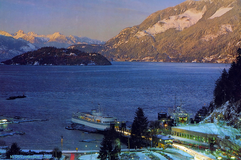 BC Ferries' Horseshoe Bay Terminal with a very new Queen of New Westminster & a not so new Langdale Queen - ~ February 1965 BC Ferries' Horseshoe Bay Terminal with a very new Queen of New Westminster & a not so new Langdale Queen - ~ February 1965
Mr. DOT collection - calendar photo by mrdot., on Flickr |
|
|
|
Post by Low Light Mike on Oct 23, 2015 6:07:51 GMT -8
Horseshoe Bay has changed just a little over the last 50 years. Anyways, here is the photo ... I was surprised to see the double-level holding compound in place as early as 1965. I didn't realize it would have been built that early. |
|
|
|
Post by Starsteward on Oct 23, 2015 13:27:31 GMT -8
Another golden oldie from the Mr. DOT collection. This shows Horseshoe Bay terminal in what I believe was late winter 1965, and is a calendar shot (perhaps the Beautiful BC calendar from 1966). I am fairly confident about the date as it shows a very new Queen of New Westminster in berth 1, and it, as well as the Langdale Queen (on the right) appear to have the new Canadian maple leaf flag flying that became our flag on 15 February 1965. The rear side of this photo shows the month of November with Remembrance Day falling on a Friday. The perpetual calendar indicates that November 11th fell on a Friday in 1966 & not again until 1977. The phases of the moon also help to confirm the date. Horseshoe Bay has changed just a little over the last 50 years. Anyways, here is the photo ...  BC Ferries' Horseshoe Bay Terminal with a very new Queen of New Westminster & a not so new Langdale Queen - ~ February 1965 BC Ferries' Horseshoe Bay Terminal with a very new Queen of New Westminster & a not so new Langdale Queen - ~ February 1965
Mr. DOT collection - calendar photo by mrdot., on Flickr Wow! What a personal time-capsule shot of post February 11th 1965, as I was either aboard doing the P.M. shift or had just come off an early morning start. For some strange reason I got to from the 15th to the end of that month without a day off. Joining the 'New West' was the second brand new ship I had the fun of working on as we had got the new 'Queen of Nanaimo' the previous summer. It's hard to imagine that the second floor of that wee old office held all the staff responsible for crewing and catering for vessels based in H.S. Bay that did Routes 2 and 3. Primarily important was the personnel office, manned in those days by a Mr. Roberts. Things were simple, back in the day, long before the advent of the union and multiple layers of administrators. If you were available to work, and had built up a good rapport with God, (a.k.a. the Chief Steward of a watch), and Mr. Roberts, continuous employment either full-time or seasonal merely took a jaunt up the stairs to Mr. R's office and one was good to go. If you had a liking for a particular watch Mr. R. would gladly accommodate your choice. As for the holding 2 level parkade to the right of the picture, one can notice that the upper open deck hasn't had the snow plowed off it. Quiet times I'm guessing. Have a look at where the 3 toll booths were located in 1965 as compared to where they are today. Thanks for a cold wintery shot of a glimpse into the past...when times were so much fun!  |
|
|
|
Post by WettCoast on Oct 23, 2015 18:31:49 GMT -8
Looking closely at that 1965 photo indicates a number of things:
1 - The centre berth (today's berth 2) was yet to be added
2 - The multi level vehicle holding 'parkade' on the right appears not to be finished as there appears to be no way to get from the roof level down to access the berth. Its no wonder there are no cars waiting there.
Also, I gather that they filled in a bit of the bay to extend the holding area out toward the berths. In other words, the berths today appear closer to the holding areas.
The truth is Horseshoe Bay was short on room even 50 years ago and they have had to be very creative to make the space available work. This is even more true today then it was then. Perhaps the whole terminal should have been (should be?) moved, but where to? I believe that the 1970's 'plan' to go to a whole new and short route 2 (Iona to Gabriola) would have solved the HSB problem.
|
|
Deleted
Deleted Member
Posts: 0
|
Post by Deleted on Oct 23, 2015 19:33:25 GMT -8
Actually Wett Coast, if you look at your 1977 pic of the Coquitlam, the second level still doesnt extend to the berths (only berth 1 had double decking at the time). I believe it used to be a parkade for walk ons. Otherwise, berths could have been accessed by the hill on the right. Also, berth 2 is there. Berth 3 was last to be built.
|
|
|
|
Post by WettCoast on Oct 23, 2015 21:54:38 GMT -8
Looking more closely to the picture I can see now that all three berths were there!
|
|
|
|
Post by chinook2 on Dec 1, 2015 22:40:34 GMT -8
Looking more closely to the picture I can see now that all three berths were there! indeed. perhaps Mr. Dot can explain the unique perspective of this shot? |
|
|
|
Post by WettCoast on Dec 1, 2015 22:45:25 GMT -8
Looking more closely to the picture I can see now that all three berths were there! indeed. perhaps Mr. Dot can explain the unique perspective of this shot? The photo is not his. It originated from a calender as outlined in the original post. |
|
|
|
Post by WettCoast on Dec 24, 2015 23:00:15 GMT -8
|
|
|
|
Post by Luke on May 31, 2016 21:35:13 GMT -8
Horseshoe Bay is, without a doubt, my favorite ferry terminal. The scenery is just breathtaking, and the perfect backdrop for ferry photos. The Queen of Coquitlam departing the terminal for Langdale 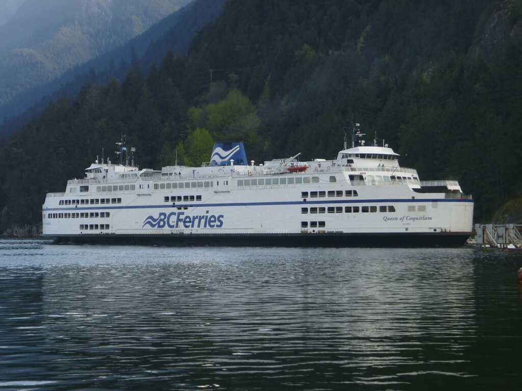 The little garden behind the Berth 2 port wingwall 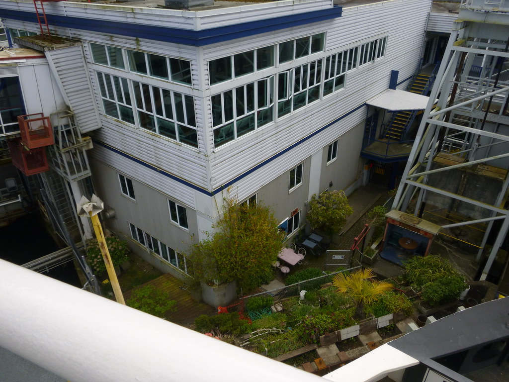 Aboard the Queen of Oak Bay as we depart Horseshoe Bay 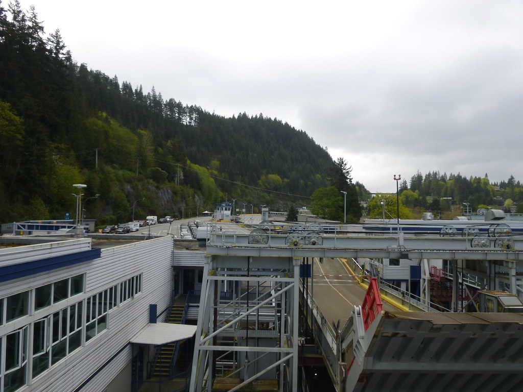 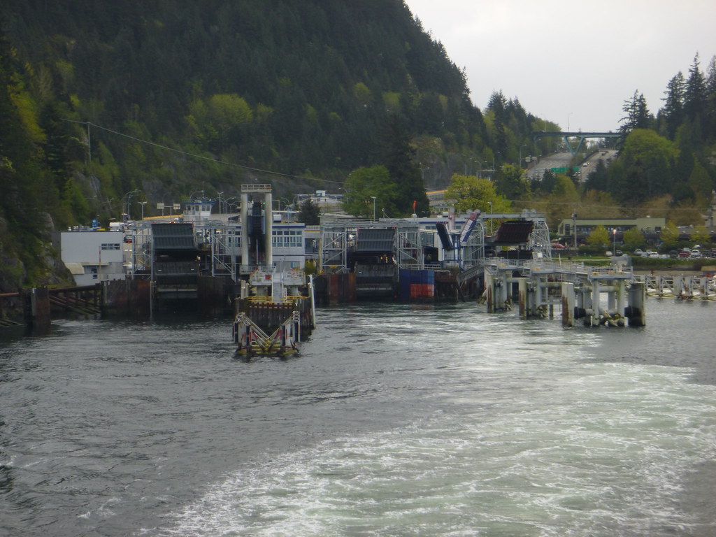 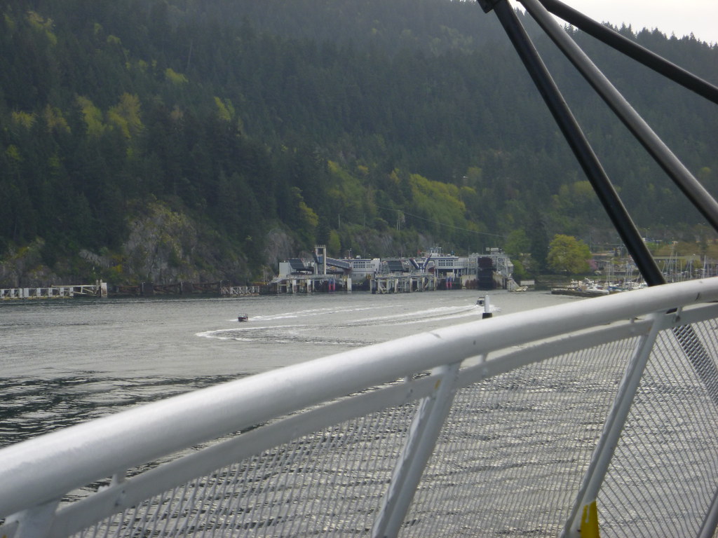 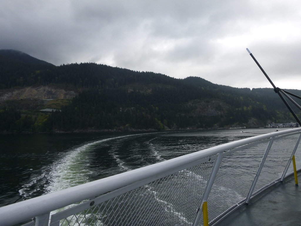 Not exactly HSB, But, well, why not? Here's A shot of the Cappy inbound in Howe Sound 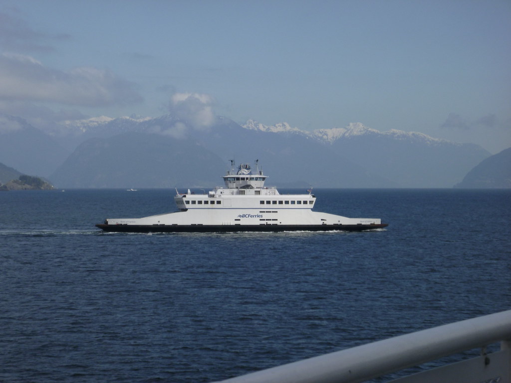 ...Why I love Canada |
|
|
|
Post by hullnumbers on Jul 14, 2016 18:40:25 GMT -8
I just realized in the 1965 photo of Horseshoe Bay Terminal that the big concrete structure (where vehicles wait to load presently) is in it, when was that built? Looking closely, it looks like parking. My suspicion is that it was rebuilt in 1976 for the Cowichan Class. Does anyone know?
|
|
|
|
Post by WettCoast on Feb 12, 2017 20:13:01 GMT -8
|
|
|
|
Post by Low Light Mike on Feb 12, 2017 20:16:48 GMT -8
Are passengers still aloud up to the wheelhouse level?Thanks for the brother team-work in getting this gem to this page. Yes, passengers still have access to that top level. |
|
|
|
Post by Ferryman on Feb 12, 2017 21:47:13 GMT -8
Fantastic photo! I'm guessing that's just a similar angle to another photo that mrdot also took showing the bow of the Queen of Nanaimo and the HSQ from that same vantage point. The blue smoke is from the main engines. They exhaust below the rubbing strake, port fwd of the superstructure, and starboard aft of the superstructure. The HSB end of the ship was the true bow or #1 end. |
|
|
|
Post by WettCoast on Feb 12, 2017 22:33:15 GMT -8
Fantastic photo! I'm guessing that's just a similar angle to another photo that mrdot also took showing the bow of the Queen of Nanaimo and the HSQ from that same vantage point. The blue smoke is from the main engines. They exhaust below the rubbing strake, port fwd of the superstructure, and starboard aft of the superstructure. The HSB end of the ship was the true bow or #1 end. Chris, it was by checking that 'other photo' that you refer to, that I was able to confirm that the 'B' class vessel next to the HSQ in this photo is indeed the Nanaimo. Both photos were taken from the same vantage point at the same time. The cars on the HSQ car deck are mostly the same & in the same locations. Now, if I was just able to locate both negatives I just might be able to digitally stitch the two images together. It would be a job to find that other negative, however. Is the exhaust ducting still the same to this day? Once upon a time the three PR class vessels had a similar arrangement. |
|
|
|
Post by paulvanb on Mar 22, 2017 20:31:36 GMT -8
|
|
|
|
Post by bigcountry on Sept 11, 2017 22:10:18 GMT -8
A couple curiosity questions I'm wondering if anyone could help me out with...
1) why is it the Renaissance uses Berth 1 at Horseshoe Bay while the C's usually use Berth 2?
And 2) why does the Capilano tie up in Berth 3 most nights while she uses Berth 1 or sometimes 2 the majority of the day?
|
|
|
|
Post by chinook2 on Sept 14, 2017 17:32:27 GMT -8
I just realized in the 1965 photo of Horseshoe Bay Terminal that the big concrete structure (where vehicles wait to load presently) is in it, when was that built? Looking closely, it looks like parking. My suspicion is that it was rebuilt in 1976 for the Cowichan Class. Does anyone know? The "Big concrete structure" was built to double deck the holding area in the terminal c. 1963-64, ie in conjunction with the fleet build/expansion of the time. Berth 2 would have been added around this time, and by 1965 the normal usage of the upper deck of the Big concrete structure would be the holding area for route 3. The only berth rebuilt for the first 2 C Class chips was berth one, Ticket booths for route 3 would have been moved back by then, but operations did not change, the lower levels were for route 2 and Bowen. |
|
|
|
Post by hullnumbers on Oct 7, 2017 15:29:28 GMT -8
I just realized in the 1965 photo of Horseshoe Bay Terminal that the big concrete structure (where vehicles wait to load presently) is in it, when was that built? Looking closely, it looks like parking. My suspicion is that it was rebuilt in 1976 for the Cowichan Class. Does anyone know? The "Big concrete structure" was built to double deck the holding area in the terminal c. 1963-64, ie in conjunction with the fleet build/expansion of the time. Berth 2 would have been added around this time, and by 1965 the normal usage of the upper deck of the Big concrete structure would be the holding area for route 3. The only berth rebuilt for the first 2 C Class chips was berth one, Ticket booths for route 3 would have been moved back by then, but operations did not change, the lower levels were for route 2 and Bowen. I see, the concrete structure was completed in 1964 but wasn't in use till 1965. As for berth one had been upgraded in 1976. That's when an upper ramp for the C Class was added. For the Ticket booths I believe they were moved back when the concrete structure was done. That huge structure definitely changed the way the terminal was designed for. |
|
|
|
Post by markkarj on Nov 4, 2017 15:59:20 GMT -8
I was under the impression the upper level structure had to be replaced very soon. Does that remain the case, and have they figured out timing/staging?
I now live in Ontario, so I'm less up to date on BC Ferries info. I suspect this would be an ugly job to do though given the tight space.
|
|
|
|
Post by Alberni on Feb 1, 2018 1:03:30 GMT -8
New release on the future of Horseshoe Bay as BC Ferries seeks input on their plans. www.bcferries.com/bcferries/faces/attachments?id=1116021For Immediate Release 18-002 January 31, 2018 BC FERRIES WORKS WITH COMMUNITIES ON FUTURE VISION FOR HORSESHOE BAY TERMINAL Your input is important to us and will help shape our future plans VICTORIA – BC Ferries is embarking on a broad engagement process from now until fall 2018 to gather community input to shape future plans for Horseshoe Bay terminal. The company values local community input as well as our customers’ input, and recognizes Horseshoe Bay terminal plays a significant role in connecting communities and customers with the people and places important in their lives. BC Ferries wants to hear from customers and communities as we start to develop a new vision for the terminal. The engagement efforts will gather community feedback to better understand the important role the terminal plays in communities’ and customers’ travel experience, and the regional transportation network, as well as gathering input on communities’ and customers’ vision for the future of Horseshoe Bay terminal. BC Ferries is currently engaging with key stakeholder groups and is planning broader community workshops and online engagement in the spring. This visioning process is the first of three phases of terminal redevelopment. It will be followed by involving communities in a detailed design process over the next two to four years. The redevelopment construction is expected to begin immediately after that. “We want to hear what our customers and communities have to say about the future of the Horseshoe Bay terminal,” said Mark Wilson, BC Ferries’ Vice President, Strategy & Community Engagement. “Redeveloping the terminal will support growth in the region, and improve the service to meet the emerging and future transportation needs of our customers.” The current Horseshoe Bay terminal is at capacity, making it difficult for customers to travel and for terminal neighbours to fully enjoy their community. Some of the terminal’s infrastructure will soon be in need of replacement, making it a good time to explore how the terminal can make better use of its existing footprint while also focusing on environmental sustainability. With technology evolving and new generations shifting their modes of travel, transportation in the region is also changing quickly, and these are trends BC Ferries needs to keep pace with and plan for. “We appreciate the process BC Ferries is undertaking for the future vision of Horseshoe Bay terminal and their efforts to ensure our voices are heard,” said Diana Mumford, Chair of the Southern Sunshine Coast Ferry Advisory Committee. “This visioning process will ensure any future redevelopment takes into consideration the voices and needs of the communities the terminal serves, and we look forward to being part of the process and providing our feedback.” The redevelopment of Horseshoe Bay terminal is intended to create a more efficient and pleasurable experience for customers, while supporting growth in the region by moving people and goods with greater ease. BC Ferries looks forward to hearing from customers and communities on their thoughts about the future of Horseshoe Bay terminal. For more information, please visit bcferries.com/about/hsbvision. |
|
|
|
Post by mybidness459 on Feb 1, 2018 18:09:24 GMT -8
New release on the future of Horseshoe Bay as BC Ferries seeks input on their plans. www.bcferries.com/bcferries/faces/attachments?id=1116021For Immediate Release 18-002 January 31, 2018 BC FERRIES WORKS WITH COMMUNITIES ON FUTURE VISION FOR HORSESHOE BAY TERMINAL Your input is important to us and will help shape our future plans VICTORIA – BC Ferries is embarking on a broad engagement process from now until fall 2018 to gather community input to shape future plans for Horseshoe Bay terminal. The company values local community input as well as our customers’ input, and recognizes Horseshoe Bay terminal plays a significant role in connecting communities and customers with the people and places important in their lives. BC Ferries wants to hear from customers and communities as we start to develop a new vision for the terminal. The engagement efforts will gather community feedback to better understand the important role the terminal plays in communities’ and customers’ travel experience, and the regional transportation network, as well as gathering input on communities’ and customers’ vision for the future of Horseshoe Bay terminal. BC Ferries is currently engaging with key stakeholder groups and is planning broader community workshops and online engagement in the spring. This visioning process is the first of three phases of terminal redevelopment. It will be followed by involving communities in a detailed design process over the next two to four years. The redevelopment construction is expected to begin immediately after that. “We want to hear what our customers and communities have to say about the future of the Horseshoe Bay terminal,” said Mark Wilson, BC Ferries’ Vice President, Strategy & Community Engagement. “Redeveloping the terminal will support growth in the region, and improve the service to meet the emerging and future transportation needs of our customers.” The current Horseshoe Bay terminal is at capacity, making it difficult for customers to travel and for terminal neighbours to fully enjoy their community. Some of the terminal’s infrastructure will soon be in need of replacement, making it a good time to explore how the terminal can make better use of its existing footprint while also focusing on environmental sustainability. With technology evolving and new generations shifting their modes of travel, transportation in the region is also changing quickly, and these are trends BC Ferries needs to keep pace with and plan for. “We appreciate the process BC Ferries is undertaking for the future vision of Horseshoe Bay terminal and their efforts to ensure our voices are heard,” said Diana Mumford, Chair of the Southern Sunshine Coast Ferry Advisory Committee. “This visioning process will ensure any future redevelopment takes into consideration the voices and needs of the communities the terminal serves, and we look forward to being part of the process and providing our feedback.” The redevelopment of Horseshoe Bay terminal is intended to create a more efficient and pleasurable experience for customers, while supporting growth in the region by moving people and goods with greater ease. BC Ferries looks forward to hearing from customers and communities on their thoughts about the future of Horseshoe Bay terminal. For more information, please visit bcferries.com/about/hsbvision. I really think it's time to move Nanaimo right out of HB completely and either commission the ferry dock closer to Squamish for use as the Nanaimo bound service or completely shut down rt 2 for good. Out of the three routes it's the Nanaimo run that doesn't really need to be there when there is a alternative via Tsawwassen. It is unreasonable and unrealistic to interfere with the Langdale and Bowen Island runs. Didn't they already do a expansion to HB in recent years? I can not tell you how many times HB has been expanded and revamped since the early 1980's when I began using the terminal. Heck, I still remember boarding the ships on the main deck before berth 2 and 3 even had double deck ramps. We need to ask, how many more times after this new upgrade will HB outgrow itself again, and again.... If they convert that dock closer to Squamish, Nanaimo ships would have that terminal all to itself. Granted I have never seen that dock, so I am not sure if it could be done. Translink's 257 could provide extended runs to service the terminal. I live in the mid Island and would personally support this. |
|
|
|
Post by compdude787 on Feb 3, 2018 20:38:49 GMT -8
Why move it up to Squamish? That seems like it would be waay out of the way for most people living in North Vancouver. Why would you drive north to the north end of Howe Sound just to take a ferry that runs back through where you just came through? I don't disagree that HSB is quite small and cramped, but that's not a good location.
|
|
Neil
Voyager  
Posts: 7,309
|
Post by Neil on Feb 3, 2018 22:34:49 GMT -8
Why move it up to Squamish? That seems like it would be waay out of the way for most people living in North Vancouver. Why would you drive north to the north end of Howe Sound just to take a ferry that runs back through where you just came through? I don't disagree that HSB is quite small and cramped, but that's not a good location. I don't think route two is going anywhere. Building a new terminal up Howe Sound would be insanely expensive, and would add to the travel time. BC Ferries, and the provincial government, make a profit as it is from the run. The most likely, and least costly scenario is to expand the marshalling area, possibly with an upper deck. Cheaper than all the costs involved with new marine structures, approaches and other infrastructure somewhere else. Tsawwassen can't absorb all the traffic if Horseshoe Bay was eliminated from service to the Island. Black Ball got it right with their location in the early '50s, and I think we're going to be living with Horseshoe Bay, with its limitations, for a long time to come. |
|