|
|
Post by gordon on Mar 26, 2009 12:22:22 GMT -8
If they did develop a 2nd berth there would that not be a tight maneuver for a ferry to dock there.
|
|
|
|
Post by Balfour on Mar 26, 2009 12:27:08 GMT -8
If they did develop a 2nd berth there would that not be a tight maneuver for a ferry to dock there. It might depend on the type of vessel. A C-class would require a pretty large radius turn similar to the Maneuver made by the Queen of Surrey at Langdale. While a single ender, say the Queen of New Westminster, could could easily dock stern-to. Departing this berth would require a pretty large radius turn, similar to what a C-class or Coastal would have to make as mentioned above. |
|
rt1commuter
Chief Steward
   JP - Overworked grad student
Posts: 167
|
Post by rt1commuter on Mar 26, 2009 12:37:50 GMT -8
I think you mean a tight radius u-turn rather than a large radius turn. A large radius turn would have the ferry crashing into Gabriola island  . |
|
|
|
Post by Ferryman on Mar 26, 2009 15:27:00 GMT -8
When Duke Point was being built, there was initially some sort of plans to try and have the Gabriola Ferry to use Duke Point instead of Downtown Nanaimo. So Berth 2 might have likely been the dock the Quinsam would have used. But the residents on Gabriola became upset because they prefered being dropped off in downtown Nanaimo, that way it was a quick little walk to the shops, as opposed to maybe some sort of 15 minute bus commute into town from Duke Point.
I remember in 1998 or so, BC Ferries had to do a major rebuild on the berth in Downtown Nanaimo, and they used Duke Point while the dock was out of service. I remember coming across incentives in the brochure rack at the Galley West food court at Tsawwassen, to travel to Gabriola via Duke Point with Free Fares, and actually taking advantage of it that summer. The schedule of course conflicted with Route 30 traffic a little bit, because it seemed to be timed so that either the Quinsam or a Route 30 vessel would be in the dock at Duke Point, when one was trying to arrive.
|
|
Mill Bay
Voyager   Long Suffering Bosun
Posts: 2,887 
|
Post by Mill Bay on Mar 26, 2009 16:15:32 GMT -8
When Duke Point Terminal was being designed, was it intended to be the same format as Langdale, two berths opposite each other. If you look at google earth it looks like there is a set up for a future 2nd berth. Moreso than "almost," it actually is. The structure was designed with a 2nd-berth in mind, for possible future expansion. Forum member "no longer" refers to it as the "hammerhead". I believe I remember hearing that they had planned to build two berths at the same time during the initial construction, but they apparently ran into an environmentally sensitive area along the shore where the second berth had been planned and they were forced to concede defeat to the almighty fragility of the environment. It's hard to say whether a second berth will ever be necessary now, however, as there is almost never more than one ship there at one time, and the terminal only serves one route, with the likelihood of another route being diverted there very slim. The only real reason to add a berth, now, would be if they were to add additional ships to the route that needed the extra berth to load and/or tie up. Also, given the way the world is moving, traffic in terms of both foot passengers and vehicles will likely never grow to the point that rte 30 would ever require more than two vessels, or more than one berth at Duke Point. |
|
|
|
Post by gordon on Mar 26, 2009 18:24:53 GMT -8
I would suspect the decision to add the 2nd berth at Duke would take substantial traffic growth and frequent multiple sailing delays over a decent period of tine before the decision was made to add a 2nd berth.
At this point are there enough satisfactory vessels to even have MD sailings if they ever became necessary?
|
|
|
|
Post by Hardy on Mar 26, 2009 21:00:02 GMT -8
Duke is probably the most ideally suited for drop trailer service. That would be perhaps the OVER-RIDING reason to add a berth at this terminal, should BCFS ever become serious about providing drop service...
|
|
|
|
Post by Retrovision on Nov 16, 2009 0:54:00 GMT -8
|
|
|
|
Post by FerryDude2012 on Aug 19, 2010 10:57:50 GMT -8
|
|
|
|
Post by FerryDude2012 on Aug 19, 2010 20:46:20 GMT -8
|
|
|
|
Post by Low Light Mike on Sept 20, 2010 12:29:09 GMT -8
Here is a new thread for photos of Duke Point ferry terminal, and discussion related to those photos.
|
|
|
|
Post by Low Light Mike on Sept 20, 2010 13:03:28 GMT -8
2 more pictures, from the Mr. 7-Sisters collection: - Here's the Genesis of the Duke Point terminal  |
|
|
|
Post by Low Light Mike on Sept 20, 2010 14:14:38 GMT -8
Duke Point Terminal: |
|
|
|
Post by Low Light Mike on Sept 20, 2010 14:34:18 GMT -8
And a picture of early morning loading on Route-30 at Duke Point: 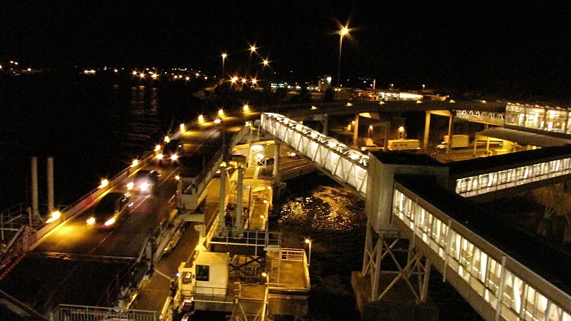 |
|
|
|
Post by Low Light Mike on Oct 17, 2010 17:41:43 GMT -8
Duke Point terminal photos from October 15, 2010: The donkey stable at Duke Point: 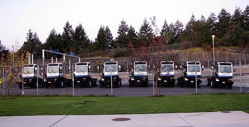 ....and one of those donkeys on-board the ferry. - I had thought the service was true drop-trailer, where each donkey stayed on its own side of the strait, like at a Seaspan yard. But no, they take the trip, which makes sense for time-efficiency of loading, but requires a larger stable of donkeys (assuming that they need a few extras in order to allow for too few left on one-side of the strait from time-to-time. But hey, when you run a subsidized drop-trailer service, you can afford that.) 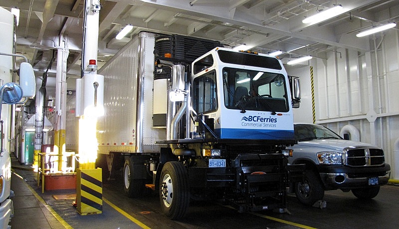 And 2 views of the passenger walkways, from vantage-point of the long-term parking lot sidewalk: - morning at 7:00am 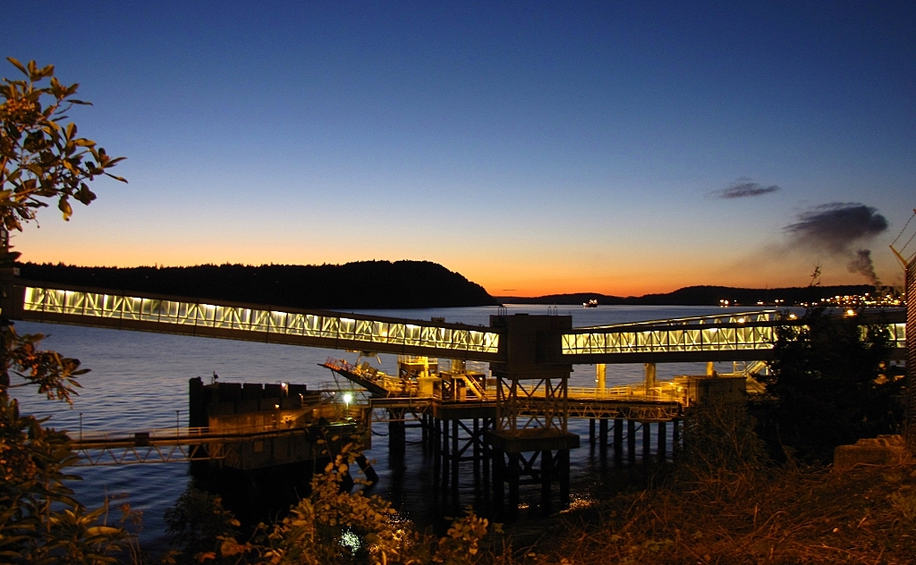 - night at 8:00pm  |
|
Neil
Voyager  
Posts: 7,306
|
Post by Neil on Oct 17, 2010 18:57:06 GMT -8
- I had thought the service was true drop-trailer, where each donkey stayed on its own side of the strait, like at a Seaspan yard. But no, they take the trip, which makes sense for time-efficiency of loading, but requires a larger stable of donkeys (assuming that they need a few extras in order to allow for too few left on one-side of the strait from time-to-time. But hey, when you run a subsidized drop-trailer service, you can afford that.) ...You might be right about the subsidy- WMG would no doubt concur- and it might also be an indication of how little drop trailer business they're doing, that they can afford to have their trucks tied up on crossings, rather than working in the terminal. Seems to me there's always lots of those things sitting around, and I never count many, if any, unaccompanied trailers on board. Of course, I'm never travelling late at night, or on the first crossing at 5:15, which is maybe when they're carrying that traffic. |
|
|
|
Post by lmtengs on Nov 25, 2010 16:40:35 GMT -8
Duke Point Terminal on November 21st, nicely framed by the Queen of Alberni's vehicle deck opening.  |
|
|
|
Post by Low Light Mike on Dec 20, 2010 18:53:25 GMT -8
Karl has given me permission to post some photos from his Facebook albums. - I've adjusted the contrast & colours a bit, and here are some of his photos relating to this thread: ------------------------------- - Queen of Alberni at Duke Point, giving a view of the pay-parking lots & employee parking lot, the footie terminal building, and the berth. 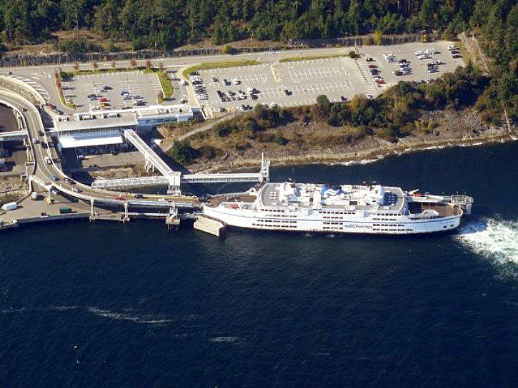 - Quinsam doing some sea-trials near Duke Point, with a view of the terminal's vehicle holding compound. 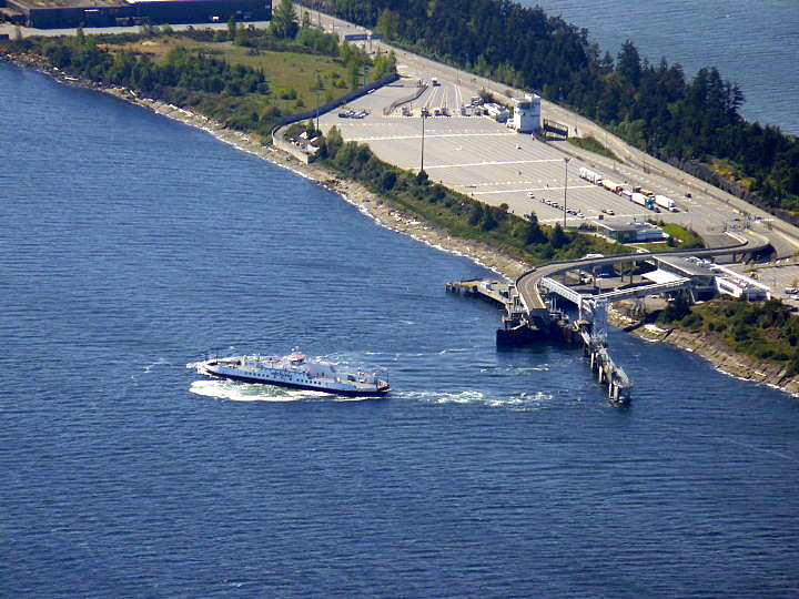 |
|
|
|
Post by Low Light Mike on Jan 6, 2011 10:14:46 GMT -8
Photos of Duke Point terminal, taken on 12/31/2010 from a lookout on Gabriola Island (accessed from the end of Keith Rd.) ============== Series of zooms: - control tower is on far-left.  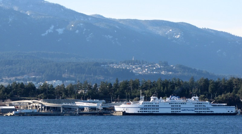 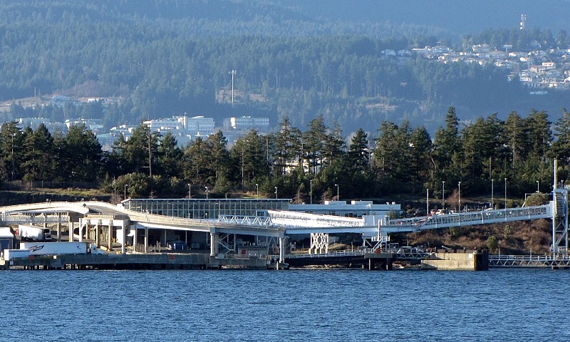 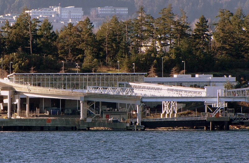 - the control tower 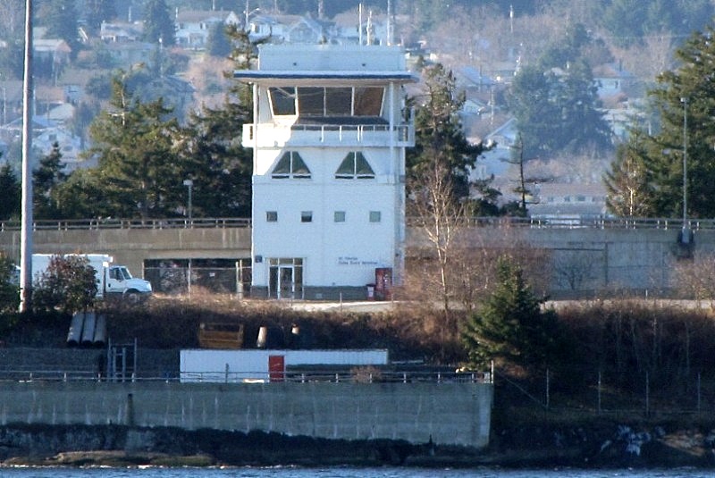 |
|
|
|
Post by FerryDude2012 on Apr 2, 2011 17:54:03 GMT -8
The traditional Duke Point Ferry Terminal shot... 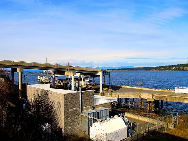 |
|
|
|
Post by Low Light Mike on Apr 2, 2011 19:20:46 GMT -8
The traditional Duke Point Ferry Terminal shot...  That's the new "honey tank" in the foreground. |
|
|
|
Post by Low Light Mike on May 14, 2011 17:59:53 GMT -8
A from-the-water view of Duke Point terminal. - from a trip on my colleague's Tollycraft, on May 7, 2011. ---------------------- The peninsula that the terminal resides on has deep water on one side, and the Nanaimo River estuary on the other side. - At one point in the 19th Century, the local 1st Nation had a canal dug across the peninsula, to use as a shortcut from their river-mouth village to Gabriola Island. The tip of the peninsula is Jack Point. The area to the rear is Duke Point. I'm not sure if "Duke" has an actual geographic point, but it's now the common name for the industrial park village on the peninsula. The park includes a lumber mill, deep sea port, the Van Isle barge terminal, Harmac Pulp Mill, etc. Here's a head-on view of Jack Point, with ferry terminal on the deep-sea side, and the river-estuary in the background on the right-hand side. 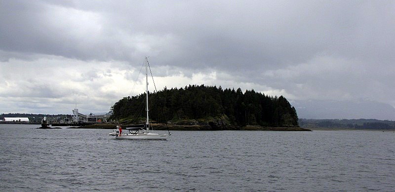 The deep-sea side of Jack Point. The tip of the point is a nice part of the park. You access the park (Biggs / Jack Point park) from a parking lot near the lumber mill, and you walk approx 2 km trail on the river-estuary side of the point. - once you get to the point's tip, you can walk around to the back-side of the ferry terminal employee parking-lot.  Here's the area of Jack Point that I like to visit for taking photos of the ships. I've taken some of Coastals Renaissance and Inspiration from this spot. - Scott and Graham have too.  View of the berth and walkways  The main terminal area 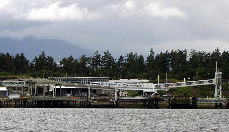 |
|
Neil
Voyager  
Posts: 7,306
|
Post by Neil on May 14, 2011 21:47:08 GMT -8
The tip of the peninsula is Jack Point. The area to the rear is Duke Point. I'm not sure if "Duke" has an actual geographic point, but it's now the common name for the industrial park village on the peninsula. The park includes a lumber mill, deep sea port, the Van Isle barge terminal, Harmac Pulp Mill, etc. I've always wondered about the Jack Point/Duke Point thing. I remember that when the terminal project was announced, I was a bit mystified because all I could find on maps was Jack Point. I always suspected that BC Ferries called it Duke Point because they didn't like the sound of 'Jack'. The two island maps I have now still call it Jack Point. |
|
|
|
Post by Low Light Mike on May 14, 2011 21:55:31 GMT -8
I've always wondered about the Jack Point/Duke Point thing. I remember that when the terminal project was announced, I was a bit mystified because all I could find on maps was Jack Point. I always suspected that BC Ferries called it Duke Point because they didn't like the sound of 'Jack'. The two island maps I have now still call it Jack Point. Back in the mid 1980's, the City of Nanaimo tried hard to get an industrial park going at what was advertised as "Duke Point". I remember that our high-school bus drove past a billboard on the highway touting "Duke Point" as a new industrial park. - then after the project was canceled, the billboard was defaced with a sign overlay that said "Canceled by Kube". I was too young at the time to understand the politics of the BC Federation of labour. Back to the point of the point talk: my guess is that "Duke Point" represents the entire peninsula, and Jack Point is just the tip. |
|
|
|
Post by DENelson83 on May 14, 2011 22:47:43 GMT -8
If you look on the NRCan topographical map of the area, map 092G04, you'll find "Duke Point" at N49.15056 W123.88171.
|
|