|
|
Post by Low Light Mike on Oct 15, 2013 18:29:25 GMT -8
Here are some rail photos from road-side on Hwy-1, just north of Gold Pan Provincial Park, along the Thompson River. September 13, 2013 - CP train on the CN line at the Skoonka rail tunnels 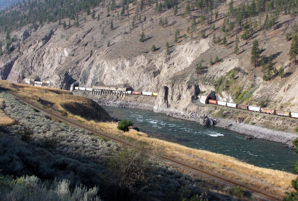 - you can see the CP line, just below my position. It has just crossed under the highway, to the left of where I am. 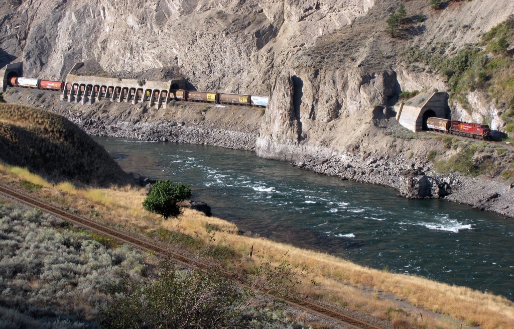 ============== And some photos of a CN freight on the CP track. The old station name for this area is Drynoch. - September 12, 2013. On the east side of the highway, almost ready to cross under the highway. 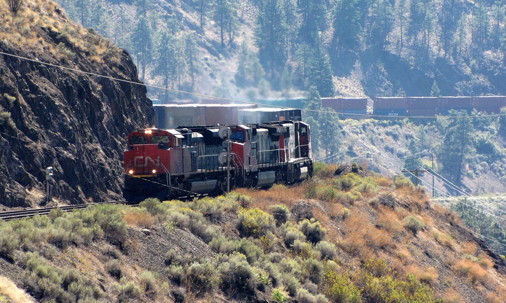 The highway overpass 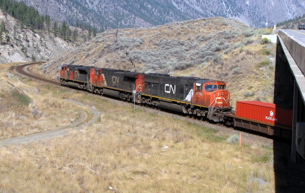 Both lines visible. - the CP track (near side) is far less dramatic here, than the CN line on the opposite side of the river. That's typical of this Fraser/Thompson corridor, where latecomer CN had to do dramatic engineering to make its line work on the opposite side of CP's Onderdonk line. 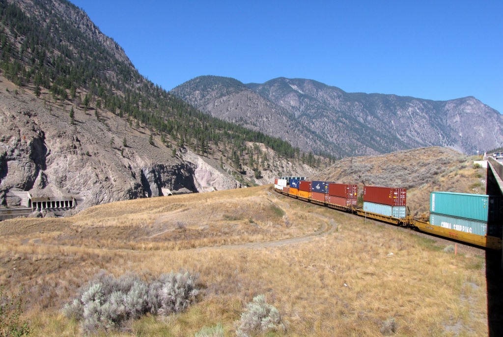 |
|
|
|
Post by Mike C on Oct 15, 2013 21:15:56 GMT -8
|
|
|
|
Post by Low Light Mike on Oct 16, 2013 9:25:47 GMT -8
Cisco Bridges, just south of Lytton, BC, on the Fraser River. - I was there in the morning of September 12, 2013, in the cool of the morning (it was going to be 40-celsius that day) The scene, of the CP bridge (foreground) and CN bridge.  The CN track is just below my location. That CN train is still on the CN bridge. 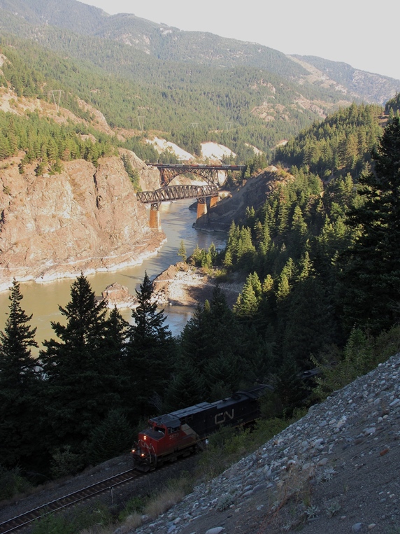 A CP train on the CP track 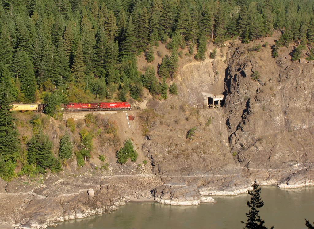 A CN train on the CP track  My location, atop a road-side berm.  |
|
|
|
Post by Mike on Oct 20, 2013 16:10:58 GMT -8
|
|
|
|
Post by Mike on Oct 27, 2013 18:46:48 GMT -8
|
|
|
|
Post by WettCoast on Oct 27, 2013 21:08:32 GMT -8
Mike, it would be nice if you would provide some location information when you post photos such as these. 'CN mainline' means somewhere in North America on CN's vast system. I assume that in reality we are talking about somewhere close to Vancouver or in the Fraser Valley. Also, CN trains sometimes are moving on CP's tracks so I'd like to know if that is the case too!
PS: They are nice pics.
|
|
|
|
Post by Low Light Mike on Nov 8, 2013 21:12:27 GMT -8
A few more views from my morning at Cisco bridges. - morning of September 12, 2013. I like the CP line in this photo, because it appears so straight, compared to the tight curves on the CN line with its bridge. Straight through the rock tunnel and then immediately straight across the bridge. - the privilege of being first in this canyon.  ...but the CP line is not perfectly straight, because there's a curve where it passes under the CN bridge, as seen by the double-stack cars in this photo. 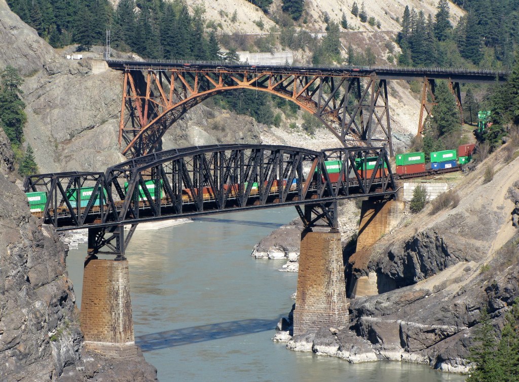 ------------------------- A CP train on the CP bridge.  ...and a CN train on the CP bridge 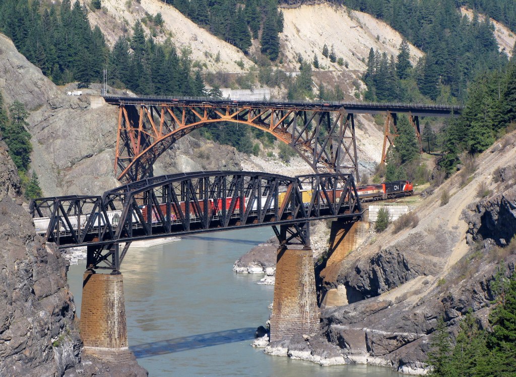 |
|
|
|
Post by Low Light Mike on Nov 9, 2013 11:15:48 GMT -8
2 different roadside locations along Hwy-1 & the Thompson River. Just south of Basque is this historical marker for the CNP's last spike - the train in the background is on the CP track. The CNP (now CN) track is below me on my side of the river - TransCanada Highway #1 is on the far left of the photo. 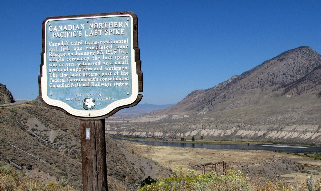 South of Martel is this south (west) bound train on the CN track.  |
|
|
|
Post by Low Light Mike on Nov 11, 2013 9:53:07 GMT -8
A couple of train passings on the CN track, near Martel. - this is between Spences Bridge & Ashcroft, off of Hwy-1 along the Thompson River. Both of these photo sets are of head-end and then tail-end. A westbound CPcoal train. 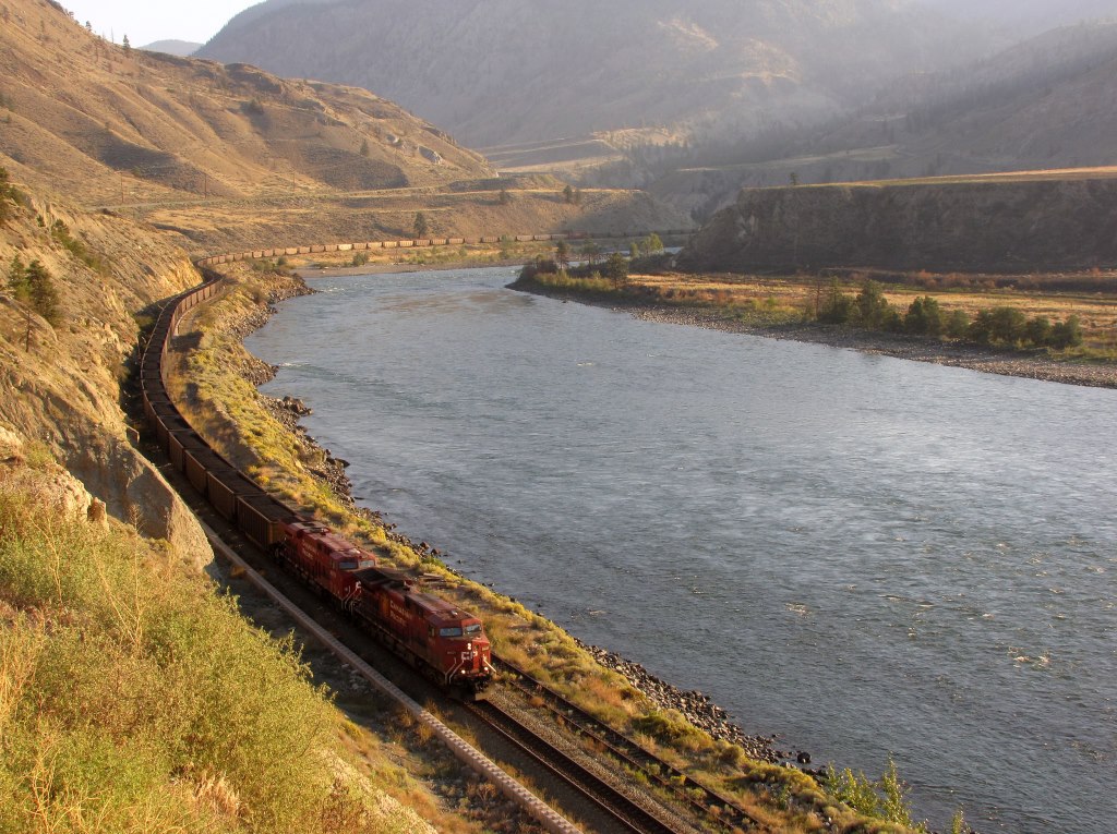  ===================== And a westbound CP freight, with an unusual (to me) blue locomotive at the head-end. 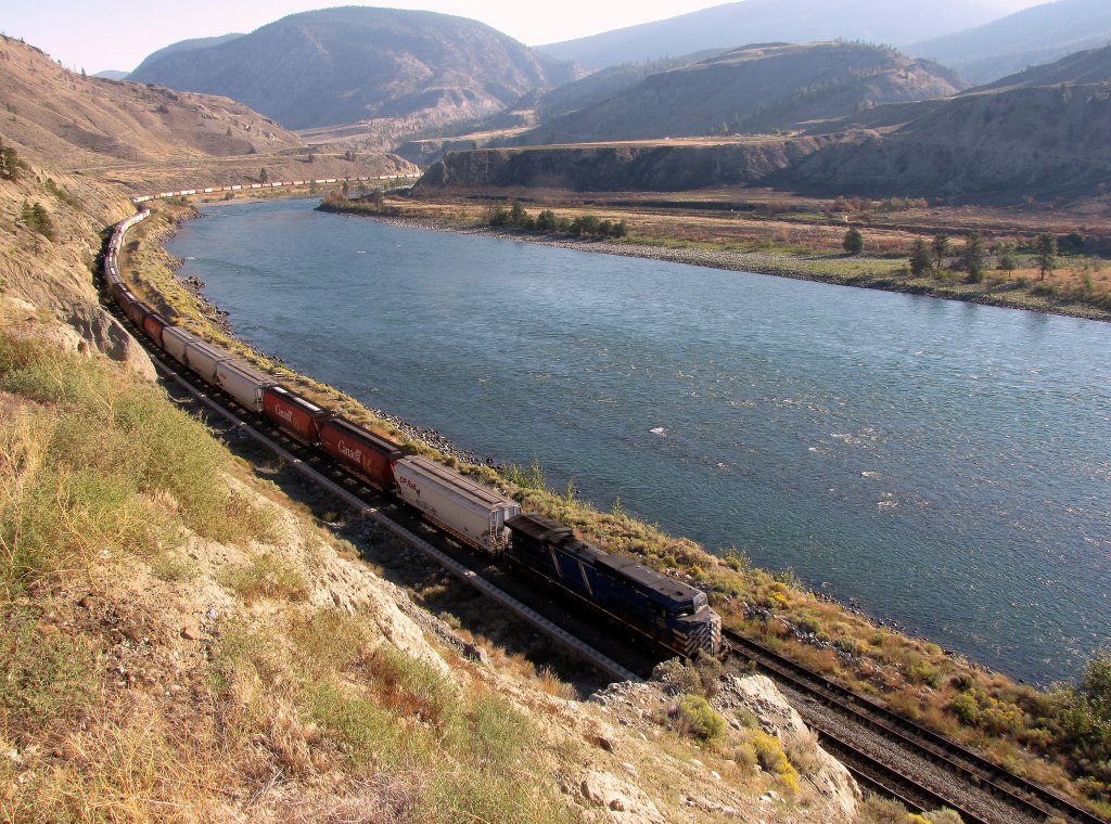 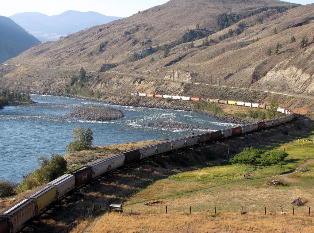 |
|
|
|
Post by Low Light Mike on Nov 12, 2013 12:03:06 GMT -8
A couple of interesting things at Martel, along the Thompson River. The CN track below me has the end-of-track sign. - this is for a short, likely unused siding.  The CP track across the river has the interesting optical-illusion where the track around the bend looks much higher in elevation than the track on this side of the hill. 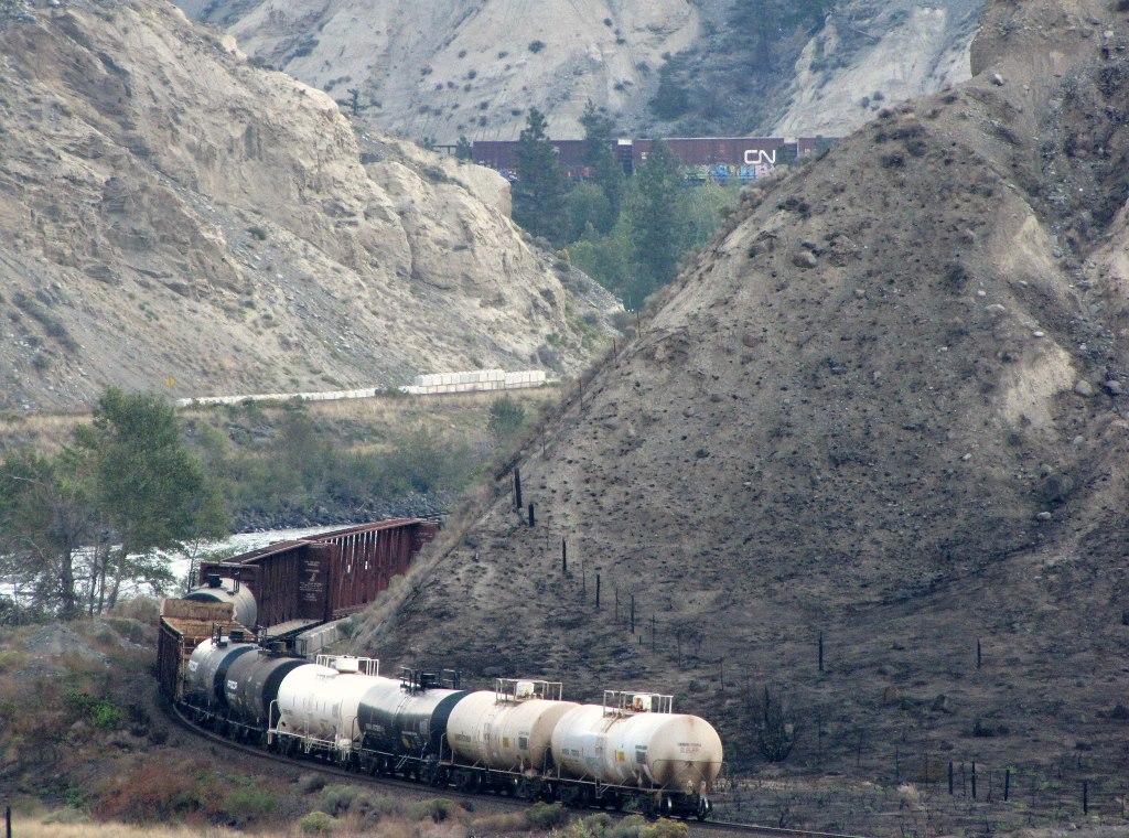 |
|
|
|
Post by WettCoast on Nov 12, 2013 13:54:01 GMT -8
... a westbound CP freight, with an unusual (to me) blue locomotive at the head-end.  That unusual blue locomotive is one of many leased units that CP has on their roster. I would guess that perhaps 20% of their mainline locomotive fleet is made up with these leased units. CP must have determined that this arrangement for a portion of their fleet is the lower cost way to go. When placed on the head-end of a train, however, it looks as though you have a train moving here that is neither CN's or CP's. |
|
|
|
Post by Mike on Nov 12, 2013 14:13:06 GMT -8
|
|
|
|
Post by WettCoast on Nov 12, 2013 16:22:17 GMT -8
The CN track below me has the end-of-track sign. - this is for a short, likely unused siding.  I think what you see here is a bit of what is left of the Martel siding. This was a signalled passing siding. The signals still remain in use today, but the siding is long gone. I suspect that with directional running in this area there was little need to keep this siding, and because it was shorter (6300 feet) CN chose this one for removal. Occasionally trains run 'ACOT'* on both CN's & CP's tracks, so there is a need to keep some sidings operational. They also allow trains moving in the same direction to overtake one another. As trains now are often two or even three km in length, sidings need to be long enough to permit such trains to pass one another. *ACOT - against the current of traffic |
|
|
|
Post by Mike on Dec 8, 2013 16:39:42 GMT -8
|
|
|
|
Post by WettCoast on Jan 2, 2014 11:16:09 GMT -8
|
|
|
|
Post by Low Light Mike on Jan 2, 2014 14:13:49 GMT -8
A 39-year range between these two photographs. That's a wonderful long time to enjoy something, and it's not over yet. I think that a long legacy of enjoying something, and sharing it, is a very good thing. For me, I'm a latecomer to this hobby and so I need to remember that what I'm doing is not a new thing. My photos from the roadside berm at Cisco Bridges are not a unique thing. I may have thought it clever to find this spot, but WCK and others found it long before I did. There's something special about "discovering" things that you later realize many other people also discovered. You then realize that it's not about finding something that you think you own (ie. "that's my location), but you realize that you've shared something special with other like-minded good people. I think it's cool that WCK has visited the same spot for rail photos over the past 39 years. And it's cool that I've now visited that same spot, for the same purpose. --------------- Similar is how our forum member "Ferryman" recently took a shot of the Queen of Nanaimo from near the Lions Gate Bridge. - He's in the same location where the cameras of Leonard Frank and David Thorne have worked, in years past. |
|
dave2
Chief Steward
   Deckhand!: Todo: Introduction post (I was born less than 100 feet from the ocean. The tide was...)
Posts: 162
|
Post by dave2 on Jan 7, 2014 4:37:06 GMT -8
|
|
|
|
Post by WettCoast on Jan 7, 2014 11:14:11 GMT -8
CP's current Cisco bridge has been in service for 105 years (1909 to 2014). The stone pillars & abutments that the current bridge rests on are the same ones used for the original. They date from 1884. You have to wonder if they might need replacing soonish?
|
|
|
|
Post by Mike on Feb 10, 2014 17:34:31 GMT -8
|
|
dave2
Chief Steward
   Deckhand!: Todo: Introduction post (I was born less than 100 feet from the ocean. The tide was...)
Posts: 162
|
Post by dave2 on Feb 23, 2014 23:49:23 GMT -8
|
|
|
|
Post by Low Light Mike on Feb 24, 2014 5:38:34 GMT -8
100 years ago today, above Hell's Gate the Canadian Northern Pacific.... Not mentioned today What happened? I can guess, but if you know, please post about it. |
|
|
|
Post by WettCoast on Feb 24, 2014 11:10:10 GMT -8
100 years ago today, above Hell's Gate the Canadian Northern Pacific.... Not mentioned today What happened? I can guess, but if you know, please post about it. Might just have something to do with this? |
|
|
|
Post by WettCoast on Feb 24, 2014 20:00:46 GMT -8
A little more... What happened 100 years ago Sunday was perhaps BC's most significant environmental disaster that very nearly caused the total loss of the Fraser River salmon fishery. Construction during 1913 of the 2nd railway line (Canadian Northern Pacific, now CN Rail) through the Fraser Canyon led to slides & discharge of waste rock into the river that severely constricted its width and led to river currents too strong & sustained to permit the fish to make it upstream. 1913 was the one in four 'big year' for the fishery. That year, the fishery was, in fact, almost wiped out. Then, on 23 February 1914, the following happened: Quoted from a book entitled The Fraser by the great Bruce Hutchinson (for many years editor of the Vancouver Sun), see page 300. * The Fraser River fishery has never really totally recovered from that event, though the construction of the Hell's Gate fishways in the 1940's did much to undo the damage.
* For Mr. Horn & others who want to know BC's history, this book, The Fraser, should be on the 'bucket' reading list. Mr. Hutchinson was perhaps BC's best newspaper man & author of the 20th century. www.gvpl.ca/using-the-library/branches-hours/bruce-hutchison/about-bruce-hutchison/ |
|
dave2
Chief Steward
   Deckhand!: Todo: Introduction post (I was born less than 100 feet from the ocean. The tide was...)
Posts: 162
|
Post by dave2 on Mar 2, 2014 11:50:26 GMT -8
100 years ago today, above Hell's Gate the Canadian Northern Pacific.... Not mentioned today What happened? I can guess, but if you know, please post about it. February 23, 1914, CNPR tunnel costruction triggered a rockslide that devasted 1914's salmon run. And 1918's. And 1922's.... "The rock filled in back-eddies the salmon rested in while getting through the gorge, and narrowed the canyon from 300 feet to 75 feet wide"  100,000 cubic yard of rock fell andnarrowed the river from 300 ft to 75 feet...    Vancouver Archives.Hi Res PhotosFurther Reading Here Vancouver Archives.Hi Res PhotosFurther Reading Here
And Here |
|
|
|
Post by Mike on Mar 19, 2014 21:20:25 GMT -8
|
|